2-07-10
Another warm
hike on dirt during what has been a warm winter with not much snow. I
wanted to get in some mileage and still get home in time to watch the
Super Bowl. I'm getting a little tired of I-90 hikes and decided it was
time to head north. I was out the door at 6:35 am. It was still dark
and a little drizzly. The drive to within 15 miles of Bellingham goes
surprisingly quickly. It is 74 miles from North Seattle to the
trailhead. I took Exit 240 for Alger. A left then another quick left on
Barrel Springs Road brought me to the signed dirt road on the right.
Just a mile up the road brought me to the lower trailhead for Blanchard
Mountain. I was the first car in the lot. It was just before 8:00 am
when I got started.
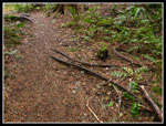
I repeated a trip I did on my first visit to Blanchard Mountain in 2005. I posted a map in that report and I'll add another link to it here. This time I did it clockwise. The trail starts a short way down the road from the parking lot. It's another 8/10 of a mile to the upper trailhead. This first trail is a nice route winding through forest. It has a number of spring flowers but even with the warmth there are none up yet. At the upper trailhead I found only one car.
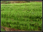
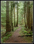
The Lily Lake Trail starts a short way down the road. It is a very gentle trail with a few long easy switchbacks to gain elevation. It is used extensively by horses and bicycles and was built at a very easy grade for them. The trail is bordered by miles of sword ferns. Millions of them. It is about as green as any trail. The dark low clouds really brought out the colors. One woman runner passed my coming down. She was the only person I was to see for the next three hours.
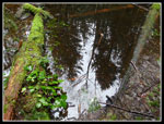
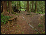
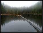
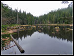
There is one unmarked junction on the Lily Lake Trail. Left goes over to Max's Shortcut Trail. Right is the way I went. Both go up to Lily Lake in about the same distance. I stopped at the small pond looking for any traces of skunk cabbage. None are up so far. There are several sets of log benches along the trail. I had no need to rest. At long last the trail reaches the old railroad grade that heads right to Lizard Lake. This is the Pacific Northwest Trail. I turned left.
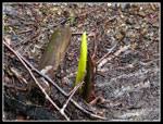
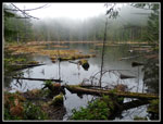
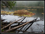
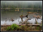
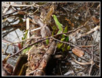
In a short distance I met the upper end of Max's Shortcut. Next was the trail over to Lily Lake. I saved that for the return. The outlet of Lily Lake flows into a swampy area before it turns to a creek again and descends. The trail goes along the side of the swamp/creek. The swamp is filled with skunk cabbage in the spring. There shouldn't be any up in early February but this winter has been unusually warm. I ventured out into the goo and found a few skunk cabbage shoots just poking up. In about three weeks the there should be a riot of big green leaves and yellow spathes.
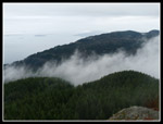
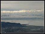
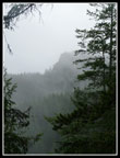
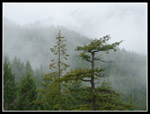
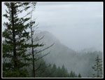
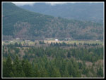
The trail descends gently with old logging cables found in a number of places. It crosses the creek twice and soon reaches another unmarked junction. Left is the Oyster Dome trail down to Chuckanut Drive. Right is the trail over to the Oyster Dome viewpoint. In short order I was up to the first viewpoint. I could see down to the water but clouds were swirling all around. At the upper viewpoint I had an early lunch. I was surprised to find nobody else up there during my whole visit.
I took a few minutes to head over to the high point. It's all forested but one spot had a view over to North Butte. It was in the clouds. Down I went as I retraced my route back to Lily Lake. This time I took the short trail to the lake. I stopped at the horse camp for a look down the lake. Next I headed along the short to the hiker camp and on. The trail has had some work since 2005 with a few new boardwalks. One freshly felled tree shows that beavers have been busy. The trail up to North Butte was drier and easier to follow than I remembered.
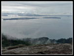
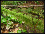
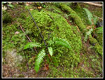
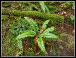
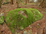
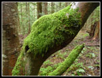
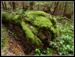
The top of the butte is rock. The trail leads all the way up. I could just see Oyster Dome and not much else. The clouds were all around me. I went into the woods just below the top and found some really bright moss hanging on everything. The higher parts of the overall hike were very green with moss. That was the prime theme of my photos. On the way down I soon met the second person of the day. My watch battery had died on the drive up and I had no idea what time it was. He let me know it was 11:40. I could hardly believe that I had been on the trail for over 3 1/2 hours.
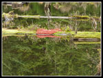
I hiked past Lily Lake and turned left on the railroad grade. It's about a mile over to Lizard Lake. There is a junction near the lake. Right drops down the Alternate Incline Trail to a road above the upper trailhead. Left goes to Lizard Lake in just a minute or two. The trail goes right along the lake shore. There are a lot of skunk cabbage along the trail here. I noticed a few were popping up. I also went to the camp at the head of the lake. Here I found one skunk cabbage with a few leaves already.
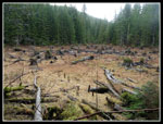
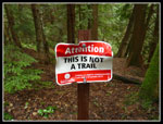
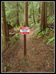
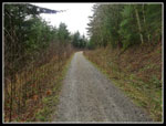
From the lake it's all down hill on the Alternate Incline Trail. On my 2005 visit the Incline Trail was still open It is now closed though both ends are easy to find. The big red "This Is Not A Trail" signs make the closed off trail easier to find. I had no interest in hiking a closed and very steep trail and stayed on the Alternate Incline Trail. It drops though some old second growth forest. In due time I came out on the gravel road. Here I met a group of four hikers. The road is much narrower than I recalled. Brush has narrowed it down and it is much more like a trail. It's still wide but not like it was. I passed two bikers along the road.
At the upper trailhead I found four vehicles, less than I was expecting. All that was left was a quick jaunt down the trail to the lower trailhead. Down there I found four trucks with horse trailers and two cars. It was 1:30 when I finished. I covered about 11 miles with 2500' of gain and succeeded in being done be early afternoon. It's only about 1:15 to drive home, not much longer than from Snoqualmie Pass. I saw 11 people over 5 1/2 hours but only three during the first 4 1/2 hours. These trails make for easy snow free walking for most winters. I'm sure I'll be back in a year or two.
Click on thumbnails to get larger pictures.
Trips - 2010
Home
I repeated a trip I did on my first visit to Blanchard Mountain in 2005. I posted a map in that report and I'll add another link to it here. This time I did it clockwise. The trail starts a short way down the road from the parking lot. It's another 8/10 of a mile to the upper trailhead. This first trail is a nice route winding through forest. It has a number of spring flowers but even with the warmth there are none up yet. At the upper trailhead I found only one car.
The Lily Lake Trail starts a short way down the road. It is a very gentle trail with a few long easy switchbacks to gain elevation. It is used extensively by horses and bicycles and was built at a very easy grade for them. The trail is bordered by miles of sword ferns. Millions of them. It is about as green as any trail. The dark low clouds really brought out the colors. One woman runner passed my coming down. She was the only person I was to see for the next three hours.
There is one unmarked junction on the Lily Lake Trail. Left goes over to Max's Shortcut Trail. Right is the way I went. Both go up to Lily Lake in about the same distance. I stopped at the small pond looking for any traces of skunk cabbage. None are up so far. There are several sets of log benches along the trail. I had no need to rest. At long last the trail reaches the old railroad grade that heads right to Lizard Lake. This is the Pacific Northwest Trail. I turned left.
In a short distance I met the upper end of Max's Shortcut. Next was the trail over to Lily Lake. I saved that for the return. The outlet of Lily Lake flows into a swampy area before it turns to a creek again and descends. The trail goes along the side of the swamp/creek. The swamp is filled with skunk cabbage in the spring. There shouldn't be any up in early February but this winter has been unusually warm. I ventured out into the goo and found a few skunk cabbage shoots just poking up. In about three weeks the there should be a riot of big green leaves and yellow spathes.
The trail descends gently with old logging cables found in a number of places. It crosses the creek twice and soon reaches another unmarked junction. Left is the Oyster Dome trail down to Chuckanut Drive. Right is the trail over to the Oyster Dome viewpoint. In short order I was up to the first viewpoint. I could see down to the water but clouds were swirling all around. At the upper viewpoint I had an early lunch. I was surprised to find nobody else up there during my whole visit.
I took a few minutes to head over to the high point. It's all forested but one spot had a view over to North Butte. It was in the clouds. Down I went as I retraced my route back to Lily Lake. This time I took the short trail to the lake. I stopped at the horse camp for a look down the lake. Next I headed along the short to the hiker camp and on. The trail has had some work since 2005 with a few new boardwalks. One freshly felled tree shows that beavers have been busy. The trail up to North Butte was drier and easier to follow than I remembered.
The top of the butte is rock. The trail leads all the way up. I could just see Oyster Dome and not much else. The clouds were all around me. I went into the woods just below the top and found some really bright moss hanging on everything. The higher parts of the overall hike were very green with moss. That was the prime theme of my photos. On the way down I soon met the second person of the day. My watch battery had died on the drive up and I had no idea what time it was. He let me know it was 11:40. I could hardly believe that I had been on the trail for over 3 1/2 hours.
I hiked past Lily Lake and turned left on the railroad grade. It's about a mile over to Lizard Lake. There is a junction near the lake. Right drops down the Alternate Incline Trail to a road above the upper trailhead. Left goes to Lizard Lake in just a minute or two. The trail goes right along the lake shore. There are a lot of skunk cabbage along the trail here. I noticed a few were popping up. I also went to the camp at the head of the lake. Here I found one skunk cabbage with a few leaves already.
From the lake it's all down hill on the Alternate Incline Trail. On my 2005 visit the Incline Trail was still open It is now closed though both ends are easy to find. The big red "This Is Not A Trail" signs make the closed off trail easier to find. I had no interest in hiking a closed and very steep trail and stayed on the Alternate Incline Trail. It drops though some old second growth forest. In due time I came out on the gravel road. Here I met a group of four hikers. The road is much narrower than I recalled. Brush has narrowed it down and it is much more like a trail. It's still wide but not like it was. I passed two bikers along the road.
At the upper trailhead I found four vehicles, less than I was expecting. All that was left was a quick jaunt down the trail to the lower trailhead. Down there I found four trucks with horse trailers and two cars. It was 1:30 when I finished. I covered about 11 miles with 2500' of gain and succeeded in being done be early afternoon. It's only about 1:15 to drive home, not much longer than from Snoqualmie Pass. I saw 11 people over 5 1/2 hours but only three during the first 4 1/2 hours. These trails make for easy snow free walking for most winters. I'm sure I'll be back in a year or two.
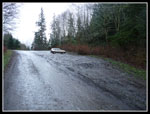 Upper Parking Lot |
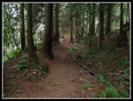 Dark Trail |
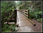 Wet Bridge |
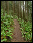 Sword Ferns |
 Pond Reflection |
 Benches |
 Meadow |
 Skunk Cabbage Shoot |
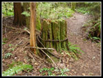
 Old Logging Cables |
 Clouds Blow By The Dome |
 Sun On Cloud Tops |
 Islands In The Sound |
 North Butte |
 All Shades Of Green |
 Ferns & Moss |
 More Green |
 Weaving Between Stumps |
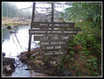 Lots Of Signs |
 Colorful Lily Lake |
 Lily Lake Reflection |
 Color On The Island |
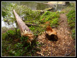 Recent Beaver Activity |
 Mist Over Lily Lake |
 Mossy Rock |
 North Butte Trees |
 Oyster Dome |
 GREEN! |
 Mossy Arch |
 Endless Moss |
 Railroad Grade |
 More Skunk Cabbage |
 Lizard Red |
 Lizard Lake Reflection |
 Cabled Stump |
 Not A Popular Sign |
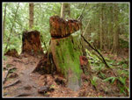
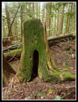 Green Stump |
 Mega Moss |
 Incline Non Trail |
 Narrowing Road |
 Distant Farms |
Trips - 2010
Home