5/26-27/12
Time
for the first backpacking trip of the year. I joined a group heading
east to the Chelan Sawtooth Mountains for the Memorial Day weekend.
This area north of Lake Chelan and south of the Methow Valley is an
area I had not hiked before. A number of peaks are between 8000' to
9000' in elevation. We let the big crowds head out on Friday and
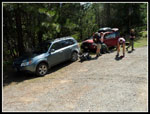
planned an early Saturday departure. The eight of us (plus two dogs)
filled up two cars. We met in Seattle at 6:00 am and again north of
Lynnwood at 6:25 am. Traffic was fairly light at we headed over the
North Cascades Highway. From Twisp we took the Twisp River Road, then
left on the W. Buttermilk Creek Road, and left again on the signed spur
to the Eagle Creek trailhead at about 3000'. Two other friends left
ahead of us and they had the only other car in the lot. Another group
of two arrived before we left. After a 215 mile drive we were finally
on the trail at 11:00 am.
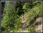
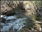
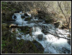
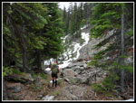
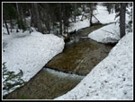
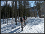
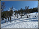
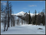
The trail is snow free at the start but it had not been logged out yet. There were 8 - 10 logs down across the trail. They were a pain to crawl over or under with overnight packs including ice axes, snow shovels, crampons and snow shoes plus the weight of warm clothing and gear. Not to mention someone my size getting under low logs with all those implements sticking up over my head. At about 1 3/4 miles we came to the crossing of Eagle Creek. No bridge or logs here. With spring snow melt the water is running pretty high. Just below the trail it is wider and not to hard to ford. Most of us took off our boots and crossed barefoot. No point soaking our boots this early in the trip.
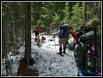
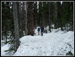
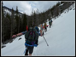
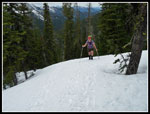
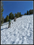
There are very few switchbacks on this trail and most are right after the crossing. A short time later the Eagle Creek Trail heads off right and our trail up Oval Creek goes left. We began to see some snow patches at about 3 miles. they became deeper with dirt stretches between. At about 3 1/2+ miles the snowshoes went on. Of course we then had several more dirt patches. Eight hikers banging away on dirt and rock with snowshoes on. Very soon the dirt was done for the rest of the day. The earlier folks made thin tracks that we followed for the most part.
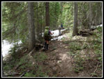
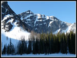
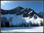
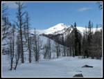
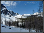
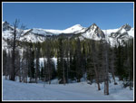
We had one more big creek crossing to get across Oval Creek. Several partly snow covered logs were options. Falling off and getting soaked would have been ugly but we all made it across fine. The summer trail continues up the valley and climbs to West Oval Lake, the highest at 6860'. To the left is Middle Oval Lake at 6695'. Our destination was East Oval Lake at 6656'. We needed to head uphill off the summer route to reach the east lake. The earlier tracks headed up sooner than we wanted so we continued up the valley.
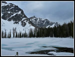
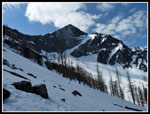
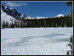
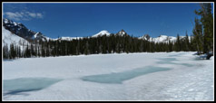
We headed up to late as it turned out. We came to a near vertical headwall. Now we had to traverse across the slope to our left looking for some more reasonable terrain. Where we did head up it was quite steep. Snowshoes worked though not with a whole lot of comfort. Janet was not comfortable here so we switched to crampons. That helped a lot. We followed the tracks left by the others on up. We topped out on the bump between the east and middle lakes. Oops! We gained 150' more than needed. The lake was still snow covered with just a little open water near the outlet. There is some light blue coloring where the snow is very thin. We arrived at about 5:30 pm. It was time to set up camp.
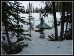
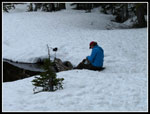
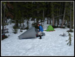
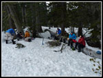
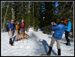
We must not be a very social group. Eight people and seven tents. Usually it is tough to find a reasonably level spot for a few folks. We had no trouble finding room for seven. Hardly needed any shoveling. We had a wide assortment of tents, pads, and sleeping bags. The water at the outlet was iced over in the morning so it was below freezing but I was very warm in my tent. I guess we were not all that anti social as was stayed up until near dark at about 9:30 pm.
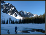
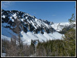
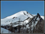
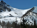
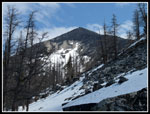
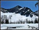
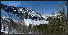
On day two we split up. One group was a lot of ambition headed for Star Peak. 7 miles round trip with 4000' of gain. The other headed for Oval Peak. I joined the Oval gang. A short hike leads into the basin below Oval. Most of the trees are larches. This must be one very colorful spot in October. At about 7100' the slope get much steeper. There was sun on the slope but it was hard and icy. I went up farther but just did not feel comfortable coming down it. Probably would have been fine later in the afternoon. I chose to call it a day. The view from 7200' was outstanding. More peaks had come into view. I took my time heading down as the snow covered basin was very photogenic. One could wander around the ridges, peaks, and lakes for weeks. I figure I'll be back before too long.
The forecast was for partly sunny but they were way off. It was all blue sky. The Star Peak group summited Gray and realized they did not have time for Star. They were back at camp by 2:00 pm. Janet and I were getting worried as the Oval Team had been gone for 5 1/2 hours for the 3 mile round trip climb. The Star folks decided to head out for Oval. The Oval folks did arrive shortly after. Four decided to stay overnight and head out in the morning. The other four of us chose to head back on Sunday.
We were on our way down by 3:00 pm. Heading to our right from the lake outlet before heading down brought much more gentle terrain than our route up. It was soft in the afternoon warmth and we all had some major post holing but all in all it was not bad at all. Back at the bottom of the valley we used Janet's GPS to home in on our now melted tracks up. We were able to follow them all the way back. The first creek crossing was a little more interesting as the snow was softer on the logs. We kept on the snowshoes longer than on the way up. I was glad to finally be done with them. At the final creek crossing we did not bother to take off boots. The water was higher than on the way in but we splashed right through it.
We reached the trailhead at 7:15 pm. By about 7:40 we were on the road. None of us owned either of the two vehicles so we took turns driving back. After gas and some food in Twisp, I had the leg over the mountains. First time I've driven highway 20 in the dark. We reached the first park and ride right after midnight and after ferrying Suzanne's car back to her house I was home by 1:00 am. The end of a long day and a great holiday weekend backpacking trip.
Click on thumbnails to get
larger pictures.
Trips - 2012
Home
The trail is snow free at the start but it had not been logged out yet. There were 8 - 10 logs down across the trail. They were a pain to crawl over or under with overnight packs including ice axes, snow shovels, crampons and snow shoes plus the weight of warm clothing and gear. Not to mention someone my size getting under low logs with all those implements sticking up over my head. At about 1 3/4 miles we came to the crossing of Eagle Creek. No bridge or logs here. With spring snow melt the water is running pretty high. Just below the trail it is wider and not to hard to ford. Most of us took off our boots and crossed barefoot. No point soaking our boots this early in the trip.
There are very few switchbacks on this trail and most are right after the crossing. A short time later the Eagle Creek Trail heads off right and our trail up Oval Creek goes left. We began to see some snow patches at about 3 miles. they became deeper with dirt stretches between. At about 3 1/2+ miles the snowshoes went on. Of course we then had several more dirt patches. Eight hikers banging away on dirt and rock with snowshoes on. Very soon the dirt was done for the rest of the day. The earlier folks made thin tracks that we followed for the most part.
We had one more big creek crossing to get across Oval Creek. Several partly snow covered logs were options. Falling off and getting soaked would have been ugly but we all made it across fine. The summer trail continues up the valley and climbs to West Oval Lake, the highest at 6860'. To the left is Middle Oval Lake at 6695'. Our destination was East Oval Lake at 6656'. We needed to head uphill off the summer route to reach the east lake. The earlier tracks headed up sooner than we wanted so we continued up the valley.
We headed up to late as it turned out. We came to a near vertical headwall. Now we had to traverse across the slope to our left looking for some more reasonable terrain. Where we did head up it was quite steep. Snowshoes worked though not with a whole lot of comfort. Janet was not comfortable here so we switched to crampons. That helped a lot. We followed the tracks left by the others on up. We topped out on the bump between the east and middle lakes. Oops! We gained 150' more than needed. The lake was still snow covered with just a little open water near the outlet. There is some light blue coloring where the snow is very thin. We arrived at about 5:30 pm. It was time to set up camp.
We must not be a very social group. Eight people and seven tents. Usually it is tough to find a reasonably level spot for a few folks. We had no trouble finding room for seven. Hardly needed any shoveling. We had a wide assortment of tents, pads, and sleeping bags. The water at the outlet was iced over in the morning so it was below freezing but I was very warm in my tent. I guess we were not all that anti social as was stayed up until near dark at about 9:30 pm.
On day two we split up. One group was a lot of ambition headed for Star Peak. 7 miles round trip with 4000' of gain. The other headed for Oval Peak. I joined the Oval gang. A short hike leads into the basin below Oval. Most of the trees are larches. This must be one very colorful spot in October. At about 7100' the slope get much steeper. There was sun on the slope but it was hard and icy. I went up farther but just did not feel comfortable coming down it. Probably would have been fine later in the afternoon. I chose to call it a day. The view from 7200' was outstanding. More peaks had come into view. I took my time heading down as the snow covered basin was very photogenic. One could wander around the ridges, peaks, and lakes for weeks. I figure I'll be back before too long.
The forecast was for partly sunny but they were way off. It was all blue sky. The Star Peak group summited Gray and realized they did not have time for Star. They were back at camp by 2:00 pm. Janet and I were getting worried as the Oval Team had been gone for 5 1/2 hours for the 3 mile round trip climb. The Star folks decided to head out for Oval. The Oval folks did arrive shortly after. Four decided to stay overnight and head out in the morning. The other four of us chose to head back on Sunday.
We were on our way down by 3:00 pm. Heading to our right from the lake outlet before heading down brought much more gentle terrain than our route up. It was soft in the afternoon warmth and we all had some major post holing but all in all it was not bad at all. Back at the bottom of the valley we used Janet's GPS to home in on our now melted tracks up. We were able to follow them all the way back. The first creek crossing was a little more interesting as the snow was softer on the logs. We kept on the snowshoes longer than on the way up. I was glad to finally be done with them. At the final creek crossing we did not bother to take off boots. The water was higher than on the way in but we splashed right through it.
We reached the trailhead at 7:15 pm. By about 7:40 we were on the road. None of us owned either of the two vehicles so we took turns driving back. After gas and some food in Twisp, I had the leg over the mountains. First time I've driven highway 20 in the dark. We reached the first park and ride right after midnight and after ferrying Suzanne's car back to her house I was home by 1:00 am. The end of a long day and a great holiday weekend backpacking trip.
 Ready To Go |
 Bare Trail |
 Crossing Eagle Creek |
 Fast Flowing Creek |
 A Little Snow |
 Snowshoes On |
 More Bare Trail |
 Solid Snow Now |
 Oval Creek |
 Traversing Open Slope |
 Janet Reaches The Top |
 View From Tent Site |
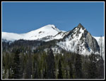
 Courtney Peak |
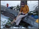
 Janet Filters Water |
 Barb & Her Nook |
 Dinner Time |
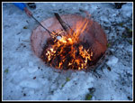 Roasting Marshmallows |
 Suzanne & Gus |
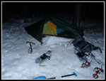 My Akto At Night |
 Morning Light |
 Sunshine & Shade |
 Sun On Courtney |
 Star Peakers |
 Sun On The Lake |
 Heading To Oval Peak |
 Steepening |
 Much Steeper |
 Buttermilk Ridge |
 Gray Pk Is White |
 Contrasting Peaks |
 Larch Filled Basin |
 A Few Clouds Appear |
 Lake & Peaks |
 Gray & Point |
 Sawtooth Ridge |
 Cornice |
 Oval Peak |
 Sun On E. Oval Lake |
 Lake & Buttermilk |
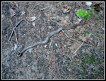 Rubber Boa |
 Buttermilk Panorama |
 East Oval Lake Panorama |
Trips - 2012
Home