3-10-12
Rain
rain everywhere. Well almost
everywhere. A real stormy day was here. Suzanne suggested going far
east and south to a place with a low chance of rain and no snow on the
ground. I was up for it and so were Barry and Janet. I have hiked the
north end of the Yakima Skyline Rim Trail a number of times over the
past 20 years. Almost always in the spring when there are wildflowers
everywhere. I had never hiked the southern part. Time for a new hike.
We headed out of town early and after a stop in Cle Elum we continued
on I-90 to I-82 southbound. Took exit 26 then right for .20 miles, left
on Harrison Road, another 1.90 miles to a "T" at Wenas Road. Go right
3.10 miles then right again on Buffalo Road. There is a trailhead soon
after pavement ends. We continued where the road turns left another .75
miles downhill to a sharp right turn. That is the trailhead. A Discover
Pass is required at each trailhead.
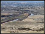
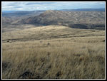
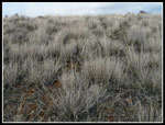
It was just about 10:00 am when we started up the trail.The start is near the Yakima River and in view of Selah and not far from Yakima. Not a tree to be seen. So unlike Western Washington. So unlike the many snow hikes this winter. Just what the doctor ordered. We saw a few wildflowers. Very few. The buttercups were a harbinger of what will soon be coming. This is a great wildflower hike and one I need to do a little later in spring. The good news is that the steady rain for most of the drive turned to mostly sunny sky. Well worth the long drive.
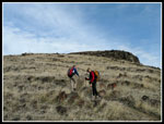
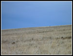
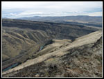
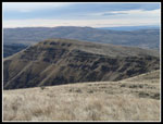
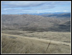
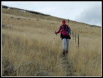
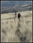
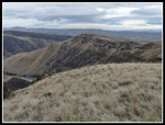
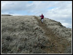
The trail is not steep but consistently gains elevation. It also loses some. With no trees the views begin immediately and just keep getting better. Several times we saw deer at a distance. We heard some song birds. Janet recognized meadowlarks. A gentle breeze kept us cool in the ascent. We climbed to the ridge top then began to descend to a saddle. The trail from the first trailhead we passed on the drive in meets up with our trail. That trail is a little shorter with less elevation gain and fewer views. I'm glad we began where we did. This is a dry trail. With no water or shade I will not be on it in the summertime. Once up to the first high point we could see Gracie Point. That is the high point on the south end of the trail.
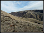
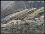
A little beyond the first junction we came to another. The trail continued uphill moving away from the edge of the ridge. Another trail dropped down the right side of the ridge. We chose to stay left. The route became an old road the gently gained elevation. The wind had been building but our route took us mostly out of the wind. We soon appeared to be getting farther away from the trail on the GPS when a sharp right turn had us back on track. There were a few small snow patches under some sagebrush. There was none on the trail all day. The route began to work around the right side of Gracie Point. The GPS showed we reached the real trail but in fact it was a very short distance below us.
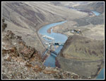
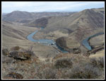
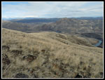
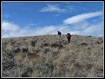
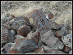
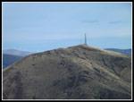
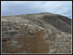
The slope of Gracie moderated as we went around and we chose to head straight up. Pretty easy climbing up the rock and grassy slope. The top is a large almost flat plateau. The wind was really strong now. We had been walking down wind and I could see how much colder it would be when we headed back. There is a short post on the summit with a "Gracie Point" cut in metal. No doubt about the name. We headed across the summit to the leeward side out of the wind. Great views north to the rest of the Skyline Ridge. Beyond our position the trail descends to the low point at Roza Creek then climbs back up high.. Mt. Stuart and peaks north were in the clouds.
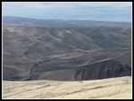
To the west there was a wall of white. No volcanoes in sight this day. There were now some clouds overhead but still lots of sunshine. I can't imagine any other hikers having better weather this day. My GPS recorded 4.75 miles to here. After a leisurely lunch we headed down towards the track we had hiked up. We crossed it and quickly reached the real Skyline Trail. I wanted to get in over 10 miles so we turned left (north) and began to descend. We hiked a little less than half a mile getting some better views down to Roza Creek. Then we turned around. The wind was now very strong. Probably 10-15 mph with gusts over 20 mph. Right in our faces. I had to have a jacket on and so did everyone else.
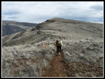
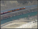
We reached the high point just below Gracie Point and the trail began a slow descent. Roza Dam was now just below us. During the hike we saw several very long trains heading down the valley along the river too. Near the low point in the trail we reached Twin Springs. Two metal basins with some not so clear water inside. We climbed up to the junction of the ridge. That completed a loop. Near the junction with the trail from the first trailhead we saw several hikers with three dogs. It was not a very busy trail this day. We climbed back to the first high point then it was all downhill. We passed another group of three heading down. We also had a runner pass us. I had to ask where he started. "Ellensburg" he said. That is a long day.
Near the trailhead we finally lost the strong wind. It was 55 degrees and without the wind it was pleasantly warm. On the drive home we chose to take the Canyon Road along the Yakima River. A very scenic drive. From Easton on it was raining on the drive home. I love a sunny hike on a rainy day. A great time was had as two of us hiked the trail for the first time. A great late winter snow free hike. I would like to come back when the wildflowers are in full bloom. We saw a lot of last year's long dead balsamroot leaves and many bitterroot leaves too. Should be a riot of color in a few months.
Suzanne's NWHikers report is at: Skyline Trail Report & Photos
Click on thumbnails to get
larger pictures.
Trips - 2012
Home
It was just about 10:00 am when we started up the trail.The start is near the Yakima River and in view of Selah and not far from Yakima. Not a tree to be seen. So unlike Western Washington. So unlike the many snow hikes this winter. Just what the doctor ordered. We saw a few wildflowers. Very few. The buttercups were a harbinger of what will soon be coming. This is a great wildflower hike and one I need to do a little later in spring. The good news is that the steady rain for most of the drive turned to mostly sunny sky. Well worth the long drive.
The trail is not steep but consistently gains elevation. It also loses some. With no trees the views begin immediately and just keep getting better. Several times we saw deer at a distance. We heard some song birds. Janet recognized meadowlarks. A gentle breeze kept us cool in the ascent. We climbed to the ridge top then began to descend to a saddle. The trail from the first trailhead we passed on the drive in meets up with our trail. That trail is a little shorter with less elevation gain and fewer views. I'm glad we began where we did. This is a dry trail. With no water or shade I will not be on it in the summertime. Once up to the first high point we could see Gracie Point. That is the high point on the south end of the trail.
A little beyond the first junction we came to another. The trail continued uphill moving away from the edge of the ridge. Another trail dropped down the right side of the ridge. We chose to stay left. The route became an old road the gently gained elevation. The wind had been building but our route took us mostly out of the wind. We soon appeared to be getting farther away from the trail on the GPS when a sharp right turn had us back on track. There were a few small snow patches under some sagebrush. There was none on the trail all day. The route began to work around the right side of Gracie Point. The GPS showed we reached the real trail but in fact it was a very short distance below us.
The slope of Gracie moderated as we went around and we chose to head straight up. Pretty easy climbing up the rock and grassy slope. The top is a large almost flat plateau. The wind was really strong now. We had been walking down wind and I could see how much colder it would be when we headed back. There is a short post on the summit with a "Gracie Point" cut in metal. No doubt about the name. We headed across the summit to the leeward side out of the wind. Great views north to the rest of the Skyline Ridge. Beyond our position the trail descends to the low point at Roza Creek then climbs back up high.. Mt. Stuart and peaks north were in the clouds.
To the west there was a wall of white. No volcanoes in sight this day. There were now some clouds overhead but still lots of sunshine. I can't imagine any other hikers having better weather this day. My GPS recorded 4.75 miles to here. After a leisurely lunch we headed down towards the track we had hiked up. We crossed it and quickly reached the real Skyline Trail. I wanted to get in over 10 miles so we turned left (north) and began to descend. We hiked a little less than half a mile getting some better views down to Roza Creek. Then we turned around. The wind was now very strong. Probably 10-15 mph with gusts over 20 mph. Right in our faces. I had to have a jacket on and so did everyone else.
We reached the high point just below Gracie Point and the trail began a slow descent. Roza Dam was now just below us. During the hike we saw several very long trains heading down the valley along the river too. Near the low point in the trail we reached Twin Springs. Two metal basins with some not so clear water inside. We climbed up to the junction of the ridge. That completed a loop. Near the junction with the trail from the first trailhead we saw several hikers with three dogs. It was not a very busy trail this day. We climbed back to the first high point then it was all downhill. We passed another group of three heading down. We also had a runner pass us. I had to ask where he started. "Ellensburg" he said. That is a long day.
Near the trailhead we finally lost the strong wind. It was 55 degrees and without the wind it was pleasantly warm. On the drive home we chose to take the Canyon Road along the Yakima River. A very scenic drive. From Easton on it was raining on the drive home. I love a sunny hike on a rainy day. A great time was had as two of us hiked the trail for the first time. A great late winter snow free hike. I would like to come back when the wildflowers are in full bloom. We saw a lot of last year's long dead balsamroot leaves and many bitterroot leaves too. Should be a riot of color in a few months.
Suzanne's NWHikers report is at: Skyline Trail Report & Photos
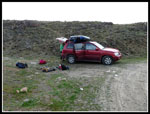 Trailhead |
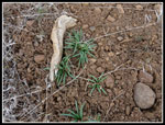
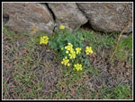 Desert Parsley |
 And The Sign Said? |
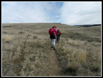 Heading Up |
 Selah |
 Ridge Is Above |
 Deer |
 Across The Canyon |
 Yakima Canyon |
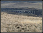
 Roza Dam |
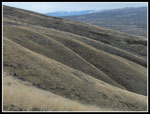
 Folds In Terrain |
 Bend In River |
 Bitterroot |
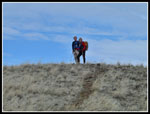 Barry & Suzanne |
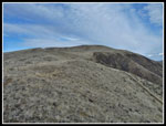 Gracie Point Ahead |
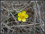 Buttercup |
 Many Shades |
 View Northeast |
 Near The Summit |
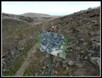
 Summit Sign |
 Umtanum Ridge |
 Tower |
 Skyline Trail |
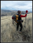 Photo Stop |
 Next Destination |
 Janet On Boot Path |
 Path Along Fence Posts |
 Sun & Shade |
 Blowing In The Wind |
 Brown & Green |
 Junction |
 Back To First High Point |
 Shades Of Grass |
 Janet On Rocky Trail |
 Train |
 Bridge |
Trips - 2012
Home