8-03-13
Kim
joined me for a long one way day hike passing four lakes and looking
down on a fifth. I had done the Melakwa Lakes - Pratt Lake loop trip
twice before. Once
since I started this website.
Kim had not done the section between Melakwa Lakes and the Pratt -
Defiance trails junction. It was an overcast morning that was supposed
to burn off in the afternoon. All the better to gain most of the
elevation before the route heated up. We left one car at the Pratt Lake
trailhead right off I-90 and drove the short distance to the Denny
Creek trailhead. There were only a few cars in the lot at 7:40 am. The
bugs were not bad at all giving us some hope for the day.
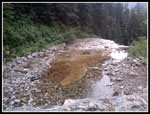
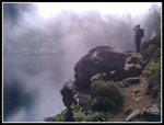
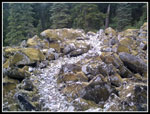
The 2006 Melakwa - Pratt loop was the last time I was on the Denny Creek trail. The log across the creek at the bathing rocks was still in place. The easy grade made for a quick trip to the bathing rocks. It was strange for me to be there when there were no other people. By going counter clockwise we hit the most popular part of the trip early in the morning. The water was low at the creek crossing and we had no trouble crossing with dry feet. it was muggy climbing up the valley but still cloudy. Keekwulee Falls soon came into view. The water flow was very low. Since Kim had not been to the flat area above the falls we took the short detour. Back on the trail we could hear one group above us and another single hiker had just passed by.
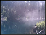
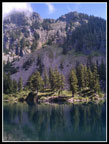
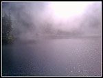
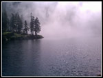
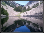
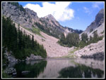
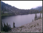
As we climbed towards Hemlock Pass we passed through the cloud layer. It was now bright sunshine and blue sky. The sea of clouds was now below us. The temperature seemed to rise about 20 degrees. One group was already on their way down. At the pass it was back into forest. We arrived at the first Melakwa Lake to find it was sunny. A few minutes later wispy clouds began to blow through. A few minutes later those wispy clouds turned into a white out. The lake disappeared into a sea of white. Well, we were heading to Upper Melakwa Lake and a few minutes later we were there. It was crystal clear. No clouds. Quite a contrast in a very short distance.
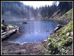
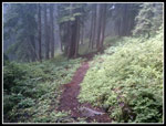
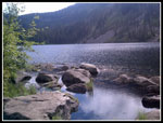
There were folks camping at the lake as expected. There were some day hikers too. We had an early lunch and headed back. Just below the main lake we reached the junction with the trail down to Lower Tuscohatchie Lake. We could see misty clouds below. This trail is seldom hiked and was in excellent condition. Some signs of a little trail maintenance in the last few years. No logs to crawl over. The forest is very pretty. We even found some ripe huckleberries. Lots of early season wildflowers like queens cup were blooming. This gentle trail is much smoother and easier than the rocky trail back down Denny Creek. Much to my surprise we even saw two groups on this section of trail.
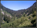
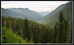
So far the bugs were nearly non existent. That made two weeks in a row in mid summer. Not that I'm complaining. We stopped at Lower Tuscohatchie for the rest of lunch. Several tents were visible. The rain the day before and overcast morning was not keeping everyone away. This was just about the middle of our trek. Still 6.5 miles to go. The trail over to Pratt Lake did not take long. We had good views down to the Pratt River Valley. No views up to Kaleetan Peak which was lost in the low clouds. I was surprised to see a new sign for the upper end of the long abandoned Pratt Valley Trail. We crossed the outlet and went a short way down the trail. The whole route is still on my schedule, hopefully this year.
More tents at Pratt Lake and more day hikers. Not as crowded as Melakwa Lake. The clouds parted for a while and it was very hot. We were soon on our way along the lake. At the end of the lake I found the old section of the Pratt Lake Trail. On my mid June hike I was able to follow the old trail up to the junction with the new trail. I noted a number of devil's club bushes without their leaves. They have them now. We made it part way before being engulfed by a sea of stickers. It was time to bail out. Straight uphill and a little right and we made it back to the new trail with minimal blood loss. Kim was able to see some of the old puncheon but the old route is not open for summer travel. Early June, yes. Early August, no. A few more switchbacks and we reached the ridge top junction with the Defiance Trail. Another group was there. That was about it for hikers. We saw only one or two the rest of the way back.
Our last break was at the Olallie Lake overlook. More white sky now and no view of Mt. Rainier. The last four miles went by fairly fast. Easy soft trail all the way. Back at the trailhead there were only a dozen cars. We took the whole day to make our trek and it was thoroughly enjoyable. A quick drive back to Danny creek to fetch my car and we were done. I always enjoy one way hikes. This one is close to Seattle, has lots of lakes and not all that many people beyond Melakwa Lakes. Not a bad way to spend an overcast summer day.
I managed to forget my camera on this trip. I've forgotten my boots, pack, water, you name it but I think this is the first time for the camera. I was forced to use my phone's camera. Not very good quality but better than nothing. On the bright side, some photos were contributed by Kim Brown.
Click on thumbnails to get
larger pictures.
Trips - 2013
Home
The 2006 Melakwa - Pratt loop was the last time I was on the Denny Creek trail. The log across the creek at the bathing rocks was still in place. The easy grade made for a quick trip to the bathing rocks. It was strange for me to be there when there were no other people. By going counter clockwise we hit the most popular part of the trip early in the morning. The water was low at the creek crossing and we had no trouble crossing with dry feet. it was muggy climbing up the valley but still cloudy. Keekwulee Falls soon came into view. The water flow was very low. Since Kim had not been to the flat area above the falls we took the short detour. Back on the trail we could hear one group above us and another single hiker had just passed by.
As we climbed towards Hemlock Pass we passed through the cloud layer. It was now bright sunshine and blue sky. The sea of clouds was now below us. The temperature seemed to rise about 20 degrees. One group was already on their way down. At the pass it was back into forest. We arrived at the first Melakwa Lake to find it was sunny. A few minutes later wispy clouds began to blow through. A few minutes later those wispy clouds turned into a white out. The lake disappeared into a sea of white. Well, we were heading to Upper Melakwa Lake and a few minutes later we were there. It was crystal clear. No clouds. Quite a contrast in a very short distance.
There were folks camping at the lake as expected. There were some day hikers too. We had an early lunch and headed back. Just below the main lake we reached the junction with the trail down to Lower Tuscohatchie Lake. We could see misty clouds below. This trail is seldom hiked and was in excellent condition. Some signs of a little trail maintenance in the last few years. No logs to crawl over. The forest is very pretty. We even found some ripe huckleberries. Lots of early season wildflowers like queens cup were blooming. This gentle trail is much smoother and easier than the rocky trail back down Denny Creek. Much to my surprise we even saw two groups on this section of trail.
So far the bugs were nearly non existent. That made two weeks in a row in mid summer. Not that I'm complaining. We stopped at Lower Tuscohatchie for the rest of lunch. Several tents were visible. The rain the day before and overcast morning was not keeping everyone away. This was just about the middle of our trek. Still 6.5 miles to go. The trail over to Pratt Lake did not take long. We had good views down to the Pratt River Valley. No views up to Kaleetan Peak which was lost in the low clouds. I was surprised to see a new sign for the upper end of the long abandoned Pratt Valley Trail. We crossed the outlet and went a short way down the trail. The whole route is still on my schedule, hopefully this year.
More tents at Pratt Lake and more day hikers. Not as crowded as Melakwa Lake. The clouds parted for a while and it was very hot. We were soon on our way along the lake. At the end of the lake I found the old section of the Pratt Lake Trail. On my mid June hike I was able to follow the old trail up to the junction with the new trail. I noted a number of devil's club bushes without their leaves. They have them now. We made it part way before being engulfed by a sea of stickers. It was time to bail out. Straight uphill and a little right and we made it back to the new trail with minimal blood loss. Kim was able to see some of the old puncheon but the old route is not open for summer travel. Early June, yes. Early August, no. A few more switchbacks and we reached the ridge top junction with the Defiance Trail. Another group was there. That was about it for hikers. We saw only one or two the rest of the way back.
Our last break was at the Olallie Lake overlook. More white sky now and no view of Mt. Rainier. The last four miles went by fairly fast. Easy soft trail all the way. Back at the trailhead there were only a dozen cars. We took the whole day to make our trek and it was thoroughly enjoyable. A quick drive back to Danny creek to fetch my car and we were done. I always enjoy one way hikes. This one is close to Seattle, has lots of lakes and not all that many people beyond Melakwa Lakes. Not a bad way to spend an overcast summer day.
I managed to forget my camera on this trip. I've forgotten my boots, pack, water, you name it but I think this is the first time for the camera. I was forced to use my phone's camera. Not very good quality but better than nothing. On the bright side, some photos were contributed by Kim Brown.
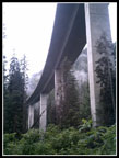 Under Highway |
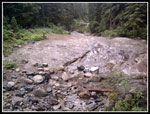 Bathing Rocks |
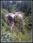 Keekwulee Falls |
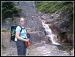 Kim Above Falls |
 Top Of Falls |
 Hemlock Pass Above |
 Melakwa Lake |
 Chair Peak |
 Clouds Roll In |
 White Out |
 Highlighted Trees |
 Upper Lake Reflection |
 Kaleetan Peak |
 Clouds Are Gone |
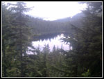
 Trail To Lower T Lake |
 Trail Through Rocks |
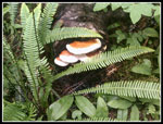 Fungus |
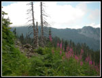 Fireweed |
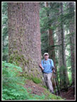 Big Hemlock |
 Lower T Reflection |
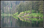
 Lower Tuscohatchie |
 Pratt River Valley |
 Pratt Lake |
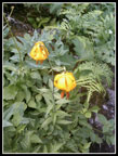 Tiger Lilies |
 Olallie Lake |
Trips - 2013
Home