7-20-14
The
"sunny Sunday" forecast changed
overnight to cloudy with a chance of rain most everywhere. There might
not be any views but I headed south to Crystal Mountain for a hike up
Norse Peak. I have snowshoed up from the ski area three times. I have
only been up the Norse Peak Trail on dirt once in the last dozen years.
That was in 2011. The lure of a nice smooth trail and some wildflowers
won out. I was out the door at 7:00 am and reached the trailhead at
8:40 am. The route starts up a dirt road located 4.2 miles up the road
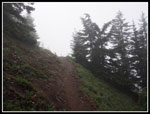
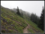
from Highway 410 to the ski area. It was very misty and drippy at the
start. Not really raining but as damp as the inside of a cloud. I
started with an umbrella. I hoped that I would be able to rise above
the clouds.
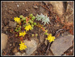
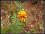
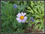
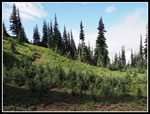
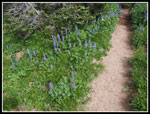
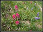
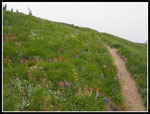
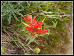
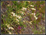
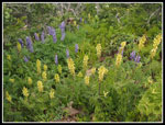
The trail starts in forest. On the way up there are a number of open spots that lead back into forest once again. It was chilly but the climbing kept me warm enough in shorts and short sleeves. A nice break from the mid 80s temperatures of the previous weekend. The flowers are finished near the bottom but began to show up as I climbed. It was not a great day for masses of wildflowers but there was a very nice variety much of the way up. After about a mile I was finished with the umbrella. Once the lupine appeared it continued most of the way up. I saw some tiger lilies and a few columbine. There was red and orange Indian paintbrush but not in profusion.
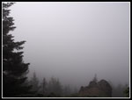
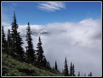
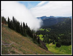
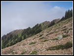
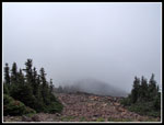
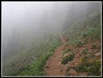
As I gained elevation the dark clouds overhead began to lighten. I had no views out but it almost seemed that the sun would soon shine. Other than photo stops I kept up a steady pace. The grade is mostly very gentle as the route takes long switchbacks even on less steep slopes. A junction is marked "Goat Lake". The main route up Norse is not signed though as the only other option it is clear where to go. The old trail cuts through in a number of places. Several have signs to keep folks off of it. The trail is in excellent shape. Only one log down and it was been limbed and can be stepped across. As I neared the ridge it became misty once again.
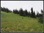
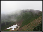
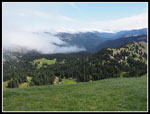
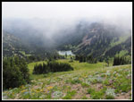
The meadows are big and green. There are wildflowers in bloom but not as thick as at their peak. The long switchbacks make for a long hike to finally reach the ridge top. Once there I had some views to the east. Clouds were blowing up the valley below but the view was infinitely better than the solid white on the west side. The trail splits with one gong down into the basin below. The summit route drops a little on the left side then climbs steeply back to the ridge top. The route switches back to the west side as it traverses a bare rock garden. The trail climbs back to the ridge and goes under the summit of Norse Peak on the east side. From here Basin Lake sits below. it was clear enough to see the lake.
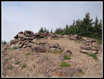
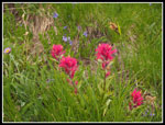
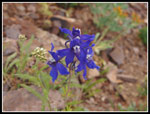
Below the summit the flowers include magenta Indian paintbrush. This variety is seen in Mt. Rainier National Park and environs. One of my favorites. A few minutes later I reached the summit at 11:22 am.. I was the only one there. Views included white and gray to the north, west, and south. There were still some views to the east. For the first time all day there was a breeze blowing on the summit. Not hard but hard enough to warrant putting on a jacket. You really can see six volcanoes from the summit. This day I could see almost nothing. Although there is a big ski resort below it felt like there was plenty of solitude. On my previous trip I reached the summit in 2:35. This time it took me 2:35. I am consistent.
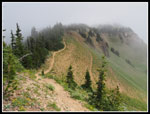
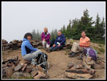
After about 15 minutes I was joined by four other hikers. It turns out that they follow my website and WTA trip reports. I seldom am recognized on the trail. It was fun to meet some fans. We talked hiking for quite awhile before Page, Deb, Drue, and Florence packed up to head down. They came up via Bullion Basin and were heading down my route to complete a loop. Several more groups arrived. I stayed on top hoping for even a short break in the clouds. It was not to be. I headed down at 12:45 pm after spending 1:23 on top. Because the trail is so gentle it as very easy going down. The only tough spots are on the ridge top where there are a few steep spots and narrow spots. I caught up to my summit friends near where I left the ridge.
On the way down I met four or five groups heading up. Not really very many. I guess the weather kept others away. As I descended I went back into the cloud layer. It was misty and visibility dwindled. It was a nice break after the heat the week before. The mist also gave this trail a totally different feel. The forest and meadows became the prime features not the views out. I had kept my jacket on for the descent. Not really necessary without the summit wind but it did ward off the wet mist lower down. In 2011 I took 2 hours exactly to hike down. This time it took... 2 hours exactly. I am consistent. Back at the car visibility was nearly non existent. The first part of the drive down I could barely see 25 feet. As I dropped I got below the clouds once and for all.
This was a totally different hike than my visit in 2011. Instead of sun and views I had mist and forest. Some good wildflowers on both trips. I most enjoy Norse Peak as a mid winter snowshoe trip on a sunny day. Still, there is a lot to be said for a gentle trail to a nearly 7000' high point. Again I hiked a popular trail on a day when there were no crowds. Just a few hardy hikers enjoying a misty wet summer day.
Click on thumbnails to get
larger pictures.
Trips - 2014
Home
The trail starts in forest. On the way up there are a number of open spots that lead back into forest once again. It was chilly but the climbing kept me warm enough in shorts and short sleeves. A nice break from the mid 80s temperatures of the previous weekend. The flowers are finished near the bottom but began to show up as I climbed. It was not a great day for masses of wildflowers but there was a very nice variety much of the way up. After about a mile I was finished with the umbrella. Once the lupine appeared it continued most of the way up. I saw some tiger lilies and a few columbine. There was red and orange Indian paintbrush but not in profusion.
As I gained elevation the dark clouds overhead began to lighten. I had no views out but it almost seemed that the sun would soon shine. Other than photo stops I kept up a steady pace. The grade is mostly very gentle as the route takes long switchbacks even on less steep slopes. A junction is marked "Goat Lake". The main route up Norse is not signed though as the only other option it is clear where to go. The old trail cuts through in a number of places. Several have signs to keep folks off of it. The trail is in excellent shape. Only one log down and it was been limbed and can be stepped across. As I neared the ridge it became misty once again.
The meadows are big and green. There are wildflowers in bloom but not as thick as at their peak. The long switchbacks make for a long hike to finally reach the ridge top. Once there I had some views to the east. Clouds were blowing up the valley below but the view was infinitely better than the solid white on the west side. The trail splits with one gong down into the basin below. The summit route drops a little on the left side then climbs steeply back to the ridge top. The route switches back to the west side as it traverses a bare rock garden. The trail climbs back to the ridge and goes under the summit of Norse Peak on the east side. From here Basin Lake sits below. it was clear enough to see the lake.
Below the summit the flowers include magenta Indian paintbrush. This variety is seen in Mt. Rainier National Park and environs. One of my favorites. A few minutes later I reached the summit at 11:22 am.. I was the only one there. Views included white and gray to the north, west, and south. There were still some views to the east. For the first time all day there was a breeze blowing on the summit. Not hard but hard enough to warrant putting on a jacket. You really can see six volcanoes from the summit. This day I could see almost nothing. Although there is a big ski resort below it felt like there was plenty of solitude. On my previous trip I reached the summit in 2:35. This time it took me 2:35. I am consistent.
After about 15 minutes I was joined by four other hikers. It turns out that they follow my website and WTA trip reports. I seldom am recognized on the trail. It was fun to meet some fans. We talked hiking for quite awhile before Page, Deb, Drue, and Florence packed up to head down. They came up via Bullion Basin and were heading down my route to complete a loop. Several more groups arrived. I stayed on top hoping for even a short break in the clouds. It was not to be. I headed down at 12:45 pm after spending 1:23 on top. Because the trail is so gentle it as very easy going down. The only tough spots are on the ridge top where there are a few steep spots and narrow spots. I caught up to my summit friends near where I left the ridge.
On the way down I met four or five groups heading up. Not really very many. I guess the weather kept others away. As I descended I went back into the cloud layer. It was misty and visibility dwindled. It was a nice break after the heat the week before. The mist also gave this trail a totally different feel. The forest and meadows became the prime features not the views out. I had kept my jacket on for the descent. Not really necessary without the summit wind but it did ward off the wet mist lower down. In 2011 I took 2 hours exactly to hike down. This time it took... 2 hours exactly. I am consistent. Back at the car visibility was nearly non existent. The first part of the drive down I could barely see 25 feet. As I dropped I got below the clouds once and for all.
This was a totally different hike than my visit in 2011. Instead of sun and views I had mist and forest. Some good wildflowers on both trips. I most enjoy Norse Peak as a mid winter snowshoe trip on a sunny day. Still, there is a lot to be said for a gentle trail to a nearly 7000' high point. Again I hiked a popular trail on a day when there were no crowds. Just a few hardy hikers enjoying a misty wet summer day.
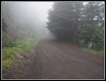 Misty At The Start |
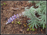 Wet Lupine |
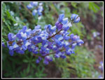
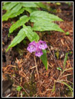 Penstemon? |
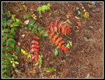 Red Leaves |
 Clouds But No Mist |
 Stonecrop |
 Getting Darker |
 Tiger Lily |
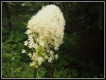 Beargrass |
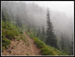 Cloudy Traverse |
 More Wet Lupine |
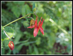 Columbine |
 Aster |
 Blue Sky! |
 Blue & White |
 Big Meadow |
 Lupine Border |
 Clouds Roll In |
 Last Bit Of Snow |
 Trail On Ridge |
 Back On West Side |
 Rock Garden |
 Views To The East |
 Magenta Paintbrush |
 Basin Lake |
 Norse Peak Summit |
 Summit Views |
 Summit Group |
 Heading Down |
 Bright Paintbrush |
 Red Paintbrush |
 Candy? |
 Lupine & Lousewort |
 Larkspur |
 Back Into The Clouds |
Trips - 2014
Home