It was cool but there was little wind making the conditions comfortable. The west side of the Cascades were snow free along Highway 2. Snow began just before Stevens Pass. Once across the pass the snow continued along the highway nearly to Leavenworth. I did not expect to see any snow at 1200'. As mentioned, snow ended at the parking lot as we hiked higher. Looking out to fields below we did see some snow. Two women passed us heading down. They were the folks whose truck parked on the ice.
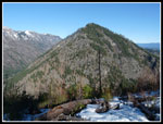
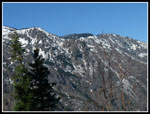
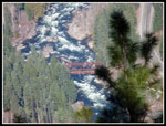
Creeks were running though they were easy to step across. We took a short break at the ridge top viewpoint. Directly below us was the Wenatchee River in Tumwater Canyon. I could see the Pipeline Bridge. Tumwater Mountain was across the valley. We could see the north side of Icicle Ridge up above us. That side had snow. After a short break and a number of photos. we headed higher. We began to run into snow patches. Really more like ice patches. The snow was packed down and frozen solid. The ice patches were interspersed with bare trail. we did not bother with traction devices yet.
The grade of the trail is very consistent and not all that steep. We gained more elevation that it felt like. 1750' up to the ridge and more as we continued up the ridge. Soon I recognized we were near where Janet and I turned around on a trip in late April 2012. That day the snow was slick and rotten. We were sinking in up to our knees. This day the snow was rock hard. Slick but no post holing. At about 4 miles we stopped to put on microspikes. Now the trail was mostly hard ice. With my spikes and Gary's Yaktrax and poles we had plenty of traction. The switchbacks finally ended and the route began to go straight up the ridge on continuous snow. By about 4000' there was little dirt to be seen.
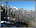
So far we had great views to the east and some good looks to the north. South we could see the Wedge Mountain area but none of the Stuart Range. We planned to keep heading higher in hopes of some views to the south. A flat spot with some bare cut logs looked like a good lunch spot. We chose to head up one more steep slope. We had been following frozen steps set on a much warmer day. They continued on after we turned around. Hoping for a view south we left the tracks on a steep slope just before heading back into thick forest. We traversed towards the south side of the ridge. After seeing no signs of flowers Gary pointed out what looked like fresh pussy willows on a tree surrounded by snow. Try as we might, we could not find a spot with views to the south. Just too many trees. At 4700' we turned around.
We quickly dropped down to the flat spot for our lunch. The temperature was only about 40 degrees but the bright sunshine made it seem warmer. We had a long lunch. When clouds blocked the sun the temperature plummeted and we headed on down. In addition to the two women we had seen just one other runner all day. We made it all the way back to the ridge top viewpoint before we met more. Some folks had set up two hammocks and they seemed to be keeping a number of kids entertained. We headed out to the point for better views of Leavenworth. The downtown area was right below us. The short detour provided some great views.
After another break at the point it was time for the last few miles. The consistent grade was easy on our knees. We began to met more and more hikers, most still coming up. We were back at the trailhead at 3:45 pm. The GPS track shows we traveled about 9.70 miles with 3700' of elevation gain. Though the parking area was partly under a sheet of ice there were many cars parked off the dirt road and along the paved road just below. On the way home we stopped at the 59er Diner for dinner. It was dark before we reached Bothell. I let home at 6:00 am and returned at 7:15 pm. Just in time to download photos and get ready for Sunday's hike.
We had a great time. The trail is mostly snow free for about 2.5 miles. The next 2.5 miles were on dirt and icy snow then just icy snow. It would have been much harder to continue without traction devices. They especially helped coming down. Getting this high up the trail in February is very unusual. We were way too early for the flower show. but a nice trail, 3700' of gain, and great views were more than good enough. It was a great winter day for a spring hike.
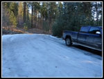 Icy Parking Lot |
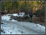 Icy Trailhead |
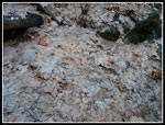 Pressed Leaves |
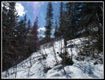
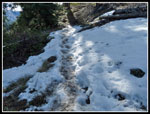
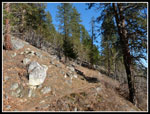 Bare Trail |
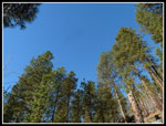 Blue & Green |
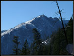
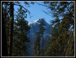 Framed Peak |
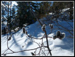
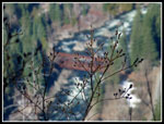 Budding Bush |
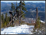
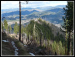
 Ridge From Viewpoint |
 Tumwater Mountain |
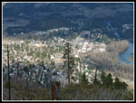
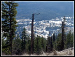 Snow In Leavenworth |
 View South |
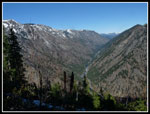 Tumwater Canyon |
 Not Much Snow |
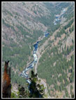 Wenatchee River |
 Pipeline Bridge |
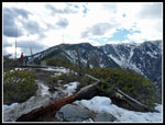
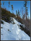 Very Hard Snow |
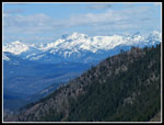
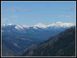 Peaks To The North |
 Break Time |
 South View? |
 Pussy Willows |
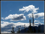 Puffy Clouds |
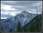
 Zoomed Peaks |
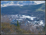 Leavenworth Snow |
 Slick Ice |
 Viewpoint Below |
 Leavenworth Is Below |
 Icicle Ridge |
 Cloudy Sky |
Trips - 2015
Home