11-15-15
I
seldom write trip reports for trips on Tiger Mountain. It takes
something out of the ordinary. After last winter with almost no snow, a
snowy trip at low elevation is out of the ordinary. I checked online
cameras in the morning and found snow at 1377" Tiger Summit on Highway
18 and snow at the high point of I-90 at the junction with Highway 18.
The snow level was several thousand feet lower than forecast over
night. Instead of a longer drive I chose a short drive to hike in the
snow. I also wanted to get some photos of the new TMT bridge with snow.
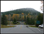
I reached the trailhead at High Point at 8:25 and was on the trail a
few minutes later. Looking across I-90 to Grand Ridge I saw snow not
far above. On the drive in I saw that Poo Poo Point was completely
white. It was cold and gray but not raining.
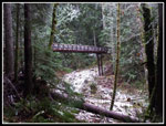
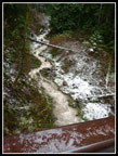
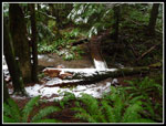
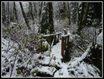
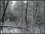
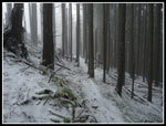
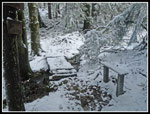
My first stop was at the bridge. Snow began to appear just below the bridge at about 850' in the open. Still none in the forest. The creek was roaring and snow was along around it. The bridge deck had some snow on it. There were a lot of footprints on the bridge. I was surprised that so many folks were ahead of me on that trail. Photos taken when I arrived showed the creek to be clear. A few minutes later it was dark brown. A slide upstream? On the way down it was clear again. I next headed up the Tiger Mountain Trail (TMT). By the time I was at Ruth's Cove the snow was on the ground in the forest. When I came out of the forest on the old High Point Trail the snow was continuous.
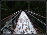
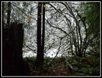
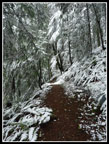
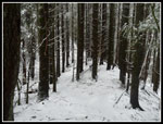
A winter wonderland at 1700' right above Issaquah. The bridge was totally white. All the brush was white. In the lower forest the snowy tree branches were melting and dripping on me. A jacket was necessary. Now the temperature was below freezing. Across the bridge the trail was a fast flowing creek. I stopped to channel most of the water off before it reached the bridge foundation. Above, the trail is in a trench. There are few places that water can be rerouted. At one place I did manage to open a filled in drainage cut. A few minutes later I opened another and moved much of the water off the trail. Mission accomplished. I had been following footprints since the snow began. while working on the trail Two hikers passed me. After "wading" up the underwater trail they quickly passed by again on their way down. They were the only people I saw on my way up.
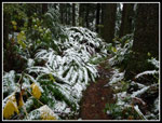
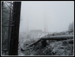
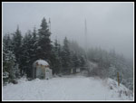
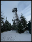
At Fred's Corner the footprints all went right on the TMT. I went left on untouched fresh snow. It snowed a little then stopped for good. At the Preston Trail I picked up more footprints. I also passed a lone hiker and then a group of four all heading down. With the bridge stop and trail work I was making very slow progress. A few brushy spots managed to soak my pants. Gaiters also would have been a good idea. At the junction with the Bootleg Trail I was just below one tower but could barely make it out as I was now in the clouds. I turned right and headed for the viewpoint at the Hiker's Hut. Along the way I realized that I had not taken the uphill detour around the big mass of downed trees. I did not notice that spot. I also did not notice a lot of freshly cut out big trees. I'll have to check it out again soon and see what happened.
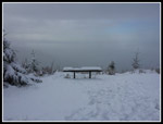
At the Hiker's Hut viewpoint the snow was deep enough to cover the ground. Clouds blocked the views though it began to clear a little. I could see over some clouds. As I left there was even a little blue sky though it did not last long. After a little food and water I retraced my steps along the Bypass Trail. There were no footprints heading up to the summit of Tiger 1. The gate into the tower facilities was closed and there were no signs of people. Going down the Poo Top Trail was the most interesting part of the day. Following the snow covered trail was no problem. Staying on my feet was. The few inches of snow gave way as I descended the steep trail. I was tempted to just sit and slide a few times. Much to my surprise, I made it down without a fall. Down on the main road I was in the sun for a few moments. The temperature was right around freezing and the sunshine felt very good.
I soon went back into the forest for the short steep descent to the TMT. A right turn and I was soon at the One View Trail junction. Here I again picked up footprints. I followed the tracks along the TMT heading towards Tiger 3 and 2. The wooden bridges in Many Creek Valley were especially slick with a thin coating of wet snow. I dropped from 2950' atop Tiger 1 to 2250' on the TMT. Now I had to climb back up to 2757' on Tiger 2. Add in a few ups and downs too. I was surprised to see footprints heading up the Seattle View Trail. Since it is so brushy I chose to go on to the Cable Line Trail and not soak my pants once again on wet brush. On the climb to Tiger 2 I finally saw another person who was heading down.
I had a short stop atop Tiger 2 and then headed down the north side back to the TMT. Right at Tom's Crossing and the TMT I met a hiker coming around from Tiger 3. We struck up a conversation and headed down together. After a long morning with much solitude it was fun to talk hiking the rest of the way back. Time goes by a little faster too. I closed my loop at Fred's Corner and was pleased to see my drainage work was holding and much of the trail/creek was now dry. Once off the old High Point Trail section and back in the woods the snow thinned and then was gone. Easy walking all the way back.
This was a slow hiking day. With trail work and trying not to overheat in a jacket going up I took 2:20 to hike four miles up Tiger 1. Slip sliding down the Poo Top I took another 35 minutes to drop to the TMT. After that I picked up the pace. I was back at the car by 2:25 pm. This is a route I have done only a few times over the years. It avoids the most used trails. I calculated it at about 10 miles with 3100' of elevation gain. It was great to actually do a snow hike with such a short drive. Maybe I'll actually use my snowshoes this winter.
Click on thumbnails to get
larger pictures.
Trips - 2015
Home
My first stop was at the bridge. Snow began to appear just below the bridge at about 850' in the open. Still none in the forest. The creek was roaring and snow was along around it. The bridge deck had some snow on it. There were a lot of footprints on the bridge. I was surprised that so many folks were ahead of me on that trail. Photos taken when I arrived showed the creek to be clear. A few minutes later it was dark brown. A slide upstream? On the way down it was clear again. I next headed up the Tiger Mountain Trail (TMT). By the time I was at Ruth's Cove the snow was on the ground in the forest. When I came out of the forest on the old High Point Trail the snow was continuous.
A winter wonderland at 1700' right above Issaquah. The bridge was totally white. All the brush was white. In the lower forest the snowy tree branches were melting and dripping on me. A jacket was necessary. Now the temperature was below freezing. Across the bridge the trail was a fast flowing creek. I stopped to channel most of the water off before it reached the bridge foundation. Above, the trail is in a trench. There are few places that water can be rerouted. At one place I did manage to open a filled in drainage cut. A few minutes later I opened another and moved much of the water off the trail. Mission accomplished. I had been following footprints since the snow began. while working on the trail Two hikers passed me. After "wading" up the underwater trail they quickly passed by again on their way down. They were the only people I saw on my way up.
At Fred's Corner the footprints all went right on the TMT. I went left on untouched fresh snow. It snowed a little then stopped for good. At the Preston Trail I picked up more footprints. I also passed a lone hiker and then a group of four all heading down. With the bridge stop and trail work I was making very slow progress. A few brushy spots managed to soak my pants. Gaiters also would have been a good idea. At the junction with the Bootleg Trail I was just below one tower but could barely make it out as I was now in the clouds. I turned right and headed for the viewpoint at the Hiker's Hut. Along the way I realized that I had not taken the uphill detour around the big mass of downed trees. I did not notice that spot. I also did not notice a lot of freshly cut out big trees. I'll have to check it out again soon and see what happened.
At the Hiker's Hut viewpoint the snow was deep enough to cover the ground. Clouds blocked the views though it began to clear a little. I could see over some clouds. As I left there was even a little blue sky though it did not last long. After a little food and water I retraced my steps along the Bypass Trail. There were no footprints heading up to the summit of Tiger 1. The gate into the tower facilities was closed and there were no signs of people. Going down the Poo Top Trail was the most interesting part of the day. Following the snow covered trail was no problem. Staying on my feet was. The few inches of snow gave way as I descended the steep trail. I was tempted to just sit and slide a few times. Much to my surprise, I made it down without a fall. Down on the main road I was in the sun for a few moments. The temperature was right around freezing and the sunshine felt very good.
I soon went back into the forest for the short steep descent to the TMT. A right turn and I was soon at the One View Trail junction. Here I again picked up footprints. I followed the tracks along the TMT heading towards Tiger 3 and 2. The wooden bridges in Many Creek Valley were especially slick with a thin coating of wet snow. I dropped from 2950' atop Tiger 1 to 2250' on the TMT. Now I had to climb back up to 2757' on Tiger 2. Add in a few ups and downs too. I was surprised to see footprints heading up the Seattle View Trail. Since it is so brushy I chose to go on to the Cable Line Trail and not soak my pants once again on wet brush. On the climb to Tiger 2 I finally saw another person who was heading down.
I had a short stop atop Tiger 2 and then headed down the north side back to the TMT. Right at Tom's Crossing and the TMT I met a hiker coming around from Tiger 3. We struck up a conversation and headed down together. After a long morning with much solitude it was fun to talk hiking the rest of the way back. Time goes by a little faster too. I closed my loop at Fred's Corner and was pleased to see my drainage work was holding and much of the trail/creek was now dry. Once off the old High Point Trail section and back in the woods the snow thinned and then was gone. Easy walking all the way back.
This was a slow hiking day. With trail work and trying not to overheat in a jacket going up I took 2:20 to hike four miles up Tiger 1. Slip sliding down the Poo Top I took another 35 minutes to drop to the TMT. After that I picked up the pace. I was back at the car by 2:25 pm. This is a route I have done only a few times over the years. It avoids the most used trails. I calculated it at about 10 miles with 3100' of elevation gain. It was great to actually do a snow hike with such a short drive. Maybe I'll actually use my snowshoes this winter.
 Snow On Grand Ridge |
 Leafy Trail |
 Snow Under Bridge |
 Snow On Bridge |
 Clear Creek |
 Muddy Creek |
 Snow On Ferns |
 Ruth's Cove |
 Dark & Light |
 Snowy Bridge |
 Almost Black & White |
 A Bare Spot |
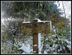
 Cloudy Tower |
 Bypass Trail |
 Snowy Hikers Hut |
 Snowy Bench |
 East Tiger Mountain |
 Poo Top Trail |
 Back On TMT |
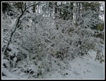 Snowy Brush |
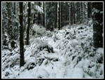 More Snow |
 Issaquah Gap Creek |
 Tiger 2 Summit |
 Tiger 2 Art |
Trips - 2015
Home