11-06-16
This
is an old favorite hike for
mileage and solitude. East of South Cle Elum and along the Yakima
River. I have hiked it a dozen or more times since my first visit in
1990. In the spring the wildflower show is outstanding. In the fall the
leaf color is excellent. In the summer there are many better places to
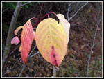
go. I knew I was too late for the best leaf color but I wanted a long
easy trip on the dry side of the mountains. Daylight saving time kicked
in this weekend so it would be darker an hour earlier in the
afternoon/evening. I enjoyed the extra hour of sleep and headed out at
7:20 am. An easy drive brought me to Cle Elum. I crossed the river to
South Cle Elum and followed the road as it turned east. A few miles
later I crossed under the freeway and reached the gravel parking lot on
the left. As I expected, I was the only car there at 9:00 am. It was a
little chilly but not really cold. Lots of folks bike the trail in the
summer. It is only 7.5 miles to the tunnel. The 15 miles round trip is
a little more challenging on foot.
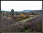
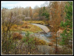
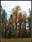
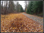
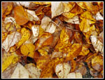
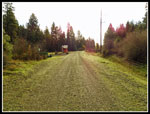
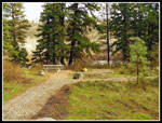
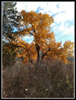
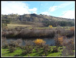
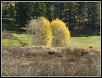
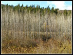
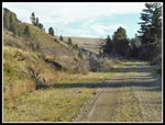
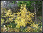
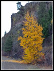
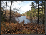
The first part has a lot of big maple and other deciduous trees. Some leaves were still on them but many more covered the ground. Far from peak color but not too bad either. A short way along the Yakima River came into view. There are three or four picnic spots along the trail. Most are in the first few miles. Picnic tables and plenty of grass. The largest one has four tables, a signboard, and a new bathroom. The old wooden outhouse was leaning over on a visit three of four years ago. A small backhoe showed construction was still underway. I stopped as always about a mile and a half along. The Teanaway River meets the Yakima there. The Teanaway was just a trickle a few months earlier. Now it nearly as big as the Yakima. The big picnic area is just before the powerline corridor. Lots of balsamroot and lupine bloom nearby in the spring.
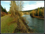
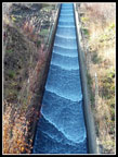
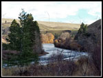
The powerline corridor is very wide. One of the major lines that feed hydro power across the mountains. It takes some time to get under all half a dozen or more sets of lines. The buzzing is pretty noticeable. Across the river are ranches and old Highway 10. Lots of cows in the fields this day. The railroad grade/trail is in a canyon most of the way. Other than spots open to the river there is a lot of solitude. Next I came to the water chute that drains water from high above the canyon to the river. It is often dry but this time there were waves of water coming down. The wave pattern was very photogenic. I spent time taking photos there.
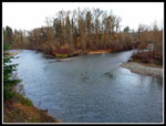
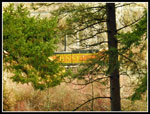
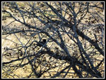
Near the end of the meadows across the river I noticed the old water wheel. It was fully intact on my early visits. It was been falling apart ever since. The lower half is still there though probably not for much longer. A little farther along is a big meadow on the right. I often see horses here. This time it was empty. Though close to the river, It is out of sight for a few miles now. Time to motor along. Soon enough the river comes back into sight. I saw the first people of the day here. Two guys fishing from a small boat near the shore. Five miles of hiking and I saw two folks fishing in the river. Not all trails are crowded. The grade itself is about as flat as possible. I log the total elevation gain and loss at 100'.
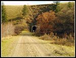
The sight of the tunnel is visible while still over a mile away. The top of the cut is all that can be seen. One big change at the east end of the route is the wind far. The windmills are seen above the tunnel and across the river atop the ridge. This late in the year the sun is so low that much of the way was in the shade while the other side of the river was in sunshine. I enjoyed the parts that were in the sun. Much warmer. I came upon several groves of trees that had lost all their leaves. The white branches looked like ghost trees. I picked up the pace and reached the tunnel at 11:50 am. I took 2:45 to hike the 7.5 miles. I found a sunny spot to sit down for lunch. Sunny and warm enough that I spent nearly an hour there.
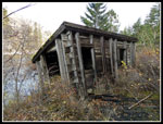
I finally packed up and headed back. I missed the small old building at the old site of Horlick. I found it on the way back. My oldest photos show it between the grade and the river. Now the brush has grown higher and the building was migrated to the edge of the embankment. Just a few feet more and it will fall into the river. Many visits over 26 years have given me a chronicle of all the changes that have occurred. The building is one. A good sized fire that charred many trees in another. A new forest is slowly replacing the old burned trees. I saw two folks fishing from the other bank on the way back. I passed under the powerlines and reached the big picnic stop and took a break. Here the first biker of the day pedaled past me. I hiked 11.5 miles before seeing anyone on the grade. The rest of the way back I saw half a dozen more bikes and one runner.
The last few hundred feet before reaching the parking lot there is a fence along the trail. Years back I would see a one eyed horse here. This day I was surprised to see two alpacas. One white and one brown. They were very interested in following me. Back at the car they posed for photos. I reached the car at 2:50 pm. I was on the road home just before 3:00 pm. Darkness now starts just before 5:00 pm. By 4:10 pm I reached the bridge to Mercer Island. The westbound lanes were closed and all traffic went onto one express lane then two. It took me as long to drive the last dozen miles as it had the first 82 miles.
I had a great time. Few folks like to walk on a level gravel railroad grade. It is a bit hard on the feet over 15 miles. On the other hand the river and the solitude make it well worthwhile, at least to me. This day I had some sunshine and no rain. That will be harder to find for the next number of months. Though the spring wildflowers were long gone and fall leaves were mostly on the ground I still found enough to see to have taken about 400 photos. I was very surprised to find I took that many. Many more than an average hike. My next visit will we in wildflower season in the next few years.
Click on thumbnails to get
larger pictures.
Trips - 2016
Home
The first part has a lot of big maple and other deciduous trees. Some leaves were still on them but many more covered the ground. Far from peak color but not too bad either. A short way along the Yakima River came into view. There are three or four picnic spots along the trail. Most are in the first few miles. Picnic tables and plenty of grass. The largest one has four tables, a signboard, and a new bathroom. The old wooden outhouse was leaning over on a visit three of four years ago. A small backhoe showed construction was still underway. I stopped as always about a mile and a half along. The Teanaway River meets the Yakima there. The Teanaway was just a trickle a few months earlier. Now it nearly as big as the Yakima. The big picnic area is just before the powerline corridor. Lots of balsamroot and lupine bloom nearby in the spring.
The powerline corridor is very wide. One of the major lines that feed hydro power across the mountains. It takes some time to get under all half a dozen or more sets of lines. The buzzing is pretty noticeable. Across the river are ranches and old Highway 10. Lots of cows in the fields this day. The railroad grade/trail is in a canyon most of the way. Other than spots open to the river there is a lot of solitude. Next I came to the water chute that drains water from high above the canyon to the river. It is often dry but this time there were waves of water coming down. The wave pattern was very photogenic. I spent time taking photos there.
Near the end of the meadows across the river I noticed the old water wheel. It was fully intact on my early visits. It was been falling apart ever since. The lower half is still there though probably not for much longer. A little farther along is a big meadow on the right. I often see horses here. This time it was empty. Though close to the river, It is out of sight for a few miles now. Time to motor along. Soon enough the river comes back into sight. I saw the first people of the day here. Two guys fishing from a small boat near the shore. Five miles of hiking and I saw two folks fishing in the river. Not all trails are crowded. The grade itself is about as flat as possible. I log the total elevation gain and loss at 100'.
The sight of the tunnel is visible while still over a mile away. The top of the cut is all that can be seen. One big change at the east end of the route is the wind far. The windmills are seen above the tunnel and across the river atop the ridge. This late in the year the sun is so low that much of the way was in the shade while the other side of the river was in sunshine. I enjoyed the parts that were in the sun. Much warmer. I came upon several groves of trees that had lost all their leaves. The white branches looked like ghost trees. I picked up the pace and reached the tunnel at 11:50 am. I took 2:45 to hike the 7.5 miles. I found a sunny spot to sit down for lunch. Sunny and warm enough that I spent nearly an hour there.
I finally packed up and headed back. I missed the small old building at the old site of Horlick. I found it on the way back. My oldest photos show it between the grade and the river. Now the brush has grown higher and the building was migrated to the edge of the embankment. Just a few feet more and it will fall into the river. Many visits over 26 years have given me a chronicle of all the changes that have occurred. The building is one. A good sized fire that charred many trees in another. A new forest is slowly replacing the old burned trees. I saw two folks fishing from the other bank on the way back. I passed under the powerlines and reached the big picnic stop and took a break. Here the first biker of the day pedaled past me. I hiked 11.5 miles before seeing anyone on the grade. The rest of the way back I saw half a dozen more bikes and one runner.
The last few hundred feet before reaching the parking lot there is a fence along the trail. Years back I would see a one eyed horse here. This day I was surprised to see two alpacas. One white and one brown. They were very interested in following me. Back at the car they posed for photos. I reached the car at 2:50 pm. I was on the road home just before 3:00 pm. Darkness now starts just before 5:00 pm. By 4:10 pm I reached the bridge to Mercer Island. The westbound lanes were closed and all traffic went onto one express lane then two. It took me as long to drive the last dozen miles as it had the first 82 miles.
I had a great time. Few folks like to walk on a level gravel railroad grade. It is a bit hard on the feet over 15 miles. On the other hand the river and the solitude make it well worthwhile, at least to me. This day I had some sunshine and no rain. That will be harder to find for the next number of months. Though the spring wildflowers were long gone and fall leaves were mostly on the ground I still found enough to see to have taken about 400 photos. I was very surprised to find I took that many. Many more than an average hike. My next visit will we in wildflower season in the next few years.
 Grade From Trailhead |
 White Berries |
 Reach The River |
 Leaf Color |
 Leaves Cover Ground |
 Lots Of Leaves |
 Teanaway River |
 Trail & Yakima River |
 Picnic Area Just Ahead |
 Train Going By |
 Picnic Tables |
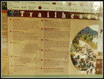 Trail Information |
 Great Fall Colors |
 Leaf Cover |
 Power Line Corridor |
 West Wind |
 Water Chute |
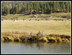 Cows In The Field |
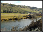 Yakima River |
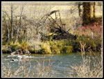 Water Wheel |
 Line Of Trees |
 Along The Grade |
 More Leaf Color |
 Stellar's Jay |
 Solitude On The Yakima |
 Starting To Drop Leaves |
 Almost To Tunnel |
 Horlick Depot |
 Heading Back |
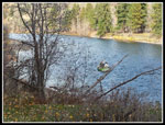 River Boating |
 Leaves Hanging On |
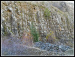 Columnar Basalt |
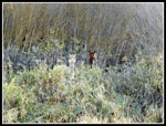 Alpacas |
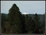 Tip Of Mt Stuart |
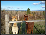 Welcoming Party |
Trips - 2016
Home