11-24-17
Kim was free for a day after
Thanksgiving hike. It looked like we would have some rain but that's
what umbrellas are for. I had to do a little work in the
morning and it went longer than expected. I did not meet Kim until
after 8:30 am. We headed on towards Monroe. I manage to get in a loop
hike to Wallace Falls and Wallace Lake most years in November or
December. The high point of the 10 mile loop is under 1900' meaning it
is often snow free much of the winter. The falls are best when it has
been raining hard and we have had plenty of recent rain. I was hoping
that with many folks off work the parking lot would not be full when we
arrived. It was not. A good number of early hikers were ahead of us but
there were plenty of empty parking spots. Better yet, the rain was
holding off.
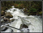
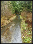
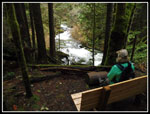
We headed onto the trail at 9:45 am. That left us about 7 hours before dark. We quickly reached the picnic table and viewpoint underneath the power lines. Mt. Baring was lost in clouds and most of Mt. Persis was too. At the junction we took the Woody Trail. We came down via the railroad grade, closing our loop at this first junction. The Woody Trail is shorter and goes alongside the Wallace River. There were a few new benches since my last visit in January. I missed hiking the route in 2016 but made a winter visit just into this year. Kim and I did the same loop in December 2015. It was clear that the Wallace River was running higher than normal for November. Lots of noise and white water.
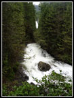
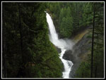
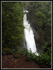
We climbed up to the high point then dropped down to the bridge over the NF Wallace River. Then came the steep climb to the picnic shelter. We stopped there for photographs. A smaller falls is right there with the bigger Middle Falls in the background. The Upper Falls is not in sight until much higher up. We saw a number of folks going up and down. We soon continued up the trail. We stopped at a good viewpoint of the Middle Falls then continued on to the Upper Falls. The falls were really full but mist was not soaking up at the top. After a short stop we headed higher. The trail to the road above is still rough. Now there are silver diamonds leading on until the trail becomes much clearer as it rises. At the upper road we turned right and went for a look at the new bridge over the main Wallace River. In due time, trails from the Reiter trailhead will reach up here.
Now it was time to hike the 2.4 miles of old and newer logging roads to Wallace Lake. This area was just recently clear cut. A lot less forest but there are now views out. In January the cut was very fresh and I had views to the valley below and out to the Olympic Mountains. This day we had views down to the valley but clouds blocked distant views. We took a short detour off the road to the best viewpoint. On a clear day the views are pretty good. This was not a clear day. Most of my December and January trips have a bit of snow on the open road. Not this time. The route was snow free. We continued to the next junction and turned right. This new road gives way to a very old dirt and gravel road to the lake. As we left the newer road and hiked the old road it became very wet. There are two creeks that are dry most of the year but cross this road in the winter. Often it's a good standing jump across the second one. I have never soaked by boots getting across.
This time was different. As we neared the creeks we met a hiker coming towards us. I thought that meant he was coming from the lake. No, he was going our way but was turned around by what he called "three foot deep water". He was going back to the junction to take another road route that completed our loop but did not go by the lake. I had to take a look. I went ahead and made it across the first creek. The road was now underwater but the side was a foot higher and dry. When I reached the second very seasonal creek it was not three feet deep but it was at least one foot. Almost knee deep very cold water with at least 15 feet to cross. Not worth soaking our boots. We headed back.
At the road junction we had a quick lunch. It was now about 1:15 pm. We had about 3.5 hours of daylight. Just under three hours until sunset. I have always gone via the lake and had never hiked the newish road that misses it. Add one more new segment to a route I have done dozens of times. The road walk went fine but it was now really cold. We both had gloves on and still had cold hands. It felt a dozen degrees colder than half an hour earlier. Much to my surprise the rain was holding off. We had a few spits of rain but then it would stop again. So far so good.
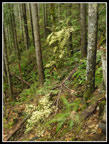
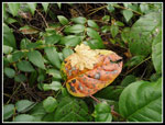
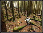
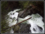
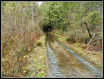
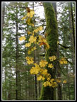
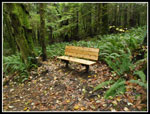
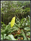
We dropped down a hill to a bridge and met the old road/trail coming from Wallace Lake. A little farther down the road we reached the top of the Greg Ball Trail. Now we were back in forest on a dirt trail. Much better than the road walking. The trail is in good shape. We found more benches along here. One sits looking down to a cascade of the NF Wallace River. Load and scenic with lots of water rushing by. Since the Upper Falls we had seen only a few folks. Quite a bit of solitude on what can be a busy trail. There is still some fall color along here. On this overcast day the yellows looked very good.
We finally reached the bottom of the trail where we picked up the railroad grade. Rather than dropping down to the Woody Trail we took the grade back. It added .80 miles of gently graded trail. We passed a few more groups along the grade but this trail is never as crowded as the trail to the falls. That's the main reason I do the loop counterclockwise. I see a lot fewer folks that way. We reached the car at about 3:45 pm. We made good time coming down. In fact we drove about half way home before it was completely dark.
This hike provided just about everything I hoped for. We saw other hikers but it was never crowded. The rain managed to hold off almost the entire day. I had my umbrella up for maybe 20 minutes over the whole day. I have seem more water going over the falls before but it was well above average. Far more water than the crowds of summer see. I missed the lake for the first time ever but did get to hike a new section of road. Even with all the recent rain, my boots stayed dry. At least they stayed dry by avoiding a big soaking if went forded the creek and went to the lake. 10 miles is a good days hiking and the 1700' of gain was good without a lot of climbing. Somehow, I expect I'll find myself doing this hike next fall or winter. It's the best time of all.
Click on thumbnails to get
larger pictures.
Trips - 2017
Home
We headed onto the trail at 9:45 am. That left us about 7 hours before dark. We quickly reached the picnic table and viewpoint underneath the power lines. Mt. Baring was lost in clouds and most of Mt. Persis was too. At the junction we took the Woody Trail. We came down via the railroad grade, closing our loop at this first junction. The Woody Trail is shorter and goes alongside the Wallace River. There were a few new benches since my last visit in January. I missed hiking the route in 2016 but made a winter visit just into this year. Kim and I did the same loop in December 2015. It was clear that the Wallace River was running higher than normal for November. Lots of noise and white water.
We climbed up to the high point then dropped down to the bridge over the NF Wallace River. Then came the steep climb to the picnic shelter. We stopped there for photographs. A smaller falls is right there with the bigger Middle Falls in the background. The Upper Falls is not in sight until much higher up. We saw a number of folks going up and down. We soon continued up the trail. We stopped at a good viewpoint of the Middle Falls then continued on to the Upper Falls. The falls were really full but mist was not soaking up at the top. After a short stop we headed higher. The trail to the road above is still rough. Now there are silver diamonds leading on until the trail becomes much clearer as it rises. At the upper road we turned right and went for a look at the new bridge over the main Wallace River. In due time, trails from the Reiter trailhead will reach up here.
Now it was time to hike the 2.4 miles of old and newer logging roads to Wallace Lake. This area was just recently clear cut. A lot less forest but there are now views out. In January the cut was very fresh and I had views to the valley below and out to the Olympic Mountains. This day we had views down to the valley but clouds blocked distant views. We took a short detour off the road to the best viewpoint. On a clear day the views are pretty good. This was not a clear day. Most of my December and January trips have a bit of snow on the open road. Not this time. The route was snow free. We continued to the next junction and turned right. This new road gives way to a very old dirt and gravel road to the lake. As we left the newer road and hiked the old road it became very wet. There are two creeks that are dry most of the year but cross this road in the winter. Often it's a good standing jump across the second one. I have never soaked by boots getting across.
This time was different. As we neared the creeks we met a hiker coming towards us. I thought that meant he was coming from the lake. No, he was going our way but was turned around by what he called "three foot deep water". He was going back to the junction to take another road route that completed our loop but did not go by the lake. I had to take a look. I went ahead and made it across the first creek. The road was now underwater but the side was a foot higher and dry. When I reached the second very seasonal creek it was not three feet deep but it was at least one foot. Almost knee deep very cold water with at least 15 feet to cross. Not worth soaking our boots. We headed back.
At the road junction we had a quick lunch. It was now about 1:15 pm. We had about 3.5 hours of daylight. Just under three hours until sunset. I have always gone via the lake and had never hiked the newish road that misses it. Add one more new segment to a route I have done dozens of times. The road walk went fine but it was now really cold. We both had gloves on and still had cold hands. It felt a dozen degrees colder than half an hour earlier. Much to my surprise the rain was holding off. We had a few spits of rain but then it would stop again. So far so good.
We dropped down a hill to a bridge and met the old road/trail coming from Wallace Lake. A little farther down the road we reached the top of the Greg Ball Trail. Now we were back in forest on a dirt trail. Much better than the road walking. The trail is in good shape. We found more benches along here. One sits looking down to a cascade of the NF Wallace River. Load and scenic with lots of water rushing by. Since the Upper Falls we had seen only a few folks. Quite a bit of solitude on what can be a busy trail. There is still some fall color along here. On this overcast day the yellows looked very good.
We finally reached the bottom of the trail where we picked up the railroad grade. Rather than dropping down to the Woody Trail we took the grade back. It added .80 miles of gently graded trail. We passed a few more groups along the grade but this trail is never as crowded as the trail to the falls. That's the main reason I do the loop counterclockwise. I see a lot fewer folks that way. We reached the car at about 3:45 pm. We made good time coming down. In fact we drove about half way home before it was completely dark.
This hike provided just about everything I hoped for. We saw other hikers but it was never crowded. The rain managed to hold off almost the entire day. I had my umbrella up for maybe 20 minutes over the whole day. I have seem more water going over the falls before but it was well above average. Far more water than the crowds of summer see. I missed the lake for the first time ever but did get to hike a new section of road. Even with all the recent rain, my boots stayed dry. At least they stayed dry by avoiding a big soaking if went forded the creek and went to the lake. 10 miles is a good days hiking and the 1700' of gain was good without a lot of climbing. Somehow, I expect I'll find myself doing this hike next fall or winter. It's the best time of all.
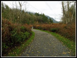 Starting Out |
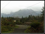 Cloudy Peaks |
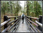 Kim On Bridge |
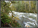 Wallace River |
 NF Wallace River |
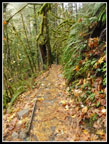 Leafy Trail |
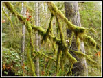 Mossy Trees |
 Lower & Middle Falls |
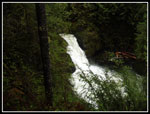 Lower Falls |
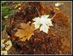 Two Leaves |
 Middle Falls |
 Colorful Leaves |
 Orange Leaf |
 Upper Falls |
 Near Upper Road |
 Above Upper Falls |
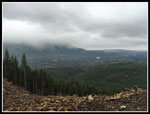 View from Clear Cut |
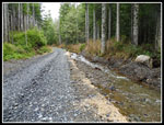 Repaired Wash Out |
 Detour Time |
 Local Trail Flooding |
 Hiker On Bench |
 Hanging On |
 Another New Bench |
 Single Leaf |
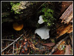 Fungi |
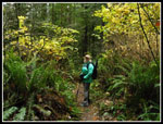 Kim On Trail |
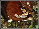 More Fungi |
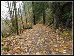 Leafy Railroad Grade |
Trips - 2017
Home