10-14-18
On
last bad traffic weekend in
Seattle. I-5 had only two lanes open northbound through the city.
Highway 99 had southbound lanes closed on the viaduct. South and east
looked to be bad choices. I chose to go north. I almost never
drive Highway 2 on a Sunday. The backups heading west in the afternoon
are awful. For Wallace Falls and Lake Loop I only had to go as far as
Gold Bar. Worth the risk. Though it is mid October it was looking like
a mid 60s sunny day. I was on the road at 7:25 am and arrived at the
330' Wallace Falls State Park lot at 8:25 am. By 8:35 am I was packed
up and on the trail. There were 8 or 9 cars there already. It
was
a chilly morning. I had gloves on at first. I wanted to get in some
miles so I took the old railroad grade both ways. It adds about one
mile each way over taking the Woody Trail that goes along the river.
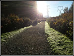
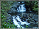
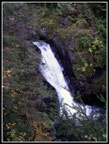
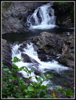
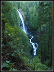
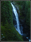
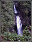
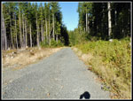
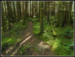
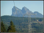
The sun was so low that I could not get a shot of Mt. Baring or Index without looking directly into the sun. The grade climbs at a gently grade making for fast hiking. There were several patches of large sharp gravel laid in. Very hard on my feet. I do not recall any mud along there in the past. At the two mile mark I took the trail which descends down to the Woody Trail. So far I had seen only a couple people. After meeting the Woody Trail the route continues down to the bridge over the NF Wallace River. Then comes the steepest climb of the day. This is one section of the old trail that has not been rerouted onto gentler switchbacks. At the top of the hill I stopped at the covered shelter. Here is the first, and one of the best spots to see the lower falls. The middle falls is also in sight. Plenty of water made for some good photos.
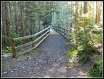
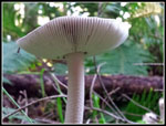
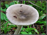
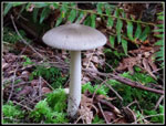
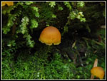
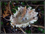
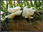
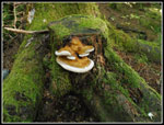
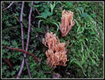
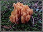
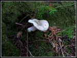
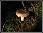
Next, I headed up to the middle falls. Sunshine was right on the falls making it hard to not blow out photos. The falls are pretty impressive. I took just a short stop at the upper falls. It was still chilly and I soon headed up the path/trail to the upper road. It is still not all that easy to follow down low. At the upper road I turned right and went over to the new bridge. It has been finished for several years. Until trails from Reiter Road arrive it will see little use. I followed one old road up a little way. I did find a number of interesting mushrooms. This fall has been a banner year for them. Lots of laying down to photograph them. Soon I was heading back. From where the Falls Trail meets the old road the going is great. Old dirt road and lots of trees. Soon that changes.
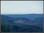
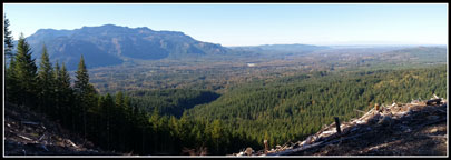
The recent logging has taken away the trees and replaced the soft dirt road with a hard gravel one. The only positive are the views that have been created. I went off the road to a logging landing with the best views. Up and down the Skykomish Valley can be seen. Just before leaving I noticed the towers of downtown Seattle are now visible. The Olympic Mountains were in sight but a bit hazy. I met one hiker here who was doing my loop. I left as he reached the landing and did not see him again. The road continues to the "T" junction. On my last visit the route to the lake was underwater and I took the left road for the first time. This time I hoped there would be much less water in October than last December. The route leaves the main logging road and resumes old soft dirt underfoot.
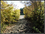
A few tenths of a mile before the lake I reached the problem water spot. The water was very high once again. The entire road was underwater. I climbed up to the low bank on the left side and continued along. I heard young people on the other side looking for another way around the "lake". Normally a small creek crosses the road where a culvert has been removed. One rock in the middle is usually enough to hop across. Now there was a dam on the left side of the road where the creek should be running through. More mud than sticks, if it was a beaver dam it looked unusual. There were footprints going across. The dam top is only a foot or so wide. I did not bring poles on this trip and they would have been helpful. I could not see bottom determine the water depth. It was knee deep at most but I did not want to soak my low boots and socks. I plodded across the top and it did hold my weight. I had almost dry feet. Two of the folks I'd been hearing showed up and I photographed them crossing.
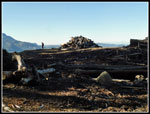
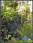
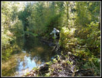
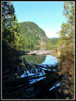
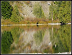
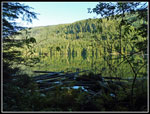
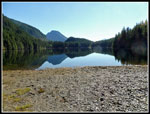
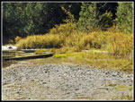
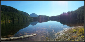
With the day's excitement behind me I reached the lake a few minutes later. The outlet end was completely in shade and would be all day. It was awfully chilly for a day that was supposed to be at least 60 degrees at the lake. Wasting no time, I headed on around the lake. I used my phone gps to determine that it is .69 miles to the inlet. A bit longer than I thought. The inlet creek was completely dry. Not a drop. I walked the creek bed to Pebble Beach. I found myself in bright sunshine. I took off my gloves. It was finally almost warm. I arrived at 11:48 am. Just in time for lunch. It was a perfect October day. Most any other lake just off a major highway near Seattle would be mobbed this day. Quite a few folks went to the dark cold outlet with it's picnic tables. I went to the sunny side and had near solitude.
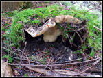
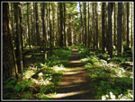
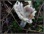
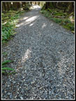
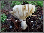
Two women did show up and had a medium long stay. Good company this day and they offered dark chocolate. Who am I to turn down such a fine offering? After they headed back I stayed. Where else would a rather be? A gentle breeze brought out my light jacket but the sunshine felt great. After a little more than 2 hours I packed up to go. My route would be about 12.4 miles and I decided to round it off to 13 miles. I went a short way up the trail to Jay Lake. Along that old dirt road I found more mushrooms. The dark forest made taking photos hard. Some of them were really interesting. White, brown, and black. Tiny colonies of many mushrooms and single very large ones. More laying down in the dirt. The mushroom photos extra time and I picked up my pace back to the Wallace Lake outlet and around the lake to the inlet. The old road from the lake down to the main logging road used to be one of my favorite sections. Thick forest and soft road/trail. Now it is mostly a gravel road with large sharp big rocks. I real pain to walk on. Far worse than on the railroad grade. Now this is by far my least favorite part of the hike. Much worse than the active logging road.
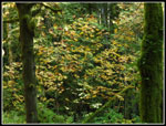
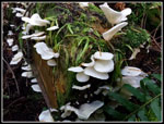
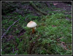
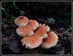
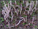
I reached the main logging road to find that it is hard packed dirt over gravel. So much easier to walk on that the crappy loose gravel on the old seldom driven road/trail. Go figure. A short walk brought me to the Greg Ball Trail. A short 2.5 miles down to near where I left the railroad grade in the morning. I met several groups hiking in on the gravel road near the lake, the nice main logging road, and the upper Greg Ball Trail. On such a sunny afternoon it did not seem that sunset was less than 3.5 hours away. I sped down the Ball Trail until suddenly I saw some amazing mushrooms. Tiny colonies on mossy stumps. Big ones, small ones, crazy colored ones. Forward progress ground to a halt. A truly Kimbrownian Utopia. The next quarter mile took half an hour. Most of that time on my knees or laying on my side on the ground. One of the best mushroom displays I have ever seen. I have no idea what the white worm like things were that stood up from the forest floor. Others I recognized though I do no their names. A really neat and unexpected event.
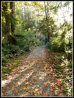
And then it ended. I saw some more mushrooms on the rest of the trail but none as interesting as in that one small micro climate. What was planned as a nice long leg stretcher hike with a long lake stay added an unexpected mushroom adventure. With the show over I sped down the rest of the Greg Ball Trail. Not much leaf color left along there. I reached the railroad grade at 3:44 pm. Now I just had about 2.2 mils of gently grade with some up and a lot more down. That distance went by fast. Near the bottom I did get some photos of Baring and Index as the sun was in a better spot. I arrived at the trailhead at 4:35 pm. The lot was still about half full. The drive home was what I feared. From Gold Bar through Sultan Google says it is 6.7 miles and takes 11 minutes to drive. I took 55 minutes. On Highway 522 I ran into another backup before the last traffic light. In all it took me 2 hours to drive 42 miles. Even the usual Sunday backup on Highway 2 did not impair my day. It was a whole lot of fun.
For the day I hiked 13 miles with 1800' of elevation gain. I was early enough to miss most of the crowds at the falls. I saw only a few folks from the upper falls to my lunch spot at the lake. A whole lot of solitude on a popular trail. I don't usually spend two hours at a lake but sitting by the lake in bright sunshine while the trails around me were in cool forest was a highlight of the day. The mushroom displays were a most unexpected delight. Especially that short section on the Greg Ball Trail. Many of them were so small I bet most hikers did not even notice them. All in all, a really nice day on the trail in mid October. One more blast before dark, cold, and wet sets in until spring or summer.
Click on thumbnails to get
larger pictures.
Trips - 2018
Home
The sun was so low that I could not get a shot of Mt. Baring or Index without looking directly into the sun. The grade climbs at a gently grade making for fast hiking. There were several patches of large sharp gravel laid in. Very hard on my feet. I do not recall any mud along there in the past. At the two mile mark I took the trail which descends down to the Woody Trail. So far I had seen only a couple people. After meeting the Woody Trail the route continues down to the bridge over the NF Wallace River. Then comes the steepest climb of the day. This is one section of the old trail that has not been rerouted onto gentler switchbacks. At the top of the hill I stopped at the covered shelter. Here is the first, and one of the best spots to see the lower falls. The middle falls is also in sight. Plenty of water made for some good photos.
Next, I headed up to the middle falls. Sunshine was right on the falls making it hard to not blow out photos. The falls are pretty impressive. I took just a short stop at the upper falls. It was still chilly and I soon headed up the path/trail to the upper road. It is still not all that easy to follow down low. At the upper road I turned right and went over to the new bridge. It has been finished for several years. Until trails from Reiter Road arrive it will see little use. I followed one old road up a little way. I did find a number of interesting mushrooms. This fall has been a banner year for them. Lots of laying down to photograph them. Soon I was heading back. From where the Falls Trail meets the old road the going is great. Old dirt road and lots of trees. Soon that changes.
The recent logging has taken away the trees and replaced the soft dirt road with a hard gravel one. The only positive are the views that have been created. I went off the road to a logging landing with the best views. Up and down the Skykomish Valley can be seen. Just before leaving I noticed the towers of downtown Seattle are now visible. The Olympic Mountains were in sight but a bit hazy. I met one hiker here who was doing my loop. I left as he reached the landing and did not see him again. The road continues to the "T" junction. On my last visit the route to the lake was underwater and I took the left road for the first time. This time I hoped there would be much less water in October than last December. The route leaves the main logging road and resumes old soft dirt underfoot.
A few tenths of a mile before the lake I reached the problem water spot. The water was very high once again. The entire road was underwater. I climbed up to the low bank on the left side and continued along. I heard young people on the other side looking for another way around the "lake". Normally a small creek crosses the road where a culvert has been removed. One rock in the middle is usually enough to hop across. Now there was a dam on the left side of the road where the creek should be running through. More mud than sticks, if it was a beaver dam it looked unusual. There were footprints going across. The dam top is only a foot or so wide. I did not bring poles on this trip and they would have been helpful. I could not see bottom determine the water depth. It was knee deep at most but I did not want to soak my low boots and socks. I plodded across the top and it did hold my weight. I had almost dry feet. Two of the folks I'd been hearing showed up and I photographed them crossing.
With the day's excitement behind me I reached the lake a few minutes later. The outlet end was completely in shade and would be all day. It was awfully chilly for a day that was supposed to be at least 60 degrees at the lake. Wasting no time, I headed on around the lake. I used my phone gps to determine that it is .69 miles to the inlet. A bit longer than I thought. The inlet creek was completely dry. Not a drop. I walked the creek bed to Pebble Beach. I found myself in bright sunshine. I took off my gloves. It was finally almost warm. I arrived at 11:48 am. Just in time for lunch. It was a perfect October day. Most any other lake just off a major highway near Seattle would be mobbed this day. Quite a few folks went to the dark cold outlet with it's picnic tables. I went to the sunny side and had near solitude.
Two women did show up and had a medium long stay. Good company this day and they offered dark chocolate. Who am I to turn down such a fine offering? After they headed back I stayed. Where else would a rather be? A gentle breeze brought out my light jacket but the sunshine felt great. After a little more than 2 hours I packed up to go. My route would be about 12.4 miles and I decided to round it off to 13 miles. I went a short way up the trail to Jay Lake. Along that old dirt road I found more mushrooms. The dark forest made taking photos hard. Some of them were really interesting. White, brown, and black. Tiny colonies of many mushrooms and single very large ones. More laying down in the dirt. The mushroom photos extra time and I picked up my pace back to the Wallace Lake outlet and around the lake to the inlet. The old road from the lake down to the main logging road used to be one of my favorite sections. Thick forest and soft road/trail. Now it is mostly a gravel road with large sharp big rocks. I real pain to walk on. Far worse than on the railroad grade. Now this is by far my least favorite part of the hike. Much worse than the active logging road.
I reached the main logging road to find that it is hard packed dirt over gravel. So much easier to walk on that the crappy loose gravel on the old seldom driven road/trail. Go figure. A short walk brought me to the Greg Ball Trail. A short 2.5 miles down to near where I left the railroad grade in the morning. I met several groups hiking in on the gravel road near the lake, the nice main logging road, and the upper Greg Ball Trail. On such a sunny afternoon it did not seem that sunset was less than 3.5 hours away. I sped down the Ball Trail until suddenly I saw some amazing mushrooms. Tiny colonies on mossy stumps. Big ones, small ones, crazy colored ones. Forward progress ground to a halt. A truly Kimbrownian Utopia. The next quarter mile took half an hour. Most of that time on my knees or laying on my side on the ground. One of the best mushroom displays I have ever seen. I have no idea what the white worm like things were that stood up from the forest floor. Others I recognized though I do no their names. A really neat and unexpected event.
And then it ended. I saw some more mushrooms on the rest of the trail but none as interesting as in that one small micro climate. What was planned as a nice long leg stretcher hike with a long lake stay added an unexpected mushroom adventure. With the show over I sped down the rest of the Greg Ball Trail. Not much leaf color left along there. I reached the railroad grade at 3:44 pm. Now I just had about 2.2 mils of gently grade with some up and a lot more down. That distance went by fast. Near the bottom I did get some photos of Baring and Index as the sun was in a better spot. I arrived at the trailhead at 4:35 pm. The lot was still about half full. The drive home was what I feared. From Gold Bar through Sultan Google says it is 6.7 miles and takes 11 minutes to drive. I took 55 minutes. On Highway 522 I ran into another backup before the last traffic light. In all it took me 2 hours to drive 42 miles. Even the usual Sunday backup on Highway 2 did not impair my day. It was a whole lot of fun.
For the day I hiked 13 miles with 1800' of elevation gain. I was early enough to miss most of the crowds at the falls. I saw only a few folks from the upper falls to my lunch spot at the lake. A whole lot of solitude on a popular trail. I don't usually spend two hours at a lake but sitting by the lake in bright sunshine while the trails around me were in cool forest was a highlight of the day. The mushroom displays were a most unexpected delight. Especially that short section on the Greg Ball Trail. Many of them were so small I bet most hikers did not even notice them. All in all, a really nice day on the trail in mid October. One more blast before dark, cold, and wet sets in until spring or summer.
 Blinding Light |
 On RR Grade |
 Lingering Leaves |
 Lower Falls |
 Lowest Falls |
 Falls Again |
 Middle Falls |
 Closer Look |
 Upper Falls |
 New Bridge |
 Bottom Of Mushroom |
 Top Of Mushroom |
 Another Mushroom |
 Raising The Ground |
 Downtown Seattle |
 Hiker At Landing |
 On The Road Again |
 Crossing Dam |
 Hiker On Dam |
 Lake From Outlet |
 Pebble Beach |
 Wallace Lake Reflection |
 Sunshine At Inlet |
 Dragonfly |
 On The Beach |
 Dry Inlet Creek |
 Jay Lake Trail |
 Tiny Mushroom |
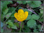 Buttercup |
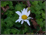 Daisy |
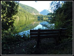 Bench Near Lake |
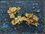 Mushrooms In Gravel |
 White Mushroom |
 Another Shroom |
 Graveled Dirt Road |
 Angel Wings |
 Even More Mushrooms |
 Underneath |
 Two Small Mushrooms |
 Bench By River |
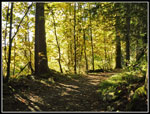
 Green Trail |
 Moss & Fungus |
 Orange Mushrooms |
 What Are They? |
 More Orange |
 Even More Orange |
 Mushroom On Moss |
 A Beam Of Light |
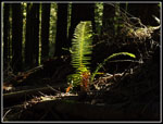 Lit Up Fern |
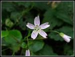 Spring Beauty |
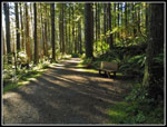 Forest Bench |
 Lit Up Leaves |
 Mt. Baring |
 Recent Logging Has Opened Up Views From Above The Falls |
 Wallace Lake Panorama |
Trips - 2018
Home