8-08-21
This was a difficult hike to choose. After several months of blue sky
and above average temperatures some rain came to Washington state. With
all the forest fires we have burning it was a good thing. I needed to
find a hike that would not be all rain. With gas prices at and above
$4.00/gallon a shorter drive was a good idea too. At first I planned on
a trip to Rainbow Lake. With the rain I changed that to Mt. Teneriffe.
The rain was expected to end there before the Cascade Crest. In the
morning the forecast changed. It was raining in North Bend and would
now likely keep it up until early afternoon. 4000' of gain on an old
road in the rain did not appeal to me. Tiger Mountain looked to dry out
much earlier. The tops of Tiger , 2, & 3 are currently closed
for
logging. I settled on East Tiger Mountain. The routes up from Tiger
Summit are only about 8 miles round trip. I wanted something longer.
Twice during the pandemic I chose a longer road route that avoids most
all of the crowds until near the summit. That was my choice. I headed
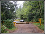
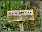
east to Highway 18 then pulled off at the gate about a mile north of
Tiger Summit. It had not rained on the drive but the summits were all
in the clouds. I arrived at 7:25 am. By 7:30 am I was on my way.
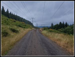
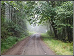
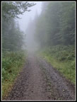
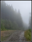
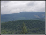
The trailhead is at 1090' and the cloud level was not much higher. The route starts with more than half a mile walking under a major powerline corridor. With the highway nearby and the buzzing wet powerlines it was not a quiet start. Views out to the mountains were non existent with the clouds. I could see the falling mist but it was not hard enough to merit opening my umbrella. Not the rain at nearby North Bend but not a clear day either. After the very warm summer we have had it was nice to be a little cold. I had plenty of layer in my pack if needed. I did put on gloves as 52 degrees and 100% cold moisture was cold.
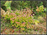
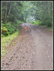
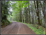
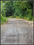
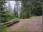
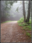
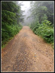
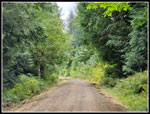
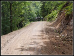
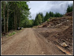
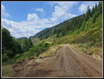
Once past the powerlines the road heads into forest. It stays that way all the way to East Tiger and back. I passed the first two of many mountain bike trails that reach and/or cross the road All was quiet. Nobody else out on my route. There were ripe blackberries on the powerline corridor. No more berries and very few wildflowers on the forest road part. Some signs of fresh logging including an ever growing quarry cut into the hillside. At 1.3 miles I passed the end of the Northwest Timber Trail. That goes south to Tiger Summit. There are mile markers the first three miles and more mileage signs at junctions with trails. At 3.1 miles the road continues ahead but the main route switches back tot he left uphill. Most of the elevation gain is in the next 3.6 miles to the summit. Slogging up this road I was passed by two guys on bikes heading uphill. That was it for the first 5.75 miles. I had plenty of solitude.
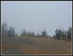
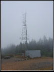
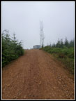
The mist grew thicker if that was possible. White mist blocked any longer distant views. I crossed the point where the Master Link changes name to Quick Link. Nobody seen here. At the top of the Quick Link I passed a group of four or five bikers. They were the second group I saw. In a little over a quarter mile I reached the junction with the East Tiger summit spur road. Up I went. The last .7 miles gains 35' and most of that is in the upper half. Now I started to see a number of mountain bikers. I reached the top at 9:48 am. I took 2:1 minutes to hike 6. miles with about 2000' of gain. There were three or four groups of bikers on top. My time was 2 minutes slower than last year's time but faster than my April trip this year with snow on the upper several miles. Views were not to be seen though I could see the tops of the towers.
After a little water and food I started down. On my two previous pandemic trips I dropped down .70 miles on the summit spur to the road junction and hiked back up again. This added 1.4 miles with 350' of gain to the trip. I decided to do it again. Climbing back up after 7.4 miles hiked was not much fun. Back at the top I finished my lunch. It was 10:39 when I started down. As I descended the mist began to dissipate. I saw more bikers going up and down. When I dropped below the Master Link junction I figured that would be about the end of other people. Instead I saw several groups riding up the road. Soon the bikers thinned out. I only saw a couple more groups in the last 3+ miles. Once on the flatter last three miles there were even some sun breaks. It was surprisingly warm in the occasional sunshine.
My feet were getting a bit sore after 12 miles of road. The last mile was not much fun. Back at the powerline corridor I could still not see the Cascade peaks to the northeast. I could now see the towers of West Rattlesnake Mountain. I made it back tot he car at 1:02 pm. My descending time was 1:22. A few minutes longer than my time going up. I managed to avoid the rain and got in a 15 mile hike. I was done by 1:00 pm. There were no views but that was true all over the state. The cool weather was a really nice break. It would be back near 9 degrees later in the week. A fun day on the trail and another hike were I managed to miss the horses who have been out hiking this year of the pandemic.
Click on thumbnails to get
larger pictures.
Trips - 2021
Home
The trailhead is at 1090' and the cloud level was not much higher. The route starts with more than half a mile walking under a major powerline corridor. With the highway nearby and the buzzing wet powerlines it was not a quiet start. Views out to the mountains were non existent with the clouds. I could see the falling mist but it was not hard enough to merit opening my umbrella. Not the rain at nearby North Bend but not a clear day either. After the very warm summer we have had it was nice to be a little cold. I had plenty of layer in my pack if needed. I did put on gloves as 52 degrees and 100% cold moisture was cold.
Once past the powerlines the road heads into forest. It stays that way all the way to East Tiger and back. I passed the first two of many mountain bike trails that reach and/or cross the road All was quiet. Nobody else out on my route. There were ripe blackberries on the powerline corridor. No more berries and very few wildflowers on the forest road part. Some signs of fresh logging including an ever growing quarry cut into the hillside. At 1.3 miles I passed the end of the Northwest Timber Trail. That goes south to Tiger Summit. There are mile markers the first three miles and more mileage signs at junctions with trails. At 3.1 miles the road continues ahead but the main route switches back tot he left uphill. Most of the elevation gain is in the next 3.6 miles to the summit. Slogging up this road I was passed by two guys on bikes heading uphill. That was it for the first 5.75 miles. I had plenty of solitude.
The mist grew thicker if that was possible. White mist blocked any longer distant views. I crossed the point where the Master Link changes name to Quick Link. Nobody seen here. At the top of the Quick Link I passed a group of four or five bikers. They were the second group I saw. In a little over a quarter mile I reached the junction with the East Tiger summit spur road. Up I went. The last .7 miles gains 35' and most of that is in the upper half. Now I started to see a number of mountain bikers. I reached the top at 9:48 am. I took 2:1 minutes to hike 6. miles with about 2000' of gain. There were three or four groups of bikers on top. My time was 2 minutes slower than last year's time but faster than my April trip this year with snow on the upper several miles. Views were not to be seen though I could see the tops of the towers.
After a little water and food I started down. On my two previous pandemic trips I dropped down .70 miles on the summit spur to the road junction and hiked back up again. This added 1.4 miles with 350' of gain to the trip. I decided to do it again. Climbing back up after 7.4 miles hiked was not much fun. Back at the top I finished my lunch. It was 10:39 when I started down. As I descended the mist began to dissipate. I saw more bikers going up and down. When I dropped below the Master Link junction I figured that would be about the end of other people. Instead I saw several groups riding up the road. Soon the bikers thinned out. I only saw a couple more groups in the last 3+ miles. Once on the flatter last three miles there were even some sun breaks. It was surprisingly warm in the occasional sunshine.
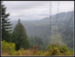
My feet were getting a bit sore after 12 miles of road. The last mile was not much fun. Back at the powerline corridor I could still not see the Cascade peaks to the northeast. I could now see the towers of West Rattlesnake Mountain. I made it back tot he car at 1:02 pm. My descending time was 1:22. A few minutes longer than my time going up. I managed to avoid the rain and got in a 15 mile hike. I was done by 1:00 pm. There were no views but that was true all over the state. The cool weather was a really nice break. It would be back near 9 degrees later in the week. A fun day on the trail and another hike were I managed to miss the horses who have been out hiking this year of the pandemic.
 Trailhead |
 Dark Overhead |
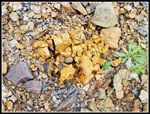
 Fall Color In Summer |
 Very Cloudy |
 Into The Forest |
 A Deer Friend |
 1 Mile Marker |
 2 More Deer |
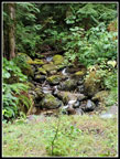 Creek |
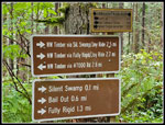 Signs |
 Trails Junction |
 Getting Misty |
 Bright Rock |
 Leveling Off |
 Summit Road |
 Bikers & No Views |
 Tower |
 Heading Down |
 Heading Up Again |
 Mountain Ash Berries |
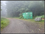 Container |
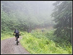 Bikers Heading Up |
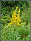 Goldenrod |
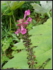 Another Flower |
 3.1 Miles To Go |
 Shadows |
 Last Bikers |
 Quarry |
 Rattlesnake Mountain |
 Blue Sky At End |
Trips - 2021
Home