10-16-21
I
was looking for a short drive and
lots of elevation gain. Also, no crowds. It looked like a last sunny
warm day before dark and damp settled in. I chose a trip up Mt. Si via
the Mt. Teneriffe road/trail. The Doppler radar showed a little rain
over the area so I held off leaving until 7:35 am. I arrived at 8:25
am. I was on my way by 8:30 am. The lot had only abut half a dozen cars
at that hour. The temperature was 52 degrees. Cool but not old. I made
good time reaching the end of the 1.50 mile flatter part at 9:00 am.
The old road turned trail climbs steadily with only one short flat spot
to the high point just above Haystack Basin on Mt. Si. One hiker sped
by me heading uphill. Later, I saw one person heading down. That was it
up to Haystack Basin. The hoped for sunshine was slow coming. It did
warm up as I continued uphill. I took one break just after
the
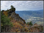
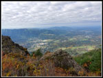
last leftward switchback. There is a a view out from here. I could see
that
Mt. Rainier was now in the clear. On the morning drive it was lost in
the clouds.
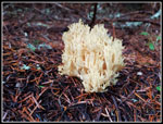
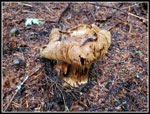
At the Si-Teneriffe junction I turned left and headed for Mt. Si. My good pace fell apart soon after. Lots of mushrooms are freshly poking out of the ground. Numerous varieties too. I stopped for a number of photos opportunities. I easily saw the unmarked turnoff for Blowdown Mountain. I tried going up it last year but the brush was very wet. I was soaked almost immediately. This time I brought waterproof pants and jacket in case I wanted to give it another try. Near the top of Mt. Si I found even more mushrooms. Some of the patches were huge. At the highest point I dropped down into the basin. I did not see anyone else. It was nearly 11:00 am and I expected multiple groups. I headed over to the viewpoint above North Bend. There was nobody there. I looked at the rocky point to the south and there was nobody there. Time for a break.
I had good views out but the sky was still 90% cloudy. There were a few small blue spots above. I spent about 20 minutes there and saw only one person at a distance for a few seconds. As was packing up a group of about 6 or 7 showed up. I was really surprised to have 20 minutes at the viewpoint on a dry Saturday alone. I headed back up to the highest point and took another mushroom break. I dropped down to the Blowdown Road/sort of trail and headed off on it. The road was cut with many pits when it was decommissioned. Erosion has filled them in to some degree. Trees and brush now grow on the entire road. It is not terrible hiking but not all that easy. At one point I was on a parallel road and caught my mistake before I had gone far. GPS is very helpful.
The route is .80 miles long to the summit of Blowdown. When I was still 100"+ below the summit it was clear the road was not going to the top. I just headed straight uphill. The last part had some snow on it. I could see an old set of footprints at times. The last part was not too bad. Just some brush to get through. I had all my rain gear on and I was getting a bit warm. The pants were soaked. It was worth wearing them this day. The top is in forest. It is also flat. I went to several spots that were a foot or so higher and figured one them was the highest spot. It was fun to reach a summit next to Mt. Si for the first time some 42 or so years after first hiking up Si. That said, I doubt I will be back very often.
Going down I got a little off course before finding the road/trail once again. I noticed footprints I did not see on the way up. Hugh? I few minutes later I heard a noise behind me. A hiker soon caught up. Tim had summited also but I never saw him. He had seen me below after I left the summit. For safety sake we hiked down to the Si trail together. He did a good job navigating a very minimal track without mistakes. Back at the main trail I took off all my rain gear and Tim took off at a fast pace. The rest of the route down was much more solitary than expected. I saw 5 or 6 more groups on the last five miles heading out. At the Si-Teneriffe junction I headed uphill for .20 miles. This extra bit brought my total mileage up to 12 for the day. I did see two folks heading down.
I turned around with 4.4 miles to go. All of it downhill. As I was descending, it kept getting warmer. At the bottom of the steeper part I zipped off my pant legs. I expected to see more folks heading down when I reached the turnoff for Teneriffe Falls. It was not the case. A very quiet last mile. After all the downhill on the relatively hard old roadbed my feet were glad to see the trailhead. The parking lot was still more empty than full at 3:45 pm. It was quite warm. My car registered 68 degrees and it was almost totally sunny. That changed on the drive home as at Mercer Island the sun was replaced with clouds once gain.
This was exactly the hike I was hoping for. A short drive, a lot of solitude, great mushrooms, a new summit. Did I mention total solitude in Haystack Basin on a Saturday? With short days and snow coming to the mountains I will not likely have many more 4000' elevation gain days this year. This one was a good one.
Click on thumbnails to get
larger pictures.
Trips - 2021
Home
At the Si-Teneriffe junction I turned left and headed for Mt. Si. My good pace fell apart soon after. Lots of mushrooms are freshly poking out of the ground. Numerous varieties too. I stopped for a number of photos opportunities. I easily saw the unmarked turnoff for Blowdown Mountain. I tried going up it last year but the brush was very wet. I was soaked almost immediately. This time I brought waterproof pants and jacket in case I wanted to give it another try. Near the top of Mt. Si I found even more mushrooms. Some of the patches were huge. At the highest point I dropped down into the basin. I did not see anyone else. It was nearly 11:00 am and I expected multiple groups. I headed over to the viewpoint above North Bend. There was nobody there. I looked at the rocky point to the south and there was nobody there. Time for a break.
I had good views out but the sky was still 90% cloudy. There were a few small blue spots above. I spent about 20 minutes there and saw only one person at a distance for a few seconds. As was packing up a group of about 6 or 7 showed up. I was really surprised to have 20 minutes at the viewpoint on a dry Saturday alone. I headed back up to the highest point and took another mushroom break. I dropped down to the Blowdown Road/sort of trail and headed off on it. The road was cut with many pits when it was decommissioned. Erosion has filled them in to some degree. Trees and brush now grow on the entire road. It is not terrible hiking but not all that easy. At one point I was on a parallel road and caught my mistake before I had gone far. GPS is very helpful.
The route is .80 miles long to the summit of Blowdown. When I was still 100"+ below the summit it was clear the road was not going to the top. I just headed straight uphill. The last part had some snow on it. I could see an old set of footprints at times. The last part was not too bad. Just some brush to get through. I had all my rain gear on and I was getting a bit warm. The pants were soaked. It was worth wearing them this day. The top is in forest. It is also flat. I went to several spots that were a foot or so higher and figured one them was the highest spot. It was fun to reach a summit next to Mt. Si for the first time some 42 or so years after first hiking up Si. That said, I doubt I will be back very often.
Going down I got a little off course before finding the road/trail once again. I noticed footprints I did not see on the way up. Hugh? I few minutes later I heard a noise behind me. A hiker soon caught up. Tim had summited also but I never saw him. He had seen me below after I left the summit. For safety sake we hiked down to the Si trail together. He did a good job navigating a very minimal track without mistakes. Back at the main trail I took off all my rain gear and Tim took off at a fast pace. The rest of the route down was much more solitary than expected. I saw 5 or 6 more groups on the last five miles heading out. At the Si-Teneriffe junction I headed uphill for .20 miles. This extra bit brought my total mileage up to 12 for the day. I did see two folks heading down.
I turned around with 4.4 miles to go. All of it downhill. As I was descending, it kept getting warmer. At the bottom of the steeper part I zipped off my pant legs. I expected to see more folks heading down when I reached the turnoff for Teneriffe Falls. It was not the case. A very quiet last mile. After all the downhill on the relatively hard old roadbed my feet were glad to see the trailhead. The parking lot was still more empty than full at 3:45 pm. It was quite warm. My car registered 68 degrees and it was almost totally sunny. That changed on the drive home as at Mercer Island the sun was replaced with clouds once gain.
This was exactly the hike I was hoping for. A short drive, a lot of solitude, great mushrooms, a new summit. Did I mention total solitude in Haystack Basin on a Saturday? With short days and snow coming to the mountains I will not likely have many more 4000' elevation gain days this year. This one was a good one.
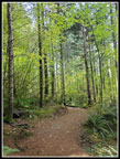
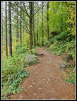 Heading Out |
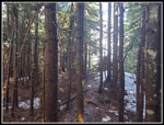
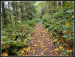 Leaves On Trail |
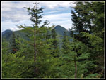
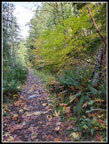 Climbing Higher |
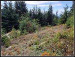
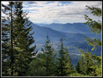 View Out |
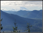 Mt. Rainier |
 First Fungus |
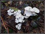 Small White Shrooms |
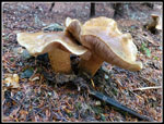
 Unique Looking |
 Close Together |
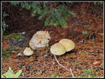 Different Types |
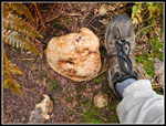 Foot For Scale |
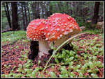
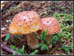 Aminitas |
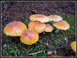
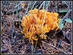
 Best Mushrooms |
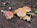
 Nice Colors |
 Still More |
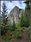 Mt. Si Haystack |
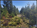
 Colors At Viewpoint |
 North Bend |
 Time To Leave |
 Tiger Mountain |
 More Shrooms |
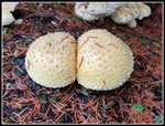 Twins |
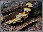 Shrooms On A Log |
 Blowdown Mt. Trail |
 Mt. Teneriffe |
 Blowdown Summit |
 Almost A Trail |
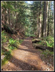 Sun On The Trail |
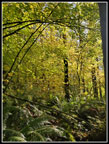
 Lesaves Turning |
 Color At The End |
Trips - 2021
Home