06-20-22
I
had done the Devil's Gulch-Mission Ridge loop hike four times
previously. First in 2005
solo, with Janet in 2011,
solo again in 2017,
and with Gary and John in 2018.
It is a very strenuous day hike at 17 miles with 3800' of elevation
gain. There is a small window in spring when the creek is low enough to
ford three times, it is not yet too hot, and wildflowers are in bloom.
Timed right, it is a great hike. This year with a cool spring, snow has
been slow to melt. Instead of early June, it was looking like late in
the month would be best. This year Juneteenth became a holiday in my
business and provided a chance to do the trip with even fewer other
people than usual. The weather also looked to be warm but not hot. Gary
was free and John took a day off work to fit the trip in. It is a long
drive from Seattle and my hiking time was expanded over the years. We
needed an early start.
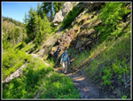
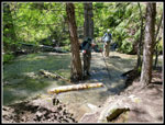
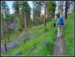
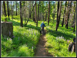
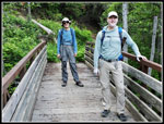
I met Gary and John at High Point near Issaquah at 6:00 am. It was overcast as we headed east. The clouds remained until we passed Easton where the sky began to clear. By Cle Elum it was sunny. We headed up over Blewett Pass to Highway 2 and on to Cashmere. We arrived at the trailhead at 8:06 am. There was one car in the lot. A couple more were along the road and one seemed to be with campers. It was not crowded at all. The trail is used by mountain bikers and motorcyclists so faster folks can catch up on the trail. We were on the trail at 8:15 am. After just a few minutes we met the bridge over Mission Creek that is the start of the Mission Ridge trail. We would end our loop there many hours later. We headed right on the Devil's Gulch Trail. The trail is mostly above the creek. Sometimes far above and sometimes close, it only reaches the shore for the three trail crossings.
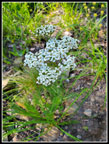
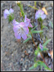
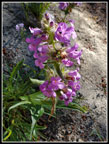
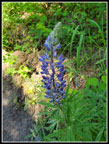
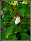
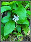
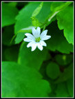
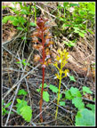
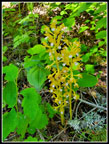
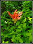
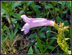
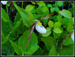
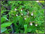
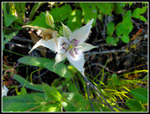
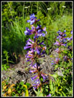
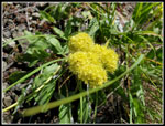
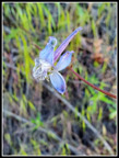
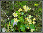
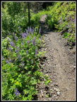
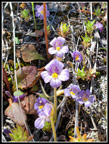
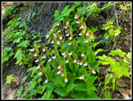
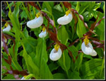
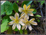
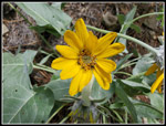
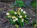
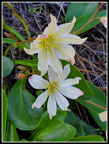
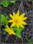
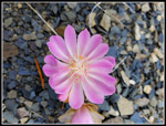
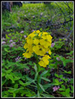
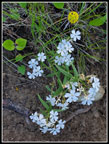
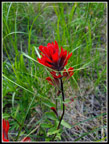
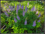
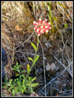
At first, we were out in the open with a steep rock and dirt hillside above us. Above was blue sky and lots of pine trees. The flower show started slowly. Some balsamroot was nearly finished. Lupine was well past prime. We did see a lot of pinkish phacelia. That flower seemed to be at most elevations of our route. We saw it everywhere. Mariposa lilies came in a close second. They were blooming in most open sunny spots on much of the route. Especially at lower elevations. At one spot I looked up the slope and saw a single scarlet gilia in bloom. We only saw a couple more of them all day. Other blooming flowers seen in the first few miles were arnica, salsify, stonecrop, penstemon, larkspur, desert parsley, prairie star, and more. Before reaching the first creek crossing at just under 3 miles, we saw a columbine, half a dozen coral root saprophytes, and mountain lady's slippers. The slippers, Tweedy Lewisia, and bitterroot were the 3 flowers I most hoped to see.
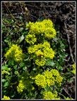
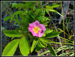
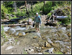
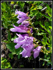
In 2018 the water level was low at 24 cfs flow and the first creek crossing was done by logs and rock hopping. This year the flow was also at 24 cfs. It dropped 3 cfs from the day before. This time there were no logs or rocks. We had to ford the creek. It took a little time to take off and put on our shoes and socks but we had dry feet. 3 miles down and only 14 to go. The first section started in sunshine and then went into forest for most of the way. The second part was also in and out of forest. On this 1.6 mile section, we saw the scarlet gilia, roses, buckwheat, more larkspur and Mariposa lilies, more lady's slippers, and different penstemon.
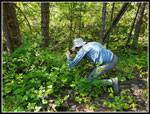
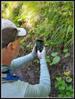
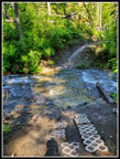
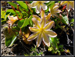
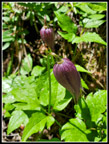
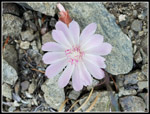
Our second creek crossing was also a ford. It was getting much warmer and the cold water on my feet felt good. After another food and water break, we headed on. The trail climbed well above the creek. More of it was now out in the open. We soon began seeing blooming Tweedy Lewisia. A few at first then more and more. As we gained elevation the Balsamroot began to look better. It was now closer to peak or just after. Penstemon mixed in width the Tweedy. Since we so seldom see this flower we took even more photo stops. We even saw more lady's slippers. The difference between moving pace and overall pace including stops grew wider. I am not a fan of hot hikes out in the open but after the wet cloudy spring, the sunshine was nice. Some side creeks were already dry and the others were easy rock hops. We reached our final creek crossing at 7 miles. It was 12:48 pm. On all my previous visits the creek was about 8'-10' wide. One rock in the middle and I was always able to jump across. This time it was much different. A tree fell and partly blocked the creek channel just downstream from the trail. That raised the water depth in the channel and sent water to the left burying the trail. It was not deep here but deep enough to soak my feet. We walked a log, stepped across to another log, and still had the main channel to go. Since I was surrounded by water I chose to just slog a few steps and jump to a rock and log to get across. It worked fine. I changed into dry socks for the rest of the trip.
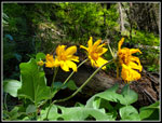
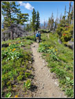
We had lunch here and then pumped water for the rest of the hike. The last 10 miles had no water at all except for quite a few small mud puddles on the trail. So far we saw or heard nobody. Total solitude. So far we had hiked from 1750' to 3450'. The trail up to the junction with the Mission Ridge Trail gains 1000' in 1.9 miles. The grade is steady and not steep. In places, we had views out to Tronsen Ridge across the valley. There were some flowers along here but not a lot. At higher elevations, the balsamroot looked even closer to its peak. We finally saw people. One mountain biker and one motorcycle went by. At the Mission Ridge Trail junction, we saw 3 more motorcyclists taking a break. That would be it for the whole day. One motorcycle and one bicycle on the trail and three folks taking a break. We saw nobody else.
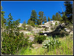
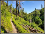
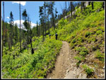
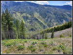
We took another break at the junction. Lots of big trees on the trail up and near the junction. The red barked ponderosa pines really looked good. We headed on at 2:28 pm. We still had 8 miles to go. First, we climbed up to the highest point of the trip must below the Mission Ridge highpoint. This was at about 4845'. The trail does not begin a steady descent to the trailhead. Far from it. On my first visit in 1991, I hiked up Mission Ridge to the junction and back. At that time it was an unregulated motorcycle track. The route followed the ridge top everywhere possible. That made for a lot of steep ups and downs in both directions. There are a lot of bumps on the ridge. Now the trail has switchbacks down low and cuts around some of the bumps. It still has a number of steep ups and downs with a narrow and wheel rutted trail. It is not easy to hike. Double hard when you have already hiked 9 miles when you reach the trail. On the positive side, the trail is right on the ridge top much of the way. We love ridge walks.
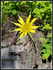
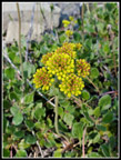
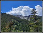
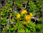
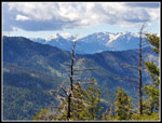
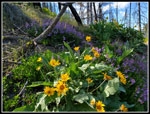
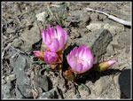
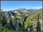
We reached the big bitterroot spot seen on previous trips to find less than half were in bloom. That was a lot but so many more are still a week or so away from full bloom. Oh well, we did get lots of photos. There were also onions in bloom. As the trail lost elevation we began to see more bitterroot right on the ridge top in bloom. The bitterroot went on for miles. We saw a ridiculous number of them by the time they finally went away. We also saw a lot of blooming Tweedy Lewisia on the ridge top. The flower show kept going and we kept stopping for photos. It was becoming clear that we would be getting down later than expected. As the afternoon progressed clouds began to come in. We had ridge top views of the Stuart Range and peaks north of Highway 2. Our phone cameras do not have long zooms so those photos were not very good. Views out were still there but some big puffy white clouds were overhead. We still had sunshine on us most of the day.
After about 13 miles the continuous short ups and downs really began to be a pain. We were all ready to just drop on down. We were losing only 100' some miles. As bitterroot, Tweedys, and higher elevation flowers went away we had lots of lower elevation flowers to replace them. Wallflower, arnica, balsamroot, and lupine were nearly at their peak. The rocky ridge top gave way to rounded hillsides of green grass and ponderosa pine trees. The changing scenery kept up our spirits. By mile 16 we were dropping faster and looking forward to the end. We crossed the bridge to close our loop and a few minutes later crossed the last bridge to the parking lot. We were tired but happy with the long day hiking.
This was a grueling hike in 2005. Now 17 years later I am older and it is a bit more grueling. We were happy to still feel pretty good after 17.1 miles and 3800' of gain. It was 6;55 pm at the finish. By the time we stopped for food in Cle Elum I did not arrive home until 10:20 pm. The wildflower show was spectacular. I saw the three I most wanted to find. They were all blooming in profusion. Timing is critical. We did not see a few flowers seen previously but saw so many in bloom. It was a weekday on a new holiday but I never thought we would see only 5 people all day and only pass 2 of them on the trail. In 2018 there was a running race and we counted 47 runners passing us plus other users. It was very quiet on the trail. The sunshine was great but it was not yet hot. The forecast for next Monday in Cashmere is 95 degrees. Summer is finally on the way. We had great conditions. This will be one of the most strenuous hikes I do this year and one of the most fun.
Click on thumbnails to get
larger pictures.
Trips - 2022
Home
I met Gary and John at High Point near Issaquah at 6:00 am. It was overcast as we headed east. The clouds remained until we passed Easton where the sky began to clear. By Cle Elum it was sunny. We headed up over Blewett Pass to Highway 2 and on to Cashmere. We arrived at the trailhead at 8:06 am. There was one car in the lot. A couple more were along the road and one seemed to be with campers. It was not crowded at all. The trail is used by mountain bikers and motorcyclists so faster folks can catch up on the trail. We were on the trail at 8:15 am. After just a few minutes we met the bridge over Mission Creek that is the start of the Mission Ridge trail. We would end our loop there many hours later. We headed right on the Devil's Gulch Trail. The trail is mostly above the creek. Sometimes far above and sometimes close, it only reaches the shore for the three trail crossings.
At first, we were out in the open with a steep rock and dirt hillside above us. Above was blue sky and lots of pine trees. The flower show started slowly. Some balsamroot was nearly finished. Lupine was well past prime. We did see a lot of pinkish phacelia. That flower seemed to be at most elevations of our route. We saw it everywhere. Mariposa lilies came in a close second. They were blooming in most open sunny spots on much of the route. Especially at lower elevations. At one spot I looked up the slope and saw a single scarlet gilia in bloom. We only saw a couple more of them all day. Other blooming flowers seen in the first few miles were arnica, salsify, stonecrop, penstemon, larkspur, desert parsley, prairie star, and more. Before reaching the first creek crossing at just under 3 miles, we saw a columbine, half a dozen coral root saprophytes, and mountain lady's slippers. The slippers, Tweedy Lewisia, and bitterroot were the 3 flowers I most hoped to see.
In 2018 the water level was low at 24 cfs flow and the first creek crossing was done by logs and rock hopping. This year the flow was also at 24 cfs. It dropped 3 cfs from the day before. This time there were no logs or rocks. We had to ford the creek. It took a little time to take off and put on our shoes and socks but we had dry feet. 3 miles down and only 14 to go. The first section started in sunshine and then went into forest for most of the way. The second part was also in and out of forest. On this 1.6 mile section, we saw the scarlet gilia, roses, buckwheat, more larkspur and Mariposa lilies, more lady's slippers, and different penstemon.
Our second creek crossing was also a ford. It was getting much warmer and the cold water on my feet felt good. After another food and water break, we headed on. The trail climbed well above the creek. More of it was now out in the open. We soon began seeing blooming Tweedy Lewisia. A few at first then more and more. As we gained elevation the Balsamroot began to look better. It was now closer to peak or just after. Penstemon mixed in width the Tweedy. Since we so seldom see this flower we took even more photo stops. We even saw more lady's slippers. The difference between moving pace and overall pace including stops grew wider. I am not a fan of hot hikes out in the open but after the wet cloudy spring, the sunshine was nice. Some side creeks were already dry and the others were easy rock hops. We reached our final creek crossing at 7 miles. It was 12:48 pm. On all my previous visits the creek was about 8'-10' wide. One rock in the middle and I was always able to jump across. This time it was much different. A tree fell and partly blocked the creek channel just downstream from the trail. That raised the water depth in the channel and sent water to the left burying the trail. It was not deep here but deep enough to soak my feet. We walked a log, stepped across to another log, and still had the main channel to go. Since I was surrounded by water I chose to just slog a few steps and jump to a rock and log to get across. It worked fine. I changed into dry socks for the rest of the trip.
We had lunch here and then pumped water for the rest of the hike. The last 10 miles had no water at all except for quite a few small mud puddles on the trail. So far we saw or heard nobody. Total solitude. So far we had hiked from 1750' to 3450'. The trail up to the junction with the Mission Ridge Trail gains 1000' in 1.9 miles. The grade is steady and not steep. In places, we had views out to Tronsen Ridge across the valley. There were some flowers along here but not a lot. At higher elevations, the balsamroot looked even closer to its peak. We finally saw people. One mountain biker and one motorcycle went by. At the Mission Ridge Trail junction, we saw 3 more motorcyclists taking a break. That would be it for the whole day. One motorcycle and one bicycle on the trail and three folks taking a break. We saw nobody else.
We took another break at the junction. Lots of big trees on the trail up and near the junction. The red barked ponderosa pines really looked good. We headed on at 2:28 pm. We still had 8 miles to go. First, we climbed up to the highest point of the trip must below the Mission Ridge highpoint. This was at about 4845'. The trail does not begin a steady descent to the trailhead. Far from it. On my first visit in 1991, I hiked up Mission Ridge to the junction and back. At that time it was an unregulated motorcycle track. The route followed the ridge top everywhere possible. That made for a lot of steep ups and downs in both directions. There are a lot of bumps on the ridge. Now the trail has switchbacks down low and cuts around some of the bumps. It still has a number of steep ups and downs with a narrow and wheel rutted trail. It is not easy to hike. Double hard when you have already hiked 9 miles when you reach the trail. On the positive side, the trail is right on the ridge top much of the way. We love ridge walks.
We reached the big bitterroot spot seen on previous trips to find less than half were in bloom. That was a lot but so many more are still a week or so away from full bloom. Oh well, we did get lots of photos. There were also onions in bloom. As the trail lost elevation we began to see more bitterroot right on the ridge top in bloom. The bitterroot went on for miles. We saw a ridiculous number of them by the time they finally went away. We also saw a lot of blooming Tweedy Lewisia on the ridge top. The flower show kept going and we kept stopping for photos. It was becoming clear that we would be getting down later than expected. As the afternoon progressed clouds began to come in. We had ridge top views of the Stuart Range and peaks north of Highway 2. Our phone cameras do not have long zooms so those photos were not very good. Views out were still there but some big puffy white clouds were overhead. We still had sunshine on us most of the day.
After about 13 miles the continuous short ups and downs really began to be a pain. We were all ready to just drop on down. We were losing only 100' some miles. As bitterroot, Tweedys, and higher elevation flowers went away we had lots of lower elevation flowers to replace them. Wallflower, arnica, balsamroot, and lupine were nearly at their peak. The rocky ridge top gave way to rounded hillsides of green grass and ponderosa pine trees. The changing scenery kept up our spirits. By mile 16 we were dropping faster and looking forward to the end. We crossed the bridge to close our loop and a few minutes later crossed the last bridge to the parking lot. We were tired but happy with the long day hiking.
This was a grueling hike in 2005. Now 17 years later I am older and it is a bit more grueling. We were happy to still feel pretty good after 17.1 miles and 3800' of gain. It was 6;55 pm at the finish. By the time we stopped for food in Cle Elum I did not arrive home until 10:20 pm. The wildflower show was spectacular. I saw the three I most wanted to find. They were all blooming in profusion. Timing is critical. We did not see a few flowers seen previously but saw so many in bloom. It was a weekday on a new holiday but I never thought we would see only 5 people all day and only pass 2 of them on the trail. In 2018 there was a running race and we counted 47 runners passing us plus other users. It was very quiet on the trail. The sunshine was great but it was not yet hot. The forecast for next Monday in Cashmere is 95 degrees. Summer is finally on the way. We had great conditions. This will be one of the most strenuous hikes I do this year and one of the most fun.
 Common Yarrow |
 Phacelia |
 Salsify |
 Looking Up |
 Pink Penstemon |
 Lupine |
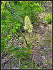
 First Lady's Slipper |
 Gary At Work |
 Woodland Star |
 John At Work |
 Past Prime Balsamroot |
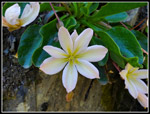
 Small White Flower |
 Coralroot |
 Twin Coralroot |
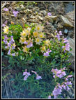
 Open Meadow |
 Columbine |
 Lone Penstemon |
 First Creek Crossing |
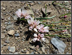
 Sulphur Buckwheat |
 Another Lady's Slipper |
 Lots Of Slippers |
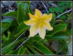
 Mariposa Lily |
 Another Buckwheat |
 Rose |
 Scarlet Gilia |
 John On Trail |
 Another Penstemon |
 Yellow Flower |
 Larkspur |
 John Fords Creek |
 First Tweedy Lewisia |
 Lupine Lined Trail |
 Sunny Tweedy |
 Lone Tweedy |
 Shaded Tweedy |
 Tweedy & Penstemon |
 Old Man's Whiskers |
 Broomrape |
 Penstemon Bush |
 Warm & Sunny |
 Mess Of Slippers |
 Closer Look |
 Triple Tweedy |
 Clematis |
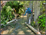 Third Creek Crossing |
 Wet Crossing |
 Blue sky & White Clouds |
 Balsamroot At Peak |
 Silver Crown |
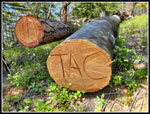 Signed Log |
 Blue Sky At Junction |
 Death Camas |
 Onions |
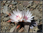 White Bitterroot |
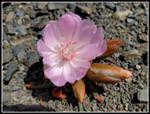 Pink Bitterroot |
 Ridge Top Trail |
 Stuart Range |
 Bunch Of Tweedy |
 Tweedy Duo |
 Arnica |
 Yellow & Pink |
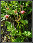
 Perfect Bitterroot |
 Very Pale Pink |
 Trail Far Below |
 Deep Pink |
 Twins |
 Sunshine On Flowers |
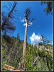
 Mission Peak |
 Steep Rock |
 Grass & Forest |
 Wallflower |
 Phlox |
 Really Red |
 Lush Lupine |
 Long Grass |
 View Near The End |
 Unknown Flower |
 Almost Finished |
Trips - 2022
Home