11-26-22
I
needed a long hike and East Tiger Mountain fit the bill. I entered
November with a slight chance of having my second 1000 mile hiking
year. Emphasis on slight. I then proceeded to have one of the best
months in years. Going into the Thanksgiving weekend I had 101 miles
for the month. I was now only 91 miles short. A big weekend would
really help. Friday was a big storm. Hiking in hard non-stop rain is
not fun. That rain fell as snow in the mountains. I was not sure if it
was rain or snow atop East Tiger. To be safe, I packed rain gear, an
umbrella, gaiters, and microspikes. The evening forecast was for some
rain and some clearing. The morning forecast looked much better. I
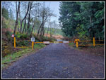
headed out at 7:00 am. The route follows a road from a point 1.5 miles
north of Tiger Summit. I was not surprised to find no cars there. It
was 34 degrees as I packed up to go. I started hiking at 7:47 am. The
expected overcast turned out to be blue sky. I headed up the road soon
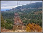
under big powerline towers and
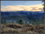
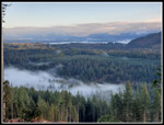
soon had a good look across to Rattlesnake Mountain. The snow level did
not look to be far above my 1090' starting elevation.
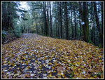
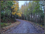
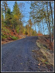
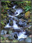
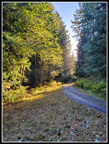
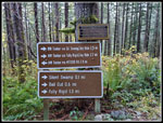
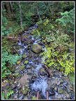
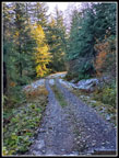
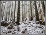
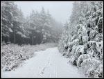
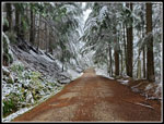
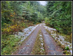
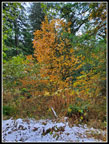
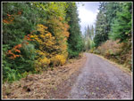
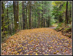
The road turns left and leaves the powerline corridor. At first the evergreen forest has many deciduous trees. The road was covered with fallen leaves. I saw a home barbecue unit that was there a year earlier. There are quite a few mountain bike trails that meet the road. The first one soon appeared. There are lots of signs on this route. I passed the 1 miles marker. At 1.30 miles I passed the end of the NW Timber Trail. The first 3 miles are at a gentle grade. There are several drops and climbs where creeks are passed. Some logged open spots allowed me to see up to blue sky. At one spot I had a view out to the Cascade Mountain front with some snow showing and clouds covering the peaks.
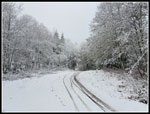
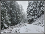
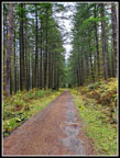
With the gentle grade I made good time even with my heavier high top boots and a winter weight pack. At 3.1 miles the main road switches back to the left. The road straight ahead is the old route up East Tiger from near Preston. That one predates my time hiking here. Now the road begins to gain elevation. It is still not steep but the ascent is steadily up. I passed the Preston RR Grade Trail and the Bail Out Trail on my right. The Silent Swamp Trail is on the left. The next landmark is the big cement bridge over a small creek. There was a little snow near the bridge. This was at about 1820'. The next junction is with two trails I hike a time or two each year. The Off The Grid comes in on the right. It continues all the way to the top of East Tiger. I decided to stick with the road. Opposite the OTG is the Fully Rigid Trail that drops to the NW Timber Trail. At this point the sides of the road were snowy but not the road itself.
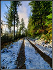
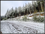
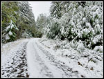
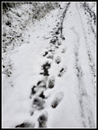
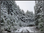
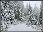
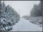
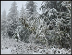
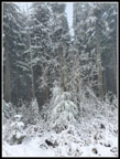
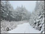
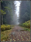
As the road continued climbing, it began to be snow covered. The trees and bushes now were covered with snow. This route was bare two days earlier but really looked good plastered with fresh snow.The road was almost fully covered when I reached the quarry. Blue sky had also turned white as I neared East Tiger Mountain. The temperature still felt like the mid 30s. The road had no recent tracks other than those from deer. Ahead is the where the Master Link uphill only bike trail crossed the road and becomes the Quick Link. On a snowy trip here in April 2021 I saw the first person of the day at this junction. He was on a bike waiting for a friend to arrive. This day a lone biker whizzed by coming down the road right at the junction. Two years in a row I saw the first person at the same spot. Some folks took the road instead of the Quick Link Trail. I now had bike tracks and a one hikers track from yesterday in front of me.
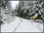
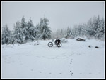
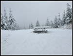
The snow was only a few inches deep and easy to hike in. The Master Link comes in at bout 2450'. I still had 550' to climb. I passed the upper ind of the Quick Link and several other bike trails before I dropped down to the junction with the road coming up from Tiger Summit. Now I had 6 miles done and just had .70 miles to go. There were some bare spots on the summit spur road as the forest overhung the entire road. I was still feeling good as I knocked out the last part. I did see one other biker heading down as I ascended. I reached the summit at 10:10 am. There was one biker on top. I took 2:23 to hike up 6.7 miles. It was the same 34 degrees I had at the start. With no wind it was not too cold. I took a few photos and was soon on my way down.
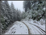
On a couple other trips up this route I descended down the spur road .70 miles losing 350' and then turned around and headed back tot he summit. This brings the 13.4 mile round trip up to 14.8 miles. I was out for more miles this day. On the way down I passed several more bikers heading uphill. Biking up the steep final bit on 3" of snow over a rocky road did not look like fun. I reached the bottom of th spur road and headed back on one more time. Even with two trips up the last part the elevation gain only added up to 2400'. I reached the top at about 10:48 am. This time I took a few photos and a video and had a quick food and water break. I headed down again at 11:00 am. The trip down was pretty easy. The snowy road was softer than the hard packed dirt and gravel. The grade is never too steep. I was surprised to see 7 or 8 bikers coming up the road from below the Master Link junction. I had not seen that before.
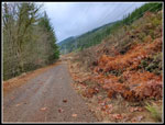
When the snow ended I was back on the dirt road. At the 3.1 mile switchback point the grade eased considerably. I did not see anyone for the last 4 miles. I had plantar fasciitis acting up last year and the last 5 miles was painful. Not so today. My feet felt fine. I was getting a little tired by the end but my feet were fine. After almost 15 miles I was glad to see the end of the road. My car was still the only one there. It was 43 degrees at the finish. I arrived at 1:17 pm. I took 5:30 to hike the entire 14.8 mile. There is a median between the lanes of Highway 18 so you can only go right an steeply uphill. This day I did not turn into Tiger Summit and then turn left. I just went around Tiger Mountain and back to Issaquah. I was surprised to see the outer lot at Tiger Summit was only about half full at 1:30 pm. There were even a few open spots at the Chirico Trailhead.
This trip worked out great. The chance of rain forecast a couple days earlier turned out to he partly sunny and dry all day. It was cold but not below freezing. Even the wind stayed calm most of the day. I went from 99 miles short of 1000 to only 84. It is hard to get in a long trip in December with more mountain snow and bad weather. This trip puts me in good shape for a run at 1000 miles.
Click on thumbnails to get
larger pictures.
Trips - 2022
Home
The road turns left and leaves the powerline corridor. At first the evergreen forest has many deciduous trees. The road was covered with fallen leaves. I saw a home barbecue unit that was there a year earlier. There are quite a few mountain bike trails that meet the road. The first one soon appeared. There are lots of signs on this route. I passed the 1 miles marker. At 1.30 miles I passed the end of the NW Timber Trail. The first 3 miles are at a gentle grade. There are several drops and climbs where creeks are passed. Some logged open spots allowed me to see up to blue sky. At one spot I had a view out to the Cascade Mountain front with some snow showing and clouds covering the peaks.
With the gentle grade I made good time even with my heavier high top boots and a winter weight pack. At 3.1 miles the main road switches back to the left. The road straight ahead is the old route up East Tiger from near Preston. That one predates my time hiking here. Now the road begins to gain elevation. It is still not steep but the ascent is steadily up. I passed the Preston RR Grade Trail and the Bail Out Trail on my right. The Silent Swamp Trail is on the left. The next landmark is the big cement bridge over a small creek. There was a little snow near the bridge. This was at about 1820'. The next junction is with two trails I hike a time or two each year. The Off The Grid comes in on the right. It continues all the way to the top of East Tiger. I decided to stick with the road. Opposite the OTG is the Fully Rigid Trail that drops to the NW Timber Trail. At this point the sides of the road were snowy but not the road itself.
As the road continued climbing, it began to be snow covered. The trees and bushes now were covered with snow. This route was bare two days earlier but really looked good plastered with fresh snow.The road was almost fully covered when I reached the quarry. Blue sky had also turned white as I neared East Tiger Mountain. The temperature still felt like the mid 30s. The road had no recent tracks other than those from deer. Ahead is the where the Master Link uphill only bike trail crossed the road and becomes the Quick Link. On a snowy trip here in April 2021 I saw the first person of the day at this junction. He was on a bike waiting for a friend to arrive. This day a lone biker whizzed by coming down the road right at the junction. Two years in a row I saw the first person at the same spot. Some folks took the road instead of the Quick Link Trail. I now had bike tracks and a one hikers track from yesterday in front of me.
The snow was only a few inches deep and easy to hike in. The Master Link comes in at bout 2450'. I still had 550' to climb. I passed the upper ind of the Quick Link and several other bike trails before I dropped down to the junction with the road coming up from Tiger Summit. Now I had 6 miles done and just had .70 miles to go. There were some bare spots on the summit spur road as the forest overhung the entire road. I was still feeling good as I knocked out the last part. I did see one other biker heading down as I ascended. I reached the summit at 10:10 am. There was one biker on top. I took 2:23 to hike up 6.7 miles. It was the same 34 degrees I had at the start. With no wind it was not too cold. I took a few photos and was soon on my way down.
On a couple other trips up this route I descended down the spur road .70 miles losing 350' and then turned around and headed back tot he summit. This brings the 13.4 mile round trip up to 14.8 miles. I was out for more miles this day. On the way down I passed several more bikers heading uphill. Biking up the steep final bit on 3" of snow over a rocky road did not look like fun. I reached the bottom of th spur road and headed back on one more time. Even with two trips up the last part the elevation gain only added up to 2400'. I reached the top at about 10:48 am. This time I took a few photos and a video and had a quick food and water break. I headed down again at 11:00 am. The trip down was pretty easy. The snowy road was softer than the hard packed dirt and gravel. The grade is never too steep. I was surprised to see 7 or 8 bikers coming up the road from below the Master Link junction. I had not seen that before.
When the snow ended I was back on the dirt road. At the 3.1 mile switchback point the grade eased considerably. I did not see anyone for the last 4 miles. I had plantar fasciitis acting up last year and the last 5 miles was painful. Not so today. My feet felt fine. I was getting a little tired by the end but my feet were fine. After almost 15 miles I was glad to see the end of the road. My car was still the only one there. It was 43 degrees at the finish. I arrived at 1:17 pm. I took 5:30 to hike the entire 14.8 mile. There is a median between the lanes of Highway 18 so you can only go right an steeply uphill. This day I did not turn into Tiger Summit and then turn left. I just went around Tiger Mountain and back to Issaquah. I was surprised to see the outer lot at Tiger Summit was only about half full at 1:30 pm. There were even a few open spots at the Chirico Trailhead.
This trip worked out great. The chance of rain forecast a couple days earlier turned out to he partly sunny and dry all day. It was cold but not below freezing. Even the wind stayed calm most of the day. I went from 99 miles short of 1000 to only 84. It is hard to get in a long trip in December with more mountain snow and bad weather. This trip puts me in good shape for a run at 1000 miles.
 Getting Started |
 Snow On Rattlesnake Mt |
 Leaves At 1 Mile |
 First Fall Color |
 Uphill |
 Fog Below |
 Cascading Creek |
 Sunshine |
 Old & New Signs |
 Big Bridge Creek |
 First Snow |
 Mostly Snow |
 Snowy Quarry |
 Flocked Trees |
 Tracks |
 Trail Crossing |
 Grade Easing |
 Deciduous Trees |
 Skinny Trees |
 Summit Spur Snow |
 Tower In Sight |
 Lone Mountain Biker |
 Heading Down |
 White Sky |
 Bare Ground |
 Bent Over |
 Back At Summit |
 Signboard |
 White Branches |
 Descending Again |
 Lower Viewpoint |
 Thinning Snow |
 Almost Gone |
 More Fall Color |
 Straight Road |
 Into The Mist |
 More Colors |
 1 Mile To Go |
 Powerline Corridor |
 Almost Back |
Trips - 2022
Home