08-06-22
Kim
was free for a Saturday hike.
With temperatures rising into the mid 80s west of the crest we chose a
hike closer to salt water. I picked Kim up at 6:50 am and we headed
north. One benefit of this hike was getting "cheap" $4.16 gas in
Arlington. That was 20% cheaper than Seattle. We headed north to
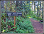
Chuckanut Drive and up to Cleator Road. After waiting for a truck with
a big trailer to turn around and let us by, we reached the Two Dollar
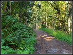
Trail. I was surprised to see no other cars there at 8:12 am. One
runner did pass by. I have seen lots of bugs on one trip. Not this day.
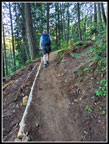
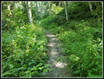
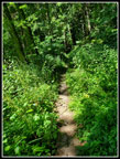
Not at the trailhead and not on the trail. The trail climbs 300' very
quickly, The trail grade is easy enough for bikes. Up a series of
switchbacks and the grade becomes fairly flat. Along here, Kim noticed
patches of fresh Indian Pipe growing in the green underbrush. This is
the third hike in the past week where I have seen Indian Pipe. That was
it for the saprophytes except for a lone coral root seen on the way
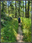
back. The trail has some ups and down as it heads for Fragrance Lake.
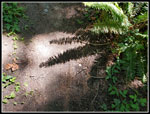
Before reaching the lake the outlet is a waterfall streaming down mosey rock slabs. I have done this hike in every season except mid summer. The waterfall has varied from pretty big to moderate flow. This day it was dry. Next, the trail switchbacks up to the lake. We arrived at Fragrance Lake at 9:28 am. We went on a clockwise trip around the lake. There was just enough wind to mess up reflection shots. The sunshine and all the green made it a pretty lake. We were really surprised to find no biting bugs at the lake. No problems with shorts and short sleeves. We took our time going around the lake. We had still only seen a few people to far. After a short break we headed on. The trail passes the junction with the trail up from Chuckanut Drive. We did not expect to see many folks on the next part of the trail.
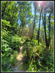
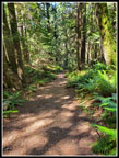
We reached the old road. I had always gone left and up to Cyrus Gates Overlook and then down the Rock Trail. This time we turned right and took the route I often hike back on. This was my first time going up the South Lost Lake Trail. The route continued to be in forest. The sun seldom heated us up. I have hiked down this next section in fall, winter, and spring. It is mostly an old roadbed with a wide track having brush on both sides. In summer, it is a narrow track with brush right along both sides. I can confidently day that much of the way has nettles close by. We were careful but both of us had a little stinging after passing through. The trail climbs at a steady though moderate grade. The trail reaches a high point then begins to descend. Another path continues straight ahead. We took it.
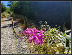
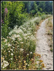
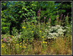
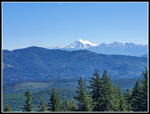
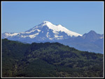
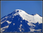
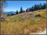
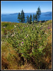
There used to be a sign where the path leaves Larrabee State Park. Not any more. The forested trail enters a clear cut. For the first and only time this day we were mostly out in the open. It was now 11:06 am and getting much warmer. The now wider logging road had a lot of wildflowers along the sides. White daisies and pearly everlasting were mixed in with yellow flowers, and pink fireweed. One left turn and we reached the east facing viewpoint. It was a bit haze, much like my first visit. Mt. Baker looked good but was not crystal clear. We managed to squeeze into the little shade found there and sat down for lunch. We arrived at 11:22 am. Our food break lasted a little longer than planned. We did not pack up and leave until 12:19 pm. We spent almost an hour looking at Mt. Baker and Samish Lake and just enjoying a summer day. Unlike places farther inland it was still in the 70s. We planned to avoid the heat and we succeeded.
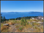
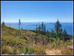
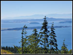
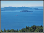
We went back to the road and headed uphill a few more minutes to the clear cut view to the west. With a map we were able to see that Lummi Island was to the west with small Eliza Island just in front of it. Anacortes was visible tot he southwest. The views are really very good. We saw one hiker when leaving the Baker view but saw nobody at the second viewpoint. I saw more people on May 1st then on this sunny summer day. Not that I am complaining.We spent almost a half hour here before starting back at 12:56 pm. With an early start and a pretty easy trail we were in no big hurry to get back to Seattle.
The trail back to Fragrance Lake was nearly all downhill. Pretty easy walking. Along the way we noticed a lot of native black cap raspberries along the trail. A few of them were even ripe. When we reached the lake we found more people, as expected. Some of them were even swimming. We hiked around the right side, the same side as in the morning. We strolled around the lake reaching the other side at 2:51 pm. On the hike back to the car we were passed by several groups. A few more were coming in. The uphill spots are a little steep but not too long. Mostly it is fairly flat until the final switchbacking drop to the road. The thick forest kept us from getting too hot. We even had a little headwind at times.
We reached the car at 4:05 pm. There were 2 or 3 cars parked next to me in the little lot and only 2 cars parked along the road. That is a really small crowd. In keeping with the theme of the day, the highway was much less crowded than on a usual early August Saturday. We just slowed to 30 mph for a short way south of Marysville. People were avoiding this trail and the highway this day and I could not have been more pleased. For the day we hiked about 8.7 miles with 1800' of elevation gain. The route was not steep and was completely in the shade except for the two viewpoints. A good route on a hot day. Now, I still need to see the views on a crystal clear day.
Click on thumbnails to get
larger pictures.
Trips - 2022
Home
Before reaching the lake the outlet is a waterfall streaming down mosey rock slabs. I have done this hike in every season except mid summer. The waterfall has varied from pretty big to moderate flow. This day it was dry. Next, the trail switchbacks up to the lake. We arrived at Fragrance Lake at 9:28 am. We went on a clockwise trip around the lake. There was just enough wind to mess up reflection shots. The sunshine and all the green made it a pretty lake. We were really surprised to find no biting bugs at the lake. No problems with shorts and short sleeves. We took our time going around the lake. We had still only seen a few people to far. After a short break we headed on. The trail passes the junction with the trail up from Chuckanut Drive. We did not expect to see many folks on the next part of the trail.
We reached the old road. I had always gone left and up to Cyrus Gates Overlook and then down the Rock Trail. This time we turned right and took the route I often hike back on. This was my first time going up the South Lost Lake Trail. The route continued to be in forest. The sun seldom heated us up. I have hiked down this next section in fall, winter, and spring. It is mostly an old roadbed with a wide track having brush on both sides. In summer, it is a narrow track with brush right along both sides. I can confidently day that much of the way has nettles close by. We were careful but both of us had a little stinging after passing through. The trail climbs at a steady though moderate grade. The trail reaches a high point then begins to descend. Another path continues straight ahead. We took it.
There used to be a sign where the path leaves Larrabee State Park. Not any more. The forested trail enters a clear cut. For the first and only time this day we were mostly out in the open. It was now 11:06 am and getting much warmer. The now wider logging road had a lot of wildflowers along the sides. White daisies and pearly everlasting were mixed in with yellow flowers, and pink fireweed. One left turn and we reached the east facing viewpoint. It was a bit haze, much like my first visit. Mt. Baker looked good but was not crystal clear. We managed to squeeze into the little shade found there and sat down for lunch. We arrived at 11:22 am. Our food break lasted a little longer than planned. We did not pack up and leave until 12:19 pm. We spent almost an hour looking at Mt. Baker and Samish Lake and just enjoying a summer day. Unlike places farther inland it was still in the 70s. We planned to avoid the heat and we succeeded.
We went back to the road and headed uphill a few more minutes to the clear cut view to the west. With a map we were able to see that Lummi Island was to the west with small Eliza Island just in front of it. Anacortes was visible tot he southwest. The views are really very good. We saw one hiker when leaving the Baker view but saw nobody at the second viewpoint. I saw more people on May 1st then on this sunny summer day. Not that I am complaining.We spent almost a half hour here before starting back at 12:56 pm. With an early start and a pretty easy trail we were in no big hurry to get back to Seattle.
The trail back to Fragrance Lake was nearly all downhill. Pretty easy walking. Along the way we noticed a lot of native black cap raspberries along the trail. A few of them were even ripe. When we reached the lake we found more people, as expected. Some of them were even swimming. We hiked around the right side, the same side as in the morning. We strolled around the lake reaching the other side at 2:51 pm. On the hike back to the car we were passed by several groups. A few more were coming in. The uphill spots are a little steep but not too long. Mostly it is fairly flat until the final switchbacking drop to the road. The thick forest kept us from getting too hot. We even had a little headwind at times.
We reached the car at 4:05 pm. There were 2 or 3 cars parked next to me in the little lot and only 2 cars parked along the road. That is a really small crowd. In keeping with the theme of the day, the highway was much less crowded than on a usual early August Saturday. We just slowed to 30 mph for a short way south of Marysville. People were avoiding this trail and the highway this day and I could not have been more pleased. For the day we hiked about 8.7 miles with 1800' of elevation gain. The route was not steep and was completely in the shade except for the two viewpoints. A good route on a hot day. Now, I still need to see the views on a crystal clear day.
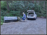 Trailhead |
 Recent Trail Work |
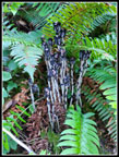 Indian Pipe |
 Dry Falls |
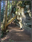 Sandstone Wall |
 Nice Reflection |
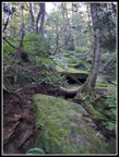
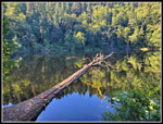 Long Log |
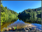 Fragrance Lake |
 Old Road |
 Trail Junction |
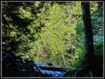
 Narrow Trail |
 Kim Leads The Way |
 Colorful Fireweed |
 Pearly Everlasting |
 More Colors |
 Baker From Viewpoint |
 Closer Mt. Baker |
 Closest Mt. Baker |
 View West |
 View Southwest |
 Anacortes |
 Anchorage |
 Field Of Fireweed |
 Thistle Bush |
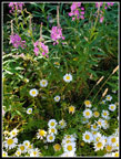 Fireweed & Daisies |
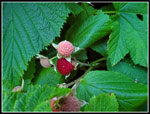 Thimbleberries |
 Sun In The Trees |
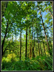 Wide Angle Trees |
 More Narrow Trail |
 Fern Shadows |
 Shady Forest |
 Back To Waterfall |
Trips - 2022
Home