08-28-22
I
had only one 4000' gain hike all
year. I had not been above 6000' either. It was time for trip to the
Teanaway. After another hot week with temperatures in the 90 in Cle
Elum, the weekend cooled down. Very cool on Saturday with winds
forecast to gust up to 24 mph. High up on ridges with high winds does
not appeal to me. Sunday would be clear and warmer with a high of 78 in
Cle Elum. That sounded better though at the upper end of my comfortable
heat level. I was out of Seattle at 6:00 am. I stopped for gas in Cle
Elum where their $4.06 was 97 cents cheaper than North Seattle. The
Beverly Creek Road is pretty awful now. It was fine until the forest
service decided to but drain trenches across the road. As cars drop in
and spin their tires the trench just keeps getting deeper. They were
put in places where there had been no erosion problems. Okay, I'll end
the rant here. Once car stopped just before the first deep trench. With
8.5" ground clearance and 4WD I did fine. At the trailhead there were 6
other vehicles. Five SUVs and one truck. The lot was more than half
empty. My car thermometer showed it was only n41 degrees outside. Just
a bit chilly.
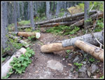
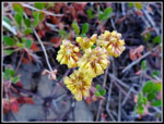
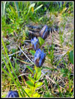
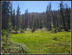
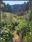
I was packed and started out at 8:19 am. The bridge is signed for only one person at a time. I hope it survives another winter snow load. There were a few flowers still blooming on the old road section. Foremost was pearly everlasting. I reached Bean Creek to find the water level low enough for an easy rock hop. The trails along my route had more than a dozen trees down. In a few spots one side of the tree was cut. Most of them were not cut at all. None were difficult to go over or around but by late August this trail has always been cleared as far back as I can recall. I don't recall any trees across the Bean Creek Trail and that one is much more popular.
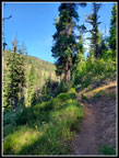
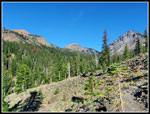
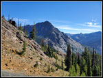
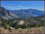
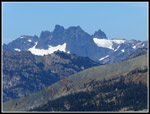
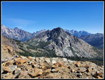
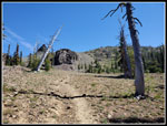
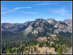
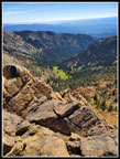
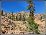
The forest walk was pleasant. The temperature began to rise quickly. By the time I was out of the forest I had my sleeves pulled up. Where the trail heads over to Beverly Creek the water was still running though there was not much. In summer it often runs underground here and the creek bed is dry. The trail has always been rocky as it switchbacks up the slope and heads up the valley. This year it is much rockier than usual. The rocks and gravel just slowed me down. There were some asters and Valerian hanging on but few flowers were still blooming. I stopped for photos where Iron, Teanaway and Bill's Peak are all in view. I was in shade but the peaks were bathed in morning sunshine. I could see ahead where shade turned to sunshine. Once out in the sunshine I would have a lot more sun than shade the rest of the day.
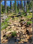
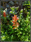
I did have a little shade higher up the basin. I reached the junction with the Fourth Creek Trail at 9:34 am. I covered 2.6 miles in 1:15. The creeks in the upper basin are often dry by late August. This year they were still running. With the water there were Indian paintbrush and asters still in bloom. After crossing the main creek the trail is always pretty rocky at first. This year the rocks and gravel continue on for quite a ways. It made the trail more tedious than usual. As I climbed up the hillside the views began to improve. At first there are breaks in forest but higher up the views are open to the peaks around the the valley below. Volcanic Neck was the first to come into view. Soon I could see Bean Peak. That is where I would be heading after summiting Iron Peak. I started to notice multiple clumps of blooming gentians. These flowers are a sign of fall. With all the recent heat it did not feel like fall.
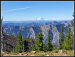
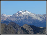
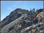
I turned off the for the trail up to Iron Peak instead of the trail heading for Beverly-Turnpike Pass. Now I was mostly out in the open. I started at 41 degrees. In the sunshine it now felt like 75 degrees. I had some shade before the final switchbacks up to the pass. I put on a short sleeve shirt and zipped off my pant legs. That really helped. A little food and water and I was ready to continue up. At the pass I added views to the west. I could see out to the Cascade Crest peaks. I could also see Mt. Rainier and Mt. Daniel. The hike up to the summit is a long ridge walk. Great views all around and pretty easy terrain. I arrived at the summit at about 10:45 am. At the summit I found the first 3 people I had seen all day. They came up Beverly Creek also but let well before me. We had a good conversation and half an hour went by very fast. I brought my super zoom camera for summit shots and put it to good use. It was a bit hazy but I could see Rainier and Adams clear enough.
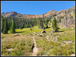
The others headed down and I followed. We left the top at 11:11 am. I picked up my pace and pulled ahead. When I reached the saddle I realized in all the talk at the summit I had forgotten to put on sunscreen. I stopped and loaded up. The descend into the valley went quickly. I passed a guy and young son heading up. At the Beverly-Turnpike Trail junction I saw two mountain bikes speed down before I arrived. That was it for the rest of the day. I passed two groups and saw one at a distance. Incredible solitude in a popular area. At the Fourth Creek Trail junction I turned left and headed uphill. This was one of the worst trail sections. It is steep and has a lot of rocks and gravel. The sun was getting very hot and the poor tread had me moving pretty slowly. Fortunately, it was short. I was up at the pass in 16 minutes. It was now 12:16 pm. Time for another food and water break. The County Line Trail heading for Volcanic Neck is mostly a fairly flat traverse through forest and meadows.
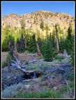
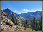
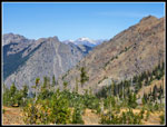
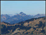
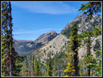
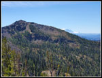
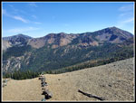
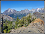
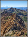
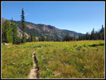
The trail is often pretty dry this late in the year. This year there were four or five creeks still flowing. I made good time on the flatter section. I knew what was coming. When the climbing stats it gets down to business. More rocky and gravelly trenches pretending to be trails. On a cool day this is just a minor problem. When it feels very hot it seems worse. The forecast was off by at least 7 or 8 degrees. For the climb up to the meadows below the ridge top pass I went slow and steadily. At the top there were some big trees to provide shade. From here there would be almost no shade going up Bean Peak and dropping down into Bean Creek Basin. The last climb to the ridge top was actual switchbacks. That felt pretty good. I also had improving views with each step. Mary, Iron, Teanaway, Bill's, Stuart, and the Stuart Range were in sight.
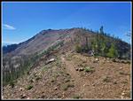
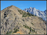
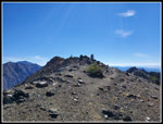
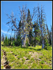
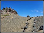
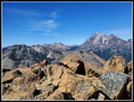
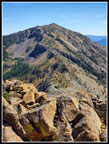
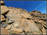
At the ridge top I had a slight breeze. That was great. Now came the fun part. A long ridge top scramble up Bean Peak. Only the last part required using hands. I was very glad when I ran out of mountain. There was nobody else atop Bean. At 6743; Bean is 233' higher than Iron Peak. It has a small summit area unlike Iron which is the high point on a long ridge. Since I was solo on this trip I left Gary my exact itinerary and texted updates. I let him know I was safely atop Bean Peak. The views are fantastic. Peaks in all directions. I have been up Bean a few dozen times and enjoy the view each time. I arrived at 1:34 pm. I finished the 4400' of gain before the hottest time of day. I was in good shape time wise. I spent 32 minutes on top and then headed down. Most people go down the southeast ridge heading towards Earl Peak. In the last half dozen years a minor boot path that climbed a short way up form Bean Creek Basin has morphed into a trail to the ridge top. I always just went cross country on my way up and down. This time I headed straight down the face and then angled a little left dropping into the basin. That is 1150' of boulders, and scree, and forest, and brush. It does make it interesting. It took me about 50 minutes to reach the basin.
There was nobody there. All the way back I saw nobody. My trail of solitude continued. I dropped down to the lower basin and then into forest. The first sustained shade I had seen since the meadow below the pass on the opposite side of Bean Peak. It was quite enjoyable. With the view behind me it was just a couple miles of forest, meadows, and brush getting down to where I crossed Bean Creek in the morning. The upper crossing of the creek was an easy rock hop. I arrived at the trailhead at 4:01 pm. I came down from the summit of Bean Peak in just under 2 hours. There were now 3 other cars in the lot. The car thermometer now showed it was 76 degrees. It was a bit toastier than I prefer for a 12 mile hike with 4400' of elevation gain,
I was very pleased with the day. It was long past time to visit a 6000'+ summit and two in one day was even better. The lack of other people was surprising. Iron Peak has a shorter trail and I usually see some folks on the way up and down the ridge. Today it was just the three on the summit. It was warmer than I was expecting but not another 80+ degree day in the Teanaway. Warm was not still not way too hot. I love the scramble up and down Bean Peak and it was just as good as always. There were a few wildflowers hanging on and the blooming gentians were blooming early. All in all, a very good day on the trail.
Click on thumbnails to get
larger pictures.
Trips - 2022
Home
I was packed and started out at 8:19 am. The bridge is signed for only one person at a time. I hope it survives another winter snow load. There were a few flowers still blooming on the old road section. Foremost was pearly everlasting. I reached Bean Creek to find the water level low enough for an easy rock hop. The trails along my route had more than a dozen trees down. In a few spots one side of the tree was cut. Most of them were not cut at all. None were difficult to go over or around but by late August this trail has always been cleared as far back as I can recall. I don't recall any trees across the Bean Creek Trail and that one is much more popular.
The forest walk was pleasant. The temperature began to rise quickly. By the time I was out of the forest I had my sleeves pulled up. Where the trail heads over to Beverly Creek the water was still running though there was not much. In summer it often runs underground here and the creek bed is dry. The trail has always been rocky as it switchbacks up the slope and heads up the valley. This year it is much rockier than usual. The rocks and gravel just slowed me down. There were some asters and Valerian hanging on but few flowers were still blooming. I stopped for photos where Iron, Teanaway and Bill's Peak are all in view. I was in shade but the peaks were bathed in morning sunshine. I could see ahead where shade turned to sunshine. Once out in the sunshine I would have a lot more sun than shade the rest of the day.
I did have a little shade higher up the basin. I reached the junction with the Fourth Creek Trail at 9:34 am. I covered 2.6 miles in 1:15. The creeks in the upper basin are often dry by late August. This year they were still running. With the water there were Indian paintbrush and asters still in bloom. After crossing the main creek the trail is always pretty rocky at first. This year the rocks and gravel continue on for quite a ways. It made the trail more tedious than usual. As I climbed up the hillside the views began to improve. At first there are breaks in forest but higher up the views are open to the peaks around the the valley below. Volcanic Neck was the first to come into view. Soon I could see Bean Peak. That is where I would be heading after summiting Iron Peak. I started to notice multiple clumps of blooming gentians. These flowers are a sign of fall. With all the recent heat it did not feel like fall.
I turned off the for the trail up to Iron Peak instead of the trail heading for Beverly-Turnpike Pass. Now I was mostly out in the open. I started at 41 degrees. In the sunshine it now felt like 75 degrees. I had some shade before the final switchbacks up to the pass. I put on a short sleeve shirt and zipped off my pant legs. That really helped. A little food and water and I was ready to continue up. At the pass I added views to the west. I could see out to the Cascade Crest peaks. I could also see Mt. Rainier and Mt. Daniel. The hike up to the summit is a long ridge walk. Great views all around and pretty easy terrain. I arrived at the summit at about 10:45 am. At the summit I found the first 3 people I had seen all day. They came up Beverly Creek also but let well before me. We had a good conversation and half an hour went by very fast. I brought my super zoom camera for summit shots and put it to good use. It was a bit hazy but I could see Rainier and Adams clear enough.
The others headed down and I followed. We left the top at 11:11 am. I picked up my pace and pulled ahead. When I reached the saddle I realized in all the talk at the summit I had forgotten to put on sunscreen. I stopped and loaded up. The descend into the valley went quickly. I passed a guy and young son heading up. At the Beverly-Turnpike Trail junction I saw two mountain bikes speed down before I arrived. That was it for the rest of the day. I passed two groups and saw one at a distance. Incredible solitude in a popular area. At the Fourth Creek Trail junction I turned left and headed uphill. This was one of the worst trail sections. It is steep and has a lot of rocks and gravel. The sun was getting very hot and the poor tread had me moving pretty slowly. Fortunately, it was short. I was up at the pass in 16 minutes. It was now 12:16 pm. Time for another food and water break. The County Line Trail heading for Volcanic Neck is mostly a fairly flat traverse through forest and meadows.
The trail is often pretty dry this late in the year. This year there were four or five creeks still flowing. I made good time on the flatter section. I knew what was coming. When the climbing stats it gets down to business. More rocky and gravelly trenches pretending to be trails. On a cool day this is just a minor problem. When it feels very hot it seems worse. The forecast was off by at least 7 or 8 degrees. For the climb up to the meadows below the ridge top pass I went slow and steadily. At the top there were some big trees to provide shade. From here there would be almost no shade going up Bean Peak and dropping down into Bean Creek Basin. The last climb to the ridge top was actual switchbacks. That felt pretty good. I also had improving views with each step. Mary, Iron, Teanaway, Bill's, Stuart, and the Stuart Range were in sight.
At the ridge top I had a slight breeze. That was great. Now came the fun part. A long ridge top scramble up Bean Peak. Only the last part required using hands. I was very glad when I ran out of mountain. There was nobody else atop Bean. At 6743; Bean is 233' higher than Iron Peak. It has a small summit area unlike Iron which is the high point on a long ridge. Since I was solo on this trip I left Gary my exact itinerary and texted updates. I let him know I was safely atop Bean Peak. The views are fantastic. Peaks in all directions. I have been up Bean a few dozen times and enjoy the view each time. I arrived at 1:34 pm. I finished the 4400' of gain before the hottest time of day. I was in good shape time wise. I spent 32 minutes on top and then headed down. Most people go down the southeast ridge heading towards Earl Peak. In the last half dozen years a minor boot path that climbed a short way up form Bean Creek Basin has morphed into a trail to the ridge top. I always just went cross country on my way up and down. This time I headed straight down the face and then angled a little left dropping into the basin. That is 1150' of boulders, and scree, and forest, and brush. It does make it interesting. It took me about 50 minutes to reach the basin.
There was nobody there. All the way back I saw nobody. My trail of solitude continued. I dropped down to the lower basin and then into forest. The first sustained shade I had seen since the meadow below the pass on the opposite side of Bean Peak. It was quite enjoyable. With the view behind me it was just a couple miles of forest, meadows, and brush getting down to where I crossed Bean Creek in the morning. The upper crossing of the creek was an easy rock hop. I arrived at the trailhead at 4:01 pm. I came down from the summit of Bean Peak in just under 2 hours. There were now 3 other cars in the lot. The car thermometer now showed it was 76 degrees. It was a bit toastier than I prefer for a 12 mile hike with 4400' of elevation gain,
I was very pleased with the day. It was long past time to visit a 6000'+ summit and two in one day was even better. The lack of other people was surprising. Iron Peak has a shorter trail and I usually see some folks on the way up and down the ridge. Today it was just the three on the summit. It was warmer than I was expecting but not another 80+ degree day in the Teanaway. Warm was not still not way too hot. I love the scramble up and down Bean Peak and it was just as good as always. There were a few wildflowers hanging on and the blooming gentians were blooming early. All in all, a very good day on the trail.
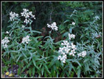 Pearly Everlasting |
 Beverly Creek Trail |
 Some Cut, Most Not |
 Sunshine On The Slope |
 Yellow Flower |
 Bill Peak In Sight |
 Iron, Teanaway, Bill's |
 Fourth Creek Junction |
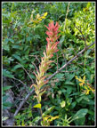 Indian Paintbrush |
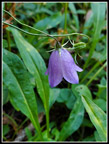 Harebell |
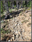 Rocky Trail |
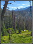 Meadow & Neck |
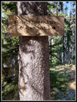
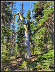 Old Snag |
 Gentians |
 Looking East |
 At Iron Pass |
 Heading For Iron Summit |
 View East To Bean |
 Mt. Rainier |
 Esmerelda & Daniel |
 Teanaway & Stuart |
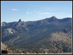
 Chimney Rock |
 Three Queens |
 Mt. Daniel |
 Leaving Iron Summit |
 Bill's Peak |
 Route To Bean Peak |
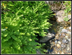 Lush Ferns |
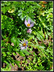 Asters |
 Meadow On Trail |
 Really Rocky Trail |
 Teanaway & Bill's Pks |
 Silvered Snag |
 Nearing Ridge |
 Mary & Rainier |
 Ridge Top! |
 Navaho & Earl |
 Route Back To Iron |
 Nearing Bean Summit |
 Stuart Range |
 Bean Peak Summit |
 Bean Basin Below |
 Ridge, Mary, & Rainier |
 Earl Peak |
 I'm Down The Face |
 Descending From Bean |
 In Bean Basin |
 Heading Out |
 Last Paintbrush |
 A Little Brushy |
 Shadows |
Trips - 2022
Home