12-17-22
John
joined me for a one way trip
over Tiger Mountain. I was after miles and elevation gain. We opted for
another close in trip that would not be all on snow. Rain was supposed
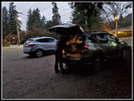
to hold off until late afternoon. We met at High Point at 7:30 am and
left my car. John drove down to the nearby Sunset Trailhead. There were
only a few cars there. We were almost at the latest sunrise of the
year. It was not fully light until just before we started out. At 7:40
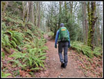
am we started up the trail. The big unknown was how much snow we would
see on the lesser traveled trail we planned to take. With cars at two
spots we hoped to do a one way trip. If the snow slowed us down too
much we could create routes that would get up back to either trailhead.
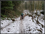
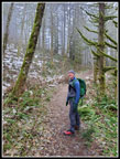
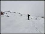
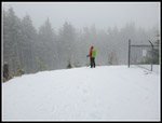
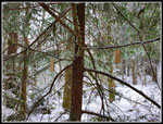
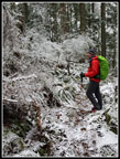
We headed up to the Tradition Plateau and took the Wetlands Trail to the Adventure Trail. This trail ends with a 140' descent to the High School Trail. That's one way to get in extra elevation gain. We then took the Poo Poo Point Trail. It was 30 degrees when we started and stayed in that vicinity all day. The high of the day was at the finish where it was up to 35 degrees. We saw a couple groups of hikers and runners along here. We saw very few people all day. The old trail went up to the railroad grade then descended to Poo Poo Point. The new route just turns and heads for the point. As we ascended we entered the clouds. The mist continued for a long way. After turning onto the new trail we had spots out of the forest and there was hard packed snow here. A little slick but we did not stop to put on microspikes.
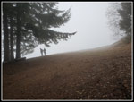
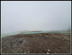
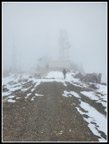
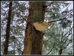
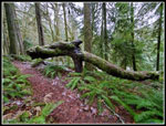
We arrived at Poo Poo Point at 9:12 am. There were two hikes down at the take off spot. Views were non-existent. We took a food and water break, figured out that the three legged thing is a seismograph, and debated how the anemometer atop the tower sent a signal to the Internet. It was quite chilly and we were ready to get moving at 9:21 am. We retraced our steps back down the trail. John suggested a detour on the old route. It would be shorter and with less elevation gain but I was interested in seeing how badly the old route was blocked. The start was easy enough. Instead of blocking both ends, they but logs down along much of the old route. It was interesting to check it out but it is not worth using in the future. The new trail is longer with more gain but a lot less hassle. We intersected the One View Trail at the four way (now three way) junction on the railroad grade.
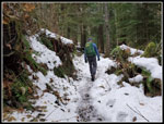
Other than the one spot in the open, we had hiked this far with no snow. The junction is at 1900'. That is much higher than I expected to get without snow. The One View Trail had some snow in places but way mostly snow free or a very thin layer. We reached the TMT and turned right heading for the Hidden Forest Trail. This section did have snow though it was still not deep at all. When we reached the junction we stopped to put on microspikes. The climb up to the road starts out very steep. We ascended for maybe 70 vertical feet and the snow went away. We had bare trail. We kept on the spikes and kept climbing. When the trail leveled off there was some snow. We reached the road to find it completely snow covered. I noticed one spike had broken. I jury rigged it several years ago and the fix had lasted. Until today that is. I made a temporary fix that lasted until just before we took off the spikes. I fixed it again at home later.
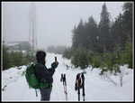
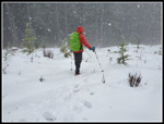
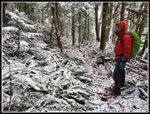
The Poo Top Trail is steep and less used. This is where I thought deeper snow and fewer tracks might slow us way down. The snow was continuous but not as deep as I feared. There was a trench all the way up to Tiger 1. It was not a wide and smooth trench but it helped. We were slow on this climb but made steady progress. We also had a little breeze and it was very cold. My hands were getting very cold. We reached the start of the clear cut and the wind was now harder. Not too hard but it made it much colder. We turned right and headed up to the road just east of the summit. The path through the clearcut had some deep postholes. We found hard snow that mostly supported our weight.
The road was wind scoured and had little snow on it. Visibility was minimal. We could not even see the towers that were just a few hundred feet away. We turned left and headed up to the summit. Now it was time for a decision. We had made better time than expected. We could take a longer route over Tiger 1 to Tiger 2 and Tiger 3. Then we could loop back down to the Sunset Trailhead. We could go east and take the Preston Trail to the TMT and down to High Point. We could also Take the Bootleg Trail down to the old Christmas Tree the over to the lower Preston Trail and down to Dwight's Way and the Lingering Trail to High Point. The wind was steady and cold and chose to take the latter route to get out of the wind and still add a few miles.
As we started down the road it began to snow. A little at first but soon we had lots of big flakes coming down. Hiking in rain sucks. Hiking in falling snow with the temperature in the mid to upper 30s is fun. We stopped to take photos and a video. A wall of trees still standing there blocked the wind. It was cold but almost pleasant. We then headed on down to the lowest tower complex and headed north. There were several tracks heading down and we chose on heading the way we needed to go. There were some very deep postholes but again, the snow was firm enough to make it easier. We sank a little not not knee deep. We found the Bootleg Trail easy enough. With gps software on our phones it would not be too hard for us to navigate the buried trail.
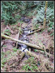
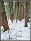
John followed thin tracks and we noticed orange dots on trees. We only checked the gps units in a couple places. The trail was not noticeable at all. Without tracks or good navigation skills this route is hard to follow when under a few feet of snow. I was glad when we reached the gate near the old Christmas tree. We were in forest but came close to a few meadows and we could see it was still snowing. We reached the Christmas tree site at 11:53 am. It was time for lunch. We next dropped to the Paw Print Connector Trail. Here, we were caught by a lone runner who turned right as we went left. She was the first person we had seen since Poo Poo Point. If we reached the junction 30 seconds earlier we would not have seen her. The trail quickly met the Bootleg Trail. We continued down on snow heading for the Preston Trail. There were several creek crossings which all went fine. Finally, the snow thinned enough for us to take off our microspikes.
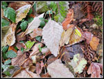
We reached the Preston Trail at 12:55 pm. Our downward traverse turned into a trail right down the fall line. By 1:12 pm we were at Dwight's Way Trail. Now we turned left and headed for the Lingering Trail. This route has ups and downs. Some of the wood bridges were quite slick. It had stopped snowing but there was fresh snow on the ferns and brush along the way. The snow level was quite low this day. I was glad to reach the Lingering Trail. We turned right and headed down. We met the High Point trail and soon we were down at High Point Creek where we left trail and walked the road the last bit up to my car. We finished the hike at 2:07 pm.
This was a great trip. we covered 11.4 miles with about 3200' of gain on a one way trip. The first 3.5 miles was almost snow free. The last 2 miles was snow free. The rest was thin to several feet deep snow. The snow squall on the summit was fun. Keeping warm hands while taking a lot of photos was challenging. We saw only 7 or 8 people all day and only one person the last 7.75 miles. Solitude on Tiger Mountain on a weekend. The 11 miles brought me up to 985 miles on the year. I am only 15 miles short of my second 1000 mile year in the 40 years I have been logging my hikes. With two weeks left in the year that should be easy to reach.
Click on thumbnails to get
larger pictures.
Trips - 2022
Home
We headed up to the Tradition Plateau and took the Wetlands Trail to the Adventure Trail. This trail ends with a 140' descent to the High School Trail. That's one way to get in extra elevation gain. We then took the Poo Poo Point Trail. It was 30 degrees when we started and stayed in that vicinity all day. The high of the day was at the finish where it was up to 35 degrees. We saw a couple groups of hikers and runners along here. We saw very few people all day. The old trail went up to the railroad grade then descended to Poo Poo Point. The new route just turns and heads for the point. As we ascended we entered the clouds. The mist continued for a long way. After turning onto the new trail we had spots out of the forest and there was hard packed snow here. A little slick but we did not stop to put on microspikes.
We arrived at Poo Poo Point at 9:12 am. There were two hikes down at the take off spot. Views were non-existent. We took a food and water break, figured out that the three legged thing is a seismograph, and debated how the anemometer atop the tower sent a signal to the Internet. It was quite chilly and we were ready to get moving at 9:21 am. We retraced our steps back down the trail. John suggested a detour on the old route. It would be shorter and with less elevation gain but I was interested in seeing how badly the old route was blocked. The start was easy enough. Instead of blocking both ends, they but logs down along much of the old route. It was interesting to check it out but it is not worth using in the future. The new trail is longer with more gain but a lot less hassle. We intersected the One View Trail at the four way (now three way) junction on the railroad grade.
Other than the one spot in the open, we had hiked this far with no snow. The junction is at 1900'. That is much higher than I expected to get without snow. The One View Trail had some snow in places but way mostly snow free or a very thin layer. We reached the TMT and turned right heading for the Hidden Forest Trail. This section did have snow though it was still not deep at all. When we reached the junction we stopped to put on microspikes. The climb up to the road starts out very steep. We ascended for maybe 70 vertical feet and the snow went away. We had bare trail. We kept on the spikes and kept climbing. When the trail leveled off there was some snow. We reached the road to find it completely snow covered. I noticed one spike had broken. I jury rigged it several years ago and the fix had lasted. Until today that is. I made a temporary fix that lasted until just before we took off the spikes. I fixed it again at home later.
The Poo Top Trail is steep and less used. This is where I thought deeper snow and fewer tracks might slow us way down. The snow was continuous but not as deep as I feared. There was a trench all the way up to Tiger 1. It was not a wide and smooth trench but it helped. We were slow on this climb but made steady progress. We also had a little breeze and it was very cold. My hands were getting very cold. We reached the start of the clear cut and the wind was now harder. Not too hard but it made it much colder. We turned right and headed up to the road just east of the summit. The path through the clearcut had some deep postholes. We found hard snow that mostly supported our weight.
The road was wind scoured and had little snow on it. Visibility was minimal. We could not even see the towers that were just a few hundred feet away. We turned left and headed up to the summit. Now it was time for a decision. We had made better time than expected. We could take a longer route over Tiger 1 to Tiger 2 and Tiger 3. Then we could loop back down to the Sunset Trailhead. We could go east and take the Preston Trail to the TMT and down to High Point. We could also Take the Bootleg Trail down to the old Christmas Tree the over to the lower Preston Trail and down to Dwight's Way and the Lingering Trail to High Point. The wind was steady and cold and chose to take the latter route to get out of the wind and still add a few miles.
As we started down the road it began to snow. A little at first but soon we had lots of big flakes coming down. Hiking in rain sucks. Hiking in falling snow with the temperature in the mid to upper 30s is fun. We stopped to take photos and a video. A wall of trees still standing there blocked the wind. It was cold but almost pleasant. We then headed on down to the lowest tower complex and headed north. There were several tracks heading down and we chose on heading the way we needed to go. There were some very deep postholes but again, the snow was firm enough to make it easier. We sank a little not not knee deep. We found the Bootleg Trail easy enough. With gps software on our phones it would not be too hard for us to navigate the buried trail.
John followed thin tracks and we noticed orange dots on trees. We only checked the gps units in a couple places. The trail was not noticeable at all. Without tracks or good navigation skills this route is hard to follow when under a few feet of snow. I was glad when we reached the gate near the old Christmas tree. We were in forest but came close to a few meadows and we could see it was still snowing. We reached the Christmas tree site at 11:53 am. It was time for lunch. We next dropped to the Paw Print Connector Trail. Here, we were caught by a lone runner who turned right as we went left. She was the first person we had seen since Poo Poo Point. If we reached the junction 30 seconds earlier we would not have seen her. The trail quickly met the Bootleg Trail. We continued down on snow heading for the Preston Trail. There were several creek crossings which all went fine. Finally, the snow thinned enough for us to take off our microspikes.
We reached the Preston Trail at 12:55 pm. Our downward traverse turned into a trail right down the fall line. By 1:12 pm we were at Dwight's Way Trail. Now we turned left and headed for the Lingering Trail. This route has ups and downs. Some of the wood bridges were quite slick. It had stopped snowing but there was fresh snow on the ferns and brush along the way. The snow level was quite low this day. I was glad to reach the Lingering Trail. We turned right and headed down. We met the High Point trail and soon we were down at High Point Creek where we left trail and walked the road the last bit up to my car. We finished the hike at 2:07 pm.
This was a great trip. we covered 11.4 miles with about 3200' of gain on a one way trip. The first 3.5 miles was almost snow free. The last 2 miles was snow free. The rest was thin to several feet deep snow. The snow squall on the summit was fun. Keeping warm hands while taking a lot of photos was challenging. We saw only 7 or 8 people all day and only one person the last 7.75 miles. Solitude on Tiger Mountain on a weekend. The 11 miles brought me up to 985 miles on the year. I am only 15 miles short of my second 1000 mile year in the 40 years I have been logging my hikes. With two weeks left in the year that should be easy to reach.
 Sunset At Sunrise |
 John On The Trail |
 Many Creek Valley |
 Leaves |
 Icy Near Poo Poo Pt |
 Near Poo Poo Pt |
 Two At Poo Poo Pt |
 No Views |
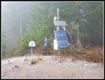 Seismograph |
 Back On Icy Trail |
 Old Trail |
 One View Trail |
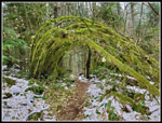 Green Mossy Arbor |
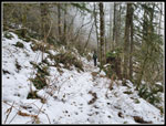 On The TMT |
 Crossing The Road |
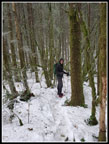 On The Poo Top Trail |
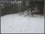
 White Snow & Sky |
 Tiger 1 Summit |
 John & Falling Snow |
 Big Snow Flakes |
 Leaving Summit Ridge |
 Near The Forest |
 Bootleg Trail? |
 Orange Dots |
 Old Christmas Tree |
 Aquatic Face? |
 Fresh Snow Today |
 Snowy Log |
 Snowy Everything |
 Suspended Log |
Trips - 2022
Home