12-31-22
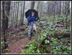
New Year's Eve means hiking on Tiger Mountain for me. This would be the 39th time I have done so in the past 40 years. It is among my oldest traditions. Gary and John were free to join me as they have on numerous other times. Recent heavy rains had turned a foot of more of snow at the Tiger summits to bare ground. It looked like we would probably have a bit of rain this day. The morning looked to be better than the afternoon so we planned an early start. We met at the Sunset Trailhead at 8:00 am. We were surprised to find the lot more than half full. Our plan was to make this a one way trip. We planned to finish at the Sunset Trailhead. I then drove us up to the High Point exit which is only a few minutes away at 70 mph. The uneven start and finish would give us more descent than ascent. We got started on the High Point Trail at 8:04 am.
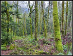
We did not have much company. We made it most of the way up Tiger 2 without seeing anyone. In fact, we saw only one person before Tom's Crossing below Tiger 2. After leaving the railroad grade on the newest section of the Tiger Mountain Trail we saw a log across the trail. We then sawed the log across the trail. I brought my smaller folding saw. I cut part of it and John did the rest. With a few more cut branches we were able to get it off the trail. We hike this trail after dark on our headlamp hikes and clearing a blockage helps.
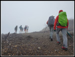
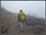
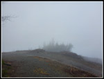
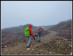
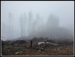
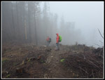
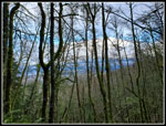
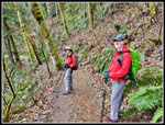
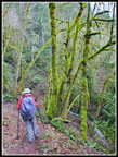
The wind was forecast to be out of the southwest. We were coming up the north east side of Tiger 2. We could hear the wind but not feel it while in the forest. We stopped to put on jackets before leaving the forest. The summit was just above us. I set my pack in the middle of the trail and then a group of runners caught up. I put my pack on and steeped off for them to go by. Only the second group we had seen. A few minutes alter I set my pack in the trail and opened it to get out my jacket. Another group of runners came along. I picked up my pack and stepped aside. What are the odds of it happing twice after only seeing one person in 3.5 miles? We headed out into light wind and continued up. The views were zero. Clouds all around us and we could see no farther than the summit tower. No Mt. Rainier, No Cascade peaks, not even nearby Tigers 1 and 3.
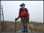
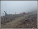
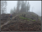
The route goes up to a road and follows it around to the south. As we came into the southwest wind it was very strong. We headed up to the tower and turned around immediately. Just down form the top there is a sheltered spot. We noticed it after the summit was clearcut last year. The wind was not bad there. We did not stay and headed over to Tiger 3. A short way along I looked back and the tower was already lost in the clouds. It was still windy most of the way over. When we reached the top of Tiger 3 the wind was even stronger. I stopped for a few photos of the "view" and hurried to catch of with Gary and John.
We planned on a stop below Tiger 3 for our lunch break. The trail is narrow and finding a spot it not easy. At one place the old trail cut below the current one and we dropped there for our break. It was now 10:31 am. We had an open view to the east and southeast but could see nothing. Even close by Tiger 2 never left the clouds. Several groups went by while we took out break. At 10:43 am we were back on the move. So far we had hiked about 4.6 miles Before we reached the railroad grade, John noticed a woodpecker just off the trail ahead. It is usually a scramble to get a photo when they are this close. They usually fly away quickly. This guy just seemed to want to pose for us. With only phone cameras we did not have much zoom capability. We took some shots with the bird very small. It was not a large pileated woodpecker. It looked like a downy woodpecker without any red on its head. We moved closer and it did not fly away. We moved even closer. Now we were able to get some good photos.
We crossed the railroad grade and neared the 5 mile point on this hike. I needed 5 miles to reach the 1000 mile mark for only the second time in the 40 years I have been logging my mileage. The first time was in even 30 year ago. I did not think I would reach this level again. By coincidence the 5 mile point was right at Jim's Rock. Jim's Rock is not a rock. It is a tree stump in the middle of the trail that is sloping, smooth, and as slick as grease. That is less accurate than the word I choose snot to use. Some years back, on a sub-freezing headlamp hike I took out my headlamp and kept moving while putting it on. I never saw that stump until I stepped on it and my feet flew out and I landed right on it. I was in pain for a week and had a big purple bruise. My hiking partners now call it Jim's Rock. I had a few photos taken to commemorate 1000 miles and we continued down.
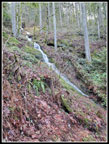
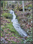
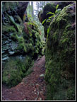
There was only one tiny spot of snow on our entire trip. The descent was easy enough. Gary had planned our route and we turned off on the Talus Rocks Trail. This gave us more uphill, a waterfall, and the Talus Rocks. It was the last hike of the year and padding my elevation gain was a good thing. The waterfall is a long narrow series of small falls. It is dry most of the year. After the recent rain it had a good amount of water. We stopped for photos. Just after that is the narrow mossy gap in the rocks. This is a really neat spot on the trail. We first planned on going down the Nook Trail but we had a group behind and passed several more groups coming up so we chose the less used Section Line Trail. This worked well as we saw nobody while descending that trail. Going this route it made sense to pick up the High School Trail and then the Adventure Trail. This adds another 160' climb. Our original 2500' gaining plan was now going to have more elevation gain.
The Adventure Trail climbs steeply then descends more gently. We had one more decision to make. At the four way junction with the Wetlands Trail we could turn left and drop to the Sunset Trailhead in half a mile. We chose to add mileage by turning right on the Wetlands Trail. On our descent the dark clouds gave way to some sun breaks. Not all blue sky but a little sun was appreciated. The afternoon rain seemed far away. We took the Wetland Connector over to the main gravel road. We then took the Powerline Trail to the Brink Trail. I did the Brink for the first time a month earlier. It was time for Gary and John to hike a new trail on Tiger. Towards the end of the Brink Trail there were a few trees down. We cut out one small one but not the bigger ones. As we neared the road again it began to rain. As it rained harder I pulled out my umbrella. We crossed the road and quickly reached the same four way junction we had been at earlier. Now we turned right on the Wetlands Trail for the last half mile to the car. The rain did not last long. we reached the car at 2:09 pm. We just had the short drive back to my car at High Point.
Hiking Tiger Mountain on New Year's Eve is a very old tradition and one I look forward to. This year it marked the end of one of the best hiking years I have had. The 1006 miles is the second highest ever. 244,000' of elevation gain is the fourth highest. 107 days on the trail is a new high by 1 day. I started the year 39 trip reports short of 1000. I worked hard to get there and kept up the pace writing reports. For the year I added 60 trip reports. That was a new record, beating the 58 done in 2018. My only regret was not getting out for a single backpacking trip. That will change in 2023. All in all, it was a fantastic year on the trail.
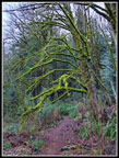 Green Mossy Tree |
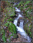 Small Cascade |
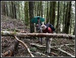 Before Cutting |
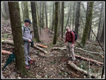 After |
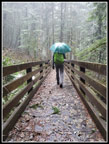 Umbrellas On The Bridge |
 Gary At The Wiggle |
 Viewpoint? |
 Near Tiger 2 Summit |
 Walking In Clouds |
 Windy Gary |
 View To Tiger 3 |
 Heading To Tiger 3 |
 Misty Trees |
 John Is Coming |
 Old Trail |
 Tiger 3 Summit |
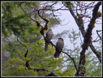 Two Camp Robber Jays |
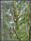 Woodpecker |
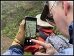 Photo of Photo |
 1000 Miles At Jim's Rock |
 Sun Breaks |
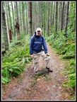
 Big Smiles |
 Waterfall |
 Below Falls |
 Narrow Gap |
 Section Line Trail |
 Bridge Ahead |
 Great Mossy Colors |
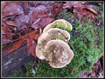 Mushrooms |
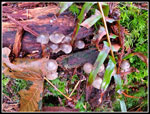 More Mushrooms |
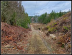 Powerline Trail |
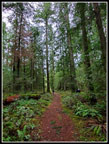 Brink Trail |
Trips - 2022
Home