11-12-22
This
would be a dry November
weekend. I needed to get in a long hike. After going over several
possibilities, I settled on a loop trip to Wallace Lake. I did a
similar trip in the spring and added a side trip to get it up to 16
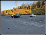
miles. I was on the road at 6:55 am. I arrived at the Wallace Falls
State Park lot at 7:54. The lot was only about one quarter full. I was
packed and on my way at 8:00 am. It was very chilly. I started out with
a knit cap and gloves. It was in the high 30s. I stopped at the
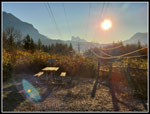
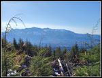
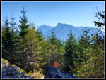
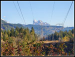
viewpoint of Mt. Baring and Index plus Persis Mountains. It is under
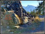
the power lines. The sun was low and right in front of me. Photos were
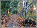
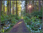
not great. The route immediately heads off the power corridor and into
the forest. I was out for mileage so I took the old railroad grade
instead of the shorter Woody Trail along the Wallace River.
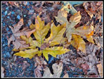
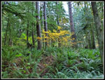
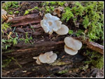
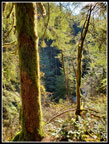
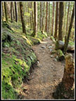
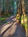
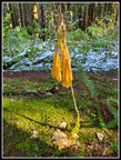
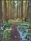
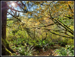
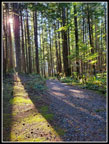
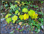
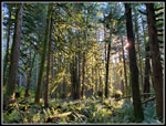
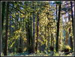
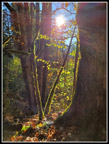
There were a lot of deciduous trees along the grade. Many leaves were on the trail. More were still on the trees. Mid November is late for leaves to be on the trees and in some cases still green. I passed a few hikers coming down. At 1.5 miles I passed the trail up to the DNR logging road. This would be the end of my loop trip to Wallace Lake. At 2.37 miles, per my gps, I reached the start of the Greg Ball Trail (GBT). I would take the nice trail on the way up and the longer road on the way back. This would also have me out in the sunshine in the afternoon. The GBT was very quiet. I did not see a single person on it. I saw one mushroom display. This fall has been disappointing in that regard. The forest is pretty dark but I did see some low sunshine reaching in. There were a few very small bit of snow still on the ground near the top. None was on the trail. I reached the DNR road at 9:35 am. That was 1:35 to cover 4.3 miles. That was a good pace. It is now dark at 5:00 pm. The park closes at that time. I hoped to get home before dark.
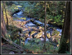
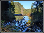
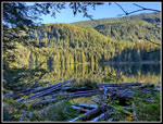
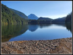
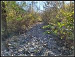
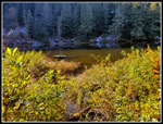
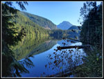
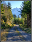
I took a right on the DNR road and soon turned left for the last leg to Wallace Lake. As always, I will complain about the big loose and sharp rocks on this old road. Fine for a truck but hard on feet. This was far worse than any part of the DNR logging road I walked this day. I arrived at Wallace Lake at 9:50 am. I was at 5.0 miles and much of the elevation gain done. I was curious if the recent rain and snow had caused the creek east of the outlet to grow considerably. When it is high it is tough to reach the lake from the Upper Wallace Falls. Recent work has raised the trail above the water level. A detour over there would add a small amount of extra mileage. I headed that way. At the trouble spot the creek was not high at all. A small bridge now crosses the last and widest part of the creek. No problem crossing at all.
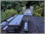
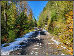
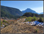
I decided to continue on to the main road to the falls to add just a little more mileage. I reached the road and considered that I had never hiked up the new logging spur to the left. Did it climb to any views down to Wallace Lake? I had no idea. I decided to head up it a short way. This would also add a little elevation gain to a below average gaining trip. The road is fairly steep. I gained elevation quickly. When it seemed that I would not have any views, I turned around. This detour added 1.5 miles from the lake and back and 280' of gain. Back at the lake outlet, the picnic table and bridge had snow on them. The ground was bare. I brought my high top winter hiking bots, gaiters, and microspikes. I did not need the latter two. The heavier boots were probably not needed but did keep my feet dry and warm. I also changed over to my winter backpack this week. It is much larger and heavier than my summer pack.
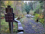
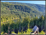
I headed around the lake. Part way I decided to check out the logged area first. Later in the day there would probably be more glare. I headed out into the sunny clearcut. It felt much warmer. The views were not bad but haze and glare affected the views. This side trip added 1 mile and another 200' of gain. Now I was set for at least 2000' of gain. I continued around to the outlet. It was very cold in the forest along the lake. The inlet was dry. I headed out to Pebble Beach. There was nobody there and it was in the sunshine. It felt much warmer. I arrived at 11:15 am. In 3:15 I had hiked 8.2 miles. I was almost half way through this trip. I would like to have spent longer at the lake but I still had a lot of hiking to do. I took photos, ate, and drank water and after 9 minutes I was back on my way. A couple arrived just before I left. It is 1 mile on to Jay Lake. After a short ascent, the way is very flat. I made good time in this dark and cold forest.
Jay Lake is hard to see. Only part of it is visible from the shore. The trail is fun but the lake is only a good destination for those camping there. I tried to get a shot of the lake but the water level was high enough and the brush still with leaves to keep me with few views. I turned around quickly and headed back. I did see two other groups on their way to Jay Lake. Back at Wallace Lake, I stopped at the outlet once again. This break was also shorter than I would have liked. I still had 7 miles to hike out.
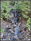
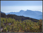
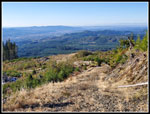
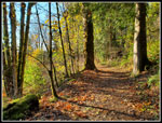
I had no more side trips. I hiked back around the lake and then on to the DNR road. At the top of the GBT, the sign shows it is 5.9 miles back to the trailhead. The road is much less traveled than the GBT. This day I only saw a single group of hikers and no bikers on the road. I had the elusive solitude and a very heavily visited state park. Much of the road walk was out in the sunshine. There was some wind and part way down I stopped to put on my windshirt. That helped a lot. The few small waterfalls were running. I even saw some good fall leaf colors. In a few spots there are views of Index and Persis peaks. I left the road for trail at 2:01 pm. I had now traveled 14.7 miles. I just had 2.5 miles to go. I closed the loop back at the railroad grade with 1.5 miles to go. My feet were getting a little sore but otherwise I felt good. I reached the parking lot at 2:52 pm. I came in just 8 minutes short of 7 hours on the trail. For 17 miles that is not too bad. For the day I hiked about 17.2 miles with 2100' of elevation gain.
The drive home was surprisingly easy. Much better than my last few weekend trips on Highway 2. I accomplished all my goals for the day. I am in much better shape to reach my overall goal for the year. With 7 weeks left I am on pace for my second most miles in a year. My route allowed me to hike in a very busy park and see only a fraction of the people. I saw two lakes from the shore and had a look down on Wallace Lake. I even hiked a new section in an often visited area. It was cold but clear and I seven had sunshine. Not bad for a day in November.
Click on thumbnails to get
larger pictures.
Trips - 2022
Home
There were a lot of deciduous trees along the grade. Many leaves were on the trail. More were still on the trees. Mid November is late for leaves to be on the trees and in some cases still green. I passed a few hikers coming down. At 1.5 miles I passed the trail up to the DNR logging road. This would be the end of my loop trip to Wallace Lake. At 2.37 miles, per my gps, I reached the start of the Greg Ball Trail (GBT). I would take the nice trail on the way up and the longer road on the way back. This would also have me out in the sunshine in the afternoon. The GBT was very quiet. I did not see a single person on it. I saw one mushroom display. This fall has been disappointing in that regard. The forest is pretty dark but I did see some low sunshine reaching in. There were a few very small bit of snow still on the ground near the top. None was on the trail. I reached the DNR road at 9:35 am. That was 1:35 to cover 4.3 miles. That was a good pace. It is now dark at 5:00 pm. The park closes at that time. I hoped to get home before dark.
I took a right on the DNR road and soon turned left for the last leg to Wallace Lake. As always, I will complain about the big loose and sharp rocks on this old road. Fine for a truck but hard on feet. This was far worse than any part of the DNR logging road I walked this day. I arrived at Wallace Lake at 9:50 am. I was at 5.0 miles and much of the elevation gain done. I was curious if the recent rain and snow had caused the creek east of the outlet to grow considerably. When it is high it is tough to reach the lake from the Upper Wallace Falls. Recent work has raised the trail above the water level. A detour over there would add a small amount of extra mileage. I headed that way. At the trouble spot the creek was not high at all. A small bridge now crosses the last and widest part of the creek. No problem crossing at all.
I decided to continue on to the main road to the falls to add just a little more mileage. I reached the road and considered that I had never hiked up the new logging spur to the left. Did it climb to any views down to Wallace Lake? I had no idea. I decided to head up it a short way. This would also add a little elevation gain to a below average gaining trip. The road is fairly steep. I gained elevation quickly. When it seemed that I would not have any views, I turned around. This detour added 1.5 miles from the lake and back and 280' of gain. Back at the lake outlet, the picnic table and bridge had snow on them. The ground was bare. I brought my high top winter hiking bots, gaiters, and microspikes. I did not need the latter two. The heavier boots were probably not needed but did keep my feet dry and warm. I also changed over to my winter backpack this week. It is much larger and heavier than my summer pack.
I headed around the lake. Part way I decided to check out the logged area first. Later in the day there would probably be more glare. I headed out into the sunny clearcut. It felt much warmer. The views were not bad but haze and glare affected the views. This side trip added 1 mile and another 200' of gain. Now I was set for at least 2000' of gain. I continued around to the outlet. It was very cold in the forest along the lake. The inlet was dry. I headed out to Pebble Beach. There was nobody there and it was in the sunshine. It felt much warmer. I arrived at 11:15 am. In 3:15 I had hiked 8.2 miles. I was almost half way through this trip. I would like to have spent longer at the lake but I still had a lot of hiking to do. I took photos, ate, and drank water and after 9 minutes I was back on my way. A couple arrived just before I left. It is 1 mile on to Jay Lake. After a short ascent, the way is very flat. I made good time in this dark and cold forest.
Jay Lake is hard to see. Only part of it is visible from the shore. The trail is fun but the lake is only a good destination for those camping there. I tried to get a shot of the lake but the water level was high enough and the brush still with leaves to keep me with few views. I turned around quickly and headed back. I did see two other groups on their way to Jay Lake. Back at Wallace Lake, I stopped at the outlet once again. This break was also shorter than I would have liked. I still had 7 miles to hike out.
I had no more side trips. I hiked back around the lake and then on to the DNR road. At the top of the GBT, the sign shows it is 5.9 miles back to the trailhead. The road is much less traveled than the GBT. This day I only saw a single group of hikers and no bikers on the road. I had the elusive solitude and a very heavily visited state park. Much of the road walk was out in the sunshine. There was some wind and part way down I stopped to put on my windshirt. That helped a lot. The few small waterfalls were running. I even saw some good fall leaf colors. In a few spots there are views of Index and Persis peaks. I left the road for trail at 2:01 pm. I had now traveled 14.7 miles. I just had 2.5 miles to go. I closed the loop back at the railroad grade with 1.5 miles to go. My feet were getting a little sore but otherwise I felt good. I reached the parking lot at 2:52 pm. I came in just 8 minutes short of 7 hours on the trail. For 17 miles that is not too bad. For the day I hiked about 17.2 miles with 2100' of elevation gain.
The drive home was surprisingly easy. Much better than my last few weekend trips on Highway 2. I accomplished all my goals for the day. I am in much better shape to reach my overall goal for the year. With 7 weeks left I am on pace for my second most miles in a year. My route allowed me to hike in a very busy park and see only a fraction of the people. I saw two lakes from the shore and had a look down on Wallace Lake. I even hiked a new section in an often visited area. It was cold but clear and I seven had sunshine. Not bad for a day in November.
 Nearly Empty Lot |
 Shooting Into The Sun |
 Lots Of Leaves |
 Big Leaves |
 Leaves & Ferns |
 Mushrooms |
 Greg Ball Trailhead |
 Glowing Moss |
 Moss Along Trail |
 NF Wallace River |
 Spotlight |
 Map |
 Gravel Trail |
 Snow At Lake |
 Lake From Inlet |
 Creek Crossing |
 Sun Through Trees |
 Small Falls |
 Snow On Road |
 Wallace Lake |
 Wallace Lake Below |
 Sunshine In Clearcut |
 Index & Persis |
 View Southwest |
 View South |
 Pebble Beach |
 Inlet Creek |
 Snow On Jay Lake Trail |
 Jay Lake |
 Devil's Club |
 Straight Trail |
 Leaves On Trees |
 View Of Wallace Lake |
 Triangle Sunlight |
 Shades Off Colors |
 Me And My Shadow |
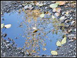 Mud Puddle Art |
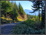 DNR Road |
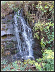 Another Falls |
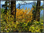 More Colors |
 Quarry & Peaks |
 Index & Persis Again |
 Index From Road |
 Mossy Trees |
 Colorful Trees |
 One Mile To Go |
 Lit Up Colors |
 Better Look At Baring |
Trips - 2022
Home