02-19-24
It
was the Presidents Day holiday and I needed to go for a hike. Nobody
else was available. I did a long drive on Saturday and opted for a
close in hike for Monday. The forecast was awful at the NWS but other
sites had it mostly dry with moderate winds. I decided on a trip I last
hiked 2 years ago. It is a loop going up East Tiger Mountain and down
via the Off The Grid and NW Timber Trail. It's a little over 10 miles
with about 1900' of gain. I wanted to get an early start to get out
ahead of the mountain bikers. The second half of my route gets a lot
less bike traffic than the route up East Tiger. Also, if the weather
did turn bad in the afternoon I would be well on my way downhill. I was
on the road at 6:58. Traffic was fairly light as I headed east. The
construction zone on Highway 18 did not slow me down much as no work
was going on. I reached the inner parking lot at Tiger Summit at 7:38
am. The lot had only a dozen cars or less. I was packed and on the move
at 7:42 am. It was overcast but in the low 40s.
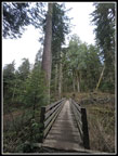
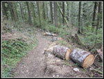
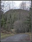
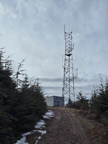
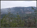
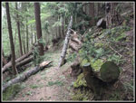
I zipped along the Connector Trail and crossed the road onto the NW Timber Trail. At the first junction I headed uphill on the Master Link Trail. I usually don't see many bikes on this trail until after about 8:30 am. A short way up this trail I was passed by two guys on bikes. I would not see anyone else until the summit of East Tiger. There were a lot of logs freshly cut that fell across the trail. I only saw one that was still on the trail. I set a good pace. I was at 3.2 mph when the bikers passed me and still at 3.0 mph at the top of the Master Link. Heat slows me down but at 40F it was much easier. That is not to say I am unhappy when war spring days return.Unfortunately, my GPS is at odds with the maps. I recorded 4.65 miles to the summit and maps show 4.10. That is a much larger difference than usual. I guess my speed was below 3 mph. I crossed the road at the top of the ML and continued on the Quick Link. It was about time that faster bikers usually show up. Not this day. I was soon back on the road. It climbs a little and drops to the junction with the East Tiger Summit spur road. I had gained about 1250' so far with 350' to go in the last .70 miles. The summit spur is steep in places and I kept up a very good pace. I reached the summit at 9:16 am. If it was 4.1 miles up in 1:34 then I averaged a little over 2.6 mph. There was a lone bikers on the summit. Two runners came up and immediately left. I saw two bikers coming up and three people on top. That is not bad for a very popular biking destination.
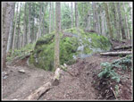
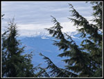
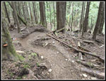
Mt. Rainier was mostly in the clouds. I could only see the bottom of it. While it was cloudy all around, it was sunny on the summit. There was a bit of a breeze but it was not that cold. I ended up staying on top until 9:40 am. That was my only break of more than five minutes all day. My plan was to drop to the East Tiger Trail crossing and then head back to the summit. That would get me up to 2000' of gain on the day and push me to near 11 miles. I did just that. There was a group of bikers at the junction when I reached it once again. Two headed out and the rest looked close to going. I headed onto the East Tiger Trail and a minute later the bikers started passing me. I think there were about 8 altogether. They went on down the East Tiger Trail and I quickly turned off on the Off The Grid Trail (OTG). This trail looks like a lot of fun if you like lots of jumps. I don't think I could bike it without serious injury. It is very narrow in spots crossing steep slopes. I hoped to not see many bikers.
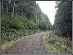
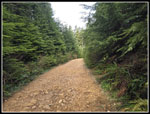
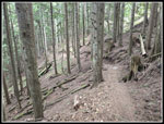
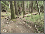
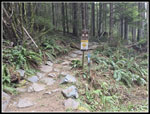
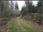
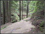
The trail was built with sharp turns for fun. It is not your average hiking trail. I got a little tired at times jumping down where bikes would be flying. It is well graded and I made good time. I was several miles along when the first and only biker passed me. The terrain was flatter and I moved off the trail easily. I reached the road crossing at 10:47 am. I was now about 7 miles along with 4 miles still to go. I crossed the road and started down the Fully Rigid Trail. This trail continued the descent. The Silent Swamp Trail came in and the trail name changes to the Joy Ride. Being a bike trail, it has some long switchbacks where a hikers trail would have several much shorter switchbacks. It adds some distance but makes the route less steep. The rest of the way back has a lot of medium long trails. Trails with handrails and 25' to 45' long. I did not have any rock hops on the entire route. I came to another junction. Until a few years ago, I had always stayed on the main bike trail. The short side trail leads to a very grassy road where vehicles can drive in with equipment and people to perform trail maintenance. I have taken to hiking this .50 mile section is easy on the feet and avoids having to pass bikes on the narrow trail. I stopped along here for my second and lat food break.
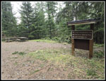
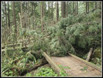
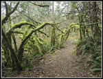
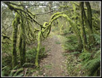
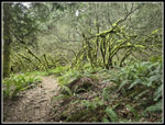
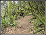
I met up with the Joy Ride Trail again followed it down to the NW Timber Trail. This would take me right back to my car. It starts with a gentle uphill grade then has some small ups and downs. It hikes pretty fast. Along the way are some great mossy arbors that reach above the trail. Some of the best ones were knocked down as trees fell across it in a big wind storm half a dozen years ago. The ones left are pretty neat. I met a lone hiker coming toward me. He mentioned that there is a big blowdown ahead. He managed to get around it but it was not easy. I figured if he could so could I. It was after I would reach the Bypass Trail. The trail is for bikes only but if the blowdown as really bad it would be an option this day.
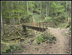
I reached the Bypass Trail and a few minutes later I reached th blowdown. I would guess there are half a dozen small and medium sized trees down. It is right at the end of a small bridge. The bridge looks to be okay. With all the branches and all the trees it would be a nightmare to go through it. Going downstream is not a good option either I went upstream and went up and over each blowdown. It took a few minutes but I made it around just fine. This is a popular trail and I expect the bikers will get to work clearing ti soon. After that it was smooth sailing the rest of the way back. I passed another hiker coming in and just after the Master Link junction, I passed a big group of about 9 bikers. That about doubled the number of people seen this day.
I arrived back at the trailhead at 12:15 pm. It was still pretty early. I had hiked 11 miles with 2000' of gain by lunchtime. The lot was not almost full. The road had one car parked along it. I often see 20 or more turning the two lane wide road into a one lane wide road. Not today. I had a little drizzle the last mile though I did not see much of it in the forest. The drive home was easy. Enough people had the holiday off that I cruised right through downtown Seattle. For the three day weekend I had two hikes for 22 miles with 4200' of gain. Good mileage but a little below average on the gain. It is still February to two dry hikes was a real plus.
Click on thumbnails to get
larger pictures.
Photo Page 2
Trips - 2024
Home
I zipped along the Connector Trail and crossed the road onto the NW Timber Trail. At the first junction I headed uphill on the Master Link Trail. I usually don't see many bikes on this trail until after about 8:30 am. A short way up this trail I was passed by two guys on bikes. I would not see anyone else until the summit of East Tiger. There were a lot of logs freshly cut that fell across the trail. I only saw one that was still on the trail. I set a good pace. I was at 3.2 mph when the bikers passed me and still at 3.0 mph at the top of the Master Link. Heat slows me down but at 40F it was much easier. That is not to say I am unhappy when war spring days return.Unfortunately, my GPS is at odds with the maps. I recorded 4.65 miles to the summit and maps show 4.10. That is a much larger difference than usual. I guess my speed was below 3 mph. I crossed the road at the top of the ML and continued on the Quick Link. It was about time that faster bikers usually show up. Not this day. I was soon back on the road. It climbs a little and drops to the junction with the East Tiger Summit spur road. I had gained about 1250' so far with 350' to go in the last .70 miles. The summit spur is steep in places and I kept up a very good pace. I reached the summit at 9:16 am. If it was 4.1 miles up in 1:34 then I averaged a little over 2.6 mph. There was a lone bikers on the summit. Two runners came up and immediately left. I saw two bikers coming up and three people on top. That is not bad for a very popular biking destination.
Mt. Rainier was mostly in the clouds. I could only see the bottom of it. While it was cloudy all around, it was sunny on the summit. There was a bit of a breeze but it was not that cold. I ended up staying on top until 9:40 am. That was my only break of more than five minutes all day. My plan was to drop to the East Tiger Trail crossing and then head back to the summit. That would get me up to 2000' of gain on the day and push me to near 11 miles. I did just that. There was a group of bikers at the junction when I reached it once again. Two headed out and the rest looked close to going. I headed onto the East Tiger Trail and a minute later the bikers started passing me. I think there were about 8 altogether. They went on down the East Tiger Trail and I quickly turned off on the Off The Grid Trail (OTG). This trail looks like a lot of fun if you like lots of jumps. I don't think I could bike it without serious injury. It is very narrow in spots crossing steep slopes. I hoped to not see many bikers.
The trail was built with sharp turns for fun. It is not your average hiking trail. I got a little tired at times jumping down where bikes would be flying. It is well graded and I made good time. I was several miles along when the first and only biker passed me. The terrain was flatter and I moved off the trail easily. I reached the road crossing at 10:47 am. I was now about 7 miles along with 4 miles still to go. I crossed the road and started down the Fully Rigid Trail. This trail continued the descent. The Silent Swamp Trail came in and the trail name changes to the Joy Ride. Being a bike trail, it has some long switchbacks where a hikers trail would have several much shorter switchbacks. It adds some distance but makes the route less steep. The rest of the way back has a lot of medium long trails. Trails with handrails and 25' to 45' long. I did not have any rock hops on the entire route. I came to another junction. Until a few years ago, I had always stayed on the main bike trail. The short side trail leads to a very grassy road where vehicles can drive in with equipment and people to perform trail maintenance. I have taken to hiking this .50 mile section is easy on the feet and avoids having to pass bikes on the narrow trail. I stopped along here for my second and lat food break.
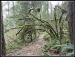
I met up with the Joy Ride Trail again followed it down to the NW Timber Trail. This would take me right back to my car. It starts with a gentle uphill grade then has some small ups and downs. It hikes pretty fast. Along the way are some great mossy arbors that reach above the trail. Some of the best ones were knocked down as trees fell across it in a big wind storm half a dozen years ago. The ones left are pretty neat. I met a lone hiker coming toward me. He mentioned that there is a big blowdown ahead. He managed to get around it but it was not easy. I figured if he could so could I. It was after I would reach the Bypass Trail. The trail is for bikes only but if the blowdown as really bad it would be an option this day.
I reached the Bypass Trail and a few minutes later I reached th blowdown. I would guess there are half a dozen small and medium sized trees down. It is right at the end of a small bridge. The bridge looks to be okay. With all the branches and all the trees it would be a nightmare to go through it. Going downstream is not a good option either I went upstream and went up and over each blowdown. It took a few minutes but I made it around just fine. This is a popular trail and I expect the bikers will get to work clearing ti soon. After that it was smooth sailing the rest of the way back. I passed another hiker coming in and just after the Master Link junction, I passed a big group of about 9 bikers. That about doubled the number of people seen this day.
I arrived back at the trailhead at 12:15 pm. It was still pretty early. I had hiked 11 miles with 2000' of gain by lunchtime. The lot was not almost full. The road had one car parked along it. I often see 20 or more turning the two lane wide road into a one lane wide road. Not today. I had a little drizzle the last mile though I did not see much of it in the forest. The drive home was easy. Enough people had the holiday off that I cruised right through downtown Seattle. For the three day weekend I had two hikes for 22 miles with 4200' of gain. Good mileage but a little below average on the gain. It is still February to two dry hikes was a real plus.
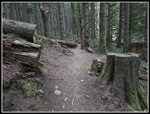 Old Cut Logs |
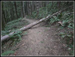 New Log Across Trail |
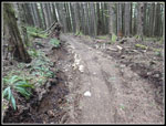 Recent Repair |
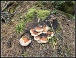 Colorful Fungi |
 Big Tree & Bridge |
 Recently Cut Logs |
 Big Mossy Erratic |
 On The Road Again |
 East Tiger In Sight |
 Clay Colored Road |
 Almost At East Summit |
 Mt. Rainier In Clouds |
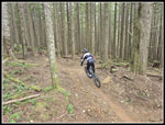 Biker Zooms By |
 Off The Grid Trail |
 Bike Jumps |
 Trail Visible Ahead |
 Slalom Turns |
 Grade Eases |
 Rock Trail Finish |
 Start Of Next Trail |
 Big Bridges Beginning |
 First Mossy Arch |
 Maintenance Road |
 On The NW Timber Trail |
 West Rattlesnake Mt. |
 Log Not Blocking Way |
 Another Bridge |
 Big Blowdown |
 More Mossy Arbors |
 Colorful Arbor |
 Mossy Non Arbor |
 The Last Arbor |
Photo Page 2
Trips - 2024
Home