01-07-24
I
wanted to get in a hike and be home for the 1:25 pm Seahawks
game. I also wanted a trip I had not done recently. A loop over East
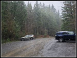
Tiger fit the bill. It was raining in Seattle when I headed out at 7:44
am. I stopped in Issaquah for much cheaper gas then on to Highway 18
and Tiger Summit. It was right about 32 degrees at the start. Including
the inner and outer lot there were about a dozen cars. That is not many
for this popular mountain biking area. It had rained/snowed overnight
and I did not know how much snow fell or at what elevation. Clouds
covered West Tiger Mountain. On Highway 18 I could see snow on trees
higher up. I wanted to see snow but not to have it deep enough to slow
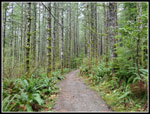
me down. I started hiking at 8:40 am. I took the Connector Trail to the
road and the NW Timber trail to the start of the Master Link. Heading
up the ML I expected to see a few bikers pass me. I kept waiting. The
grade is moderate and I kept up a good pace. It was cool enough I
needed to keep up a good pace.
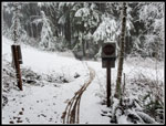
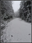
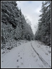
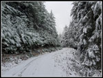
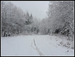
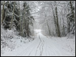
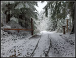
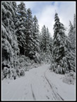
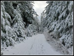
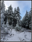
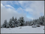
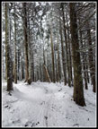
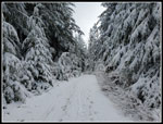
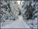
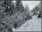
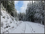
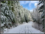
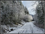
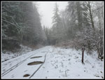
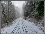
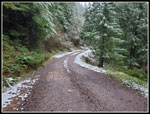
I was half way up the trail when I saw the first snow. By the time I reached the Inside Passage Trail there was snow on th trail. I heard voices below me and kept waiting for bikers to pass me. They never did. The big bridge showed fresh bike tracks and two hikers footprints. I passed Jim's Erratic and kept moving. I reached the road crossing the there were several inches of fresh snow on the road. I crossed onto the Quick Link where the snow was thinner. That went by fast and I was back on the road. I did see two runners coming down the QL. The first people seen all morning. Now there was a little more snow on the road. All the evergreen trees along the road were heavily flocked. It was really pretty. I took photos all along the road. Where the road descends, the trees turned to deciduous. All the branches were also heavily flocked. I was in a cloud. Visibility was okay but I knew there would be no summit views. At the low point I turned onto the East Tiger Summit Spur Road. I just had .70 miles to go. I saw a few more footprints. A few people had come up the main road from Tiger Summit. The road has trees above and it first there was less snow. Higher up, the road is more open and had more snow. I wore high top boots and did not need to put on gaiters.
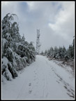
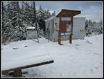
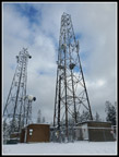
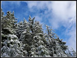
I kept waiting to see someone and nobody appeared. The last steep part of the route, above the Summit Trail intersection, was the slickest. The rocks were icy with zero to a few inches of snow on top. I was very careful and made it up without falling. At the top I found... nobody. I was passed by two runners coming down over four plus miles. The picnic tables had 4-5 inches of snow on top. Views out were non-existent. I did see a few small blue sucker holes overhead. That was better than anywhere else on the hike up. I wanted to get in 10 miles and 2000' of gain. The easiest way to do so was to drop down the spur road and come back up again. That adds 1.4 miles with 360' of gain. I had a short food and water break and headed down. The upper slick spots were no fun. At least I did not fall. At the bottom I turned around and headed back up. I was a little slower now but I arrived back at the summit at 11:05 am. There was a bit more blue sky now. Not a lot but it was looking better. Three minutes on top and I was heading down. Rather than another trip down the icy road top, I took the Tiger Summit Trail. It was in forest and had less snow. It did have a couple bike jumps but had much better traction. This route is .20 mile longer as well.
I reached the road at the bottom of the steep icy spot. There were a couple bikers resting there. They were the first bikers I had seen. The road was easy walking to the bottom of the spur road. It the lower viewpoint I saw two bikers at the picnic table. At the bottom I turned right on the main road. Hiking down I saw a lone hiker coming up. As he passed by we both stopped. I recognized Tim Nair. He recognized me. Tim hikes to summits and verifies contacts on his mobile ham radio setup. I see his postings at NWHikers Facebook page. We managed not to see each other as we hiked many of the same summits on different days. Sometimes just a weekend apart. 51 weeks earlier we finally met atop East Tiger Mountain. That day was 40 degrees, sunny, and almost snow free. Quite a coincidence to meet again on the same peak nearly one year later. I wished him well and continued down.
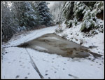
At the next junction the road turns left and drops to Tiger Summit in about 2.7 miles. I needed a little more distance to get up to 10 miles. I went straight about .20 miles and turned around. The extra .40 miles would get me up to 10 miles. The road is less steep the last 2.7 miles. I made good time. The road was still snow covered and much softer to walk than the rocky road. The snow stayed on the road until about 1.5 miles to go. At that point the trees were dripping melting snow. One adult and youngster biked by me on the last section in the snow. This route is fairly busy even in the winter. I was surprised to see so few people. I soon reached the Connector Trail and turned right for the last .40 miles to the parking lot. I found the lot to be more than half full. It began to snow as I entered the lot. At my car it was now snowing pretty hard. I took a video. It is the hardest snow I have seen since last winter. It was not sticking and was no problem for driving.
I reached the lot at 12:44 pm. I spent 4:04 to hike 10 miles with 2000' of elevation gain. As I drove through the outer lot near Highway 18, I noted just how big the puddles/lakes were. One was a circle about 20' in diameter. There was far more water than dry land. I managed to get a left turn saving some time vs. going around Tiger to Issaquah on the south side. Traffic was light and I was home by 1:35 pm. The Seahawks won but so did Green Bay so we missed the playoffs.
Click on thumbnails to get
larger pictures.
Trips - 2024
Home
I was half way up the trail when I saw the first snow. By the time I reached the Inside Passage Trail there was snow on th trail. I heard voices below me and kept waiting for bikers to pass me. They never did. The big bridge showed fresh bike tracks and two hikers footprints. I passed Jim's Erratic and kept moving. I reached the road crossing the there were several inches of fresh snow on the road. I crossed onto the Quick Link where the snow was thinner. That went by fast and I was back on the road. I did see two runners coming down the QL. The first people seen all morning. Now there was a little more snow on the road. All the evergreen trees along the road were heavily flocked. It was really pretty. I took photos all along the road. Where the road descends, the trees turned to deciduous. All the branches were also heavily flocked. I was in a cloud. Visibility was okay but I knew there would be no summit views. At the low point I turned onto the East Tiger Summit Spur Road. I just had .70 miles to go. I saw a few more footprints. A few people had come up the main road from Tiger Summit. The road has trees above and it first there was less snow. Higher up, the road is more open and had more snow. I wore high top boots and did not need to put on gaiters.
I kept waiting to see someone and nobody appeared. The last steep part of the route, above the Summit Trail intersection, was the slickest. The rocks were icy with zero to a few inches of snow on top. I was very careful and made it up without falling. At the top I found... nobody. I was passed by two runners coming down over four plus miles. The picnic tables had 4-5 inches of snow on top. Views out were non-existent. I did see a few small blue sucker holes overhead. That was better than anywhere else on the hike up. I wanted to get in 10 miles and 2000' of gain. The easiest way to do so was to drop down the spur road and come back up again. That adds 1.4 miles with 360' of gain. I had a short food and water break and headed down. The upper slick spots were no fun. At least I did not fall. At the bottom I turned around and headed back up. I was a little slower now but I arrived back at the summit at 11:05 am. There was a bit more blue sky now. Not a lot but it was looking better. Three minutes on top and I was heading down. Rather than another trip down the icy road top, I took the Tiger Summit Trail. It was in forest and had less snow. It did have a couple bike jumps but had much better traction. This route is .20 mile longer as well.
I reached the road at the bottom of the steep icy spot. There were a couple bikers resting there. They were the first bikers I had seen. The road was easy walking to the bottom of the spur road. It the lower viewpoint I saw two bikers at the picnic table. At the bottom I turned right on the main road. Hiking down I saw a lone hiker coming up. As he passed by we both stopped. I recognized Tim Nair. He recognized me. Tim hikes to summits and verifies contacts on his mobile ham radio setup. I see his postings at NWHikers Facebook page. We managed not to see each other as we hiked many of the same summits on different days. Sometimes just a weekend apart. 51 weeks earlier we finally met atop East Tiger Mountain. That day was 40 degrees, sunny, and almost snow free. Quite a coincidence to meet again on the same peak nearly one year later. I wished him well and continued down.
At the next junction the road turns left and drops to Tiger Summit in about 2.7 miles. I needed a little more distance to get up to 10 miles. I went straight about .20 miles and turned around. The extra .40 miles would get me up to 10 miles. The road is less steep the last 2.7 miles. I made good time. The road was still snow covered and much softer to walk than the rocky road. The snow stayed on the road until about 1.5 miles to go. At that point the trees were dripping melting snow. One adult and youngster biked by me on the last section in the snow. This route is fairly busy even in the winter. I was surprised to see so few people. I soon reached the Connector Trail and turned right for the last .40 miles to the parking lot. I found the lot to be more than half full. It began to snow as I entered the lot. At my car it was now snowing pretty hard. I took a video. It is the hardest snow I have seen since last winter. It was not sticking and was no problem for driving.
I reached the lot at 12:44 pm. I spent 4:04 to hike 10 miles with 2000' of elevation gain. As I drove through the outer lot near Highway 18, I noted just how big the puddles/lakes were. One was a circle about 20' in diameter. There was far more water than dry land. I managed to get a left turn saving some time vs. going around Tiger to Issaquah on the south side. Traffic was light and I was home by 1:35 pm. The Seahawks won but so did Green Bay so we missed the playoffs.
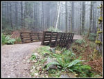 First Bridge |
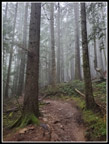 Heading Uphill |
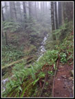 A Running Creek |
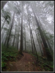 Wide Angle View |
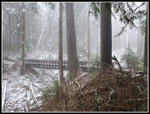 The Big Bridge |
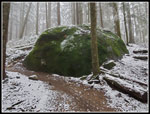 Jim's Erratic |
 Road Crossing |
 Untracked Road Above |
 Slogging Up The Road |
 Nearing The Top |
 Deciduous Forest |
 Nearing Summit Spur |
 Summit Spur Gate |
 Heavily Flocked Trees |
 Tower In Sight |
 Summit Signboard |
 More Towers & Blue |
 Heading Down 1st Time |
 Continuing Down |
 Passing Summit Trail |
 Back To Summit |
 Descending ET Trail |
 Back On Road |
 Sunlit Trees |
 East Tiger Lake |
 More Deciduous Trees |
 Back Near Junction |
 Most Blue Sky |
 Sunny Road |
 Nicely Lit |
 Cold & Cloudy Again |
 Two Bikers |
 Almost Bare Road |
 Very Green |
 Snowing At The End |
Trips - 2024
Home