03-02-24
It
looked like a pretty awful weekend. After snow during the week on
Tiger, the weekend would be mostly rain. I decided to go early and hope
for the best. I reached High Point at 8:05 am. The road near the
interchange usually has 4-6 cars at this time of morning. There were 37
cars parked along the road. What was going on? I briefly considered
going elsewhere but I wanted more than 2000' of gain and with possible
afternoon thunderstorms I needed to get going quickly. I was on my way
at 8:09 am. Beyond the gate I saw a big group of hikers. They had ice
axes. That is not usual for Tiger Mountain. I asked what the group was
and found it was the Mountaineers Alpine Scramble Class. When I took
the class in 1993 I do not recall a meet and greet on the trail. That
is what it was. I had a brief chat with the leader and headed out ahead
of them. It rained on much of my drive over but it was cloudy and dry
at the start. My first decision was whether to take the Lingering
Trail. I brought a saw as there were reports of trees down from the
recent storms. The big one was reported as about a half mile before the
railroad grade on the TMT. There were no reports of trees down the High
Point trail. I decided to check out the LT. That route also adds about
.40 miles. I wanted to get in 8+ miles and this would help.
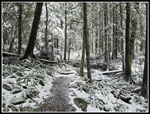
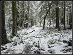
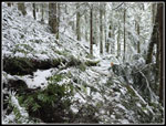
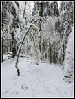
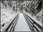
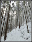
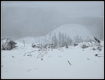
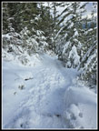
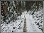
There is one tree down on the LT but it is small enough to step over. I left it to save time for the bigger one ahead. The LT is in excellent shape. Near the upper end the trail had a dusting of fresh snow. This was lower than I was expecting. The snow was not on the Tiger Mountain Trail (TMT) after I turned onto it. I saw a group ahead of me and feared the Mountaineer had passed me while I was on the longer route. The group ahead stopped and I went on by. This group of 8 or so were not with the Mountaineer group. In fact, I never saw them on the trail. By 9:00 am I was at about 1450' and the trail had a thin coat of snow. At Ruth's Cove (1560') the bridge was snow covered but the trail was patchy snow. Once across the bridge the snow became continuous on the trail.
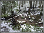
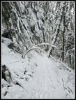
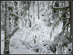
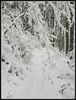
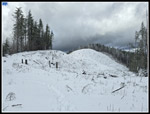
Just before the trail reaches the right turn where it turns onto a fairly recent reroute I found the down tree. The tree was not that big but it had dozens of branches sticking out in all directions. Hikers had been going up the slope on salal to get around. A boot path was already being formed. I set out to see if I could remove the whole thing. I had no trouble sawing off the branches. One by one I tossed them down the slope. Two runners and a long hiker and dog came through while I was working. After taking off the limbs I cut the tree and tossed it away. The result is the trail is back in business. My GPS recorded only 10 minutes to do the job. Cutting is hard work and I was a bit tired as I continued up. Several more groups of runners zoomed by. At the railroad grade I turned right for Tiger 2. I considered going to Tiger 1 but I might end up in a thunderstorm and chose the shorter route.
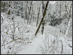
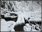
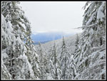
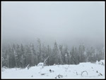
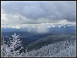
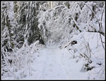
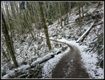
By the time I reached the big bridge (2020') over the tiny creek there was about five inches of snow on the bridge deck and handrails. I had on gaiters and a wool hat. I saw a lot of trailrunner shoes and no gaiter this day. That could not have been comfortable with knee deep snow drifts on Tiger 2. With gainers and high top leather boots My feet stayed dry. The best part of the day was that the snow was not knee deep most of the way and the brush and trees were plastered with snow. This has been almost a non-winter on close in summits like Tiger Mountain and I have not seen much beautiful snow cover. It is already March and I may not see too much more. I took a lot of photos.
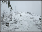
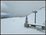
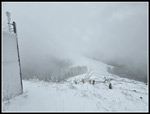
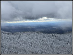
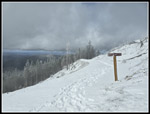
When I reached Tom's Crossing I looked out at the viewpoint for Mt. Si. I could just barely make out the lower 2/3 of Si through the mist. The upper mountain was buried in clouds. It is just a short way up to the top of Tiger 2 from there. It took longer than usual. When I reached the clearcut I stopped to put on a jacket. I started with the jacket but took it off on the Lingering Trail. Now I needed it. The wind was not howling but it was present. I followed the footprints in the snow. This is where the snow drifts were. Only a few inches here and then knee deep there. It was slow going but I was almost on top. The trail turns right and reaches the remains of a road. It crosses and the trail is narrow on a steep slope. It was not visible. I saw two hikers coming towards me and headed for them. They were following a boot path straight down the slope. We commented on the fine weather and passed by. It was very cloudy. I could barely make out the tower right above me. I followed the tracks up to the new bench and a few minutes later I was on the summit.
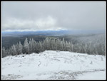
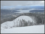
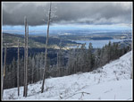
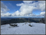
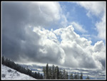
Five weeks earlier, I did a trip over Tiger 2. At the actual summit, there was a short sleeve t-shirt hung up on the barb wire fence around the tower complex. When John and I came by 9 days ago it was still there. This day it was there and coated with snow. This may become a permanent fixture. The clouds overhead began to break up. I had a big blue sucker hole above. One minute I could barely see Tiger 1 and Tiger 3. The next moment, they were in the clear. Views south remained poor. Views west and north went from poor to great to poor. I stayed for a while to get some photos of the views and the clouds. The views were pretty but it was cold. My thermometer read 30F but the roughly 10-14 mph gusts were very cold. I arrived at the actual summit at 10:42 am. I left at 10:55 am. That was long enough. On the hike over to Tiger 3 I passed 4-5 groups coming up and a few runners going down. The views kept changing by the second and provided more interesting photo opportunities. My pace was slow as a result.
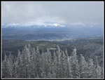
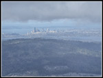
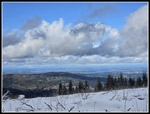
Near the low point below Tiger 3 I stopped to but on microspikes. I asked about the snow conditions from hikers who had hiked up Tiger 3. As expected they mentioned the packed icy snow and recommended the spikes. I spent a few minutes atop Tiger 3. I had my closest views of Seattle and Bellevue. Even when the low clouds dispersed, the city buildings were not far below the solid cloud cover. It was a very interesting view. I headed down at 11:17 am. I was in good shape if thunderstorms did come in after 1:00 pm. Descending the upper mountain was great. The trail has loose rocks and big steps when bare. With the packed snow it was smooth. With microspikes I had much better traction than on dirt. I hiked with my hands in my pockets to warm them up. I had no slips at all. There were quite a few groups coming up and I had to step off the trail many times. Below the railroad grade the trail is much wider and passing was easy. Below the 2000' railroad grade the snow began to lessen fast. There was a narrow dirt trail soon. I kept the spikes on longer than necessary since the traction was so good. As snow gave way to dirt they came off.
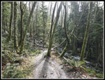
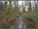
By the leftward switchback heading towards the Talus Rocks Trail junction, the tread was almost entirely dirt. I made good time down to the flats near the parking lot. I figured that with the Lingering Trail section, I would be at about 8 miles when back at my car. I decided to add some more mileage as the weather was pretty good and not raining as forecast. I took a left turn on the Bus Trail and followed it all the way to the end. I stopped by Round Lake and took the Powerline Trail north. I turned around after 1.1 miles and headed back. Along the Bus Trail it began to hail. It was coming down pretty hard. The hail bounced off my jacket. It's much better than rain. I took the Around The Lake Trail back to the parking lot. Now I had just under a mile to go. The Connector Trail took me to the main road I was parked along. About .40 miles later at 1:18 pm, I was back at my car.
This turned out to be a much better hike than I expected. I carried my umbrella and never used it. The snow was only deep near the top of Tiger 2. The rest of the snow travel was slower than dirt but not a problem. The snow plastered trees and everything else was beautiful. I had the crowds expected for 2.6 miles coming down Tiger 3 but not a lot of people on the other 7.4 miles. The blowing clouds an white out turned to clear views in seconds made for some memorable views. I had a little hail pour on me but no rain all day. I had rain on the drive both ways but not on the trail. I even managed to clear up an impenetrable mess of a tree over the trail. All in all it was an excellent day on the trail both bare and snowy.
Click on thumbnails to get
larger pictures.
Trips - 2024
Home
There is one tree down on the LT but it is small enough to step over. I left it to save time for the bigger one ahead. The LT is in excellent shape. Near the upper end the trail had a dusting of fresh snow. This was lower than I was expecting. The snow was not on the Tiger Mountain Trail (TMT) after I turned onto it. I saw a group ahead of me and feared the Mountaineer had passed me while I was on the longer route. The group ahead stopped and I went on by. This group of 8 or so were not with the Mountaineer group. In fact, I never saw them on the trail. By 9:00 am I was at about 1450' and the trail had a thin coat of snow. At Ruth's Cove (1560') the bridge was snow covered but the trail was patchy snow. Once across the bridge the snow became continuous on the trail.
Just before the trail reaches the right turn where it turns onto a fairly recent reroute I found the down tree. The tree was not that big but it had dozens of branches sticking out in all directions. Hikers had been going up the slope on salal to get around. A boot path was already being formed. I set out to see if I could remove the whole thing. I had no trouble sawing off the branches. One by one I tossed them down the slope. Two runners and a long hiker and dog came through while I was working. After taking off the limbs I cut the tree and tossed it away. The result is the trail is back in business. My GPS recorded only 10 minutes to do the job. Cutting is hard work and I was a bit tired as I continued up. Several more groups of runners zoomed by. At the railroad grade I turned right for Tiger 2. I considered going to Tiger 1 but I might end up in a thunderstorm and chose the shorter route.
By the time I reached the big bridge (2020') over the tiny creek there was about five inches of snow on the bridge deck and handrails. I had on gaiters and a wool hat. I saw a lot of trailrunner shoes and no gaiter this day. That could not have been comfortable with knee deep snow drifts on Tiger 2. With gainers and high top leather boots My feet stayed dry. The best part of the day was that the snow was not knee deep most of the way and the brush and trees were plastered with snow. This has been almost a non-winter on close in summits like Tiger Mountain and I have not seen much beautiful snow cover. It is already March and I may not see too much more. I took a lot of photos.
When I reached Tom's Crossing I looked out at the viewpoint for Mt. Si. I could just barely make out the lower 2/3 of Si through the mist. The upper mountain was buried in clouds. It is just a short way up to the top of Tiger 2 from there. It took longer than usual. When I reached the clearcut I stopped to put on a jacket. I started with the jacket but took it off on the Lingering Trail. Now I needed it. The wind was not howling but it was present. I followed the footprints in the snow. This is where the snow drifts were. Only a few inches here and then knee deep there. It was slow going but I was almost on top. The trail turns right and reaches the remains of a road. It crosses and the trail is narrow on a steep slope. It was not visible. I saw two hikers coming towards me and headed for them. They were following a boot path straight down the slope. We commented on the fine weather and passed by. It was very cloudy. I could barely make out the tower right above me. I followed the tracks up to the new bench and a few minutes later I was on the summit.
Five weeks earlier, I did a trip over Tiger 2. At the actual summit, there was a short sleeve t-shirt hung up on the barb wire fence around the tower complex. When John and I came by 9 days ago it was still there. This day it was there and coated with snow. This may become a permanent fixture. The clouds overhead began to break up. I had a big blue sucker hole above. One minute I could barely see Tiger 1 and Tiger 3. The next moment, they were in the clear. Views south remained poor. Views west and north went from poor to great to poor. I stayed for a while to get some photos of the views and the clouds. The views were pretty but it was cold. My thermometer read 30F but the roughly 10-14 mph gusts were very cold. I arrived at the actual summit at 10:42 am. I left at 10:55 am. That was long enough. On the hike over to Tiger 3 I passed 4-5 groups coming up and a few runners going down. The views kept changing by the second and provided more interesting photo opportunities. My pace was slow as a result.
Near the low point below Tiger 3 I stopped to but on microspikes. I asked about the snow conditions from hikers who had hiked up Tiger 3. As expected they mentioned the packed icy snow and recommended the spikes. I spent a few minutes atop Tiger 3. I had my closest views of Seattle and Bellevue. Even when the low clouds dispersed, the city buildings were not far below the solid cloud cover. It was a very interesting view. I headed down at 11:17 am. I was in good shape if thunderstorms did come in after 1:00 pm. Descending the upper mountain was great. The trail has loose rocks and big steps when bare. With the packed snow it was smooth. With microspikes I had much better traction than on dirt. I hiked with my hands in my pockets to warm them up. I had no slips at all. There were quite a few groups coming up and I had to step off the trail many times. Below the railroad grade the trail is much wider and passing was easy. Below the 2000' railroad grade the snow began to lessen fast. There was a narrow dirt trail soon. I kept the spikes on longer than necessary since the traction was so good. As snow gave way to dirt they came off.
By the leftward switchback heading towards the Talus Rocks Trail junction, the tread was almost entirely dirt. I made good time down to the flats near the parking lot. I figured that with the Lingering Trail section, I would be at about 8 miles when back at my car. I decided to add some more mileage as the weather was pretty good and not raining as forecast. I took a left turn on the Bus Trail and followed it all the way to the end. I stopped by Round Lake and took the Powerline Trail north. I turned around after 1.1 miles and headed back. Along the Bus Trail it began to hail. It was coming down pretty hard. The hail bounced off my jacket. It's much better than rain. I took the Around The Lake Trail back to the parking lot. Now I had just under a mile to go. The Connector Trail took me to the main road I was parked along. About .40 miles later at 1:18 pm, I was back at my car.
This turned out to be a much better hike than I expected. I carried my umbrella and never used it. The snow was only deep near the top of Tiger 2. The rest of the snow travel was slower than dirt but not a problem. The snow plastered trees and everything else was beautiful. I had the crowds expected for 2.6 miles coming down Tiger 3 but not a lot of people on the other 7.4 miles. The blowing clouds an white out turned to clear views in seconds made for some memorable views. I had a little hail pour on me but no rain all day. I had rain on the drive both ways but not on the trail. I even managed to clear up an impenetrable mess of a tree over the trail. All in all it was an excellent day on the trail both bare and snowy.
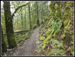
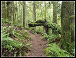 The Mossy Dragon |
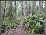 Partly Fallen Trees |
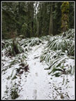 Snow On Lingering Trail |
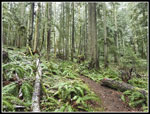 On The TMT |
 Snow Begins |
 Ruth's Cove |
 Snowy Flats |
 Tree Down On Trail |
 Tree Has Been Cleared |
 Snow Is Getting Deeper |
 Deeper In The Open |
 Bare & Snowy Bridge |
 Snow Weighted Tree |
 Snowy Big Bridge |
 Winter Wonderland |
 Snow Laden Branches |
 Wide Angle Trees |
 Tom's Crossing View |
 Trail Signs At Tom's |
 Tiger 2 Summit In Sight |
 Very Cloudy |
 Starting To Clear Up |
 Closer Look |
 Snowy Bench |
 Cloudy Tiger 3 |
 Clear Tiger 3 |
 Where Is Tiger 1? |
 Faintly Seen Seattle |
 Seattle View Is Clearing |
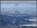 Issaquah & Bellevue |
 Bright & Dark |
 Sunshine Leaving T2 |
 Improving Views |
 Nearing Tiger 3 |
 Neat Clouds |
 Raining In The Distance |
 Clouds From Tiger 3 |
 More Clouds |
 Starting Down |
 Pretty Snowscape |
 Dirt Appears |
 Snow Is Almost Gone |
 Sunshine! |
 Bus Trail |
 Spring Flower |
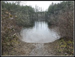 Round Lake |
 Hailing |
 Some Great Colors |
Trips - 2024
Home