10-30-25
Heavy
rain was coming and Thursday was the last dry day for a while. I took a
day off work and Gary and John joined me for a hike. It would be dry
but overcast all day. We considered a long drive to see western larch
but without sun they don't look their best. Instead, we chose to do a
long hike close to home. In addition I saw a trip report saying that
the trails around and up Middle Tiger were open and rebuilt through the
recent clearcutting. The views I saw 35 years ago were back as the
trees grew and were cut once again. John and I did a very similar hike
for my year end Tiger
hike in 2011. We would be
starting at about 560' and finishing at about 1380'. That meant over
800'
less descent than ascent. We met at Tiger Summit at 8:00 am. With the
recent opening of two lanes all the way to Tiger Summit, our drive was
a breeze. John had more of a backup. We dropped to the next exit at a
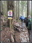
steady speed. We reached the south Tiger Mountain Trail (TMT) trailhead
and started hiking at 8:12 am.
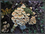
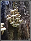
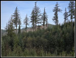
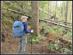
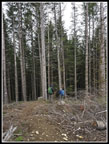
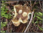
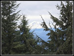
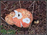
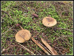
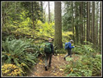
The TMT is moderately graded almost all the way up to the north end at High Point. It was cool and we tried to get out to a fast pace to warm up. Unfortunately, some of the best mushrooms of the day were in the first half mile. We kept stopping for photos. At the first junction we took the hiker trail to the left. The narrow trail on the steep slope has eroded in one place. It is now even narrower but easy enough to cross. At just about one mile, we reached the road where the TMT turns right and goes around the right side of South Tiger Mountain. We went left then right again and climbed a steep road up to the powerline corridor. This road was one of the steepest trail sections of the day. At the top, we stopped for more photos. The sky was mostly blue with some high white clouds. We had a great view of the Olympic Mountains. The Brothers was most prominent from this angle. It had some fresh snow on top. The total overcast was not here yet.
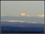
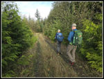
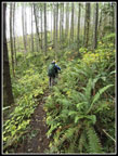
The South Tiger Traverse Trail is a road since the last clearcut. It is in the open not in dark forest. It does provide a nice view of Mt. Rainier right were it leaves the road. John had not been here since the most recent logging. Most of the way to the tops of South Tiger Mountain are now out in the open. In the year and a half since my last visit, the brush and small fir trees have really grown. It is high enough to block views of Rainier in places. The trail crosses a couple old logging roads and climbs higher on the side of the most southern top of South Tiger. It comes within a few dozen feet of the top of that summit before dropping to a road between the two summits. The south peak is the one I always considered the higher. They are close in height. After the northern summit was logged. 15 years ago, a boot path went straight up the slope to the top. The top had unobstructed views of East Tiger and Mt. Si. That was the year before our year end 2011 trip. Now there is a new trail that gently climbs up in three times the distance. The views are totally obscured by 30' tall fir trees. It does not take long for them to grow back. After a little food and water we were on our way down. The two South Tiger peaks are just over 2000'.
We dropped down to the road and followed it north. We left the road to go over to the old end of the South Tiger Traverse trail. It brought us to the same place as the road we left. We passed the side trail to the Carol Hapke horse trail to a lunch spot on a nearby mound. I had to look all over to find the start of the short trail. It was not a popular trail but with most hikers taking the road down from South Tiger, few people even go by it. The road drops down to the TMT coming around the other side of South Tiger. It quickly reaches the West Side Road and crossed it. When I first started hiking the TMT this was the start. You drove here from Tiger Summit where I parked on this trip. Any path down to where we started was not the TMT. I hiked this section of the TMT to the Train Wreck Site in February on its 100th Anniversary. There were a few down logs but most had been cut our after the November 2024 big storm. Now they were all cut out. The trail was a creek that day. Now it was mostly dry.
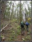
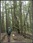
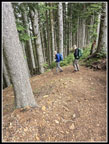
We reached the Train Wreck site and continued by. The TMT used to take a long route around the left side of a hill here. Now it goes around the right side and is much shorter. We found many big logs cut out and a few big ones over the trail. We had to duck under them. John had a saw and cut out branches that were in the way. The wind was now audible. The day before, the spot forecast had gusts of 20+ mph in the late morning. The morning forecast removed the gusts. I was getting a little concerned about the top of Middle Tiger with mostly clearcut but trees left on one side of the summit. We did not need more falling branches. We next reached the logging road used in the clearcutting. Gary and I were here a year ago. The TMT was obliterated across the road. There were lots of down logs and no sign of a trail. We looked all around. We ended up hiking the road to intersect the Middle Tiger Trail above. Per the trip report I read the day before, the TMT is now rebuilt. We followed it along to the junction with the old trail. That junction is not were it used to be. The TMT is not exactly where it used to be. We found the Middle Tiger Trail going down but it is not obviously open. We went back to the new junction and took the trail up. The new Middle Tiger Trail starts before and below the old TMT - Middle Tiger junction.
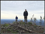
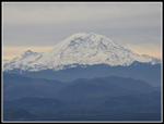
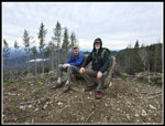
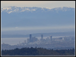
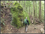
The trail reaches the new road and crosses it. It is very obvious on the uphill slope side. Last year, Gary and I climbed a very steep slope and hunted around to find the trail. Now it is easy and quickly picks up the old trail. The rest of the way up is on the old very steep trail. It climbs to the ridge and then climbs the steep ridges to the top. Part way up the ridge is a new trail we saw last year. It is the way to continue towards East Tiger Mountain. Much of the old trail is still in forest. Just to our left we could see the nearby clearcut. Nearing the summit we popped out into the clearcut. Some tall forest still blocks the views east. To the north, west, and south it is mostly clear. Only a stand of trees in the clearcut blocks views towards Seattle. It can still be seen from another part of the summit. We arrived on top at 11:19 am. So far, we had hiked 5.9 miles with about 2600' of gain. It was windy enough to put on jackets but not blowing real hard. The view of Mt. Rainier is spectacular. Seattle, Bellevue, and the Olympics are mostly in sight. We could see the ridge of the One View Trail from Poo Poo Point to near the top of Tiger 1 but could not see that summit. It was behind the remaining forest. I saw these views here in the early 1990s but not since. We had part of our lunch and admired the views. There is already a bench on top., Not ornate like on Tiger 1, 2, and 3 but sturdy.
We still had a long way to go so at 11:39 am we headed down. The trail used to go over the summit and drop to a road below. That road went out to main road from Tiger Summit to East Tiger and Tiger 1 & 2. We back tracked down the ridge and took the new trail. We already knew it goes to the junction of the old road mentioned and the main road. From that junction we were about 4 miles or less from my car by the road. That would not do. We followed the road to the Preston RR Grade Trail. These trails are mostly for bikes but hikers are allowed on most of them. We could have followed roads to the top of East Tiger but chose to take the bike trails. A very short way up the trail we turned right on the East Tiger Trail. This one is narrow on a very steep hillside. I avoid it on my weekend hikes as it is tough for bikes and hikers to pass each other. This was a Thursday in late October. Would there be any bikes in the time we hiked the trail? The answer is "yes". Part way up we jumped off the trail for a biker to pass. It is a one way downhill bike trail. Then another. Then another. We saw one hiker coming down in the first mile of the trip. We had solitude until now. Eventually, the trail attains flatter ground and passing was easy there. We reached the East Tiger spur road and turned right. In a few steep climbing minutes we reached the top of East Tiger Mountain at 3004'. It was now 12:53 pm. This is the highest point on the Tiger Mountains.
The sky had long ago turned solid white but we still had a narrow view out to a clear Mt. Rainier. We finished lunch and packed up to go. We took the Power Link Trail down. We reached the road just before the bottom. At the road junction we could turn right and follow the road back to the car or go left and climb and drop to the Master Link Trail. The trail is longer but much gentler on the knees. We went left. The Master link is a busy bike trail. It is one way uphill for bikes and hikers can go in either direction. Uphill bikers are slower and easy to see. It is no problem to hike down though on a weekend you will be stepping off the trail often as bikes go my. We saw quite a few bikers going uphill on the trail. The grade is much gentler than most hiking trails. It seems to take a long time to get down to the bottom. On the positive side, as mentioned earlier, we had over 800' less drop than climb. We finally reached the Northwest Timber Trail at 2:52 pm. It is just a couple minutes from there to the main road coming down.
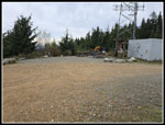
There were two main reasons I wanted to do this hike. One was to see the views from the newly opened trail to the newly scalped Middle Tiger Mountain. The other was to see the new parking lot before it opens. From where we reached the road it is .30 miles to the old parking lot along Highway 18 at Tiger Summit A couple dozen years ago, a new 50 car lot was built just up the West Side Road. Where we reached the main road, it is just .30 miles to the new lot on the Connector Trail. We headed onto that trail. The new lot has 170 parking spaces and two sets of two bathrooms. It will soon be mobbed by mountain bikers. I wanted to see it before the crowds arrive. The contract was for the lot to be finished by October 31. That would be the next day. The trip report from just two days earlier had photos and the lot was paved, parking spaces marked, and appeared to be finished. When we arrived we saw several big trucks and steam rising off of fresh asphalt. Workers were busy putting the finishing touches on the lot. Rather than walk the road from the lot to where my car was, we turned around and hiked back to the East Side Road and then to my car. We arrived at 3:21 pm. I drove back to John's car in some heavy but steadily moving traffic.
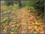
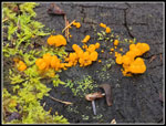
For the day we hiked 13.04 miles with 3400' of gain and about 2600' of descent. I felt surprisingly good at the finish after a long day of hiking. Although we gained 3400' the grade was mostly at a moderate grade. We had a good display of mushrooms, especially at lower elevations. We had a lot of solitude until we neared East Tiger Mountain. I hiked a short section of new trail on the TMT and Middle Tiger rebuilt trails. The weather was cool at first but dry all day. The overcast did come in but we had good views of far away peaks. I had my views from Middle Tiger for the first time in three decades and saw the new lot before it opens. We even had a rare long one way hike with a short drive between ends. The traffic was even much better than expected. We breezed through Seattle at around 4:00 pm. All in all, it was a very nice day to be on the trails.
Click on thumbnails to get
larger pictures.
Trips - 2025
Home
The TMT is moderately graded almost all the way up to the north end at High Point. It was cool and we tried to get out to a fast pace to warm up. Unfortunately, some of the best mushrooms of the day were in the first half mile. We kept stopping for photos. At the first junction we took the hiker trail to the left. The narrow trail on the steep slope has eroded in one place. It is now even narrower but easy enough to cross. At just about one mile, we reached the road where the TMT turns right and goes around the right side of South Tiger Mountain. We went left then right again and climbed a steep road up to the powerline corridor. This road was one of the steepest trail sections of the day. At the top, we stopped for more photos. The sky was mostly blue with some high white clouds. We had a great view of the Olympic Mountains. The Brothers was most prominent from this angle. It had some fresh snow on top. The total overcast was not here yet.
The South Tiger Traverse Trail is a road since the last clearcut. It is in the open not in dark forest. It does provide a nice view of Mt. Rainier right were it leaves the road. John had not been here since the most recent logging. Most of the way to the tops of South Tiger Mountain are now out in the open. In the year and a half since my last visit, the brush and small fir trees have really grown. It is high enough to block views of Rainier in places. The trail crosses a couple old logging roads and climbs higher on the side of the most southern top of South Tiger. It comes within a few dozen feet of the top of that summit before dropping to a road between the two summits. The south peak is the one I always considered the higher. They are close in height. After the northern summit was logged. 15 years ago, a boot path went straight up the slope to the top. The top had unobstructed views of East Tiger and Mt. Si. That was the year before our year end 2011 trip. Now there is a new trail that gently climbs up in three times the distance. The views are totally obscured by 30' tall fir trees. It does not take long for them to grow back. After a little food and water we were on our way down. The two South Tiger peaks are just over 2000'.
We dropped down to the road and followed it north. We left the road to go over to the old end of the South Tiger Traverse trail. It brought us to the same place as the road we left. We passed the side trail to the Carol Hapke horse trail to a lunch spot on a nearby mound. I had to look all over to find the start of the short trail. It was not a popular trail but with most hikers taking the road down from South Tiger, few people even go by it. The road drops down to the TMT coming around the other side of South Tiger. It quickly reaches the West Side Road and crossed it. When I first started hiking the TMT this was the start. You drove here from Tiger Summit where I parked on this trip. Any path down to where we started was not the TMT. I hiked this section of the TMT to the Train Wreck Site in February on its 100th Anniversary. There were a few down logs but most had been cut our after the November 2024 big storm. Now they were all cut out. The trail was a creek that day. Now it was mostly dry.
We reached the Train Wreck site and continued by. The TMT used to take a long route around the left side of a hill here. Now it goes around the right side and is much shorter. We found many big logs cut out and a few big ones over the trail. We had to duck under them. John had a saw and cut out branches that were in the way. The wind was now audible. The day before, the spot forecast had gusts of 20+ mph in the late morning. The morning forecast removed the gusts. I was getting a little concerned about the top of Middle Tiger with mostly clearcut but trees left on one side of the summit. We did not need more falling branches. We next reached the logging road used in the clearcutting. Gary and I were here a year ago. The TMT was obliterated across the road. There were lots of down logs and no sign of a trail. We looked all around. We ended up hiking the road to intersect the Middle Tiger Trail above. Per the trip report I read the day before, the TMT is now rebuilt. We followed it along to the junction with the old trail. That junction is not were it used to be. The TMT is not exactly where it used to be. We found the Middle Tiger Trail going down but it is not obviously open. We went back to the new junction and took the trail up. The new Middle Tiger Trail starts before and below the old TMT - Middle Tiger junction.
The trail reaches the new road and crosses it. It is very obvious on the uphill slope side. Last year, Gary and I climbed a very steep slope and hunted around to find the trail. Now it is easy and quickly picks up the old trail. The rest of the way up is on the old very steep trail. It climbs to the ridge and then climbs the steep ridges to the top. Part way up the ridge is a new trail we saw last year. It is the way to continue towards East Tiger Mountain. Much of the old trail is still in forest. Just to our left we could see the nearby clearcut. Nearing the summit we popped out into the clearcut. Some tall forest still blocks the views east. To the north, west, and south it is mostly clear. Only a stand of trees in the clearcut blocks views towards Seattle. It can still be seen from another part of the summit. We arrived on top at 11:19 am. So far, we had hiked 5.9 miles with about 2600' of gain. It was windy enough to put on jackets but not blowing real hard. The view of Mt. Rainier is spectacular. Seattle, Bellevue, and the Olympics are mostly in sight. We could see the ridge of the One View Trail from Poo Poo Point to near the top of Tiger 1 but could not see that summit. It was behind the remaining forest. I saw these views here in the early 1990s but not since. We had part of our lunch and admired the views. There is already a bench on top., Not ornate like on Tiger 1, 2, and 3 but sturdy.
We still had a long way to go so at 11:39 am we headed down. The trail used to go over the summit and drop to a road below. That road went out to main road from Tiger Summit to East Tiger and Tiger 1 & 2. We back tracked down the ridge and took the new trail. We already knew it goes to the junction of the old road mentioned and the main road. From that junction we were about 4 miles or less from my car by the road. That would not do. We followed the road to the Preston RR Grade Trail. These trails are mostly for bikes but hikers are allowed on most of them. We could have followed roads to the top of East Tiger but chose to take the bike trails. A very short way up the trail we turned right on the East Tiger Trail. This one is narrow on a very steep hillside. I avoid it on my weekend hikes as it is tough for bikes and hikers to pass each other. This was a Thursday in late October. Would there be any bikes in the time we hiked the trail? The answer is "yes". Part way up we jumped off the trail for a biker to pass. It is a one way downhill bike trail. Then another. Then another. We saw one hiker coming down in the first mile of the trip. We had solitude until now. Eventually, the trail attains flatter ground and passing was easy there. We reached the East Tiger spur road and turned right. In a few steep climbing minutes we reached the top of East Tiger Mountain at 3004'. It was now 12:53 pm. This is the highest point on the Tiger Mountains.
The sky had long ago turned solid white but we still had a narrow view out to a clear Mt. Rainier. We finished lunch and packed up to go. We took the Power Link Trail down. We reached the road just before the bottom. At the road junction we could turn right and follow the road back to the car or go left and climb and drop to the Master Link Trail. The trail is longer but much gentler on the knees. We went left. The Master link is a busy bike trail. It is one way uphill for bikes and hikers can go in either direction. Uphill bikers are slower and easy to see. It is no problem to hike down though on a weekend you will be stepping off the trail often as bikes go my. We saw quite a few bikers going uphill on the trail. The grade is much gentler than most hiking trails. It seems to take a long time to get down to the bottom. On the positive side, as mentioned earlier, we had over 800' less drop than climb. We finally reached the Northwest Timber Trail at 2:52 pm. It is just a couple minutes from there to the main road coming down.
There were two main reasons I wanted to do this hike. One was to see the views from the newly opened trail to the newly scalped Middle Tiger Mountain. The other was to see the new parking lot before it opens. From where we reached the road it is .30 miles to the old parking lot along Highway 18 at Tiger Summit A couple dozen years ago, a new 50 car lot was built just up the West Side Road. Where we reached the main road, it is just .30 miles to the new lot on the Connector Trail. We headed onto that trail. The new lot has 170 parking spaces and two sets of two bathrooms. It will soon be mobbed by mountain bikers. I wanted to see it before the crowds arrive. The contract was for the lot to be finished by October 31. That would be the next day. The trip report from just two days earlier had photos and the lot was paved, parking spaces marked, and appeared to be finished. When we arrived we saw several big trucks and steam rising off of fresh asphalt. Workers were busy putting the finishing touches on the lot. Rather than walk the road from the lot to where my car was, we turned around and hiked back to the East Side Road and then to my car. We arrived at 3:21 pm. I drove back to John's car in some heavy but steadily moving traffic.
For the day we hiked 13.04 miles with 3400' of gain and about 2600' of descent. I felt surprisingly good at the finish after a long day of hiking. Although we gained 3400' the grade was mostly at a moderate grade. We had a good display of mushrooms, especially at lower elevations. We had a lot of solitude until we neared East Tiger Mountain. I hiked a short section of new trail on the TMT and Middle Tiger rebuilt trails. The weather was cool at first but dry all day. The overcast did come in but we had good views of far away peaks. I had my views from Middle Tiger for the first time in three decades and saw the new lot before it opens. We even had a rare long one way hike with a short drive between ends. The traffic was even much better than expected. We breezed through Seattle at around 4:00 pm. All in all, it was a very nice day to be on the trails.
 Mushrooms Start Early |
 More Mushrooms |
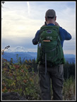
 Gary On TMT |
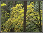
 Leaves At Junction |
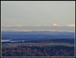 Olympic Mountains |
 The Brothers |
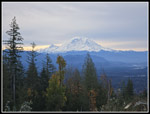 Mt. Rainier |
 John & Mt. Rainier |
 Middle Tiger In Sight |
 Descending From S. Tiger |
 Leaves Everywhere |
 Witches' Butter |
 Trees Down Over Trail |
 TMT Near Middle Tiger |
 Steep Middle Tiger Trail |
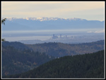 Seattle & Olympic Mts. |
 John & Gary On M. Tiger |
 Mt. Rainier From Summit |
 Summit Bench |
 Seattle Close Up |
 MT Summit Trees |
 Neat Tree |
 Stump & Root |
 More Mushrooms |
 A Face? |
 East Summit Trail |
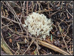 Coral Fungus |
 An Undocumented Alien |
 East Tiger Summit |
 Barely Visible Mt. Rainier |
 Descending Power Link |
 Master Link Trail |
 Big Green Erratic |
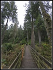 Big Bridge |
 Chomped Mushroom |
 Two More Shrooms |
 Leaf Colors |
 More Colors |
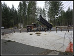 New Parking Lot |
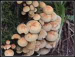 Last Mushrooms |
Trips - 2025
Home