9-14-13
The
new Pratt River Connector Trail was completed last fall. At the end of
March I hiked
the trail for the first time. I
reached the Pratt River, hiked up to the Big Tree, and then up to the
old logging railroad grade and another mile along it. I was aware of
the old trail up the Pratt River to Pratt Lake for more than 25 years.
Back in the 1980s I drove to the Middle Fork Snoqualmie River ford site
near the junction with the Pratt River. There is only a short time in
the fall when the river is low enough to safely ford. I also had poked
around at Pratt Lake a few times looking for the upper end of the
trail, to no avail. In mid April Kim joined me for another
hike on the Connector trail and
a short way up the Pratt River. She was interested in joining me for a
long awaited one way trip through the Pratt River Valley.
There is currently no log across the Pratt River. Fording can be very dangerous during spring and early summer snow melt. I decided to wait until later in the year. When Kim and I posted a trip report for our earlier trip Kim mentioned an interest in doing a key exchange trip with two groups starting at opposite ends. No need to drive the Middle Fork Road twice retrieving a car. Monty immediately expressed an interest in being part of that trip. Monty does a lot more hiking in the Middle Fork than me. He even has a website devoted to the area. Also, Bill contacted me after my trip report and provided a wealth of information on the whole route. He has spent a great deal of time on the old trail.
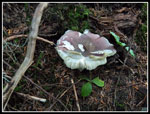
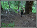
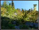
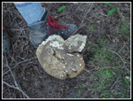
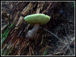
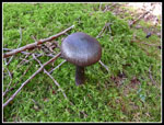
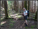
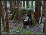
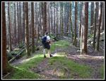
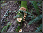
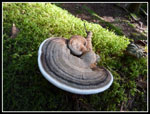
With summer coming to an end Monty lobbied for getting the trip in now. Kim and I agreed. Gwen signed on. Monty volunteered to start on the Middle Fork. He would have a little over 3000' of elevation gain. We started at the Talapus Lake trailhead off of I-90. We would have just over half that gain. We aimed for an early start, hitting the trail at 7:15 am. The trail up to Talapus Lake is short and very gentle. We immediately saw mushrooms all around the trail. The show continued for much of the day. Lots of colors and some were just huge. There were several groups camping at Talapus Lake. It was overcast for most of our drive east but bright and sunny on the trail.
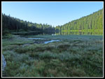
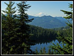
A quick look at Talapus Lake and we were off to Olallie Lake. At Olallie there were several more groups camping. Folks even out fishing already. We made another stop at the end of Olallie Lake. Nice views down the lake. A little food and water and we climbed up to the Pratt Lake Trail some 300' above us. From there it was just a short hike to the ridge top junction. We went right and began to drop down to Pratt Lake. After just 3.5 miles we had climbed all but about 200' of the elevation gain for the day. Nearly all downhill the last 12 miles. in the forest approaching Pratt Lake we noticed on old wire insulator on a tree that Bill had mentioned.
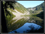
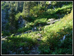
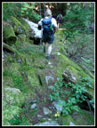
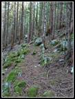
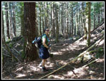
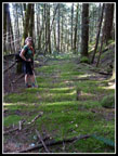
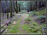
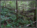
Nice and sunny at Pratt Lake. We took a break at the outlet. I pumped water and we had part of our lunches. It was 11:30 am when we headed for the old trail. The Forest Service has added a new sign on the main trail showing the way to the old Pratt River Trail. The outlet creek is very wide at the end of the lake but the crossing is where large slabs cover the entire creek. Easy walking across. On the other side we again found the old sign showing 10 miles to the Middle Fork Snoqualmie River. I went down about half a mile on a visit in mid June. Beyond that it would all be new for the next 8 miles. The trail is in surprisingly good shape, There are a few trees down in the upper mile but not many. Stumps show that the Pratt River Valley logging went nearly all the way up to Pratt Lake. Part way down the forest goes from larger trees to smaller sickly trees. Dark with almost no underbrush at all. The small trees mean to big trees to fall across the trail. There area a few small creeks with wet mossy rocks to cross. The trail is narrow in spots but generally easy to follow.
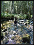
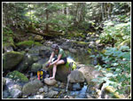
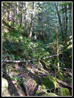
The last half mile before reaching the Pratt River there are some very old puncheon bridges. They are completely covered in bright green moss. Most are in various stages of decomposition. A neat piece of history. We were glad to meet Monty around here. There would be a car at the end of our journey. One of the keys to our trip is that Monty was sure that we could ford the Middle Fork and save the nearly four miles of the new Connector Trail. Monty verified that it was less than knee deep for him. He provided more info on the route he had just traveled. Soon we were on our way again. The valley bottom flattens right about where the trail crosses. The trail is hard to follow on the flats. We found a few pink flags that took us a little ways upstream. The River level was easily fordable. The only question is if we could rock hop with dry feet. The rocks were very wet and slick. I made it just dunking on foot once. Kim just plowed ahead. Gwen switched to light shoes and made it across.
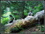
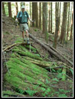
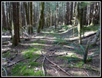
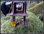
We were soon heading up to the railroad grade. Angling slightly upstream kept us out of the worst of the brush. The climb is steep but short to the old grade. As Monty told us, the first quarter mile is by for the most brushy. We quickly found the first of more than half a dozen rusty metal barrels. I am curious as to what they originally contained. Soon enough the brush bash turned into a walk along a wide flat old grade. For whatever reason, when the rails were removed the ties were left in place. In some places you can see the ties. More often you can see wavy bumps where moss or dirt have covered the old ties. A little more history. There are some logs down across the grade. Not nearly as many as I was expecting.
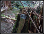
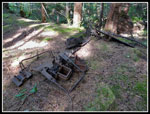
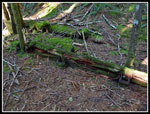
The neatest thing was at a wide spot where there may have been two sets of tracks. Some old metal caught our eyes. We found a long wooden panel with metal attached along it's length. The metal had a square open center. Another panel was parallel to the first. My guess is either a buried flatbed train car or just the top of one. Posts in the metal openings would hold the logs on the car. More fun history.
Kaleetan Creek had plenty of water. The rocks were a little slick but it was easy to cross with dry boots. We took another break here. Refilled our water bottles and ate the rest of our lunches. Lots of photos and gawking had slowed our pace considerably. Now we wanted to make the river ford before dark. Heading down the grade we encountered a few spots where the grade was a bog and we climbed up to the bank above. A number of small drops where trestles were missing required us to drop down and climb back up. None were all that difficult. At the extent of my explorations in the early spring I recognized two interesting spots. First is a missing trestle over a deep gorge. The trail leaves the grade and climbs up the hillside. The creek is crossed and then the trail drops down to the grade again. Soon after is a spot where the grade crosses a creek between drops of a long waterfall.
Now the just had a mile to go to the end of the grade. Some spots with moss covering everything. Trees, rocks, and the ground were bright green. At the end of the grade the route drops more steeply to the junction with the Big Tree Trail. It was now 7:00 pm and we picked up our pace a little more. There is a new boardwalk just before reaching the Middle Fork River. Tall brush between the trail and river. In the spring there was an obvious trail over to the river. Not so now. We went right by the route before coming back. It is right near the boardwalk. We followed it to where it drops to the river bank. 7:30 now and almost dark. I put on my dive booties, Gwen added gaiters, and Kim just plowed ahead. The river is very wide here. In the middle are dry rocks. Poles were helpful as we worked our way across. The water was just below my knees at the deepest.. A little higher on Kim, and Gwen. We had no problems getting across.
On the other side was a wall of brush. Rather than put my boots back on I hiked out in my booties. A break in the brush brought us to an old road. We soon found ourselves on a trail. The trail ended in 8 foot tall hellberry bushes. In two minutes I had more cuts than in over 15 miles of hiking. We retreated and found the overgrown road. It was now dark. Gwen led most of the way as we worked our way back. The GPS was very helpful here. At last we reached the Middle Fork Road right at Monty's car. It was almost 8:00 pm. After a quick dinner in North Bend I returned Monty's car and was home by 11:05 pm
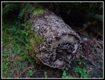
This was a really fun hike. Not far from Seattle but a trail than neither I nor anyone I knew had hiked before. There is nothing like a bit of adventure on the trail. The star of the day was not the three lakes or all the mushrooms we saw. It was hiking a historical railroad grade that has seen few feet the last four or five decades. It was seeing the seven foot wide stumps along the grade. It was not knowing what we would see farther down the grade. I had a great time. This is not a trail I will hike often but I'm very glad I had the chance to hike it now.
Click on thumbnails to get
larger pictures.
Trips - 2013
Home
There is currently no log across the Pratt River. Fording can be very dangerous during spring and early summer snow melt. I decided to wait until later in the year. When Kim and I posted a trip report for our earlier trip Kim mentioned an interest in doing a key exchange trip with two groups starting at opposite ends. No need to drive the Middle Fork Road twice retrieving a car. Monty immediately expressed an interest in being part of that trip. Monty does a lot more hiking in the Middle Fork than me. He even has a website devoted to the area. Also, Bill contacted me after my trip report and provided a wealth of information on the whole route. He has spent a great deal of time on the old trail.
With summer coming to an end Monty lobbied for getting the trip in now. Kim and I agreed. Gwen signed on. Monty volunteered to start on the Middle Fork. He would have a little over 3000' of elevation gain. We started at the Talapus Lake trailhead off of I-90. We would have just over half that gain. We aimed for an early start, hitting the trail at 7:15 am. The trail up to Talapus Lake is short and very gentle. We immediately saw mushrooms all around the trail. The show continued for much of the day. Lots of colors and some were just huge. There were several groups camping at Talapus Lake. It was overcast for most of our drive east but bright and sunny on the trail.
A quick look at Talapus Lake and we were off to Olallie Lake. At Olallie there were several more groups camping. Folks even out fishing already. We made another stop at the end of Olallie Lake. Nice views down the lake. A little food and water and we climbed up to the Pratt Lake Trail some 300' above us. From there it was just a short hike to the ridge top junction. We went right and began to drop down to Pratt Lake. After just 3.5 miles we had climbed all but about 200' of the elevation gain for the day. Nearly all downhill the last 12 miles. in the forest approaching Pratt Lake we noticed on old wire insulator on a tree that Bill had mentioned.
Nice and sunny at Pratt Lake. We took a break at the outlet. I pumped water and we had part of our lunches. It was 11:30 am when we headed for the old trail. The Forest Service has added a new sign on the main trail showing the way to the old Pratt River Trail. The outlet creek is very wide at the end of the lake but the crossing is where large slabs cover the entire creek. Easy walking across. On the other side we again found the old sign showing 10 miles to the Middle Fork Snoqualmie River. I went down about half a mile on a visit in mid June. Beyond that it would all be new for the next 8 miles. The trail is in surprisingly good shape, There are a few trees down in the upper mile but not many. Stumps show that the Pratt River Valley logging went nearly all the way up to Pratt Lake. Part way down the forest goes from larger trees to smaller sickly trees. Dark with almost no underbrush at all. The small trees mean to big trees to fall across the trail. There area a few small creeks with wet mossy rocks to cross. The trail is narrow in spots but generally easy to follow.
The last half mile before reaching the Pratt River there are some very old puncheon bridges. They are completely covered in bright green moss. Most are in various stages of decomposition. A neat piece of history. We were glad to meet Monty around here. There would be a car at the end of our journey. One of the keys to our trip is that Monty was sure that we could ford the Middle Fork and save the nearly four miles of the new Connector Trail. Monty verified that it was less than knee deep for him. He provided more info on the route he had just traveled. Soon we were on our way again. The valley bottom flattens right about where the trail crosses. The trail is hard to follow on the flats. We found a few pink flags that took us a little ways upstream. The River level was easily fordable. The only question is if we could rock hop with dry feet. The rocks were very wet and slick. I made it just dunking on foot once. Kim just plowed ahead. Gwen switched to light shoes and made it across.
We were soon heading up to the railroad grade. Angling slightly upstream kept us out of the worst of the brush. The climb is steep but short to the old grade. As Monty told us, the first quarter mile is by for the most brushy. We quickly found the first of more than half a dozen rusty metal barrels. I am curious as to what they originally contained. Soon enough the brush bash turned into a walk along a wide flat old grade. For whatever reason, when the rails were removed the ties were left in place. In some places you can see the ties. More often you can see wavy bumps where moss or dirt have covered the old ties. A little more history. There are some logs down across the grade. Not nearly as many as I was expecting.
The neatest thing was at a wide spot where there may have been two sets of tracks. Some old metal caught our eyes. We found a long wooden panel with metal attached along it's length. The metal had a square open center. Another panel was parallel to the first. My guess is either a buried flatbed train car or just the top of one. Posts in the metal openings would hold the logs on the car. More fun history.
Kaleetan Creek had plenty of water. The rocks were a little slick but it was easy to cross with dry boots. We took another break here. Refilled our water bottles and ate the rest of our lunches. Lots of photos and gawking had slowed our pace considerably. Now we wanted to make the river ford before dark. Heading down the grade we encountered a few spots where the grade was a bog and we climbed up to the bank above. A number of small drops where trestles were missing required us to drop down and climb back up. None were all that difficult. At the extent of my explorations in the early spring I recognized two interesting spots. First is a missing trestle over a deep gorge. The trail leaves the grade and climbs up the hillside. The creek is crossed and then the trail drops down to the grade again. Soon after is a spot where the grade crosses a creek between drops of a long waterfall.
Now the just had a mile to go to the end of the grade. Some spots with moss covering everything. Trees, rocks, and the ground were bright green. At the end of the grade the route drops more steeply to the junction with the Big Tree Trail. It was now 7:00 pm and we picked up our pace a little more. There is a new boardwalk just before reaching the Middle Fork River. Tall brush between the trail and river. In the spring there was an obvious trail over to the river. Not so now. We went right by the route before coming back. It is right near the boardwalk. We followed it to where it drops to the river bank. 7:30 now and almost dark. I put on my dive booties, Gwen added gaiters, and Kim just plowed ahead. The river is very wide here. In the middle are dry rocks. Poles were helpful as we worked our way across. The water was just below my knees at the deepest.. A little higher on Kim, and Gwen. We had no problems getting across.
On the other side was a wall of brush. Rather than put my boots back on I hiked out in my booties. A break in the brush brought us to an old road. We soon found ourselves on a trail. The trail ended in 8 foot tall hellberry bushes. In two minutes I had more cuts than in over 15 miles of hiking. We retreated and found the overgrown road. It was now dark. Gwen led most of the way as we worked our way back. The GPS was very helpful here. At last we reached the Middle Fork Road right at Monty's car. It was almost 8:00 pm. After a quick dinner in North Bend I returned Monty's car and was home by 11:05 pm
This was a really fun hike. Not far from Seattle but a trail than neither I nor anyone I knew had hiked before. There is nothing like a bit of adventure on the trail. The star of the day was not the three lakes or all the mushrooms we saw. It was hiking a historical railroad grade that has seen few feet the last four or five decades. It was seeing the seven foot wide stumps along the grade. It was not knowing what we would see farther down the grade. I had a great time. This is not a trail I will hike often but I'm very glad I had the chance to hike it now.
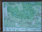 Map Of Our Route |
 First Of Many Shrooms |
 Talapus Lake |
 Olallie Lake |
 Up To Pratt Trail |
 Olallie Lake Overlook |
 Turning Color |
 Descending To Pratt |
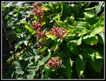 Berries |
 Meadow Below |
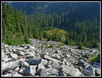
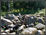
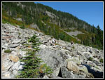 Talus Field |
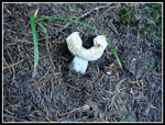 White Mushroom |
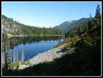 Pratt Lake |
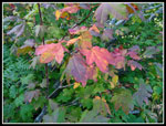 Fall Color |
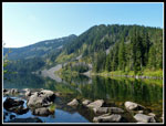 Pratt Mountain |
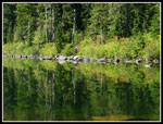 Pratt Reflection |
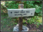 New Sign |
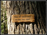 Not Maintained |
 Crossing Outlet |
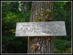 10 Miles To Go |
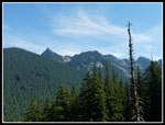 Kaleetan Peak |
 Old Pratt Trail |
 Boot Sized Shroom |
 Partly Cut |
 Colorful Mushroom |
 Barren Forest |
 Puncheon |
 8 Mile Marker |
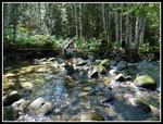 Kim Crosses Pratt River |
 Gwen Crossing |
 Brushy RR Grade |
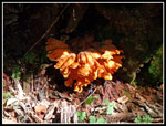 Chicken Of The Woods |
 Gwen On Grade |
 Kaleetan Creek Break |
 More Brush |
 Bare Open Grade |
 Railroad Parts |
 Thompson Spur |
 Lone Mushroom |
 Kim On Railroad Grade |
 20 Spikes |
 Big Stump |
 Railroad Ties |
 Bypass |
 Mossy Grade |
 Mushroom Colony |
 Dark & Light |
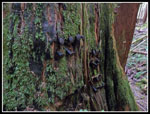
 Big Fungus |
 Flatbed Rail Car? |
 More Sunlight |
 Detour |
 ICU2 |
 Mega Fungi |
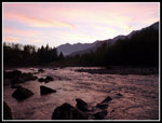 Sunset At MF River |
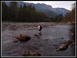 Kim Fords River |
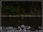 Gwen Wades Across |
Trips - 2013
Home