11-30-14
With
very cold temperatures and
wind in the mountains Gwen, Kim, and I chose a lowland destination. We
had a little snow in Seattle and sub freezing temperatures. At least we
would have sunshine as there were no clouds at all. We transfered to
Gwen's car in Lynnwood and headed for Mukilteo. We just made the 8:30
am ferry. Pretty quiet on an early Sunday morning ferry heading for
Whidbey Island. We landed at Clinton on the far south end of the island
and headed north. We immediately drove into mid winter. The ground was
white and tall trees on either side of the highway were turned white
with frozen snow. It was also only 26 degrees. About 27 miles up the
road we passed the turnoff for Coupeville and soon turned left on
Sherman Road. Just opposite the cemetery we parked in the small lot.
It was still in the upper 20s but with little wind.
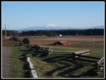
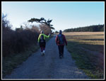
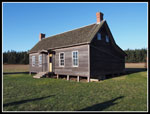
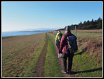
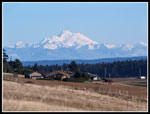
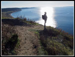
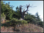
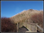
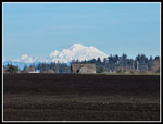
Farms were just below us. The bluff above Puget Sound was just .75 miles away. To the east we could see Mt. Baker, Three Fingers, Whitehorse, Glacier Peak, Sloan Peak, Mt. Pilchuck, and more. The mountains looked great with fresh snow. Gwen had hiked this trail before. It was a first visit for Kim and I. The trail used to head over to a gravel road and soon return to trail. Now it is shorter as it is all on trail. We were on our way by 9:30 am and quickly reached one of four old blockhouses dating back over 150 years. The trail soon reaches the bluff and a junction. To the left it drops down to sea level at another trailhead. To the right it ascends higher and follows the bluff to the north.
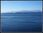
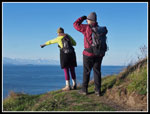
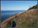
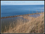
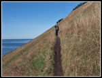
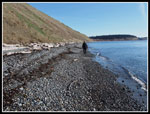
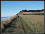
There are trees along the top of the bluff and the trail is just below them. Great views across the water to Port Townsend. Farther west we had clear views of the Olympic Mountains. We were not alone as several other groups passed us heading out. We were in no hurry. The entire loop trip is just over five miles with about 300' of elevation gain. We had all day. Lots of time to enjoy the view and take photos. "All day" is only a little over eight hours this time of year. Sunset is already up to 4:20 pm. Though there was no snow the recent rain and snow had left the trail a little muddy in spots. It is also very narrow.
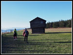
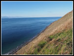
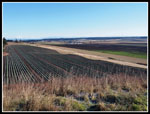
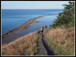
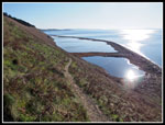
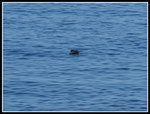
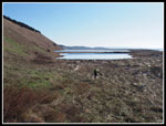
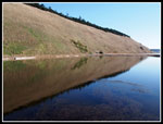
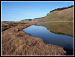
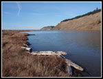
There are several ups and downs as the route heads north. The tide was way in leaving just a narrow band of sand and rock below us. Parego's Lake or lagoon came into view. It takes up much of the room between the Sound and the bluff. We were entertained by a large raptor circling below us looking for breakfast. Two runners ran by and were quickly out of sight. Towards the end of the lake our route began a descent to the beach. Several long switchbacks took us down. We ended up just at the north end of the lake. A quick look at the beach and we followed a trail along the west side of the lake. A long berm of logs, dirt, and rocks blocked our view of the Sound and also blocked most cold wind. We saw several varieties of birds on the lake. Most were small except for a lone heron.
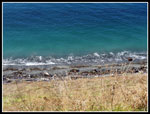
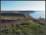
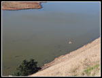
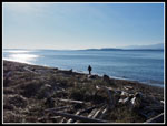
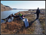
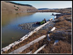
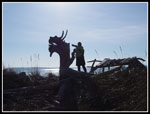
Along the way we found a log that resembles a Viking ship. The front looks just like a dragon's head. We were not the only ones who thought that as someone has nailed on a round metal eye for the dragon. Gwen went "onboard" for a photo. By 11:45 am it was time for some lunch. We took over two hours to hike about 2.5 miles. And we enjoyed every minute of it. At the end of the lake we were out on the gravel beach. The tide had receded a little. We could almost walk on sand. The gravel was much slower going. Looking out to the Sound we saw ferries and container ships speeding by. The high bluff above us began to descend. We could now see more folks above. There were also people heading north from the lower parking lot.
We reached that lot at the far south end of the trail to find lots of cars. When the lot fills cars are parked on the side of the road. From here the trail climbs a short steep grade to reach the top of the bluff. The Cascade Mountains were now back in sight. We had an easy grade climbing back to the junction where we would leave the bluff. On the last .75 miles we met a number of groups heading out. Lots of down jackets as it was still only about 34 degrees. The sunshine made it seem a little warmer.
We were back at the car at about 1:20 pm. We spent about four hours doing the five mile route. We had time to stop at the Greenbank Farm for a late lunch. It was the end of the Thanksgiving weekend and we just missed fitting on the ferry. The wait is only 30 minutes. We were back in Lynnwood before dark. I have been aware of Ebey's Landing for many years. It always seemed to be such a long trip. It isn't. The trail is so short. It is also extremely scenic. Salt water, mountains, and beach make for a great hike. I'll be interested in a spring visit when wildflowers are in bloom. It was a great trip on a cold but sunny last day of November.
Click on thumbnails to get
larger pictures.
Trips - 2014
Home
Farms were just below us. The bluff above Puget Sound was just .75 miles away. To the east we could see Mt. Baker, Three Fingers, Whitehorse, Glacier Peak, Sloan Peak, Mt. Pilchuck, and more. The mountains looked great with fresh snow. Gwen had hiked this trail before. It was a first visit for Kim and I. The trail used to head over to a gravel road and soon return to trail. Now it is shorter as it is all on trail. We were on our way by 9:30 am and quickly reached one of four old blockhouses dating back over 150 years. The trail soon reaches the bluff and a junction. To the left it drops down to sea level at another trailhead. To the right it ascends higher and follows the bluff to the north.
There are trees along the top of the bluff and the trail is just below them. Great views across the water to Port Townsend. Farther west we had clear views of the Olympic Mountains. We were not alone as several other groups passed us heading out. We were in no hurry. The entire loop trip is just over five miles with about 300' of elevation gain. We had all day. Lots of time to enjoy the view and take photos. "All day" is only a little over eight hours this time of year. Sunset is already up to 4:20 pm. Though there was no snow the recent rain and snow had left the trail a little muddy in spots. It is also very narrow.
There are several ups and downs as the route heads north. The tide was way in leaving just a narrow band of sand and rock below us. Parego's Lake or lagoon came into view. It takes up much of the room between the Sound and the bluff. We were entertained by a large raptor circling below us looking for breakfast. Two runners ran by and were quickly out of sight. Towards the end of the lake our route began a descent to the beach. Several long switchbacks took us down. We ended up just at the north end of the lake. A quick look at the beach and we followed a trail along the west side of the lake. A long berm of logs, dirt, and rocks blocked our view of the Sound and also blocked most cold wind. We saw several varieties of birds on the lake. Most were small except for a lone heron.
Along the way we found a log that resembles a Viking ship. The front looks just like a dragon's head. We were not the only ones who thought that as someone has nailed on a round metal eye for the dragon. Gwen went "onboard" for a photo. By 11:45 am it was time for some lunch. We took over two hours to hike about 2.5 miles. And we enjoyed every minute of it. At the end of the lake we were out on the gravel beach. The tide had receded a little. We could almost walk on sand. The gravel was much slower going. Looking out to the Sound we saw ferries and container ships speeding by. The high bluff above us began to descend. We could now see more folks above. There were also people heading north from the lower parking lot.
We reached that lot at the far south end of the trail to find lots of cars. When the lot fills cars are parked on the side of the road. From here the trail climbs a short steep grade to reach the top of the bluff. The Cascade Mountains were now back in sight. We had an easy grade climbing back to the junction where we would leave the bluff. On the last .75 miles we met a number of groups heading out. Lots of down jackets as it was still only about 34 degrees. The sunshine made it seem a little warmer.
We were back at the car at about 1:20 pm. We spent about four hours doing the five mile route. We had time to stop at the Greenbank Farm for a late lunch. It was the end of the Thanksgiving weekend and we just missed fitting on the ferry. The wait is only 30 minutes. We were back in Lynnwood before dark. I have been aware of Ebey's Landing for many years. It always seemed to be such a long trip. It isn't. The trail is so short. It is also extremely scenic. Salt water, mountains, and beach make for a great hike. I'll be interested in a spring visit when wildflowers are in bloom. It was a great trip on a cold but sunny last day of November.
 Parking Lot View |
 Starting Out |
 Building |
 Blockhouse |
 Nearing Bluff |
 View West |
 Steep Slope |
 Tide Is In |
 Mt. Baker |
 Making A Point |
 Winter Crop |
 View South |
 Highlighted |
 Bluff Trail |
 Lake Is In Sight |
 Raptor In Flight |
 Old Snag |
 Golden Grass On Bluff |
 Looking South |
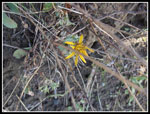 November Flower |
 Muddy Trail |
 Crocodile? |
 Kim On Beach |
 At Lake Level |
 Reflection |
 Log Lounging |
 Bluff To The North |
 Lake Break |
 Along Perego Lake |
 Viking Ship |
 Beach Cabana |
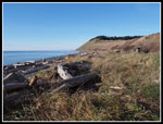
 Beach Walking |
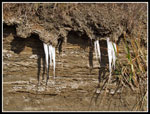 Icicles |
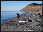 Hi Kim! |
 South Trailhead |
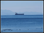 Ship |
 Steps To Bluff |
 Mt. Baker From Bluff |
 Bluff Walk |
 Ebey Info |
Trips - 2014
Home