6-28-14
How
to salvage a pretty crummy
month of hiking? Get out often at the very end of the month. Thursday
6-26 I did an after work trip to Mason Lake. For the last weekend of
the month I joined guide book author Craig Romano for two trips in the
Teanaway Valley. He was working on the east side of the mountains. I
headed over early on Saturday morning. I arrived early enough to find a
campsite along the Stafford Creek Road and set up my tent. We met at
the Stafford Creek trailhead. We were on our way by 9:50 am.
I
had never seen the parking lot so full so early. It turns out there
were a lot of backpackers heading in. Rainy weather was expected on the
west side of the Cascades and part of the east side on Saturday. It was
supposed to begin clearing up on Sunday. It did not work out that way
exactly.
This is a trail I do often and one Craig has done, just not recently. I had a little different route planned or Navaho Peak. He was working on a possible project. I was just out for some fun. The sky was overcast at first but it was dry. It rained from Bellevue to Cle Elum on my drive over. The trail is moderately graded as it climbs 3000' to Navaho Pass in about six miles. Much to my surprise, we were recognized by a group of hikers. Craig is a little more recognizable than me but these folks attended WTA's Hike The State presentation a few weeks back where both of us talked. Perhaps if I hiked with Craig more often then I would.... nah. I take the photos and remain fairly anonymous.
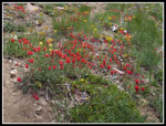
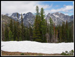
The trail is in good shape. I can't recall any tough logs to get around. Plenty of water running but no difficult creeks to get across. The largest one was just an easy rock hop. The wildflower display is coming along nicely. Meadows of Indian paintbrush and scarlet gilia brightened up the route. The big meadow after the largest creek crossing was full of shotting stars. That is the one flower we saw the most of during our weekend hikes. Craig is loquacious and we talked with everyone who would passed by. Everyone seemed to be having a great time. From atop Earl peak the week before I could see that the route up Navaho was virtually snow free. That was the case. Only some patches just below the summit.
At the Standup Creek junction we detoured to the creek. The water level is dropping fast. It is still wide but much less than a few weeks ago. The long switchbacks are next. No snow and no creeks big enough to get my boots wet. The usual flower show along there. Up at the upper meadow there were several tents already up. The meadow was full of shooting stars. Above that the trail climbs the land where nothing grows. Now there is a little grass in places. As we neared the pass we came to patches of balsamroot in full bloom. Lots of low flowers like buckwheat too. There were several groups at Navaho Pass. the tops of the Stuart Range peaks were just out of the clouds. A few minutes later they were deep in the clouds. Our timing was good to see them this day. The north side of the pass still holds snow. There will be snow to melt for water if you camp at the pass at least for the next few weeks.
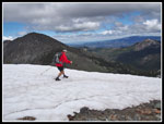
After a break and a number of photos we headed on towards the summit of Navaho. The pass is at 6000' and the summit is at 7223'. That 1223' is gained in less than a mile. The place where the summit boot path left the County Line Trail was difficult to find when I first scrambled Navaho in 1992. On this trip I missed the point where the County Line Trail left the Navaho Peak Trail. Quite a change. We played leap from with one group heading up. Several other groups were coming down. The wind was light up to the pass but it began to blow harder as we neared the summit. After crossing several large snow patches the area around the summit was snow free. We reached the top at 2:00 pm Not a fast trip but an enjoyable one.
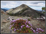
The wind on the summit was strong and cold. We dropped behind the summit block to get out of it. A puffy layer was also helpful. Short sleeves coming up gave way to a very cold summit. There were other folks on the summit the whole time we were there. The peak has certainly been "discovered". Craig had the info he needed so rather than retrace our steps I suggested a different way down. We headed east on the ridge. There is still snow on part of the ridge and everywhere on the north slope. We headed down on some dirt and some snow. Nice views over to Three Brothers on the way. There were a number of interesting wildflowers in bloom along the ridge.
We passed the County Line Trail. Dropping down towards Three Brothers would still be on steep snow. The last part of our route to the saddle next to Little Navaho is a bit of a scramble. There was a steady breeze but nothing like on the summit. There were bitterroot on the barren slope just about to bloom. It is quite steep dropping from the saddle. 1200' later we were back on the trail. We bypassed most of the hikers and had mostly solitude the rest of the way out. It was about 6:10 pm when we reached the trailhead.Lots of cars still in the lot and parked along the road. It was another fun summit in the Teanaway Valley. We moth had a great time. Soon Craig headed off to his hotel room in Cle Elum and I had a one mile drive back to my campsite. Sunday morning we would be back on the trail in the Teanaway.
Click on thumbnails to get
larger pictures.
Trips - 2014
Home
This is a trail I do often and one Craig has done, just not recently. I had a little different route planned or Navaho Peak. He was working on a possible project. I was just out for some fun. The sky was overcast at first but it was dry. It rained from Bellevue to Cle Elum on my drive over. The trail is moderately graded as it climbs 3000' to Navaho Pass in about six miles. Much to my surprise, we were recognized by a group of hikers. Craig is a little more recognizable than me but these folks attended WTA's Hike The State presentation a few weeks back where both of us talked. Perhaps if I hiked with Craig more often then I would.... nah. I take the photos and remain fairly anonymous.
The trail is in good shape. I can't recall any tough logs to get around. Plenty of water running but no difficult creeks to get across. The largest one was just an easy rock hop. The wildflower display is coming along nicely. Meadows of Indian paintbrush and scarlet gilia brightened up the route. The big meadow after the largest creek crossing was full of shotting stars. That is the one flower we saw the most of during our weekend hikes. Craig is loquacious and we talked with everyone who would passed by. Everyone seemed to be having a great time. From atop Earl peak the week before I could see that the route up Navaho was virtually snow free. That was the case. Only some patches just below the summit.
At the Standup Creek junction we detoured to the creek. The water level is dropping fast. It is still wide but much less than a few weeks ago. The long switchbacks are next. No snow and no creeks big enough to get my boots wet. The usual flower show along there. Up at the upper meadow there were several tents already up. The meadow was full of shooting stars. Above that the trail climbs the land where nothing grows. Now there is a little grass in places. As we neared the pass we came to patches of balsamroot in full bloom. Lots of low flowers like buckwheat too. There were several groups at Navaho Pass. the tops of the Stuart Range peaks were just out of the clouds. A few minutes later they were deep in the clouds. Our timing was good to see them this day. The north side of the pass still holds snow. There will be snow to melt for water if you camp at the pass at least for the next few weeks.
After a break and a number of photos we headed on towards the summit of Navaho. The pass is at 6000' and the summit is at 7223'. That 1223' is gained in less than a mile. The place where the summit boot path left the County Line Trail was difficult to find when I first scrambled Navaho in 1992. On this trip I missed the point where the County Line Trail left the Navaho Peak Trail. Quite a change. We played leap from with one group heading up. Several other groups were coming down. The wind was light up to the pass but it began to blow harder as we neared the summit. After crossing several large snow patches the area around the summit was snow free. We reached the top at 2:00 pm Not a fast trip but an enjoyable one.
The wind on the summit was strong and cold. We dropped behind the summit block to get out of it. A puffy layer was also helpful. Short sleeves coming up gave way to a very cold summit. There were other folks on the summit the whole time we were there. The peak has certainly been "discovered". Craig had the info he needed so rather than retrace our steps I suggested a different way down. We headed east on the ridge. There is still snow on part of the ridge and everywhere on the north slope. We headed down on some dirt and some snow. Nice views over to Three Brothers on the way. There were a number of interesting wildflowers in bloom along the ridge.
We passed the County Line Trail. Dropping down towards Three Brothers would still be on steep snow. The last part of our route to the saddle next to Little Navaho is a bit of a scramble. There was a steady breeze but nothing like on the summit. There were bitterroot on the barren slope just about to bloom. It is quite steep dropping from the saddle. 1200' later we were back on the trail. We bypassed most of the hikers and had mostly solitude the rest of the way out. It was about 6:10 pm when we reached the trailhead.Lots of cars still in the lot and parked along the road. It was another fun summit in the Teanaway Valley. We moth had a great time. Soon Craig headed off to his hotel room in Cle Elum and I had a one mile drive back to my campsite. Sunday morning we would be back on the trail in the Teanaway.
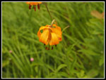 Tiger Lilies |
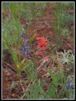 Lupine & Scarlet Gilia |
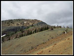
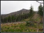 Avalanche Swath |
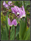 Shooting Stars |
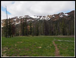 Upper Meadow |
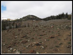 Barren Slope |
 Indian Paintbrush |
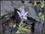
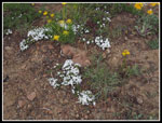 Phlox |
 Stuart Range |
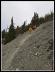 Hikers Descending |
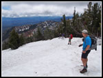 Snow Near Summit |
 Folks On Summit |
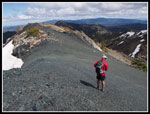
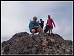 Craig On Navaho |
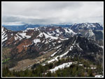 View West |
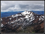 Earl Peak |
 Three Brothers |
 Descending On Snow |
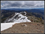 Ridge Down |
 Penstemon |
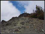
 Black Rock |
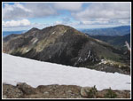
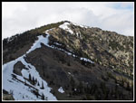 Navaho Ridge |
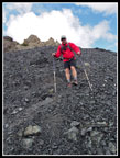 Craig Descending |
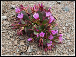
 Rough Harebell |
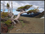 Old Tree |
 Bright Color |
 Ridge We Descended |
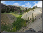 Green Ravine |
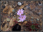 Columbia Lewisia |
Trips - 2014
Home