4-24-16
The
Teanaway Community Forest is
very new. Private land, much of it for logging, was purchased by the
forest service and department of natural resources. The forest will
still have some logging while keeping the watershed clean and adding
more recreational opportunities. Trailheads in the forest do require a
Discover Pass. The board overseeing this forest includes DNR, community
residents, hiking, biking, and wildlife representatives and more. Much
of the land is in the area of the Middle and West Forks of the Teanaway
River. Other than hikes up to Yellow Hill and Elbow Peak I rarely ever
visit. I recently became aware of an unusual rock called Exclamation
Point Rock. Doing a little Google searching and perusing this DNR
brochure on the geology of the
area I thought I had located the spot. I set out to find out.
Mountain bikers reach the site on a series of trails in 8.5 miles. 17 miles round trip makes for a long day. I was not sure of the difficulty of the trails and did not want to be alone when I fell off and hurt myself. I looked for a shorter way to do it on foot. I found a road route that was shorter. Unfortunately, with logging the maps showed some roads not on other maps. I was not at all sure which went through. This would be a bit more of an adventure than most road walks. To make matters more interesting, my GPS unit would not load a track I found online. The map on the GPS was way outdated too. I have two cell phones, personal and business. The personal does not download maps with Gaia software. The other phone has a different version of Android and does. I loaded a map a few days earlier and successfully loaded the GPS track. All set to go.
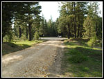
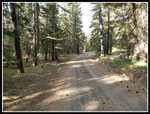
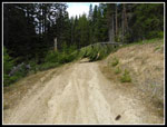
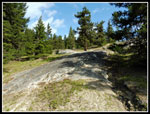
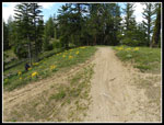
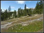
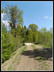
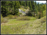
I was out the door by 6:15 am on Sunday. It rained off and on on the west side. Once over Snoqualmie Pass the rain ended. by Cle Elum it was partly sunny. I headed up the NF Teanaway Road and turned onto the West Fork Teanaway Road. It quickly came to the end of pavement at a big turnaround. My research said that their were two roads heading out along the right side of the river. Another dropped to cross the river on a bridge. I expected them all to be gated. I was wrong. The left road does drop to the river. The middle road is gated and heads out near the river. The right road heads gently uphill paralleling the river. It is not gated. I could drive at least a little farther on that road. I chose not too. At 8:18 am I headed up the right most road.
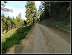
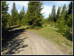
The maps show the right and middle roads coming together a half mile or so upriver. I figured I'd take the other road on the way back. I immediately saw two deer run across the road. Off to a promising start. There was a rocky spot near the start where a washout was repaired. Most of the rest of the road was more hard dirt than rock. Hard but better than most road walks. I stopped at the first road heading off uphill to the right. This should be the shortest route. Just before that road the middle road along the river comes up to meet the right road. Except there was no road. Was this right turn the road I wanted.? That road was not on my GPS map. Time to turn on the phone GPS. I loaded the GPS app and... a crisscrossed blank screen. No map. Uh oh... I always use my personal cell phone. The business one has the loaded map and GPS track. So much for electronic help. With that in mind I headed straight on the main road.
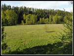
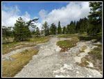
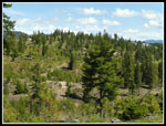
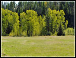
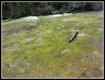
I was curious if you could drive all the way to near Exclamation Point Rock. At 1.75 miles I found the answer. The gate ended all vehicle access. I went around the gate and continued. Shortly the forest between me and the river turned into a huge meadow. Trees lined the meadow and green grasses covered the ground over to the road. The road came to an abrupt switchback. From Google Earth it appeared that the road had washed out at some point in the past. The old road continued on. This trip was long enough I did not want to find a steep slope, a high river, and no way through. I chose to head up the switchback. My map did show the next left hand turn. I expected the road to be on a hillside above the river. Not so. At the junction I turned left and began to parallel the river on a big flat plateau a few hundred feet above the river. I saw some wildflowers blooming here and in many spots along the roads.
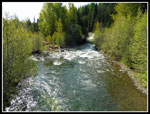
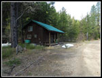
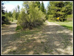
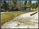
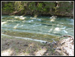
This section seemed to go on far longer than it should. The road gains a little, drops to cross a creek, and then begins to drop back down to the river. I was making very good time. The forecast was for up to 25 mph winds and so far I had had headwinds of 5-10 mph. A little chilly but not too bad. I dropped down to the road and saw a berm blocking the other end of the old washed out road. Perhaps someday I'll check it out. A short walk near the river and I reached the junction with the bridge. My GPS read about 5.5 miles to here. That's about what I guesstimated for the entire distance. It would be a bit longer than I had planned. The river was really raging. Probably as high as it gets in the spring. Across the river I passed a nicely maintained cabin and came to two junctions. The middle of the three road options seemed to be the correct one and it was.
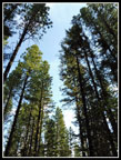
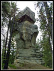
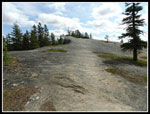
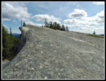
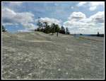
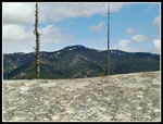
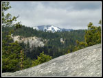
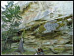
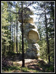
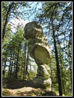
Then the road began to climb. Much of the day's elevation gain comes in the next mile. The bikers GPS track is on the left side of the river from where I parked. I had now intersected their route. This part I had seen on my cell phone I had left at home. By memory regarding where to leave the road and distance I recalled from the bridge I turned off on what I thought was the trail up to the ridge top and the Rock. It soon was clearly not a bike path. Back to the road and a little farther I found the correct route. It goes more steeply uphill on grass then flat rock slabs above the grasses. A really neat topography. 6+ miles of road walking brought me to the best part. As I neared the ridge Mammoth Rock became visible to my left. The trail reached the ridge top in forest and not far away was Exclamation Point Rock. It looks like a Mayan ruin sitting in trees even taller than it is. It is quite an unusual sight. The amazing thing is that the top is larger than the bottom. How has it managed to stand for so many years?
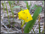
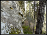
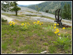
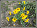
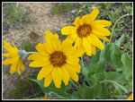
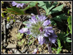
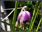
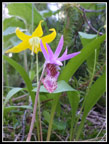
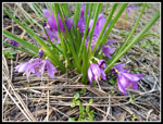
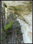
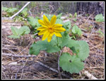
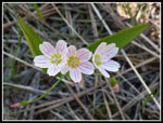
I took a number of photos from several angles. It is very narrow form one angle and much wider from another. Seeing it was well worth the physical effort and mental effort to figure out just where it is. I could see that I was very close to Mammoth Rock. That was the other sight I wanted to visit. I expected to be able to walk right onto the big rock. There is a spot for a rock climber to get up the 15 or so feet to get on top. Solo I was not ready to fall then roll all the way down from the ridge top. The bike trail cuts around the right edge of the Rock. The route is right on the steep slope. It is plenty wide to walk on. At the top edge of Mammoth Rock it is vertical to even overhanging. It is all sandstone. I saw a lot of sandstone a few weeks earlier at the Rock Trail on Chuckanut Mountain. It is not something often seen in Washington state. The route went quite a long way to get to the other end where I could get on top. There were a bunch of wildflowers in bloom including, balsamroot, lupine. grass widows, glacier lilies, spring beauty, and calypso orchids. Far more wildflowers in bloom here than on any other part of the trip.
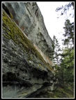
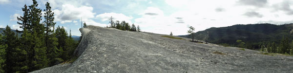
Once on top it is clear that this escarpment is enormous. The gently sloping rock is very sticky providing good traction. I had seen a video online showing bikes crossing it. It is much more impressive in person. On a better day I could have spent a few hours laying in the sun. This day it was mostly cloudy and probably in the upper 40s with a strong wind. I bundled up. I reached Exclamation Point Rock at 10:20 am. Only 2:02 to cover 6.5+ miles. I had plenty of time to enjoy the spot before heading back. After crossing Mammoth Rock I was looking right down that spot I did not want to try rock climbing up. Down below I saw two then a third turkey. They were spooked before I could get my camera out. This is not the first time I have seen them in the Teanaway. On the way back I passed two groups of hunters. It seems this is turkey hunting season. I was the only person to actually see them this day.
I spent 1:30 at the Rocks. By 11:50 am I packed up and headed down. It was still early but it had been cold on top. It even rained for a few minutes. One more stop at Exclamation Point Rock. The lighting had changed quite a bit. Then it was down the grass and slabs. I navigated by following exposed slabs. It worked great. In no time I was back at the road. This is the hard part of a long road walk. 7.5 miles done and still about 6 more miles of road to walk. I never did see any bikers or hikers. Down to the bridge and the sun began to shine. It was warm for the climb back up the road and around the washed out road along the river. The road seemed to be getting longer. I saw two deer in a meadow near the road. I doubt they see many people.
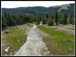
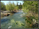
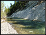
I did see two motorcycles go past me. I don't think they are now allowed on these roads. The folks at the cabin must have a key to the gate and an exemption to drive to it. The motorcyclists may have been them. When I made it back to the gate I finally saw a truck and two of the turkey hunters. Nice guys. Walking back I saw a trail leading towards the river and took it. Why not another side trip. The river was very high. The trail continued on the other side. I would guess the water was at least four feet deep and running fast. At least up to my waist. Crossing would be a bad idea this time of year. When I reached that first road I passed in the morning which headed uphill I started looking for the missing road that went over to the river then downstream to the gate where I parked. I found it. The junction has been obliterated but grassy old tire tracks are visible across the meadow. I took this route back. The river is worth a trip on its own here. A steep white wall on one side. White rock slabs on my side. The white rock continues under the river. The white rock makes the bottom of the river very visible. I spent some time just enjoying this amazing geology.
By 2:40 pm I was on the road for home. By 4:30 pm I was home back in North Seattle. That is a very early return for a Teanaway hike. For the day I hiked at least 13 miles. My GPS said 14.9 but that is too high. Call it 13+ miles. While the Rocks are only 800' above the parking lot there are ups and downs. I calculated about 1600' of gain. This was another of the dreaded road walks that folks avoid like the plague. Once again a road walk with virtually total solitude. The wildflower show was good. The deer and turkey sightings were unexpected. The destination lived up to my expectations and then some. I managed to navigate pretty well though having the correct electronics would have helped. Experience with outdated maps also helped. All in all, a really fun first day in the Teanaway Community Forest.
Click on thumbnails to get
larger pictures.
Trips - 2016
Home
Mountain bikers reach the site on a series of trails in 8.5 miles. 17 miles round trip makes for a long day. I was not sure of the difficulty of the trails and did not want to be alone when I fell off and hurt myself. I looked for a shorter way to do it on foot. I found a road route that was shorter. Unfortunately, with logging the maps showed some roads not on other maps. I was not at all sure which went through. This would be a bit more of an adventure than most road walks. To make matters more interesting, my GPS unit would not load a track I found online. The map on the GPS was way outdated too. I have two cell phones, personal and business. The personal does not download maps with Gaia software. The other phone has a different version of Android and does. I loaded a map a few days earlier and successfully loaded the GPS track. All set to go.
I was out the door by 6:15 am on Sunday. It rained off and on on the west side. Once over Snoqualmie Pass the rain ended. by Cle Elum it was partly sunny. I headed up the NF Teanaway Road and turned onto the West Fork Teanaway Road. It quickly came to the end of pavement at a big turnaround. My research said that their were two roads heading out along the right side of the river. Another dropped to cross the river on a bridge. I expected them all to be gated. I was wrong. The left road does drop to the river. The middle road is gated and heads out near the river. The right road heads gently uphill paralleling the river. It is not gated. I could drive at least a little farther on that road. I chose not too. At 8:18 am I headed up the right most road.
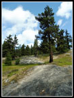
The maps show the right and middle roads coming together a half mile or so upriver. I figured I'd take the other road on the way back. I immediately saw two deer run across the road. Off to a promising start. There was a rocky spot near the start where a washout was repaired. Most of the rest of the road was more hard dirt than rock. Hard but better than most road walks. I stopped at the first road heading off uphill to the right. This should be the shortest route. Just before that road the middle road along the river comes up to meet the right road. Except there was no road. Was this right turn the road I wanted.? That road was not on my GPS map. Time to turn on the phone GPS. I loaded the GPS app and... a crisscrossed blank screen. No map. Uh oh... I always use my personal cell phone. The business one has the loaded map and GPS track. So much for electronic help. With that in mind I headed straight on the main road.
I was curious if you could drive all the way to near Exclamation Point Rock. At 1.75 miles I found the answer. The gate ended all vehicle access. I went around the gate and continued. Shortly the forest between me and the river turned into a huge meadow. Trees lined the meadow and green grasses covered the ground over to the road. The road came to an abrupt switchback. From Google Earth it appeared that the road had washed out at some point in the past. The old road continued on. This trip was long enough I did not want to find a steep slope, a high river, and no way through. I chose to head up the switchback. My map did show the next left hand turn. I expected the road to be on a hillside above the river. Not so. At the junction I turned left and began to parallel the river on a big flat plateau a few hundred feet above the river. I saw some wildflowers blooming here and in many spots along the roads.
This section seemed to go on far longer than it should. The road gains a little, drops to cross a creek, and then begins to drop back down to the river. I was making very good time. The forecast was for up to 25 mph winds and so far I had had headwinds of 5-10 mph. A little chilly but not too bad. I dropped down to the road and saw a berm blocking the other end of the old washed out road. Perhaps someday I'll check it out. A short walk near the river and I reached the junction with the bridge. My GPS read about 5.5 miles to here. That's about what I guesstimated for the entire distance. It would be a bit longer than I had planned. The river was really raging. Probably as high as it gets in the spring. Across the river I passed a nicely maintained cabin and came to two junctions. The middle of the three road options seemed to be the correct one and it was.
Then the road began to climb. Much of the day's elevation gain comes in the next mile. The bikers GPS track is on the left side of the river from where I parked. I had now intersected their route. This part I had seen on my cell phone I had left at home. By memory regarding where to leave the road and distance I recalled from the bridge I turned off on what I thought was the trail up to the ridge top and the Rock. It soon was clearly not a bike path. Back to the road and a little farther I found the correct route. It goes more steeply uphill on grass then flat rock slabs above the grasses. A really neat topography. 6+ miles of road walking brought me to the best part. As I neared the ridge Mammoth Rock became visible to my left. The trail reached the ridge top in forest and not far away was Exclamation Point Rock. It looks like a Mayan ruin sitting in trees even taller than it is. It is quite an unusual sight. The amazing thing is that the top is larger than the bottom. How has it managed to stand for so many years?
I took a number of photos from several angles. It is very narrow form one angle and much wider from another. Seeing it was well worth the physical effort and mental effort to figure out just where it is. I could see that I was very close to Mammoth Rock. That was the other sight I wanted to visit. I expected to be able to walk right onto the big rock. There is a spot for a rock climber to get up the 15 or so feet to get on top. Solo I was not ready to fall then roll all the way down from the ridge top. The bike trail cuts around the right edge of the Rock. The route is right on the steep slope. It is plenty wide to walk on. At the top edge of Mammoth Rock it is vertical to even overhanging. It is all sandstone. I saw a lot of sandstone a few weeks earlier at the Rock Trail on Chuckanut Mountain. It is not something often seen in Washington state. The route went quite a long way to get to the other end where I could get on top. There were a bunch of wildflowers in bloom including, balsamroot, lupine. grass widows, glacier lilies, spring beauty, and calypso orchids. Far more wildflowers in bloom here than on any other part of the trip.
Once on top it is clear that this escarpment is enormous. The gently sloping rock is very sticky providing good traction. I had seen a video online showing bikes crossing it. It is much more impressive in person. On a better day I could have spent a few hours laying in the sun. This day it was mostly cloudy and probably in the upper 40s with a strong wind. I bundled up. I reached Exclamation Point Rock at 10:20 am. Only 2:02 to cover 6.5+ miles. I had plenty of time to enjoy the spot before heading back. After crossing Mammoth Rock I was looking right down that spot I did not want to try rock climbing up. Down below I saw two then a third turkey. They were spooked before I could get my camera out. This is not the first time I have seen them in the Teanaway. On the way back I passed two groups of hunters. It seems this is turkey hunting season. I was the only person to actually see them this day.
I spent 1:30 at the Rocks. By 11:50 am I packed up and headed down. It was still early but it had been cold on top. It even rained for a few minutes. One more stop at Exclamation Point Rock. The lighting had changed quite a bit. Then it was down the grass and slabs. I navigated by following exposed slabs. It worked great. In no time I was back at the road. This is the hard part of a long road walk. 7.5 miles done and still about 6 more miles of road to walk. I never did see any bikers or hikers. Down to the bridge and the sun began to shine. It was warm for the climb back up the road and around the washed out road along the river. The road seemed to be getting longer. I saw two deer in a meadow near the road. I doubt they see many people.
I did see two motorcycles go past me. I don't think they are now allowed on these roads. The folks at the cabin must have a key to the gate and an exemption to drive to it. The motorcyclists may have been them. When I made it back to the gate I finally saw a truck and two of the turkey hunters. Nice guys. Walking back I saw a trail leading towards the river and took it. Why not another side trip. The river was very high. The trail continued on the other side. I would guess the water was at least four feet deep and running fast. At least up to my waist. Crossing would be a bad idea this time of year. When I reached that first road I passed in the morning which headed uphill I started looking for the missing road that went over to the river then downstream to the gate where I parked. I found it. The junction has been obliterated but grassy old tire tracks are visible across the meadow. I took this route back. The river is worth a trip on its own here. A steep white wall on one side. White rock slabs on my side. The white rock continues under the river. The white rock makes the bottom of the river very visible. I spent some time just enjoying this amazing geology.
By 2:40 pm I was on the road for home. By 4:30 pm I was home back in North Seattle. That is a very early return for a Teanaway hike. For the day I hiked at least 13 miles. My GPS said 14.9 but that is too high. Call it 13+ miles. While the Rocks are only 800' above the parking lot there are ups and downs. I calculated about 1600' of gain. This was another of the dreaded road walks that folks avoid like the plague. Once again a road walk with virtually total solitude. The wildflower show was good. The deer and turkey sightings were unexpected. The destination lived up to my expectations and then some. I managed to navigate pretty well though having the correct electronics would have helped. Experience with outdated maps also helped. All in all, a really fun first day in the Teanaway Community Forest.
 Starting Out |
 More Dirt Than Rocky |
 Big Meadow |
 Brightly Lit Trees |
 Bypass Road |
 Tall Trees |
 Not A Road |
 Glacier Lily |
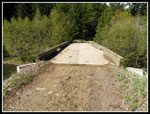 WF Bridge |
 WF Teanaway River |
 Private Property |
 Tree Down |
 Off The Road |
 Trees & Rock |
 Rock Route |
 Something's There |
 Exclamation Point Rock |
 Different Angle |
 Rock Wall |
 Mammoth Wall |
 Wildflowers |
 Balsamroot |
 Close Up |
 Onto The Rock |
 Traversing Rock |
 Still Going |
 Framed Peak |
 More Rock Walls |
 Looking Down |
 Heading Back |
 Ball Head Waterleaf |
 Calypso |
 Calypso Glacier Lily |
 Grass Widows |
 Along The Wall |
 Duck! |
 Back At Exclamation |
 Clear View |
 Arnica |
 Mammoth Rock |
 Rock Pathway |
 Look Back To Rock |
 Nearby Meadow |
 Back At Bridge |
 Road Split |
 Roadside View |
 Nice Afternoon Lighting |
 At The River |
 Spring Beauty |
 Near The End |
 Green River |
 White Banks |
 River Lanes |
 Panorama View Of Mammoth Rock |
Trips - 2016
Home