6-12-16
So
far this year I hiked up the
West Fork Teanaway River to Exclamation Point. I also hiked up to Iron
Bear and Jester Peaks. I had not been up the main North Fork Teanaway
River Valley. Time to correct that. Navaho is an old favorite. A check
of my hiking log shows that this would be my 16th visit to the summit.
Several trips included Three Brothers. I have also hiked it in six
different months from April to November. The crowds have really picked
up on this trip over the last six or seven years. I planned a fairly
early start and was on the road by 6:10 am. I reached the Stafford
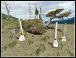
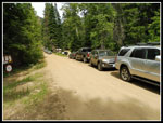
Creek trailhead at 8:05 am. All the parking in the main lot was taken.
Cars were parked along the road. I could have fit into a spot along the
road above the lot but it was on the road. I chose instead to drive
back across the bridge and park a short way off the road. So much for
beating the crowds. I was on the trail at 8:17 am. This day was
supposed to warm up to the low 60s at the trailhead and low 50s near
the summit. I started with long sleeves and long pants.
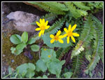
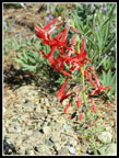
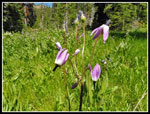
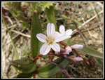
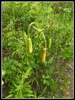
I saw a photo from a few days before and chose to take light boots, no ice axe, and no microspikes. This proved to be a good choice. Wildflowers are starting along the trail but it real color is still a week or two away. I saw some Indian paintbrush, vanilla leaf, serviceberry, arnica, Nootka rose, spirea, valerian, glacier lilies, shooting stars, and more. Most were in small numbers. There were a few good patches of shooting stars higher up. I saw three scarlet gilia flowers and almost no spring beauty. Those should be out in force soon. A mile or so up the trail I met the first group coming down. They mentioned that it was very cold overnight. It seems that it was sub freezing and there was a little but of snow falling. Welcome to mid June in the Cascade Mountains.
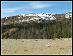
Before too long the pant legs came off and a short sleeve shirt went on. Not the cool day I was expecting. In fact, by 9:30 am it was warmer than the expected high for the day. There are a couple creek crossings and they were no problem. When I came out of the forest I had a good look up at Little Navaho and could see the west side was snow free. One group zoomed by while I was taking a photo and I did not see them again until the summit. Meanwhile the traffic coming down was consistent. I guess that cold night was reason enough for them to get moving early. I passed at least twenty folks who were hiking down. It seems that a lot of the crowd were backpackers who went up on Friday. One person mentioned hearing that the NF Teanaway road was closed higher up. That too could have caused folks who would have gone to Ingalls Pass/Esmerelda Basin to head to Stafford Creek.
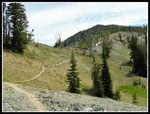
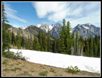
At the junction with the Standup Creek trail I found a big patch of shooting stars. There were more along the switchbacks up to the meadow. At one switchback there was a very big patch just off the trail. Those nearly flat switchbacks may be good for horses but they really add distance to the hike. I still remember the old trail that went nearly straight up the not so steep slope. I figured that with all the campers already headed down the meadow would be pretty empty. Not at all. I arrived to find quite a few tents still there. I have no idea where all the others who had left found a camping spot. I took a food and water break at the meadow and applied lots of sunscreen. While I had read about bad bugs I saw very few all day long. No bug dope needed.
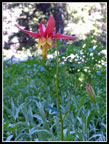
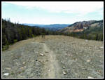
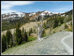
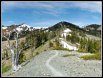
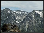
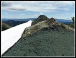
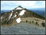
The last push to Navaho Pass went quickly. There was one snow patch below the trail. There is none at all on the trail. I did see a patch of red and a few yellow Indian paintbrush on the last switchback. The sky was all blue and it was very clear looking across to the Stuart Range. Mt. Stuart is not in sight but Dragontail, Little Annapurna, and McClellan Peaks are right across the valley of Ingalls Creek. With six miles and 2900' of gain out of the way it was time for the steep part. The last 1200+ feet is done in less than a mile. The route up was once a barely perceptible boot path once off the County Line Trail. Now I could not even see the junction. The only trail is the well beaten down trail to the summit. I was dragging a bit going up. The steepest part ends where the route tops out on a ridge. From there up it is not very steep. It was, however, largely snow covered. My lightweight boots/shoes did not have much traction. Poles did help. Soon enough I was onto bare dirt and approaching the summit.
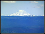
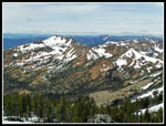
Half a dozen or more folks were on the summit. For the first time in many visits the wind was not blowing hard. In fact, it was almost non existent. I arrived at 12:00 pm. Not a great time but with a few breaks and many photos 3:43 was not too bad. I arrived just in time for lunch. Nearly seven miles and 4200' of elevation gain will make for a good appetite. With the early start, time was not a problem. I spent about 35 minutes on top. Several more groups came and went in that time. A few white clouds were blowing in but the views were outstanding. Mt. Rainier and Mt. Adams were clear to the south though Rainier was partly cloaked by the time I left. All closer peaks were in the clear. Mt. Stuart is melting fast but still has some white left. Mt. Daniel showed up just right of Ingalls Peaks and was still very snowy. Great views all around.
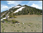
I headed down at 12:35 pm. My preferred route is down the east ridge. There was still snow for the first part. I avoided some by staying right of the ridge. I boot skied some of it. Boot skiing works pretty good when you do not have much tread on your boots. To my surprise I met one group coming up. They were doing my route in reverse. I like doing it clockwise as you miss the heavier afternoon traffic on the trail. I would only have about 3.5 miles on the main trail going down. The snow thinned out as I descended. There is still a lot of snow on the left side of the ridge. I dropped down to where the County Line Trail comes through. The switchbacks down the slope heading towards Three Brothers are still fully under snow. An ice axe would be a good idea for a few weeks more if heading that way. From the bottom of the slope to the top of the western Brother's summit looked to be snow free.
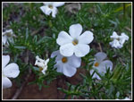
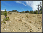
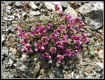
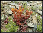
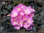
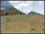
I continued along the ridge crest to the scramble section. One steeper spot and I was at the top of the scree slope. It is dark black volcanic rock and does not look like normal scree. The switchbacking path down the slope is starting to disappear. Part of it is still there. Not to difficult to descend. Part way down I was very surprised to find a whole lot of desert wildflowers in bloom. By far the best wildflower display of the day. The best I have seen this year. Many pink bitterroot were blooming. The colors were among the best I have seen. I also found some patches of white bitterroot. There were onions too. More than a dozen varieties of flowers in bloom. A very nice surprise to find.
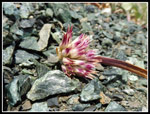
Down at the saddle between Navaho and Little Navaho I poured rocks out of my boots and laced them up tight for the next part. The drop down to the Stafford Creek Trail is on steep grass and rock. It is largely in forest. This route is much steeper than the main trail up Navaho but also much shorter. Several miles shorter. My knees had a good workout as I dropped to the trail. A little way above the trail I reached a big patch of Columbia lewisia. I notice it on each visit. Back on the trail I just had the easy trail out. Easy grade but it is rocky. With all my flower photos I took almost two hours descending from the summit to the trail. The last 3.5 miles took only 1:20.
After all the years and 16 visits, this is still among my favorite hikes. Lots of miles and elevation gain. Lots of flowers in season. Now there are lots of people. No, nothing like hikes along I-90 west of Snoqualmie Pass. Not crowded enough to really bother me. The summit is a heck of a viewpoint as you might expect from 7223'. I was back at my car by 3:40 pm and home by 6:00 pm. It was sunny most all day but not too hot. A most excellent day spent on the trail.
Click on thumbnails to get
larger pictures.
Trips - 2016
Home
I saw a photo from a few days before and chose to take light boots, no ice axe, and no microspikes. This proved to be a good choice. Wildflowers are starting along the trail but it real color is still a week or two away. I saw some Indian paintbrush, vanilla leaf, serviceberry, arnica, Nootka rose, spirea, valerian, glacier lilies, shooting stars, and more. Most were in small numbers. There were a few good patches of shooting stars higher up. I saw three scarlet gilia flowers and almost no spring beauty. Those should be out in force soon. A mile or so up the trail I met the first group coming down. They mentioned that it was very cold overnight. It seems that it was sub freezing and there was a little but of snow falling. Welcome to mid June in the Cascade Mountains.
Before too long the pant legs came off and a short sleeve shirt went on. Not the cool day I was expecting. In fact, by 9:30 am it was warmer than the expected high for the day. There are a couple creek crossings and they were no problem. When I came out of the forest I had a good look up at Little Navaho and could see the west side was snow free. One group zoomed by while I was taking a photo and I did not see them again until the summit. Meanwhile the traffic coming down was consistent. I guess that cold night was reason enough for them to get moving early. I passed at least twenty folks who were hiking down. It seems that a lot of the crowd were backpackers who went up on Friday. One person mentioned hearing that the NF Teanaway road was closed higher up. That too could have caused folks who would have gone to Ingalls Pass/Esmerelda Basin to head to Stafford Creek.
At the junction with the Standup Creek trail I found a big patch of shooting stars. There were more along the switchbacks up to the meadow. At one switchback there was a very big patch just off the trail. Those nearly flat switchbacks may be good for horses but they really add distance to the hike. I still remember the old trail that went nearly straight up the not so steep slope. I figured that with all the campers already headed down the meadow would be pretty empty. Not at all. I arrived to find quite a few tents still there. I have no idea where all the others who had left found a camping spot. I took a food and water break at the meadow and applied lots of sunscreen. While I had read about bad bugs I saw very few all day long. No bug dope needed.
The last push to Navaho Pass went quickly. There was one snow patch below the trail. There is none at all on the trail. I did see a patch of red and a few yellow Indian paintbrush on the last switchback. The sky was all blue and it was very clear looking across to the Stuart Range. Mt. Stuart is not in sight but Dragontail, Little Annapurna, and McClellan Peaks are right across the valley of Ingalls Creek. With six miles and 2900' of gain out of the way it was time for the steep part. The last 1200+ feet is done in less than a mile. The route up was once a barely perceptible boot path once off the County Line Trail. Now I could not even see the junction. The only trail is the well beaten down trail to the summit. I was dragging a bit going up. The steepest part ends where the route tops out on a ridge. From there up it is not very steep. It was, however, largely snow covered. My lightweight boots/shoes did not have much traction. Poles did help. Soon enough I was onto bare dirt and approaching the summit.
Half a dozen or more folks were on the summit. For the first time in many visits the wind was not blowing hard. In fact, it was almost non existent. I arrived at 12:00 pm. Not a great time but with a few breaks and many photos 3:43 was not too bad. I arrived just in time for lunch. Nearly seven miles and 4200' of elevation gain will make for a good appetite. With the early start, time was not a problem. I spent about 35 minutes on top. Several more groups came and went in that time. A few white clouds were blowing in but the views were outstanding. Mt. Rainier and Mt. Adams were clear to the south though Rainier was partly cloaked by the time I left. All closer peaks were in the clear. Mt. Stuart is melting fast but still has some white left. Mt. Daniel showed up just right of Ingalls Peaks and was still very snowy. Great views all around.
I headed down at 12:35 pm. My preferred route is down the east ridge. There was still snow for the first part. I avoided some by staying right of the ridge. I boot skied some of it. Boot skiing works pretty good when you do not have much tread on your boots. To my surprise I met one group coming up. They were doing my route in reverse. I like doing it clockwise as you miss the heavier afternoon traffic on the trail. I would only have about 3.5 miles on the main trail going down. The snow thinned out as I descended. There is still a lot of snow on the left side of the ridge. I dropped down to where the County Line Trail comes through. The switchbacks down the slope heading towards Three Brothers are still fully under snow. An ice axe would be a good idea for a few weeks more if heading that way. From the bottom of the slope to the top of the western Brother's summit looked to be snow free.
I continued along the ridge crest to the scramble section. One steeper spot and I was at the top of the scree slope. It is dark black volcanic rock and does not look like normal scree. The switchbacking path down the slope is starting to disappear. Part of it is still there. Not to difficult to descend. Part way down I was very surprised to find a whole lot of desert wildflowers in bloom. By far the best wildflower display of the day. The best I have seen this year. Many pink bitterroot were blooming. The colors were among the best I have seen. I also found some patches of white bitterroot. There were onions too. More than a dozen varieties of flowers in bloom. A very nice surprise to find.
Down at the saddle between Navaho and Little Navaho I poured rocks out of my boots and laced them up tight for the next part. The drop down to the Stafford Creek Trail is on steep grass and rock. It is largely in forest. This route is much steeper than the main trail up Navaho but also much shorter. Several miles shorter. My knees had a good workout as I dropped to the trail. A little way above the trail I reached a big patch of Columbia lewisia. I notice it on each visit. Back on the trail I just had the easy trail out. Easy grade but it is rocky. With all my flower photos I took almost two hours descending from the summit to the trail. The last 3.5 miles took only 1:20.
After all the years and 16 visits, this is still among my favorite hikes. Lots of miles and elevation gain. Lots of flowers in season. Now there are lots of people. No, nothing like hikes along I-90 west of Snoqualmie Pass. Not crowded enough to really bother me. The summit is a heck of a viewpoint as you might expect from 7223'. I was back at my car by 3:40 pm and home by 6:00 pm. It was sunny most all day but not too hot. A most excellent day spent on the trail.
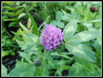 Clover |
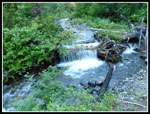 Small Waterfall |
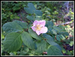 Rose |
 Indian Paintbrush |
 Arnica |
 Phlox |
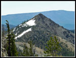
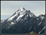
 Little Navaho Peak |
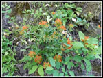
 Scarlet Gilia |
 Columbine |
 Trail Junction |
 Patch Of Shooting Stars |
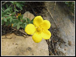 Small Yellow Flower |
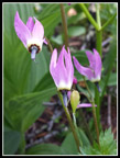 Shooting Stars |
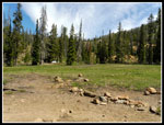 Meadow |
 Heading Higher |
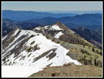
 Earl Peak |
 Moonscape |
 Nearing Navaho Pass |
 View From Pass |
 Looking Back |
 Across Navaho Pass |
 Douglasia |
 Little Navaho |
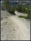 Steep Boot Path |
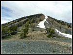
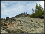 Nearing Navaho Summit |
 Mt. Adams |
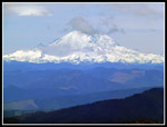 Mt. Rainier |
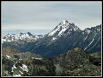
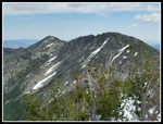 Three Brothers |
 Looking southwest |
 Enchantment Peaks |
 Mt. Stuart |
 Ingalls & Stuart |
 Heading Down Ridge |
 Looking To Navaho |
 Spring Beauty |
 Stonecrop |
 More Phlox |
 Black & White Rock |
 Saddle Is Below |
 Colorful Pods |
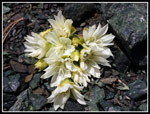 White Bitterroot |
 Bunch Of Bitterroot |
 Onion |
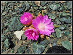 Very Pink Bitterroot |
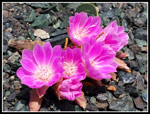 Best Flower This Year |
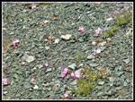 Lots Of Bitterroot |
 At The Saddle |
 Number 4 |
 Heading Down |
 Back On Trail |
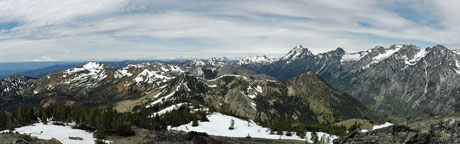 Teanaway Panorama From Navaho Peak |
 Tiger Lily |
 Lots Of Cars |
Trips - 2016
Home