9-03-17
Kim
wanted to head up to Mt. Baker for a trip on the Scott Paul Trail. We
hiked the trail and added Park Butte lookout in
2007. Kim had been back but I
had not. It looked like a spot that would miss the smoke from numerous
fires burning in the state plus in Oregon and British Columbia. We met
in Shoreline at 6:45 am and headed north. Up to Highway 20 then east to
the Baker Lake Road. The last nine miles are on gravel. The road has
some big potholes in the first few miles and is better farther along.
We arrived at the trailhead at about 9:10 am. Most parking spots were
taken but I found a spot alongside the road near the start of the
trail. By 9:25 am we were on the trail. Very quickly we came to the
Scott Paul Trail junction. A vast majority of folks head up the Part
Butte trail to the lookout or Railroad Grade. We took the longer route.
It reaches the upper trail junction in about 5.5 miles vs. 2 miles on
the Park Butte Trail. The uphill grade is very smooth and gently
graded. It also begins in forest.
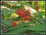
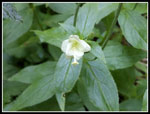
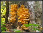
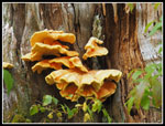
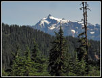
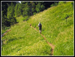
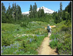
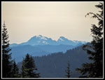
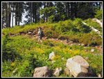
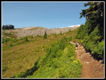
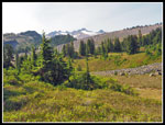
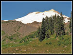
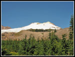
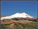
We were not far up the trail when Kim noticed some very orange fungus on a tree. We spent the next ten minutes viewing and photographing them. Some of the most colorful fungus I have seen. Back on trail we saw a lot of big trees. Not huge at high elevations but very old growth. We saw a few wildflowers and some mountain ash berries. The grade smoothly gains elevation. After several miles at 4800' the forest thinned. We had some views up to Mt. Baker. Across a small meadow we had great views of Mt. Shuksan. The grade eased and we began a long traverse around Mt. Baker. Up over a number of small ridges and down into more basins.
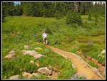
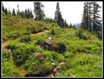
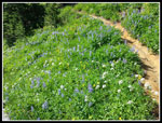
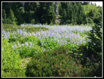
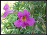
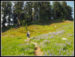
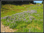
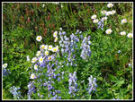
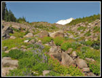
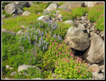
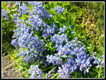
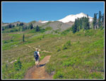
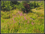
Monkey Flower became more prevalent. Soon lupine joined in. There was a lot of lupine still in bloom. Far more color than I expected in early September. It was rapidly warming up in the open sections. There were enough short forested sections to provide enough shade. We occasionally had some cool breezes too. Many of the creeks were dry or just seeping. Any amount of water provided for a flower garden. One creek was big enough to require several rock hops. Most were very small. The trail continues for 5.5 miles before meeting up with the Park Butte Trail. Much of it is high elevation roaming.
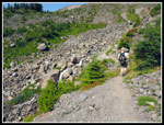
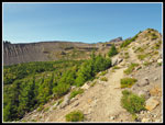
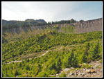
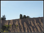
After crossing more ridges Railroad Grade came into view. Nobody passed us in our direction but we did pass a number of folks going clockwise. The moraine wall of Railroad Grade slowly drew closer. The descent was steeper than our ascent. It was much warmer. A few folks heading up were struggling a bit. One of the fun parts of the trip is crossing the suspension bridge right before reaching Railroad Grade. I went across first and took a video of Kim crossing. The bridge is bouncy and the creek is loud. It made for an interesting crossing. From there we ascended gently the grade while it dropped down. We were soon on top. We crossed one more creek and reached the Park Butte Trail junction. From there it is just 2.0 miles back to the trailhead.
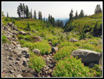
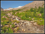
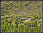
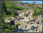
We were not at all surprised to find many more hikers on the trail now. The route switchbacks down a steep slope to Rocky Creek. There are quite a few new structures on the trail since my last snow free visit in 2007. The trail is also pretty dusty. I don't recall that. After dropping down in forest we came to the very wide swathe where Rocky Creek runs. Last time we had one big creek at the far end of the wide gravel and rock flats. Now we had a creek at the near end. Another is in the middle and another small one at the far end. The largest creek has a portable metal bridge across. That made it easy. The others were just rock hops. The path of Rocky Creek has changed many times since my first visit some thirty years ago.
The rest of the way back was mostly flattish. Closer to the end we entered Schreiber's Meadow. There were some blueberries but they were mostly small. The Scott Paul trail head some better berries. We crossed the final bridge and reached the trailhead at 4:52 pm. The lot was still mostly full and largely in shade. I had just enough water to last the full day.
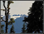
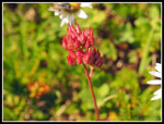
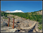
This proved to be a great trip. It was hot but cooler than staying back in Seattle. The wildfire smoke stayed away. We had good views out from high on the trail. Glacier Peak, Sloan, Whitehorse, and Three Fingers were easy to pick out. Baker and Shuksan were often in view. The flower display was much better than expected. We saw others but had a lot of solitude on the Scott Paul part of the trip. We started at 3340' and reached as high at 5240'. For the day we hiked 8 miles with 2000' of elevation gain. Even with the long drive home I arrived just before dark. The Scott Paul Trail is worth the trip. With some more effort Park Butte can be added. I still need to go back for the fall leaf colors. We definitely were happy with the conditions this day.
Click on thumbnails to get
larger pictures.
Trips - 2017
Home
We were not far up the trail when Kim noticed some very orange fungus on a tree. We spent the next ten minutes viewing and photographing them. Some of the most colorful fungus I have seen. Back on trail we saw a lot of big trees. Not huge at high elevations but very old growth. We saw a few wildflowers and some mountain ash berries. The grade smoothly gains elevation. After several miles at 4800' the forest thinned. We had some views up to Mt. Baker. Across a small meadow we had great views of Mt. Shuksan. The grade eased and we began a long traverse around Mt. Baker. Up over a number of small ridges and down into more basins.
Monkey Flower became more prevalent. Soon lupine joined in. There was a lot of lupine still in bloom. Far more color than I expected in early September. It was rapidly warming up in the open sections. There were enough short forested sections to provide enough shade. We occasionally had some cool breezes too. Many of the creeks were dry or just seeping. Any amount of water provided for a flower garden. One creek was big enough to require several rock hops. Most were very small. The trail continues for 5.5 miles before meeting up with the Park Butte Trail. Much of it is high elevation roaming.
After crossing more ridges Railroad Grade came into view. Nobody passed us in our direction but we did pass a number of folks going clockwise. The moraine wall of Railroad Grade slowly drew closer. The descent was steeper than our ascent. It was much warmer. A few folks heading up were struggling a bit. One of the fun parts of the trip is crossing the suspension bridge right before reaching Railroad Grade. I went across first and took a video of Kim crossing. The bridge is bouncy and the creek is loud. It made for an interesting crossing. From there we ascended gently the grade while it dropped down. We were soon on top. We crossed one more creek and reached the Park Butte Trail junction. From there it is just 2.0 miles back to the trailhead.
We were not at all surprised to find many more hikers on the trail now. The route switchbacks down a steep slope to Rocky Creek. There are quite a few new structures on the trail since my last snow free visit in 2007. The trail is also pretty dusty. I don't recall that. After dropping down in forest we came to the very wide swathe where Rocky Creek runs. Last time we had one big creek at the far end of the wide gravel and rock flats. Now we had a creek at the near end. Another is in the middle and another small one at the far end. The largest creek has a portable metal bridge across. That made it easy. The others were just rock hops. The path of Rocky Creek has changed many times since my first visit some thirty years ago.
The rest of the way back was mostly flattish. Closer to the end we entered Schreiber's Meadow. There were some blueberries but they were mostly small. The Scott Paul trail head some better berries. We crossed the final bridge and reached the trailhead at 4:52 pm. The lot was still mostly full and largely in shade. I had just enough water to last the full day.
This proved to be a great trip. It was hot but cooler than staying back in Seattle. The wildfire smoke stayed away. We had good views out from high on the trail. Glacier Peak, Sloan, Whitehorse, and Three Fingers were easy to pick out. Baker and Shuksan were often in view. The flower display was much better than expected. We saw others but had a lot of solitude on the Scott Paul part of the trip. We started at 3340' and reached as high at 5240'. For the day we hiked 8 miles with 2000' of elevation gain. Even with the long drive home I arrived just before dark. The Scott Paul Trail is worth the trip. With some more effort Park Butte can be added. I still need to go back for the fall leaf colors. We definitely were happy with the conditions this day.
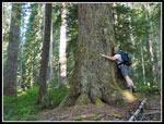 Tree Hugger Kim |
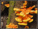 Very Orange Fungus |
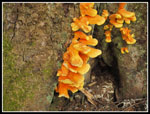 More Fungus |
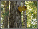 Big Shelf Fungus |
 Elderberries |
 Unknown Flower |
 Even More Fungus |
 Last Fungus |
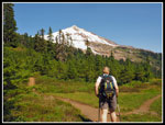 First Look At Baker |
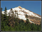 Closer Look At Baker |
 Mt. Shuksan |
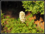 Bistort |
 Kim In Yellow Meadow |
 Glaciated Peak |
 Lupine Time |
 September Flowers? |
 Whitehorse & 3 Fingers |
 Colorful Meadow |
 Lined With Wildflowers |
 Lots Of Lupine |
 Kim On Trail |
 High Basin |
 Rocks Ahead |
 Lewis Monkey Flower |
 Sunny & Very Warm |
 Even More Lupine |
 Very Red |
 Lupine & Daisies |
 Colorful Creek Bed |
 Wet = Green |
 Great Flower Display |
 Lupine Close Up |
 Grade In Sight |
 Another Basin |
 More Of Mt. Baker |
 Near Railroad Grade |
 Crees Are Below |
 First Creek To Cross |
 Fireweed |
 Blue & White |
 Shadows On Grade |
 Bridge In Sight |
 Suspension Bridge |
 Muddy Creek |
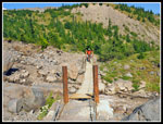 Hiker On Bridge |
 Last Mt. Baker Shot |
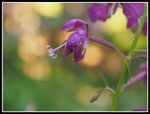 Lone Fireweed Flower |
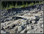 Rocky Creek Bridge |
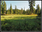 Schrieber's Meadow |
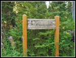 Scott Paul Junction |
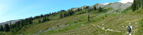 Panorama In Basin High On Scott Paul Trail |
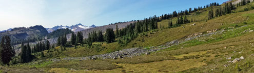 Panorama Including Railroad Grade |
Trips - 2017
Home