3-04-18
I
have been thinking about hiking Lord Hill Park for several years.
Another low elevation trip for winter walking when I do not want to
slog through snow. I had just not gotten to it. After a Thursday night
headlamp hike and a snowshoe slog on Saturday I was up for something
new without a lot of elevation gain. It was snowing in the foothills
and the mountains too. Lord Hill it would be. I had a GPS with trails
loaded to help with navigation.. There are a lot of trails in the park.
A map or GPS with maps is very helpful for exploring. A mile from home
I realized I forgot my GPS. Rather than turning around. I pulled over
and downloaded the map to my phone GPS app. Hopefully the phone battery
would last all day. I took Highway 522 to Monroe and took the
first exit. I followed the Old Snohomish Monroe Road to 127th Ave NE
and turned south following Lord Hill signs. I reached the park at 8:48
am. By 8:55 I was on my way. It was surprising to see that it was only
31 miles from my home in North Seattle. Just a little farther than
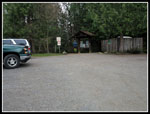
Tiger Mountain. There were half a dozen cars in the lot.
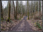
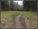
I did not have a route preplanned. This day would be figured on route. I did hope to get down to the Snohomish River and up to some viewpoint. I quickly found that most main junctions are well signed. Those on the main trails have maps included. There are also a number of mountain bike trails that have names but are not on the main maps. My GPS map had almost all the trails. My map did not have all the trail names. There are a lot of trails and a lot so a lot of junctions. Again, a map is very helpful until one starts to memorize all the trails. I headed down the Boardwalk Trail and turned right, heading for the other parking lot start. Hikers and bikers have one lot. Horse riders have another lot. I headed south and west towards Devil's Butte. I hoped to find a viewpoint there.
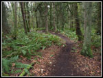
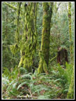
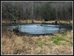
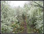
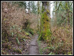
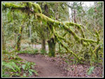
The main trails are old roads. The bike/hiker trails are much narrower. I made a clockwise loop up to Devil's Butte. Along the way I saw one hiker and one biker. For the first 7 miles I saw them plus one more biker. Much more solitude than I was expecting. I found no views on Devil's Butte and continued around a pond and onto the Springboard Trail. I had seen the other end of it earlier. This loop went through some very green and mossy forest. I saw some tiny mushrooms too. A short distance on the road/trail and I dropped down on the Lower Springboard Trail. I somehow completely missed the Meet Cutter Trail and ended up on the Main Trail. At a junction I had two trails that would lead down to the river. The River Trail Short Cut. I went down the longer River Trail. It ran into the other end of the Meet Cutter. I'll figure that one out another day.
At the Meet Cutter junction I went off the road/trail onto a smaller trail. This was the continuation of the River Trail. It soon ran into the short cut and headed down to the river. At the river I found a spot to drop through brush to the riverbank. A great spot right on the river. I walked the bank a short way and turned around. I still had a lot to see. So far I had covered 5.2 miles. The WTA description mentioned 8 miles of trail. Clearly there is a lot more. I went up the short cut back to the Main Trail junction. It is .3 miles shorter and a bit wetter. I did fine with low top boots. The junction has a bench and a trails map. I studied that and my GPS map to figure out where to go next. Two more hikers went by. Only the fourth and fifth people I had seen so far.
After a quick lunch I continued on the Main Trail heading for the Pipeline Trail. I paused my GPS during my break and did not turn it back on until reaching the Pipeline Trail. The GPS connected the two points and did not follow the trail in this spot. The Pipeline Trail is grassy. Beneath it is a gas pipeline coming from Canada. I turned north on it a short way then turned right on a trail over to Temple Pond. The pond was more scenic than I was expecting. More like a small lake. I retraced my steps to the Pipeline Trail and started the steepest climb of the day. The park has a low point at the river of about 25'. My high point of the day was about 650'. There were a number of ups and downs. It is possible to get in will over 1000' of elevation gain even with such a low high point. The pipeline gained 150' very quickly straight up the fall line.
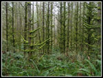
I noticed a "Viewpoint" on my map. I had to check it out. The park is full of trees both evergreen and deciduous. I could not figure where there might be a viewpoint with all the trees. I turned off left onto a small trail and shortly turned left again. The trail dropped down a little then climbed steeply to the viewpoint. I left forest onto an open bald with very good views to the south and east. The low clouds precluded any far off views. I could see the Snohomish River Valley and Highway 522 dropping the the river. A short trail took me though trees and to another viewpoint looking more east and a little north east. I could see out towards Gold Bar and Wallace Falls. Again, a clear day would provide better views.
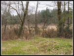
I dropped back down to the junction and headed left then right on a bike trail that climbed then dropped back to the Pipeline Trail. I turned left and headed north to another big junction. Now I headed right on the Temple Pond Loop. This 1.5 mile loop took me back south to the other side of Temple Pond. It then headed north and back to the Pipeline trail. Some very nice forest trails though there. The Pipeline trail continued north past Beaver Lake. Except Beaver Lake did not have any water in it. Right now it is not a lake. As I came within a few miles of the parking lot the crowds began to show up. Just another few junctions and I was back at the Boardwalk Trail where I started. It is uphill back to the parking lot. I arrived back at the start at 1:00 pm. I spent just about 4 hours hiking 12 miles all around Lord Hill Park. My total elevation gain was just over 1000'.
I was pleasantly surprised at the variety in the park. The river, lakes, viewpoints, and a whole lot of trails. One can do any number of routes linking numerous trails together. I did not get down to the south end of the park at all. I like more elevation gain for my close in hikes but this park easily earns one or two visits per year. I had a fun half day and was home by 2:00 pm.
Click on thumbnails to get
larger pictures.
Trips - 2018
Home
I did not have a route preplanned. This day would be figured on route. I did hope to get down to the Snohomish River and up to some viewpoint. I quickly found that most main junctions are well signed. Those on the main trails have maps included. There are also a number of mountain bike trails that have names but are not on the main maps. My GPS map had almost all the trails. My map did not have all the trail names. There are a lot of trails and a lot so a lot of junctions. Again, a map is very helpful until one starts to memorize all the trails. I headed down the Boardwalk Trail and turned right, heading for the other parking lot start. Hikers and bikers have one lot. Horse riders have another lot. I headed south and west towards Devil's Butte. I hoped to find a viewpoint there.
The main trails are old roads. The bike/hiker trails are much narrower. I made a clockwise loop up to Devil's Butte. Along the way I saw one hiker and one biker. For the first 7 miles I saw them plus one more biker. Much more solitude than I was expecting. I found no views on Devil's Butte and continued around a pond and onto the Springboard Trail. I had seen the other end of it earlier. This loop went through some very green and mossy forest. I saw some tiny mushrooms too. A short distance on the road/trail and I dropped down on the Lower Springboard Trail. I somehow completely missed the Meet Cutter Trail and ended up on the Main Trail. At a junction I had two trails that would lead down to the river. The River Trail Short Cut. I went down the longer River Trail. It ran into the other end of the Meet Cutter. I'll figure that one out another day.
At the Meet Cutter junction I went off the road/trail onto a smaller trail. This was the continuation of the River Trail. It soon ran into the short cut and headed down to the river. At the river I found a spot to drop through brush to the riverbank. A great spot right on the river. I walked the bank a short way and turned around. I still had a lot to see. So far I had covered 5.2 miles. The WTA description mentioned 8 miles of trail. Clearly there is a lot more. I went up the short cut back to the Main Trail junction. It is .3 miles shorter and a bit wetter. I did fine with low top boots. The junction has a bench and a trails map. I studied that and my GPS map to figure out where to go next. Two more hikers went by. Only the fourth and fifth people I had seen so far.
After a quick lunch I continued on the Main Trail heading for the Pipeline Trail. I paused my GPS during my break and did not turn it back on until reaching the Pipeline Trail. The GPS connected the two points and did not follow the trail in this spot. The Pipeline Trail is grassy. Beneath it is a gas pipeline coming from Canada. I turned north on it a short way then turned right on a trail over to Temple Pond. The pond was more scenic than I was expecting. More like a small lake. I retraced my steps to the Pipeline Trail and started the steepest climb of the day. The park has a low point at the river of about 25'. My high point of the day was about 650'. There were a number of ups and downs. It is possible to get in will over 1000' of elevation gain even with such a low high point. The pipeline gained 150' very quickly straight up the fall line.
I noticed a "Viewpoint" on my map. I had to check it out. The park is full of trees both evergreen and deciduous. I could not figure where there might be a viewpoint with all the trees. I turned off left onto a small trail and shortly turned left again. The trail dropped down a little then climbed steeply to the viewpoint. I left forest onto an open bald with very good views to the south and east. The low clouds precluded any far off views. I could see the Snohomish River Valley and Highway 522 dropping the the river. A short trail took me though trees and to another viewpoint looking more east and a little north east. I could see out towards Gold Bar and Wallace Falls. Again, a clear day would provide better views.
I dropped back down to the junction and headed left then right on a bike trail that climbed then dropped back to the Pipeline Trail. I turned left and headed north to another big junction. Now I headed right on the Temple Pond Loop. This 1.5 mile loop took me back south to the other side of Temple Pond. It then headed north and back to the Pipeline trail. Some very nice forest trails though there. The Pipeline trail continued north past Beaver Lake. Except Beaver Lake did not have any water in it. Right now it is not a lake. As I came within a few miles of the parking lot the crowds began to show up. Just another few junctions and I was back at the Boardwalk Trail where I started. It is uphill back to the parking lot. I arrived back at the start at 1:00 pm. I spent just about 4 hours hiking 12 miles all around Lord Hill Park. My total elevation gain was just over 1000'.
I was pleasantly surprised at the variety in the park. The river, lakes, viewpoints, and a whole lot of trails. One can do any number of routes linking numerous trails together. I did not get down to the south end of the park at all. I like more elevation gain for my close in hikes but this park easily earns one or two visits per year. I had a fun half day and was home by 2:00 pm.
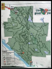 Trails Map |
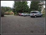 Parking Lot |
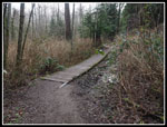 Boardwalk Trail |
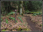
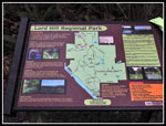 Trail Junction Sign |
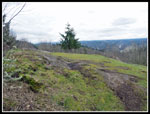
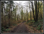 Road/Trail |
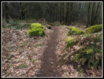 Mossy Rocks |
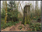 Old Stump |
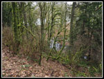
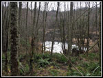 Small Pond |
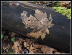 Leaf On A Log |
 Springboard Trail |
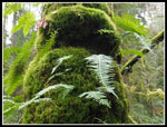 Moss & Ferns |
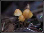 Tiny Mushrooms |
 Bike Trail |
 Rain Forest |
 Interesting Trees |
 Another Road/Trail |
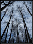 Looking Up |
 Nearing The River |
 Down River |
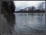 Up River |
 Another Pond |
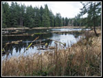 Temple Pond |
 Viewpoint |
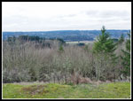 Cloudy Day |
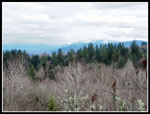 Eastern Viewpoint |
 White Moss |
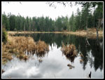 Temple Pond Again |
 More Moss |
 Even More Moss |
 Beaver Lake |
 Pipeline Trail |
 Trailhead |
Trips - 2018
Home