7-21-18
Gwen
wanted to head to Mt. Rainier for a hike. Pam and I joined in. Kim
signed on later. It looked to be near 80 degrees at sea level in
Seattle. At 6100 near Sunrise at Mt. Rainier it would only reach the
mid 60s. Perfect conditions for a sunny summer day. We met in North
Seattle at 6:35 am and headed south. After a stop in Enumclaw we joined
a caravan of cars heading east on Highway 410. We were not early enough
to beat the crowds though we were ahead of many more. A little over
half the cars turned into the White River entrance to Mt. Rainier
National Park (MRNP). With 7 or 8 cars ahead of us at the pay station a
second ranger met cars and directed those with permits around the pay
booth. That saved us a few minutes. The Owyhigh Lakes lot was almost
full. The Fryingpan Creek parking was already full. Cars were pulling
off past the lot. Some right on the white fog line. 8:30 am is no
longer early enough to get a good parking spot. At the top of the
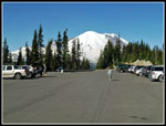
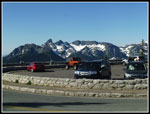
switchbacks we parked at Sunrise Point.It was about 8:50 when we
reached the 6104' lot.
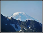
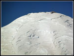
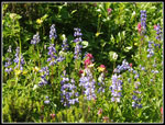
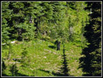
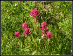
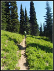
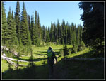
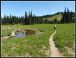
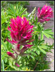
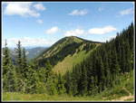
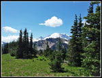
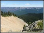
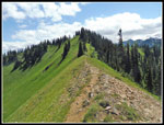
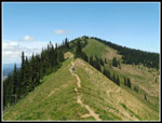
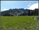
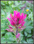
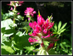
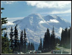
Right at the start the views are excellent. We could see Mt. Rainier, Little Tahoma, Cowlitz Chimneys, Mt. Adams, and much of our route and peaks to the north. I do very few hikes in Washington State where the trail begins by going downhill and ends with a steep climb. This is one of them. It was 9:12 am when we started out. From the top I could see Sunrise Lake right below. That would be the first of a number of lakes along the trail. The trail gently descends Sunrise Ridge then switchbacks and begins a steep descent. The hillside has a good display of magenta Indian paintbrush and a variety of other wildflowers in bloom. At the next switchback left goes down a short distance to Sunrise Lake. Right drops into forest. We met a group here. They pointed t the meadow below where there was a mother and a bear cub. They were so far away I needed my maximum zoom lens to get a good view. My first bear sighting in several years.
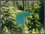
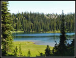
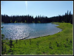
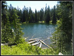
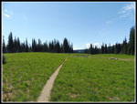
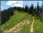
The high point of the trail between the start and Upper Palisades Lake is 6100' and the low is 5550'. Out and back is about 1800' gained over 7 miles. Clearly, there are some ups and downs. A number of them. We had nearly continuous wildflowers along the route though no huge dense fields. The trail goes through forest with a number of small meadows appearing. The lakes also have some meadow areas. After 1 1/2 miles we reached Clover Lake. This was the most photogenic lake of the day. The meadows around the lake had lots of blooming paintbrush. We stopped to enjoy the lake. Here as with most of the day on trail we saw other people. It was never crowded. More in the afternoon too. It was quite pleasant seeing people occasionally on the way in. It is understandable, as there are no views of Mt. Rainier after the parking lot. It's a long drive to not see the mountain all day.
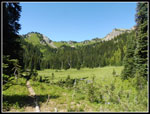
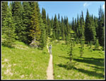
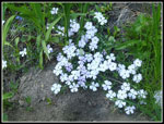
After Clover Lake the trail has a steep climb to a saddle. The descent is longer and steeper. A fun spot for the return trip. At least it was not all that hot when we climbed back up later. The route passes a small lake and reaches a meadow with a creek flowing through. Here we saw a few pink monkeyflower and some shooting stars. A big talus field climbs the slope above the meadow. More forest led to a junction. Left climbs up to Hidden Lake. We choses to go right on the main trail. next is a turn off to Dick Lake Camp. The lake is visible from the trail. We passed by and continued. More ups and downs took us to a bigger meadow. False hellebore was in bloom here as well as many places along our route. A ridge rose ahead to the right that we correctly guessed was Brown Peak. We would have to visit this since Kim Brown was along.
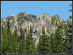
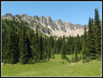
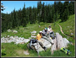
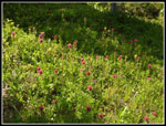
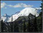
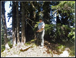
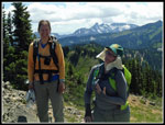
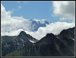
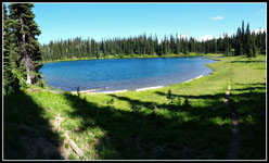
The trail reached the base of that ridge and Upper Palisades Lake came into view ahead and below us. A short drop and Kim, Gwen, and I met Pam who had been out ahead. It's a nice lake sitting below the summit of The Palisades. Vertical columnar basalt makes that peak unique in appearance. We found a lot more magenta Indian paintbrush around the lake. It was now 11:28 am. The temperature was very comfortable. We sat on some big rocks and enjoyed a leisurely lunch. After that we took some more photos. We did not have a firm plan at the start. Scramble up The Palisades or Marcus Peak? Head up Brown Peak and continue north? At this point we settle on heading up Brown Peak first. Back at the ridge we found a good boot path heading up. Very steep at first, the grade relented as we climbed. Higher up we had a clear view out to Mt. Rainier.
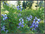
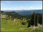
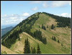
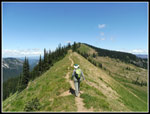
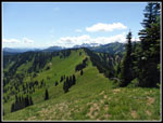
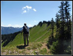
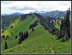
The 6322' summit of Brown Peak is completely forested but those views are only a short way below. Kim chose to wait here as the rest of us followed the boot path as it steeply descended Brown Peak to begin a ridge walk over to a 6500' point. Bear Park was to our right. Upper then Lower Palisades Lakes were below to our left. There were a number of wildflowers in bloom along the ridge including buckwheat, harebells, and columbine. Pam got started first and Gwen and I followed. There were also sights and smells of many elk that sleep along the ridge top. I did not see any but both Gwen and Pam did see them below us. I reached the top of Point 6500 to find Pam and Gwen arrived shortly after. We could see one of the Slide Mountains ahead. The ridge dropped again and then climbed to the 6620' high point. The real Slide Mountain is even farther along the ridge and is about 250' lower than the high point. This highest Slide is often called South Slide. The east side of it has "slid" down into the valley. I have no idea why that one is not the real Slide Mountain.
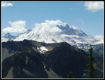
With the 6620' summit in sight we dropped left and picked up a boot path again. It was very clear as it dropped and climbed to the top. It petered out the last little bit to the top. Our detour was about 1.5 miles one way from the main trail near Upper Palisades Lake. As with the entire route, all the ups and downs accounted for much of the total elevation gain of our summits scramble. Some really nice views from South Slide Mountain. My zoom lens verified that we were seeing the top of Crystal Mountain Ski Area right across the White River Valley. Ski Lift towers were at several spots. Mt. Rainier, Little Tahoma, and Mt. Adams were clearly in view. Flashes of light showed the sun reflecting off cars in the parking lot where we started. We were only 500' above the trailhead. We arrived at 1:29 pm and stayed until 2:04 pm.
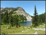
The trip back to Brown Peak had almost as much up as down. Back at the base of Brown Peak we chose a trail side hilling left vs. the almost straight down route we took on the other side while coming down. It proved to be easier. We met Kim back near the op of her namesake peak and headed down. We still had about 900' of uphill on our way back. The steep drop brought us to the main trail and a last look at Upper Palisades Lake. On the way back we did stop at Dick Lake Camp. It has one campsite. Upper Palisades Lake has two sites. Permits must be obtained from the park. The lake looked better than I expected. We met a backcountry ranger here too.
All the trip reports from the preceding two weeks mentioned the awful bugs. Skeeters everywhere. We had a cooler day and a pretty steady breeze. It was also cool enough for me to keep on a long sleeve shirt and zip off pants legs. With all that, I never applied any bug repellent. I received a few bites but it was not nearly as bad as we feared. The climb back to the saddle before Clover Lake was a pain but was largely in shade. The last climb up to Sunrise Point was longer and almost as steep. We all did just fine. We reached the trailhead at 5:20 pm. It was a long but very enjoyable day.
Although we were only a mile from one of the most crowded locations in MRNP, we did not face crowds on our route. The off the main trail section provided total solitude. The lakes and meadows are one of the main highlights. The views from up high were spectacular. I love high ridge walks and this one did not disappoint. This was one of the few hikes I have down when I did not know the exact route ahead of time. It was also nice to do a trip where I had hiked none of the route before. This was one of the best trips I have had in MRNP. A very good time was had by all.
Click on thumbnails to get
larger pictures.
Trips - 2018
Home
Right at the start the views are excellent. We could see Mt. Rainier, Little Tahoma, Cowlitz Chimneys, Mt. Adams, and much of our route and peaks to the north. I do very few hikes in Washington State where the trail begins by going downhill and ends with a steep climb. This is one of them. It was 9:12 am when we started out. From the top I could see Sunrise Lake right below. That would be the first of a number of lakes along the trail. The trail gently descends Sunrise Ridge then switchbacks and begins a steep descent. The hillside has a good display of magenta Indian paintbrush and a variety of other wildflowers in bloom. At the next switchback left goes down a short distance to Sunrise Lake. Right drops into forest. We met a group here. They pointed t the meadow below where there was a mother and a bear cub. They were so far away I needed my maximum zoom lens to get a good view. My first bear sighting in several years.
The high point of the trail between the start and Upper Palisades Lake is 6100' and the low is 5550'. Out and back is about 1800' gained over 7 miles. Clearly, there are some ups and downs. A number of them. We had nearly continuous wildflowers along the route though no huge dense fields. The trail goes through forest with a number of small meadows appearing. The lakes also have some meadow areas. After 1 1/2 miles we reached Clover Lake. This was the most photogenic lake of the day. The meadows around the lake had lots of blooming paintbrush. We stopped to enjoy the lake. Here as with most of the day on trail we saw other people. It was never crowded. More in the afternoon too. It was quite pleasant seeing people occasionally on the way in. It is understandable, as there are no views of Mt. Rainier after the parking lot. It's a long drive to not see the mountain all day.
After Clover Lake the trail has a steep climb to a saddle. The descent is longer and steeper. A fun spot for the return trip. At least it was not all that hot when we climbed back up later. The route passes a small lake and reaches a meadow with a creek flowing through. Here we saw a few pink monkeyflower and some shooting stars. A big talus field climbs the slope above the meadow. More forest led to a junction. Left climbs up to Hidden Lake. We choses to go right on the main trail. next is a turn off to Dick Lake Camp. The lake is visible from the trail. We passed by and continued. More ups and downs took us to a bigger meadow. False hellebore was in bloom here as well as many places along our route. A ridge rose ahead to the right that we correctly guessed was Brown Peak. We would have to visit this since Kim Brown was along.
The trail reached the base of that ridge and Upper Palisades Lake came into view ahead and below us. A short drop and Kim, Gwen, and I met Pam who had been out ahead. It's a nice lake sitting below the summit of The Palisades. Vertical columnar basalt makes that peak unique in appearance. We found a lot more magenta Indian paintbrush around the lake. It was now 11:28 am. The temperature was very comfortable. We sat on some big rocks and enjoyed a leisurely lunch. After that we took some more photos. We did not have a firm plan at the start. Scramble up The Palisades or Marcus Peak? Head up Brown Peak and continue north? At this point we settle on heading up Brown Peak first. Back at the ridge we found a good boot path heading up. Very steep at first, the grade relented as we climbed. Higher up we had a clear view out to Mt. Rainier.
The 6322' summit of Brown Peak is completely forested but those views are only a short way below. Kim chose to wait here as the rest of us followed the boot path as it steeply descended Brown Peak to begin a ridge walk over to a 6500' point. Bear Park was to our right. Upper then Lower Palisades Lakes were below to our left. There were a number of wildflowers in bloom along the ridge including buckwheat, harebells, and columbine. Pam got started first and Gwen and I followed. There were also sights and smells of many elk that sleep along the ridge top. I did not see any but both Gwen and Pam did see them below us. I reached the top of Point 6500 to find Pam and Gwen arrived shortly after. We could see one of the Slide Mountains ahead. The ridge dropped again and then climbed to the 6620' high point. The real Slide Mountain is even farther along the ridge and is about 250' lower than the high point. This highest Slide is often called South Slide. The east side of it has "slid" down into the valley. I have no idea why that one is not the real Slide Mountain.
With the 6620' summit in sight we dropped left and picked up a boot path again. It was very clear as it dropped and climbed to the top. It petered out the last little bit to the top. Our detour was about 1.5 miles one way from the main trail near Upper Palisades Lake. As with the entire route, all the ups and downs accounted for much of the total elevation gain of our summits scramble. Some really nice views from South Slide Mountain. My zoom lens verified that we were seeing the top of Crystal Mountain Ski Area right across the White River Valley. Ski Lift towers were at several spots. Mt. Rainier, Little Tahoma, and Mt. Adams were clearly in view. Flashes of light showed the sun reflecting off cars in the parking lot where we started. We were only 500' above the trailhead. We arrived at 1:29 pm and stayed until 2:04 pm.
The trip back to Brown Peak had almost as much up as down. Back at the base of Brown Peak we chose a trail side hilling left vs. the almost straight down route we took on the other side while coming down. It proved to be easier. We met Kim back near the op of her namesake peak and headed down. We still had about 900' of uphill on our way back. The steep drop brought us to the main trail and a last look at Upper Palisades Lake. On the way back we did stop at Dick Lake Camp. It has one campsite. Upper Palisades Lake has two sites. Permits must be obtained from the park. The lake looked better than I expected. We met a backcountry ranger here too.
All the trip reports from the preceding two weeks mentioned the awful bugs. Skeeters everywhere. We had a cooler day and a pretty steady breeze. It was also cool enough for me to keep on a long sleeve shirt and zip off pants legs. With all that, I never applied any bug repellent. I received a few bites but it was not nearly as bad as we feared. The climb back to the saddle before Clover Lake was a pain but was largely in shade. The last climb up to Sunrise Point was longer and almost as steep. We all did just fine. We reached the trailhead at 5:20 pm. It was a long but very enjoyable day.
Although we were only a mile from one of the most crowded locations in MRNP, we did not face crowds on our route. The off the main trail section provided total solitude. The lakes and meadows are one of the main highlights. The views from up high were spectacular. I love high ridge walks and this one did not disappoint. This was one of the few hikes I have down when I did not know the exact route ahead of time. It was also nice to do a trip where I had hiked none of the route before. This was one of the best trips I have had in MRNP. A very good time was had by all.
 Rainier From Parking |
 Mt. Adams |
 The Palisades |
 Sunrise Lake |
 Cowlitz Chimneys |
 Rainier Summit |
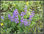
 Blooming Lupine |
 Bouquet |
 Mama Bear |
 Magenta Paintbrush |
 Silvered Snags |
 Clover Lake |
 Sparkling Water |
 Uphill |
 Trail Along Meadow |
 Western Anemone |
 Sun & Shade |
 Columnar Basalt |
 Lake By Trail |
 Another Meadow |
 Pond & Meadow |
 Palisades & Meadow |
 Biggest Meadow |
 Lower Palisades Lake |
 Lunch Time |
 Paintbrush Close Up |
 Many Paintbrush |
 Purple Flower |
 Ridge To Point 6500 |
 Ascending Brown Pk |
 Rainier In Sight |
 Bear Park |
 Ridge To Pt 6500 |
 Brown On Brown |
 Great Ridge Walk |
 Looking Back |
 Top Of Point 6500 |
 Pam On Ridge |
 Cloudy Mt. Rainier |
 Grand Park |
 Slide Mt. Slide |
 Pam & Gwen |
 Returning On Ridge |
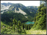 Lower Palisades Lake |
 Bump On Ridge |
 Nearing Brown Pk |
 Cloudier Rainier |
 Mountain Daisy |
 Shadows |
 Phlox |
 Perfect Paintbrush |
 Bright On Dark |
 Talus Field |
 More Lupine |
 Last Flowers |
 Hazy Mt. Rainier |
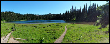 Clover Lake Panorama |
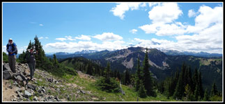 Panorama View From South Slide Mountain |
 Returning Panorama of Clover Lake |
Trips - 2018
Home