12-31-18
My
longest lasting tradition is a
New Year's Eve hike on Tiger Mountain. This would be my 35th hike there
in the last 36 years. For this year's trip I was joined by Gary
Westerlund and John Sluder. We kicked around a route and settled on a
one way hike of the Tiger Mountain Trail.. Gary and I did it one time
back in 2002.
It is about 16 miles one way and by adding in a visit to
Tiger 2 and parking down the road at the north end we brought it to 17
miles. We met at High Point at 7:45 am. I drove to the south end of the
trail on Tiger Mountain Road. There was one vehicle there at 8:05 am.
It was about 30 degrees but we had zero wind all day long. It was not
too bad. The trail climbs at a moderate grade for 1.5 miles to Hobart
Gap. Normally I would go left then right on the South Tiger Traverse.
That route is currently closed for logging. Also, it's not the TMT. We
went right.
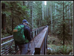
There is one creek crossing that can be challenging after a heavy rain but logs made it an easy crossing. We soon reached the powerline road. A right turn leads to a gravel road going left. There used to be a sign pointing the turn for the TMT route but it was been missing for years. it still is. Quickly the real trail is met going off right. I wore my lightest non waterproof hiking shoes as recent trips on Tiger showed little snow and little mud. The next half mile of old road/trail was largely a creek. It was not possible to keep my feet dry. I did my best to avoid it but I was not entirely successful. The road trail met the road which is the other end of the South Tiger Traverse. The West Side Road comes up quickly. At one time it was the south end of the TMT. Now were were 3.6 miles along the route with 1100' of elevation gain.
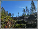
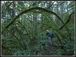
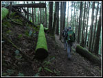
The next section of the TMT was once in dark forest. Now it is in a clear cut. The cut was not that many year ago though new trees are up to a dozen feet tall. This section also took advantage of the sunny day and allowed us to bask in a little sunshine. We reached the train wreck site and the trail takes a sharp left going off on another old railroad grade. We came to a new road crossing the trail. Past that the trail reenters forest. Colder but we were surrounded by green. I stopped to tighten a shoe lace and a minute later John pointed out a neat photo. Oops! I no longer had a camera. It fell out. I went back and found the spot where I had stopped and off the trail was my camera. I was fortunate that John stopped for the photo. I might not have found my camera otherwise. Perhaps to allay my forgetfulness, Gary dropped a glove and had to go retrieve it. The rest of the way we did not misplace anything.
The route is never steep but over so many miles the elevation gain and loss does pile up. We reached the Middle Tiger Trail at 5 miles and 1670 total elevation gain. We were almost one third of the way. On our 2002 trip Gary and I climbed 500' to the summit. This day we just passed by. At 11:19 am we reached a spot where another clear cut above the trail allowed sun to shine on the trail. This was probably the sunniest spot we had all day. Time for our lunch break. It was still in the 30s but felt much warmer. The sun was so nice we ended up taking 23 minutes for lunch. We were now 6.7 miles in with 1960' of total elevation gain. It was 11:40 am when we started moving again. Along the middle of the trail there were a number of small bridges and a number of rock hops. None were difficult.
We reached the Custer Bridge and were surprised to see the makings of a replacement bridge. Steel I beams and some lumber. The old bridge has a post in the center holding it up. At 7 miles it is a little short of the mid point. The trail from Middle Tiger to the Hidden Forest Trail makes a big "U' around the valley of 15 Mile Creek. It takes many miles to cover a short distance as the crow flies. We did reach the Hidden Forest Trail at 12:39 pm. 8.7 miles in with 2465' gained. A couple minutes later we reached the top of the One View Trail. The sign there says 6.7 miles to go and 9.3 mile done. The next section I had already done twice this month. I usually only hike it every year or two. The trail climbs another 400' to Manning's Reach. A number more creeks to cross too. Remlinger's bridge is now gone but the sing for it remains.
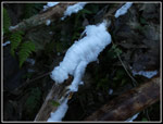
Along the trail we periodically saw one or two hikers or runners. The average remained at or below one person per mile. A lone hiker knew my name and knew my friend Kim, two women were on a 20 mile run. We had a lot of solitude between meetings. At Manning's Reach we met a lone hiker. At that point we reached the highest point on the TMT at just under 2600'. This was 9.7 miles along with 2930' of gain. The trail drops down a little to the Seattle View Trail. This is parallel to the Cable Line Trail that goes up Tiger 2. Our one detour off the TMT was up the Seattle View to the top of 2757' Tiger 2. It added about 200' of elevation gain. We had a short food break on top then headed back down the Seattle View. We crossed the Cable Line at 2500' The trail traverses around Tiger 2 reaching Tom's Crossing.
Now the route begins the drop to the north trailhead. Now on the north side of Tiger we were done with any sunshine reaching into the forest. It was noticeably colder. There are several trails that rapidly down the north side. The TMT is not one of them. It meanders all over the mountain. That's great if you want to take as long as possible to finish the hike. The trail drips to the junction with the K-3 trail. Our route would meet the bottom of the k-3 later taking several more miles to get there. Down we went passed the Christmas tree and Ruth's Cove. Down we went to the Lingering Trail junction and the High Point Trail junction soon after that. We reached Murat's Bridge at 3:12 pm. We were now 12.7 miles in (including the T2 detour) with 3390'. We still had another 300' to gain.
Our route passed the bottom of the K-3 Trail then crossed two big bridges. From the last high point we dropped over 900' to the end of the TMT. We crossed the Cable Line again and reached the junction with the Tradition Lake Trail. We were no just a few tenths of a mile from the big High Point parking lot. We looked to be a little short of a projected 17 miles so I took off down the Bus Trail to get in a few last tenths of a mile. I ran back and caught up with the guys on the trail from the parking lot to the gate on the road in. We then walled the last .40 miles back to the car.
Getting accurate gps mileage in forest over around 17 miles at a slow speed is difficult. I have seen gps tracks our our route varying from 15-20 miles. Best I can tell with our Tiger 2 detour and about an additional mile from the end of the TMT at the Tradition Lake junction to the car plus my Bus Trail jaunt I hiked just about 17 miles. WTA says the elevation gain is 2360' and that is just way low. An edited gps track shows 3800' of gain. That might be a little high but it is hard to tell exactly. There are a lot of small ups and downs over a lot of miles. Anyway you look at it, it was a long day hike on a short winter day. We did make it back to the car after sunset but before total darkness. For a year end trip it was cool but not frigid and not wet. Well, except for my feet. Even they remained warm. I do not anticipate many TMT through hikes but this one made for a great end to a very good hiking year. I finished with the second most miles and third highest elevation gain ever.
Click on thumbnails to get
larger pictures.
Trips - 2018
Home
There is one creek crossing that can be challenging after a heavy rain but logs made it an easy crossing. We soon reached the powerline road. A right turn leads to a gravel road going left. There used to be a sign pointing the turn for the TMT route but it was been missing for years. it still is. Quickly the real trail is met going off right. I wore my lightest non waterproof hiking shoes as recent trips on Tiger showed little snow and little mud. The next half mile of old road/trail was largely a creek. It was not possible to keep my feet dry. I did my best to avoid it but I was not entirely successful. The road trail met the road which is the other end of the South Tiger Traverse. The West Side Road comes up quickly. At one time it was the south end of the TMT. Now were were 3.6 miles along the route with 1100' of elevation gain.
The next section of the TMT was once in dark forest. Now it is in a clear cut. The cut was not that many year ago though new trees are up to a dozen feet tall. This section also took advantage of the sunny day and allowed us to bask in a little sunshine. We reached the train wreck site and the trail takes a sharp left going off on another old railroad grade. We came to a new road crossing the trail. Past that the trail reenters forest. Colder but we were surrounded by green. I stopped to tighten a shoe lace and a minute later John pointed out a neat photo. Oops! I no longer had a camera. It fell out. I went back and found the spot where I had stopped and off the trail was my camera. I was fortunate that John stopped for the photo. I might not have found my camera otherwise. Perhaps to allay my forgetfulness, Gary dropped a glove and had to go retrieve it. The rest of the way we did not misplace anything.
The route is never steep but over so many miles the elevation gain and loss does pile up. We reached the Middle Tiger Trail at 5 miles and 1670 total elevation gain. We were almost one third of the way. On our 2002 trip Gary and I climbed 500' to the summit. This day we just passed by. At 11:19 am we reached a spot where another clear cut above the trail allowed sun to shine on the trail. This was probably the sunniest spot we had all day. Time for our lunch break. It was still in the 30s but felt much warmer. The sun was so nice we ended up taking 23 minutes for lunch. We were now 6.7 miles in with 1960' of total elevation gain. It was 11:40 am when we started moving again. Along the middle of the trail there were a number of small bridges and a number of rock hops. None were difficult.
We reached the Custer Bridge and were surprised to see the makings of a replacement bridge. Steel I beams and some lumber. The old bridge has a post in the center holding it up. At 7 miles it is a little short of the mid point. The trail from Middle Tiger to the Hidden Forest Trail makes a big "U' around the valley of 15 Mile Creek. It takes many miles to cover a short distance as the crow flies. We did reach the Hidden Forest Trail at 12:39 pm. 8.7 miles in with 2465' gained. A couple minutes later we reached the top of the One View Trail. The sign there says 6.7 miles to go and 9.3 mile done. The next section I had already done twice this month. I usually only hike it every year or two. The trail climbs another 400' to Manning's Reach. A number more creeks to cross too. Remlinger's bridge is now gone but the sing for it remains.
Along the trail we periodically saw one or two hikers or runners. The average remained at or below one person per mile. A lone hiker knew my name and knew my friend Kim, two women were on a 20 mile run. We had a lot of solitude between meetings. At Manning's Reach we met a lone hiker. At that point we reached the highest point on the TMT at just under 2600'. This was 9.7 miles along with 2930' of gain. The trail drops down a little to the Seattle View Trail. This is parallel to the Cable Line Trail that goes up Tiger 2. Our one detour off the TMT was up the Seattle View to the top of 2757' Tiger 2. It added about 200' of elevation gain. We had a short food break on top then headed back down the Seattle View. We crossed the Cable Line at 2500' The trail traverses around Tiger 2 reaching Tom's Crossing.
Now the route begins the drop to the north trailhead. Now on the north side of Tiger we were done with any sunshine reaching into the forest. It was noticeably colder. There are several trails that rapidly down the north side. The TMT is not one of them. It meanders all over the mountain. That's great if you want to take as long as possible to finish the hike. The trail drips to the junction with the K-3 trail. Our route would meet the bottom of the k-3 later taking several more miles to get there. Down we went passed the Christmas tree and Ruth's Cove. Down we went to the Lingering Trail junction and the High Point Trail junction soon after that. We reached Murat's Bridge at 3:12 pm. We were now 12.7 miles in (including the T2 detour) with 3390'. We still had another 300' to gain.
Our route passed the bottom of the K-3 Trail then crossed two big bridges. From the last high point we dropped over 900' to the end of the TMT. We crossed the Cable Line again and reached the junction with the Tradition Lake Trail. We were no just a few tenths of a mile from the big High Point parking lot. We looked to be a little short of a projected 17 miles so I took off down the Bus Trail to get in a few last tenths of a mile. I ran back and caught up with the guys on the trail from the parking lot to the gate on the road in. We then walled the last .40 miles back to the car.
Getting accurate gps mileage in forest over around 17 miles at a slow speed is difficult. I have seen gps tracks our our route varying from 15-20 miles. Best I can tell with our Tiger 2 detour and about an additional mile from the end of the TMT at the Tradition Lake junction to the car plus my Bus Trail jaunt I hiked just about 17 miles. WTA says the elevation gain is 2360' and that is just way low. An edited gps track shows 3800' of gain. That might be a little high but it is hard to tell exactly. There are a lot of small ups and downs over a lot of miles. Anyway you look at it, it was a long day hike on a short winter day. We did make it back to the car after sunset but before total darkness. For a year end trip it was cool but not frigid and not wet. Well, except for my feet. Even they remained warm. I do not anticipate many TMT through hikes but this one made for a great end to a very good hiking year. I finished with the second most miles and third highest elevation gain ever.
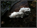
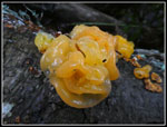 Witches Butter |
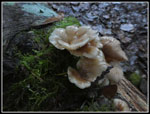 Mushrooms |
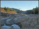
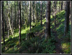
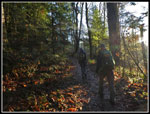 Low Morning Sun |
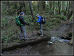 Creek Crossing |
 TMT Goes On Road |
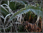 Frosted Fern |
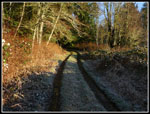 Onto A Dirt Road |
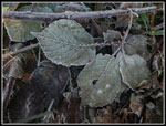 Frosted Leaves |
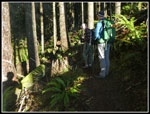
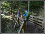
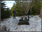
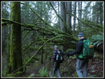
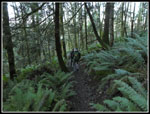
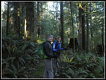 Guys On The Trail |
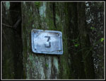 3 Mile Marker |
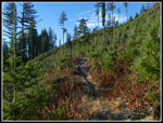 Into A Clear Cut |
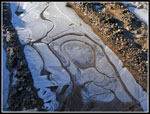 Icy Puddle |
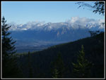
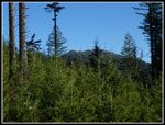 East Tiger Mountain |
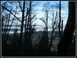 Fog Below |
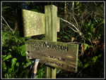
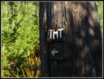 TMT Marker |
 My Shadow! |
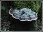 Fungus |
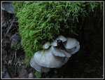 Mossy Mushrooms |
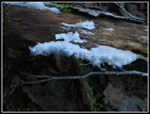 First Hair Ice |
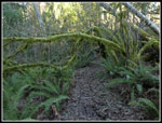 Mossy Tree |
 Lunch Spot |
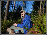 Gary At Lunch |
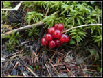 Red Berries |
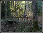 Custer Bridge |
 Bright Hair Ice |
 Open Forest |
 Icy Bridge |
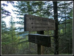
 Mileage Sign |
 Perfect Arch |
 More Hair Ice |
 Closer Look |
 Photo Of Hair Ice |
 One More |
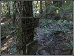 Remlinger Bridge Sign |
 Tiger 2 Summit |
 Tom's Crossing |
 View To The East |
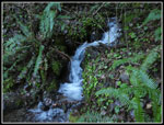 Cascade |
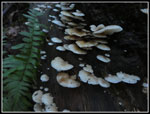 More Mushrooms |
 Another Arch |
 Murat's Bridge |
 Bright Mushrooms |
 Green Log |
 Nearing The End |
Trips - 2018
Home