11-17-18
I
was ready for a big mileage day.
It would be cold but clear. Last November I did a 17 mile trip up West
Rattlesnake Mountain from Highway 18. Time for a repeat. I headed out
at 7:30 am heading east. Off I-90 onto Highway 18 heading south. I
quickly reached the left turn lane and turned. Much to my surprise
there were two vehicles already parked there when I arrived at 8:12:
am. It was 34 degrees. A little colder than I was expecting. I headed
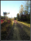
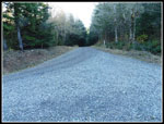
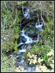
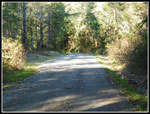
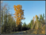
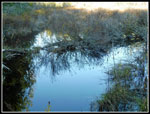
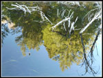
off on the paved road. The gate was closed. Some reflection shots in
the water near the start. The road crosses a swamp. Soon it turns left
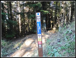
and heads to the power sub station at the one mile mark. This route has
markers every half mile. It makes it easy to see where you are.
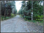
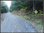
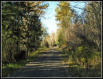
After a short climb above the swamp the route is extremely flat up to the 2 1/2 mile marker. The pavement ends at the half mile mark. I cruised by the sub station and continued on. The smooth road and flat grade makes for fast hiking. I hiked the first mile in 21 minutes with several photo stops. The next few miles were at less than 17 minutes per mile. That's fast for me. Just past 2 1/2 miles the road crosses Canyon Creek on a fairly new bridge. After a few turns the grade steepens. This section has gained a layer of sharp thick gravel. It was never muddy or pot holed. Just a hard packed logging road. Now it is very hard on ones feet. That is too bad.
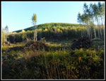
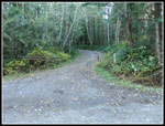
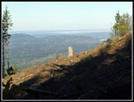
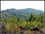
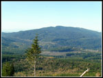
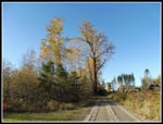
Up the hill the route turned left and the grade eased. I reached the 4 1/2 mile marker in 1:20 at 9:35. The marker is right at the junction with the road to the left that heads for the summit. With 3.6 miles to go I still had much of the elevation gain to go. It had warmed up a little but was still quite cool. I quickly reached a number of major clear cuts. There were a few down low last year. There are more now. On the negative side they are clear cuts. On the positive side, there are now some pretty good views. The difference in temperature in the forest vs out in the open was huge. The sunshine sure felt good. After a few switchbacks I reached the last junction. I turned right on a better road. Much less gravel and easy walking. I was at about the 7 mile mark. The other road at the junction began to drop down. I quickly reached a 5 mile mark. The other road seems to be two miles shorter than the way I came up. Something for me to explore at a later date.
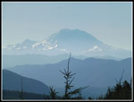
I reached the place where the new bike trail crosses the road. Both road and trail lead to the west peak summit. I chose to take the trail. So far I had not seen anyone. I expected to have a few bikes pass me on this section. The trail climbs to cross the road once again. Last year I was on snow through here. Not a trace this year. The route reaches the road one more time just below the summit. I crossed the road and the trail comes out of forest and into the big clear cut along the south side of Rattlesnake's ridge. I was met by a strong and very cold wind. I had had no wind until the top. I arrived at 11:55 am. 2:40 from car to the top. Nice views to the north east through southeast. Mt. Rainier was in the clear though it was a bit hazy. Finally, three mountain bikers went on by. I hiked 8.1 miles before seeing the first other person.
The wind was frigid and before long I hiked back to the road. The road is in forest so the wind was not a problem. A few minutes later I was at the summit. There are a number of towers on top. There is one small square building that provided a wind break. I sat on the stairs and pulled out my lunch. I'd guess the wind was blowing 15 mph with gusts to about 20 mph. With the temperature in the mid 30s and the wind it was really cold. I dug out a jacket immediately. After lunch I dropped down the other side of the top to another set of towers. On the hike up I was surprised to be passed by a small truck coming down. That is the first time I have seen a vehicle on the roads. There was a bigger truck near the lower towers. I soon hiked back to the summit and started down. I took the road for the first part down. The road crosses the upper trail crossing then switches back. My phone gps unit shows a trail just a short way out from the middle of the switchback. I checked and found an old grassy road. Where the map showed this trail crossing the grassy road I found a minimal trail going straight downhill. It is definitely not a built trail. It should cross a real new bike trail and reach a road below. That road goes back to the road I hiked up. I see another loop to explore in the future.
At the next place the bike trail crosses the road I turned onto the trail. Where it met the road again is the spot I went back onto the road for good. At that spot I found a lot of bicyclers. About 7 or 8 of them. They accounted for most of the folks I saw all day. I headed down the road alone again. At the 4 1/2 mile junction I was very surprised to see two hikers. They had come up the main road and gone straight where I turned left. Now they were coming back on the main road. I said "hi" and took a food and water break. The other folks kept going. They were the last people I saw all day. Farther down the main road starts the steep descent and I took a side road that climbed slightly. I walked about .40 miles to a new bridge over Canyon Creek. This side trip brought me up to 17 miles total for the day.
After the short detour I followed the road the rest of the way back. It was a sunny afternoon and not so cold now. I expected to see a few bikers on the lower road. Not this day. It was 2:29 pm when I reached my car. Still early afternoon. One of the benefits of a short drive. The sun was in a good spot while I crossed the swamp and I had some good reflection shots in the water. I did see two more hikers starting out just as I finished.
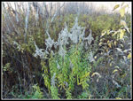
Most folks don't go out for a long hike where most of the trip is on logging roads. Most of the times I have done this trip there has been snow on the upper half. The snow makes for some great scenery. Without snow it is a little less scenic. The clear cuts have opened up some great views however. This trip always provides a whole lot of solitude. Still, I was surprised to make it all the way up seeing one truck but not a single person. With the sin in my eyes and tinted windows I did not see the truck driver. The totals for the day were 17 miles hiked with 2600' of elevation gain. Even with the frigid wind on the summit it was a very enjoyable day on the trail and the road.
Click on thumbnails to get
larger pictures.
Trips - 2018
Home
After a short climb above the swamp the route is extremely flat up to the 2 1/2 mile marker. The pavement ends at the half mile mark. I cruised by the sub station and continued on. The smooth road and flat grade makes for fast hiking. I hiked the first mile in 21 minutes with several photo stops. The next few miles were at less than 17 minutes per mile. That's fast for me. Just past 2 1/2 miles the road crosses Canyon Creek on a fairly new bridge. After a few turns the grade steepens. This section has gained a layer of sharp thick gravel. It was never muddy or pot holed. Just a hard packed logging road. Now it is very hard on ones feet. That is too bad.
Up the hill the route turned left and the grade eased. I reached the 4 1/2 mile marker in 1:20 at 9:35. The marker is right at the junction with the road to the left that heads for the summit. With 3.6 miles to go I still had much of the elevation gain to go. It had warmed up a little but was still quite cool. I quickly reached a number of major clear cuts. There were a few down low last year. There are more now. On the negative side they are clear cuts. On the positive side, there are now some pretty good views. The difference in temperature in the forest vs out in the open was huge. The sunshine sure felt good. After a few switchbacks I reached the last junction. I turned right on a better road. Much less gravel and easy walking. I was at about the 7 mile mark. The other road at the junction began to drop down. I quickly reached a 5 mile mark. The other road seems to be two miles shorter than the way I came up. Something for me to explore at a later date.
I reached the place where the new bike trail crosses the road. Both road and trail lead to the west peak summit. I chose to take the trail. So far I had not seen anyone. I expected to have a few bikes pass me on this section. The trail climbs to cross the road once again. Last year I was on snow through here. Not a trace this year. The route reaches the road one more time just below the summit. I crossed the road and the trail comes out of forest and into the big clear cut along the south side of Rattlesnake's ridge. I was met by a strong and very cold wind. I had had no wind until the top. I arrived at 11:55 am. 2:40 from car to the top. Nice views to the north east through southeast. Mt. Rainier was in the clear though it was a bit hazy. Finally, three mountain bikers went on by. I hiked 8.1 miles before seeing the first other person.
The wind was frigid and before long I hiked back to the road. The road is in forest so the wind was not a problem. A few minutes later I was at the summit. There are a number of towers on top. There is one small square building that provided a wind break. I sat on the stairs and pulled out my lunch. I'd guess the wind was blowing 15 mph with gusts to about 20 mph. With the temperature in the mid 30s and the wind it was really cold. I dug out a jacket immediately. After lunch I dropped down the other side of the top to another set of towers. On the hike up I was surprised to be passed by a small truck coming down. That is the first time I have seen a vehicle on the roads. There was a bigger truck near the lower towers. I soon hiked back to the summit and started down. I took the road for the first part down. The road crosses the upper trail crossing then switches back. My phone gps unit shows a trail just a short way out from the middle of the switchback. I checked and found an old grassy road. Where the map showed this trail crossing the grassy road I found a minimal trail going straight downhill. It is definitely not a built trail. It should cross a real new bike trail and reach a road below. That road goes back to the road I hiked up. I see another loop to explore in the future.
At the next place the bike trail crosses the road I turned onto the trail. Where it met the road again is the spot I went back onto the road for good. At that spot I found a lot of bicyclers. About 7 or 8 of them. They accounted for most of the folks I saw all day. I headed down the road alone again. At the 4 1/2 mile junction I was very surprised to see two hikers. They had come up the main road and gone straight where I turned left. Now they were coming back on the main road. I said "hi" and took a food and water break. The other folks kept going. They were the last people I saw all day. Farther down the main road starts the steep descent and I took a side road that climbed slightly. I walked about .40 miles to a new bridge over Canyon Creek. This side trip brought me up to 17 miles total for the day.
After the short detour I followed the road the rest of the way back. It was a sunny afternoon and not so cold now. I expected to see a few bikers on the lower road. Not this day. It was 2:29 pm when I reached my car. Still early afternoon. One of the benefits of a short drive. The sun was in a good spot while I crossed the swamp and I had some good reflection shots in the water. I did see two more hikers starting out just as I finished.
Most folks don't go out for a long hike where most of the trip is on logging roads. Most of the times I have done this trip there has been snow on the upper half. The snow makes for some great scenery. Without snow it is a little less scenic. The clear cuts have opened up some great views however. This trip always provides a whole lot of solitude. Still, I was surprised to make it all the way up seeing one truck but not a single person. With the sin in my eyes and tinted windows I did not see the truck driver. The totals for the day were 17 miles hiked with 2600' of elevation gain. Even with the frigid wind on the summit it was a very enjoyable day on the trail and the road.
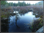 Reflection Shot |
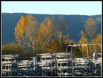 Fall Color & Power |
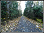 Leafy Road |
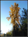 Tall Fall Color |
 Sun In My Eyes |
 Looking Towards Summit |
 4.5 Mile Junction |
 Uphill Time |
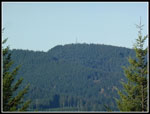 East Tiger Mt. Towers |
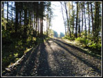 Long Shadows |
 Now Views Out |
 Cool In The Shade |
 Next Junction |
 Bike Trail Ahead |
 Rocks On Stumps |
 Trail Marker |
 East Rattlesnake Mt. |
 Mt. Rainier |
 View Northeast |
 Mt. Si |
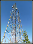 Towers |
 Heading Down Trail |
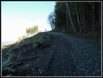
 Smooth Sailing |
 View West |
 Cascades |
 People! |
 Leafy Trees Again |
 Big Trees |
 Best Leaf Display |
 Blooming |
 Nice Reflection |
 Colorful Reflection |
Trips - 2018
Home