12-08-19
Time
for another long hike. I have hiked the Iron Horse Trail east from
South Cle Elum many times but I don't think I have done it in December.
With such short days and a long drive I was on the road at 6:54 am. Wet
road all the way to Easton. Water thrown up by cars and some rain as
well. I was glad I chose to head east. At Easton the sun came out and
it was low enough to provide blinding glare off the wet road. Not a fun
drive. I exited I-90, drove through South Cle Elum, passed under I-90
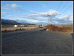
and reached the small parking lot at 8:28 am. I was the first to
arrive. By 8:36 I was on my way.
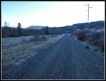
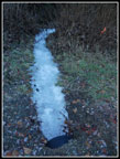
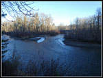
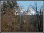
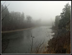
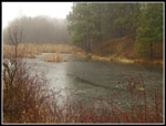
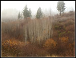
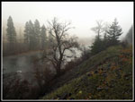
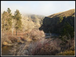
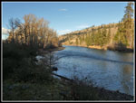
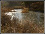
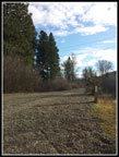
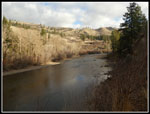
I was well aware that the old railroad grade/trail is right up against the south wall of the canyon. Most of it has not seen sun for months and won't until the sun is high in the sky next spring. With the temperature at 35 degrees it soon felt colder as I quickly entered the canyon. The grade meets up with the Yakima River and follows it for the rest of my trip. At the first rest area with a picnic table I had a close up look at the river. I stopped again at the confluence with the Teanaway River. There was some snow along the edge of the Teanaway. I saw only a few patches all day. The grade is very flat and an be hiked fast. Good news on a day with not much more than eight hours of daylight. Spring provides a lot of wildflowers and photo opportunities. Fall had a lot of leaves and mushrooms. I did not expect to take many photos this day. That is not how it worked out.
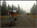
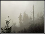
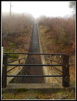
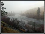
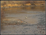
As I neared the big rest area with campsites and an outhouse I entered the fog zone. It was okay on the grade but the slops above were lost in the fog. It was also much cooler. A cold breeze came up and I stopped at the restroom and put on a wind shirt. While inside a heard a voice and a dog barking. Continuously barking. Then more dogs. Huh? Was someone biking with many dogs? I stepped outside and found... two wheeled carts pulled by sled dogs. That explained it. They soon headed back the way I had come. They were the only people I saw all day long. Almost total solitude. Except for two guys at a distance in waders fishing in the river. There are two sets of gates on the grade. One on each side of the big power lines corridor. They used to have a chain that went around the post and had to be clipped shut. Now there is a metal bar that sets in a groove atop the posts. Much faster and easier to open and close, especially in gloves.
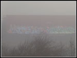
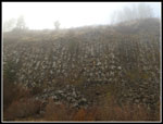
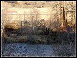
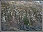
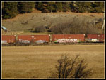
The fog was so thick that I heard a train pass on the other side of the river but could not see it at all. I did see some strange graffiti in the fog. I could not figure out what it was written on. I did not figure it out until I returned and the fog was fall gone. There is a big water chute that drops down the slope and runs under the grade right at the second gate. It usually has water running down it. Sometimes it is a big flow. This time it was completely empty. Next came the columnar basalt. It was shrouded in fog and more interesting looking than usual. Just after that I looked for the remains of the waterwheel across the river. It too was in the mist. Not much of it is still standing.
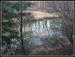
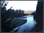
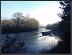
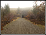
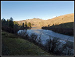
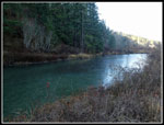
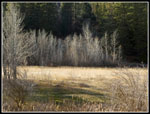
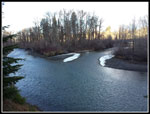
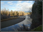
Not much is seen until the big meadow. I often see horses here but not the last several times. It was still very misty. At the end of the meadow is a long narrow pond. It was completely covered with ice. I should have brought skates. There are miles markers along the route. The numbers start from Chicago, the other end of the Chicago, Milwaukee, and St. Paul Railroad. The 2081 marker should by a short way after the parking lot. The tunnel where I turn around is about half a mile east of the 2074 marker. They let you know where you are along the 7.5 miles one way. At about the five mile mark I noticed the old Horlick depot. It is now right on the edge of the slope dropping to the river. It way end up in the river some day soon. The last several miles are just above the river. This is the best river walk of the route. It is always near the river but some sections have a narrow forest or thick brush that blocks the view. Not a problem at the east end.
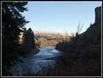
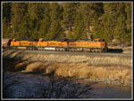
I could see the river but the fog was pretty thick along here. At 11:13 am I reached the tunnel. 7.5 miles in 2:37. The fog was just beginning to break. After reaching the tunnel I walked a few hundred feet back west and into a small patch of sunshine. It was 36 degrees but felt much warmer in the sunshine. There are wind turbines on the ridges above the river here. I could not see them coming in but as the fog broke they came into sight. Lunch was quick. It was too cold for a longer stop. I packed up and headed back at 11:36 am. Half a mile back I heard another train. I stopped to take a photo and ended up videoing it passing. It took 2:49 seconds. A whole lot of train cars passed by. three engines and 118 cars in all. The contrast of the clear view vs. the foggy ones on the way in called for more photos. I obliged.
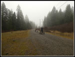
The downside of the gravel grade that by the last few miles my feet are starting to hurt. Not too bad but more than on a dirt trail. At the power line corridor I looked for the mysterious graffiti on the hillside. It urned out to be along line of old railroad cars on a siding. Many of them have colorful paint on them. I did not expect that. The power lines corridor was in sunshine. At the gate at the end I could see the outhouse and rest area was on the edge of shade. I chose to take a last break at the gate in the sunshine. I really did not want to go back into the shady canyon for the last three miles. All too soon I had to get moving. While it was warmer now it was not warm. I still had gloves on. The last three miles did go by pretty fast. I reached the parking lot at 2:31 pm. I took 2:55 coming out. It included a train video break and a second lunch break. It also included more photos than on the way in.
The drive home was much better than the drive out. There were clouds at the summit and over much of the west side but there was no rain. I made it home right about at dark. The forecast was for partly sunny sky over the west side and mostly sunny to the east. In fact it was very cloudy and wet on the west side and much nicer to the east. I was quite pleased with the long drive. Snow will soon by in the mountains and 15 mile hikes will be much tougher. It was great to get away from Tiger Mountain and still have a dirt hike. I will break out the snowshoes soon enough. The combination of blue sky and moody fog made this two very different hikes in one trip. Both of them were a lot of fun. In a few years I will be back for a spring wildflower hike along the Yakima River.
Click on thumbnails to get
larger pictures.
Trips - 2019
Home
I was well aware that the old railroad grade/trail is right up against the south wall of the canyon. Most of it has not seen sun for months and won't until the sun is high in the sky next spring. With the temperature at 35 degrees it soon felt colder as I quickly entered the canyon. The grade meets up with the Yakima River and follows it for the rest of my trip. At the first rest area with a picnic table I had a close up look at the river. I stopped again at the confluence with the Teanaway River. There was some snow along the edge of the Teanaway. I saw only a few patches all day. The grade is very flat and an be hiked fast. Good news on a day with not much more than eight hours of daylight. Spring provides a lot of wildflowers and photo opportunities. Fall had a lot of leaves and mushrooms. I did not expect to take many photos this day. That is not how it worked out.
As I neared the big rest area with campsites and an outhouse I entered the fog zone. It was okay on the grade but the slops above were lost in the fog. It was also much cooler. A cold breeze came up and I stopped at the restroom and put on a wind shirt. While inside a heard a voice and a dog barking. Continuously barking. Then more dogs. Huh? Was someone biking with many dogs? I stepped outside and found... two wheeled carts pulled by sled dogs. That explained it. They soon headed back the way I had come. They were the only people I saw all day long. Almost total solitude. Except for two guys at a distance in waders fishing in the river. There are two sets of gates on the grade. One on each side of the big power lines corridor. They used to have a chain that went around the post and had to be clipped shut. Now there is a metal bar that sets in a groove atop the posts. Much faster and easier to open and close, especially in gloves.
The fog was so thick that I heard a train pass on the other side of the river but could not see it at all. I did see some strange graffiti in the fog. I could not figure out what it was written on. I did not figure it out until I returned and the fog was fall gone. There is a big water chute that drops down the slope and runs under the grade right at the second gate. It usually has water running down it. Sometimes it is a big flow. This time it was completely empty. Next came the columnar basalt. It was shrouded in fog and more interesting looking than usual. Just after that I looked for the remains of the waterwheel across the river. It too was in the mist. Not much of it is still standing.
Not much is seen until the big meadow. I often see horses here but not the last several times. It was still very misty. At the end of the meadow is a long narrow pond. It was completely covered with ice. I should have brought skates. There are miles markers along the route. The numbers start from Chicago, the other end of the Chicago, Milwaukee, and St. Paul Railroad. The 2081 marker should by a short way after the parking lot. The tunnel where I turn around is about half a mile east of the 2074 marker. They let you know where you are along the 7.5 miles one way. At about the five mile mark I noticed the old Horlick depot. It is now right on the edge of the slope dropping to the river. It way end up in the river some day soon. The last several miles are just above the river. This is the best river walk of the route. It is always near the river but some sections have a narrow forest or thick brush that blocks the view. Not a problem at the east end.
I could see the river but the fog was pretty thick along here. At 11:13 am I reached the tunnel. 7.5 miles in 2:37. The fog was just beginning to break. After reaching the tunnel I walked a few hundred feet back west and into a small patch of sunshine. It was 36 degrees but felt much warmer in the sunshine. There are wind turbines on the ridges above the river here. I could not see them coming in but as the fog broke they came into sight. Lunch was quick. It was too cold for a longer stop. I packed up and headed back at 11:36 am. Half a mile back I heard another train. I stopped to take a photo and ended up videoing it passing. It took 2:49 seconds. A whole lot of train cars passed by. three engines and 118 cars in all. The contrast of the clear view vs. the foggy ones on the way in called for more photos. I obliged.
The downside of the gravel grade that by the last few miles my feet are starting to hurt. Not too bad but more than on a dirt trail. At the power line corridor I looked for the mysterious graffiti on the hillside. It urned out to be along line of old railroad cars on a siding. Many of them have colorful paint on them. I did not expect that. The power lines corridor was in sunshine. At the gate at the end I could see the outhouse and rest area was on the edge of shade. I chose to take a last break at the gate in the sunshine. I really did not want to go back into the shady canyon for the last three miles. All too soon I had to get moving. While it was warmer now it was not warm. I still had gloves on. The last three miles did go by pretty fast. I reached the parking lot at 2:31 pm. I took 2:55 coming out. It included a train video break and a second lunch break. It also included more photos than on the way in.
The drive home was much better than the drive out. There were clouds at the summit and over much of the west side but there was no rain. I made it home right about at dark. The forecast was for partly sunny sky over the west side and mostly sunny to the east. In fact it was very cloudy and wet on the west side and much nicer to the east. I was quite pleased with the long drive. Snow will soon by in the mountains and 15 mile hikes will be much tougher. It was great to get away from Tiger Mountain and still have a dirt hike. I will break out the snowshoes soon enough. The combination of blue sky and moody fog made this two very different hikes in one trip. Both of them were a lot of fun. In a few years I will be back for a spring wildflower hike along the Yakima River.
 Sunny Parking Lot |
 Shady Start |
 Reflection |
 Dark With Bright River |
 Frozen Stream |
 Teanaway River |
 Teanaway Peaks |
 Light On Yakima River |
 Into The Fog |
 Lone Outhouse |
 Dog Sleds |
 Frozen Pond |
 Pylons In The Fog |
 What Is It? |
 Good Colors |
 Trees In The Fog |
 Empty Chute |
 Foggy Basalt |
 Second Frozen Pond |
 Horlick Depot |
 Even Foggier |
 Back At The River |
 Looking Upstream |
 Tunnel Ahead |
 Fisherman |
 Canyon |
 Sunshine At Last! |
 Dark & Light |
 Interesting Tree |
 A Train's A Coming |
 Totally Different Hike Back |
 Shiny Frozen Pond |
 Lit Up Trees |
 Waterwheel |
 Sunny Basalt |
 Graffiti Background |
 Power Line Corridor |
 Sunny Break Spot |
 Sun & Clouds |
 Another River View |
 Teanaway Junction Again |
 Last River View |
Trips - 2019
Home