8-18-19
On
Saturday I did an 11 mile hike with 4200' of gain to Thompson Lake. I
wanted an easier hike for Sunday. Kim was free and wanted to get out.
She had been hiking on Friday and wanted to get out again. We decided
on a trip to the old mining town of Monte Cristo. Neither of us had
been there since it was closed for several years while a major clean up
was undertaken. Lots of arsenic and sulfur was moved out of the site
and buried. It had been leaching into the creeks for a century. We were
curious how much had been changed during the clean up. I don't visit
Monte Cristo so much as hike through on my way to Glacier Basin or
Silver Lake, or Twin Lakes. Over the years I had been all though the
old town. Not many of the original buildings are still standing. When I
was young you could drive there. The road has been closed to visitors
for most of my life since floods washed out part of the route. It was
rebuilt for inholders to reach their cabins but never reopened to the
general public. When the lodge burned down interest waned among non
hikers.
We met at 6:45 am and headed north. The hike to Gothic Basin off the same trailhead has become very popular in the age of Instagram. We were concerned with being early enough to find a parking spot at Barlow Pass. Traffic was light an we arrived at the 2361' pass at 8:10 am. The parking spots were all taken and most of the spots along the side of the road too. We were able to find a spot off the road. Later in the morning folks would be parking will over the fog line. Several other groups were getting ready to go. At 8:17 we were on our way. 16 years ago the route to the townsite was just a nice wide road and two bridges over the SF Sauk River. Four miles with a gentle drop to the river in just under one mile then three plus miles of mostly flat road to Monte Cristo. There are two short hills on the route. The floods of 2006 and 2006 affected the route. A big slide before the bridge took out the road. A trail was built around it. One of the bridges was stranded as the river took out the approach. What used to be forest is now a river channel.
To facilitate the clean up an old road was rebuilt and reopened. It meets the main road at just about the 2 mile marker. We did in fact see a small truck at Monte Cristo. The main road will never be reopened. A big log crosses the river and has been in use by hikers and bikers for quite some time. I had been across it several times. A short way down the trail was a board with a sign telling hikers to use the new start to the Gothic Basin Trail. I had not heard about it. The old trail started at the river crossing. Now it starts well before that heading above the old road. We lost most of the crowds when we passed that point. After the big floods the road was washed out in one spot but continued most of the way to the river crossing. Not any more. Now more of the road has fallen into the river and newer trails lead to the crossing. I had not been to Monte Cristo since 2012 so I'm not sure what has changed since then.
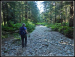
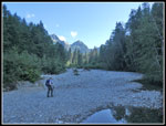
We reached the big log to find that there was no river. Just a big puddle under the start of the log. It was dry. I have not seen that before. After the log we went over to the second bridge that did have the river under it. It was running very low. Once back on the road we found the road to be a river bed. The next quarter mile was just a deep cut with small and medium sized rocks covering the entire road bed. A flood had come all the way in to the road and torn it apart. I could not have ridden a bike here though some folks surely do. At the Weden House sign the road was still a mess. A little way beyond it returns to a gravel road. Even here it is much different than in 2012. It is narrowing to a wide trail instead of a wide road. I was amazed how much it has changed in seven years.
We continued on to the meeting with the new/old road at the 2 mile mark. Somewhere around 3 miles we saw cut in the hillside above the road. It had grass and brush along with cut logs placed across it. We theorized it was where they dug dirt to cover the polluted soil. A little farther we found a larger cleared hillside. It seems that they placed the bad soil here. A sign mentioned that it was placed so it would not destroy an old historic switchback in the railroad grade. The road mostly follows the old railroad grade. Those two hills I mentioned earlier were too steep for trails so they put in switchbacks to allow the trains to climb the grade. Kim had seen a bit of the old grade years earlier. We did a little exploring and found the old grade. A short way along the grade is a big washout. We climbed down and back up again and found the grade on the other side. We also found what looked like part of the old trestle. Old rotted wood was held together with long bolts. A neat find. At the top of the hill on the road the grade meets it again.
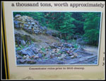
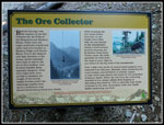
The last mile went by fast and we arrived at Monte Cristo. Years back there was a big automobile bridge into town. Now there is a narrower bridge for hikers and bikers. We arrived at Monte Cristo at 11:52. My best time hiking the four miles to Monte Cristo is one hour exactly. This day we arrived in 3:35. Easily my slowest time ever. It was also by far the most interesting hike I have done to Monte Cristo. We had lunch and started exploring. There were a number of folks at the townsite. We headed up Dumas Street. No changes took place here. In fact, most of the townsite looked just as it used to. The biggest problem was the old concentrator building. Ore from the mines went there and it was broken down and much of the rock was left as purer ore was left to be transported to Everett for more processing. A lot of those tailings contained arsenic and sulfur. The concentrator location was all cleaned up. What is left is rock parts of the foundation that used to be buried under the collapsed building. All the wood was removed too. The Monte Cristo Preservation Association has put up a number of signs that tell the history and explain what has been done. Very educational.
We found an old sign for the start of the Glacier Basin Trail. This must have been the end of the Mine To Market Road. We followed it a bit then lost it and just went uphill to the road leading to the Glacier Basin Trailhead. More clean up work was down along here. There are more signs explaining it. Overhead ore buckets went up to mines above and in Glacier Basin. The bases of these trams were along this road. A covered grade used horses to pull ore carts along tracks to the concentrator. A bit of the old grade is clearly visible along with one piece of the track. Neat history. We walked around more of the townsite but did not find more cleaned up areas. We went back down to the lower town to finish our food and get set for the hike back.
We started back at 3:30 pm. Kim was interested in the campgrounds so we took a quick look at it. The hike out had a lot less stops than coming in. We set a steady pace. We saw only two hikers going out, a couple still hiking in, and a few bikers coming out. Back at the new start of the Gothic Basin Trail we met a big group coming out. We reached the car at 5:47 pm. 2:27 minutes from the middle of the townsite was a more reasonable time. This turned out to be much more interesting than I expected. We found a railroad grade that I did not know existed and the remains of a trestle too. We saw where the bad soil and rock was buried. We saw a cleaned up concentrator foundation. We found the old start of the Glacier Basin Trail. We found out about the covered rails that brought the ore to the concentrator. I was knowledgeable about the general history of Monte Cristo but I learned more on this trip. We hiked about 9 miles on the day with about 1000' of elevation gain. A fun day was had by both of us.
Click on thumbnails to get
larger pictures.
Trips - 2019
Home
We met at 6:45 am and headed north. The hike to Gothic Basin off the same trailhead has become very popular in the age of Instagram. We were concerned with being early enough to find a parking spot at Barlow Pass. Traffic was light an we arrived at the 2361' pass at 8:10 am. The parking spots were all taken and most of the spots along the side of the road too. We were able to find a spot off the road. Later in the morning folks would be parking will over the fog line. Several other groups were getting ready to go. At 8:17 we were on our way. 16 years ago the route to the townsite was just a nice wide road and two bridges over the SF Sauk River. Four miles with a gentle drop to the river in just under one mile then three plus miles of mostly flat road to Monte Cristo. There are two short hills on the route. The floods of 2006 and 2006 affected the route. A big slide before the bridge took out the road. A trail was built around it. One of the bridges was stranded as the river took out the approach. What used to be forest is now a river channel.
To facilitate the clean up an old road was rebuilt and reopened. It meets the main road at just about the 2 mile marker. We did in fact see a small truck at Monte Cristo. The main road will never be reopened. A big log crosses the river and has been in use by hikers and bikers for quite some time. I had been across it several times. A short way down the trail was a board with a sign telling hikers to use the new start to the Gothic Basin Trail. I had not heard about it. The old trail started at the river crossing. Now it starts well before that heading above the old road. We lost most of the crowds when we passed that point. After the big floods the road was washed out in one spot but continued most of the way to the river crossing. Not any more. Now more of the road has fallen into the river and newer trails lead to the crossing. I had not been to Monte Cristo since 2012 so I'm not sure what has changed since then.
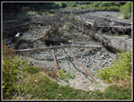
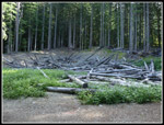
We reached the big log to find that there was no river. Just a big puddle under the start of the log. It was dry. I have not seen that before. After the log we went over to the second bridge that did have the river under it. It was running very low. Once back on the road we found the road to be a river bed. The next quarter mile was just a deep cut with small and medium sized rocks covering the entire road bed. A flood had come all the way in to the road and torn it apart. I could not have ridden a bike here though some folks surely do. At the Weden House sign the road was still a mess. A little way beyond it returns to a gravel road. Even here it is much different than in 2012. It is narrowing to a wide trail instead of a wide road. I was amazed how much it has changed in seven years.
We continued on to the meeting with the new/old road at the 2 mile mark. Somewhere around 3 miles we saw cut in the hillside above the road. It had grass and brush along with cut logs placed across it. We theorized it was where they dug dirt to cover the polluted soil. A little farther we found a larger cleared hillside. It seems that they placed the bad soil here. A sign mentioned that it was placed so it would not destroy an old historic switchback in the railroad grade. The road mostly follows the old railroad grade. Those two hills I mentioned earlier were too steep for trails so they put in switchbacks to allow the trains to climb the grade. Kim had seen a bit of the old grade years earlier. We did a little exploring and found the old grade. A short way along the grade is a big washout. We climbed down and back up again and found the grade on the other side. We also found what looked like part of the old trestle. Old rotted wood was held together with long bolts. A neat find. At the top of the hill on the road the grade meets it again.
The last mile went by fast and we arrived at Monte Cristo. Years back there was a big automobile bridge into town. Now there is a narrower bridge for hikers and bikers. We arrived at Monte Cristo at 11:52. My best time hiking the four miles to Monte Cristo is one hour exactly. This day we arrived in 3:35. Easily my slowest time ever. It was also by far the most interesting hike I have done to Monte Cristo. We had lunch and started exploring. There were a number of folks at the townsite. We headed up Dumas Street. No changes took place here. In fact, most of the townsite looked just as it used to. The biggest problem was the old concentrator building. Ore from the mines went there and it was broken down and much of the rock was left as purer ore was left to be transported to Everett for more processing. A lot of those tailings contained arsenic and sulfur. The concentrator location was all cleaned up. What is left is rock parts of the foundation that used to be buried under the collapsed building. All the wood was removed too. The Monte Cristo Preservation Association has put up a number of signs that tell the history and explain what has been done. Very educational.
We found an old sign for the start of the Glacier Basin Trail. This must have been the end of the Mine To Market Road. We followed it a bit then lost it and just went uphill to the road leading to the Glacier Basin Trailhead. More clean up work was down along here. There are more signs explaining it. Overhead ore buckets went up to mines above and in Glacier Basin. The bases of these trams were along this road. A covered grade used horses to pull ore carts along tracks to the concentrator. A bit of the old grade is clearly visible along with one piece of the track. Neat history. We walked around more of the townsite but did not find more cleaned up areas. We went back down to the lower town to finish our food and get set for the hike back.
We started back at 3:30 pm. Kim was interested in the campgrounds so we took a quick look at it. The hike out had a lot less stops than coming in. We set a steady pace. We saw only two hikers going out, a couple still hiking in, and a few bikers coming out. Back at the new start of the Gothic Basin Trail we met a big group coming out. We reached the car at 5:47 pm. 2:27 minutes from the middle of the townsite was a more reasonable time. This turned out to be much more interesting than I expected. We found a railroad grade that I did not know existed and the remains of a trestle too. We saw where the bad soil and rock was buried. We saw a cleaned up concentrator foundation. We found the old start of the Glacier Basin Trail. We found out about the covered rails that brought the ore to the concentrator. I was knowledgeable about the general history of Monte Cristo but I learned more on this trip. We hiked about 9 miles on the day with about 1000' of elevation gain. A fun day was had by both of us.
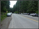 Busy Parking Area |
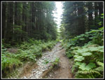
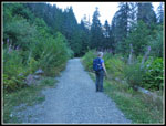
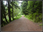 Wide Old Grade |
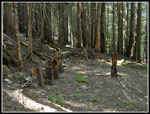
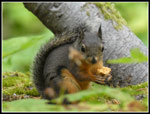 Squirrel |
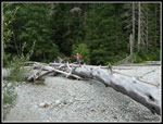 Where Is The River? |
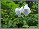 White Foxglove |
 Road Washed Out |
 Old Railroad Rails |
 First Cleanup Site |
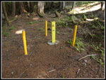 Groundwater Wells |
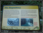 The Repository |
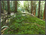 Railroad Grade |
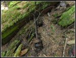 Trestle Hardware |
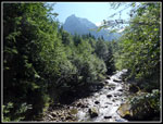 River From Bridge |
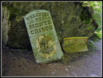 Monte Cristo Signs |
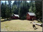 Townsite |
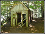
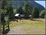
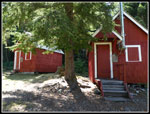 Restored Cabins |
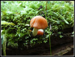
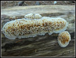
 Shadows On Shrooms |
 Dumas Street |
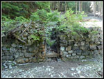
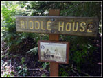 Riddle House |
 New Signs |
 Tiny Mushroom |
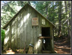 Guides Cabin |
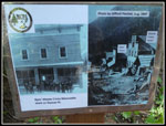 Mercantile Store Site |
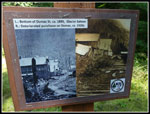
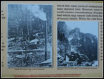
 Concentrator Photo |
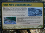 Concentrator Info |
 Before Cleanup |
 Foundation |
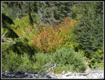 Fall Color |
 Moving The Ore |
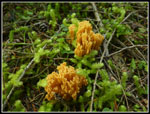
 Strange Fungus |
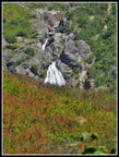 Waterfall |
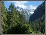
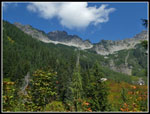 Ridge & Sky |
 Ore Terminals |
 Tramway Remains |
 More Fungus |
 Back In Town |
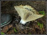 Big Mushroom |
 Snow Up High |
 Road Is Gone |
 Across The Non River |
 Fireweed |
 Lit Up Leaves |
Trips - 2019
Home