03-12-23
Saturday
I woke up early and it was raining everywhere. I had no motivation to
get out. It cleared up later but the motivation did not perk up. Gary
was off skiing east of the crest where it was sunny. I lightly sprained
a foot the past weekend while cross country skiing. I needed a smooth
dirt trail if I was to go hiking. The low snow level made that hard.
John was unable to get out on Saturday but he was free on Sunday. I
gave him a call Friday afternoon. We looked at a number of ideas and
then an updated weather report. Now it was supposed to begin raining
around noon and keep it up for the rest of the day. We chose a short
drive for an early start and a lower hike to avoid snow. That added up
meaning Cougar Mountain. To make it more interesting, it was the start
of Daylight Saving Time. We would lose an hour of sleep.
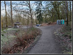
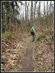
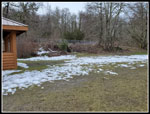
We met at Red Town at 7:55 am. There were some cars there already but not many. We had partial blue sky and 32 degrees at the start. My plan was to do the loop counterclockwise. This would put us on Anti-Aircraft Peak at about when the rain was expected to start. There are roofed picnic shelters there for lunch. It also means a steep descent at the end instead of a long flat finish. So much the better for late in the day umbrella hiking. We headed off on the Wildside Trail over to the Indian Trail. We had a group of runners zoom by us. We saw runners off and on all day but saw few hikers on our trip. We also had some long periods where we saw nobody. It was cold and that helped us get out on a fast pace. We took a short detour to Far Country Falls. There was some water flowing but not a lot.
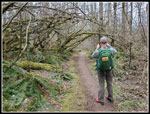
Our first sustained climb was up to Far Country Lookout. It was warmer up a little higher. My gloves came off after a mile or so. My wool beanie gave way to a ball cap at the lookout. Next, we dropped down and then climbed steadily higher. At the next junction we turned right on the Deceiver Ridge Trail. We went over the ridge and dropped down to another very short detour to Doughty Falls. Some water running but not impressive. I looked for any signs or early skunk cabbage leaves as we crossed the creek. None as of yet. Now we had a longer climb up to the top of Deceiver Ridge. This always goes on longer than I am expecting. At the top we soon reached another short detour. This time it was up Long View Peak. Our blue sky had turned white and there are almost no views left between all the trees.
We dropped down the trail and headed over to Shy Bear Pass. It used to be .40 miles from the pass to the top of Wilderness Peak. The new trail is much longer with a gentler grade. It is now .60 miles up. We saw a few small snow patches as this would be the highest point on our trip at 1598'. There was no snow on the trail. My sore foot was holding up fine so far. We were still just over a mile short of the half way point on our hike. So far we had hiked 4.8 miles in 1:48. It was now 9:47 am. We took a short food and water break on the summit. Now it was down hill back to the pass and then on to Fred's Railroad and the top of the Quarry Trail. That brought us up to just over 6 miles and the half way point on our trip.
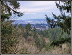
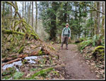
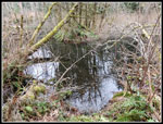
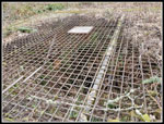
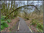
We continued along the old grade to the East Fork Trail where we turned right. The trail slowly climbs to Jerry's Duck Pond. We rounded the pond, climbed a little and descended to the metal grate covered mine airshaft and then the Clay Pit Road. We went up to the Clay Pit for views to the east. Tiger Mountain was clearly seen with lots of recent snow on top. Mt. Si was mostly visible in the background. Next, we headed on the trail over to Anti-Aircraft Peak. Along the way we took a short detour towards Cougar Pass. There is a creek here that often has the first skunk cabbage of the year. Not a single leaf had emerged from the swampy water. We retraced our steps and dropped to the bridge over Tibbetts Creek.
We had one more good sized climb of the day up to Anti-Aircraft Peak. We arrived at the peak and went over to the Million Dollar View. It as now 11:14 am. There was no wind there for a change so we had lunch at the picnic table in the pergola. The Cascade peaks were in the clouds but Lake Sammamish was clearly seen. After lunch we headed over to the grass field and went to the far picnic shelter. We crossed the field back to the other shelter. On the way John pointed out a circle of fir tree branches. We had no idea why it was there. The most snow seen was near the shelter. We could walk right around it though. We headed up to the top of AA Peak. From there it was all downhill on the Lost Beagle Trail. My sprained foot still felt fine. My bottom of my other foot was becoming a problem. My cushion insole was warn down to no cushion behind my toes. It was not very comfortable hiking the last 3+ miles. I ordered new insoles the next day.
We hiked down to the Klondike Swamp trail and turned left, following it back to the Clay Pit Road. There are a few nice overhanging mossy arbors here. There are quite a few of them on the entire loop. I have a lot of photos as I add more on each trip. We crossed the road and took a right on the connector trail. This brought us to the Cave Hole Road trail. It goes directly back to Red Town. We followed it to the Nike Horse Trail and turned right. This took us to the Sky Country Trailhead. At the junction sign it is almost exactly 1 mile back to the cars. Eleven miles down and just one to go. A few minutes later I thought I felt a raindrop. A few minutes later I felt another. It was past 12:30 pm and right about the time that rain was forecast to begin.
We reached the end of our journey at 12:52 pm. It was just under five hours since we started. That was not bad for a 12 mile hike with a few breaks. The drips were turned into rain as I changed shoes and my shirt. It rained most of the way home. Our timing was great. We carried umbrellas and rain gear and did not need them. For the day we hiked just over 12 miles with 2000' of elevation gain. That is not a lot of gain over 12 miles but it added some effort and came with a number of ups and downs instead of the long climbs and descents we have on most trips. For a trail system encircled by cities it is amazingly like wilderness and not as crowded as it should be. Taking lesser used trails helps. I did not get out on the midweek hike and missed Saturday but 12 miles on Sunday made up for it a bit. It was a nice long hike and I was still home by 1:35 pm.
Click on thumbnails to get
larger pictures.
Trips - 2023
Home
We met at Red Town at 7:55 am. There were some cars there already but not many. We had partial blue sky and 32 degrees at the start. My plan was to do the loop counterclockwise. This would put us on Anti-Aircraft Peak at about when the rain was expected to start. There are roofed picnic shelters there for lunch. It also means a steep descent at the end instead of a long flat finish. So much the better for late in the day umbrella hiking. We headed off on the Wildside Trail over to the Indian Trail. We had a group of runners zoom by us. We saw runners off and on all day but saw few hikers on our trip. We also had some long periods where we saw nobody. It was cold and that helped us get out on a fast pace. We took a short detour to Far Country Falls. There was some water flowing but not a lot.
Our first sustained climb was up to Far Country Lookout. It was warmer up a little higher. My gloves came off after a mile or so. My wool beanie gave way to a ball cap at the lookout. Next, we dropped down and then climbed steadily higher. At the next junction we turned right on the Deceiver Ridge Trail. We went over the ridge and dropped down to another very short detour to Doughty Falls. Some water running but not impressive. I looked for any signs or early skunk cabbage leaves as we crossed the creek. None as of yet. Now we had a longer climb up to the top of Deceiver Ridge. This always goes on longer than I am expecting. At the top we soon reached another short detour. This time it was up Long View Peak. Our blue sky had turned white and there are almost no views left between all the trees.
We dropped down the trail and headed over to Shy Bear Pass. It used to be .40 miles from the pass to the top of Wilderness Peak. The new trail is much longer with a gentler grade. It is now .60 miles up. We saw a few small snow patches as this would be the highest point on our trip at 1598'. There was no snow on the trail. My sore foot was holding up fine so far. We were still just over a mile short of the half way point on our hike. So far we had hiked 4.8 miles in 1:48. It was now 9:47 am. We took a short food and water break on the summit. Now it was down hill back to the pass and then on to Fred's Railroad and the top of the Quarry Trail. That brought us up to just over 6 miles and the half way point on our trip.
We continued along the old grade to the East Fork Trail where we turned right. The trail slowly climbs to Jerry's Duck Pond. We rounded the pond, climbed a little and descended to the metal grate covered mine airshaft and then the Clay Pit Road. We went up to the Clay Pit for views to the east. Tiger Mountain was clearly seen with lots of recent snow on top. Mt. Si was mostly visible in the background. Next, we headed on the trail over to Anti-Aircraft Peak. Along the way we took a short detour towards Cougar Pass. There is a creek here that often has the first skunk cabbage of the year. Not a single leaf had emerged from the swampy water. We retraced our steps and dropped to the bridge over Tibbetts Creek.
We had one more good sized climb of the day up to Anti-Aircraft Peak. We arrived at the peak and went over to the Million Dollar View. It as now 11:14 am. There was no wind there for a change so we had lunch at the picnic table in the pergola. The Cascade peaks were in the clouds but Lake Sammamish was clearly seen. After lunch we headed over to the grass field and went to the far picnic shelter. We crossed the field back to the other shelter. On the way John pointed out a circle of fir tree branches. We had no idea why it was there. The most snow seen was near the shelter. We could walk right around it though. We headed up to the top of AA Peak. From there it was all downhill on the Lost Beagle Trail. My sprained foot still felt fine. My bottom of my other foot was becoming a problem. My cushion insole was warn down to no cushion behind my toes. It was not very comfortable hiking the last 3+ miles. I ordered new insoles the next day.
We hiked down to the Klondike Swamp trail and turned left, following it back to the Clay Pit Road. There are a few nice overhanging mossy arbors here. There are quite a few of them on the entire loop. I have a lot of photos as I add more on each trip. We crossed the road and took a right on the connector trail. This brought us to the Cave Hole Road trail. It goes directly back to Red Town. We followed it to the Nike Horse Trail and turned right. This took us to the Sky Country Trailhead. At the junction sign it is almost exactly 1 mile back to the cars. Eleven miles down and just one to go. A few minutes later I thought I felt a raindrop. A few minutes later I felt another. It was past 12:30 pm and right about the time that rain was forecast to begin.
We reached the end of our journey at 12:52 pm. It was just under five hours since we started. That was not bad for a 12 mile hike with a few breaks. The drips were turned into rain as I changed shoes and my shirt. It rained most of the way home. Our timing was great. We carried umbrellas and rain gear and did not need them. For the day we hiked just over 12 miles with 2000' of elevation gain. That is not a lot of gain over 12 miles but it added some effort and came with a number of ups and downs instead of the long climbs and descents we have on most trips. For a trail system encircled by cities it is amazingly like wilderness and not as crowded as it should be. Taking lesser used trails helps. I did not get out on the midweek hike and missed Saturday but 12 miles on Sunday made up for it a bit. It was a nice long hike and I was still home by 1:35 pm.
 Getting Started |
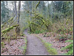 The First Arbor |
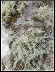
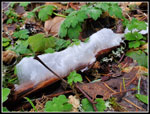 Hair Ice |
 Far Country Falls |
 Far Country Lookout |
 Doughty Falls |
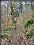 John On Deceiver Trail |
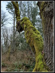
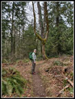 Tuning Fork Tree |
 First Snow |
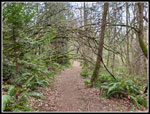
 East Fork Trail |
 Jerry's Duck Pond |
 Another Mossy Arbor |
 Mine Air Shaft |
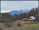 Tiger From Clay Pit |
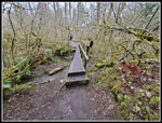 Tibbetts Creek Bridge |
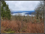 Million Dollar View |
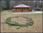 Branch Circle |
 The Most Snow |
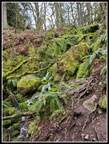
 Moss On Tree |
 Klondike Swamp Arch |
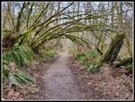 Big Mossy Arch |
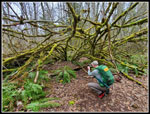 John At Work |
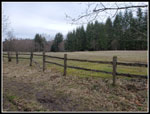 Big Meadow |
 Mossy Tree |
 Last Mossy Arch |
Trips - 2023
Home