03-25-23
I
woke up at 6:00 am rolled over
and then woke up at 7:00 am. It was 8:35 am before I was on my way. At
11:00 pm the forecast was for a few showers early then rain after 12:00
pm. Farther from Seattle meant more rain. I planned for this with the
close in morning trip to Squak. With snow about about 2000' I did not
want to do a rainy trip on snow. By 7:00 am the forecast changed
radically. Now, it was no rain until evening. My later start was no
problem. I had all day. I arrived at the Squak State Part lot at 9:15
am. The lot was less than half full. I was on my way at 9:19 am. I did
not even bother to bring an umbrella. The trail quickly reaches the
road that goes up to Central Peak. I would be there later by a much
longer route. First, I took a short loop on the Pretzel Tree Trail. I
have yet to see a single wildflower this year. I hoped to find some at
the lower levels. The flat quarter mile loop also adds some mileage.
This month has been a bit below average so a little more is good.
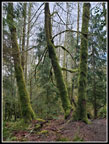
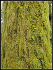
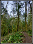
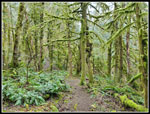
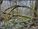
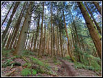
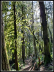
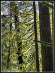
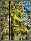
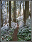
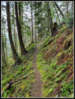
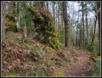
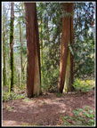
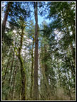
After not being able to see the Pretzel Tree on several visits, I have it figured out now. A sign says to look behind you. That did not help on those visits The tree splits in two and the trunks wrap around each other. It is an unusual tree. After that flowerless loop I reached the road again and turned onto the main trail. This well graded smooth trail makes for fast and easy hiking. This day I had my winter weight backpack so there would be no speed records. I also stop for many photos as the forest is filled will moss covered trees. There is plenty to see if you look around. At a half mile up the trail I reached the start and end of my loop trip. Last time I went right. This time I went left. The main trail to the left is usually much more crowded in the afternoon when I return. Going clockwise I see few folks until that last half mile.
I passed several groups already coming down. That only happens when I have a late start like today. It was 37 degrees when I started with mostly overcast sky. Later on I had some blue sky and sunshine abut the clouds never went away entirely. I was trying out a new pair of boots. They are low top but waterproof. I have been wearing high top heavier boots most of the winter. They did fine this day and were lighter. I continued on the main trail until turning left on the Perimeter Trail. There are several right turns earlier and they just go over to the main road. I did not see a single wildflower in bloom on the lower trail. By the end of the day I still had not seen a single flower. It may be into April before I do. This has been a late spring.
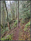
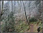
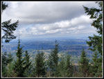
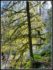
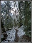
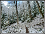
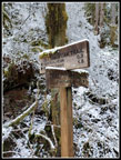
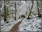
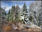
I reached the turn off to Debbie's View at 10:30 am. I took 1:11 minutes to hike 3 miles. I was almost one third of the way but had gained 1450' or 60% of the day's total. I dropped to the viewpoint to find several groups looking at a cloudy view. I took two photos and headed back. Back at the Perimeter Trail I turned left. I followed this trail over to the top of Margaret's Way Trail. Across from it is the new Chybinski Trail. Part of the old Chybinski Loop was decommissioned. This nicely graded trail drops down the north side of Squak Mountain. Ascending the south and then the north side of the mountain provides a good elevation gain workout. I hit a little fresh snow on the trees and brush near the top of the Perimeter Trail. On the north side the snow continued much farther down the mountain. I walked on almost no snow all day but had snowy trees to add to the scenery.
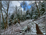
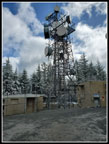
The trail drops to a junction where I turned right and began to climb back uphill on the West Access Trail. This trail runs into the Bullitt Access Trail. It was once the road access to the Bullitt Cabin, now known for the big fireplace that remains. As I ascended the trees were once again snowy. I turned off on the Central Peak Trail. This would take me to the highest point on Squak Mountain. In the trees the ground was brown dirt. In open spots the trees were flocked and snow was on the sides of the trail. The trail itself was a narrow brown line. It was beautiful and still easy walking. I reached the next junction. Right goes to the Bullitt Fireplace. Left goes to 2031' Central Peak. I passed the Old Griz Trail near the summit. That would be by route down. I expected to find some snow on the gravel at the summit. I was surprised to find none. I arrived at 11:47 am. I had hiked 5.9 miles in 2:28. I had about 4 miles to go but very little elevation to gain.
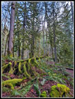
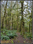
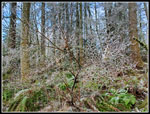
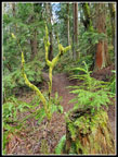
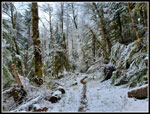
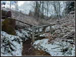
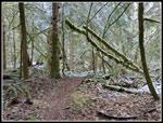
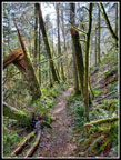
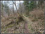
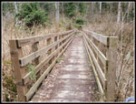
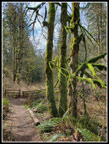
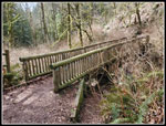
After lunch, I headed down to the Old Griz Trail. This is one of my favorite trails on Squak. Good forest, nicely graded, and lots to see. This day that included snow covered trees in places. Half a mile later I turned right on Phil's Creek Trail. There are down trees that have been cut out and a couple to step over along here. All day I had cold hands and it was worse as I had a cold headwind now. They were cold even with liner gloves on. At the Summit Trial junction I met a runner coming up. He was the first person I had seen since coming up the north side of Squak. April is less than a week away but there is no buds let alone leaves on all the brush along Phil's Creek Trail. There was the only muddy spot I saw all day. It was short. With no brush I could see the bridge on the side trail crossing the creek well before I reached it. The junction is not signed currently. I turned left. The trail descends in a neat forest.
There is a tall narrow rock right above the trail. I added to my photos of it. There are more mossy trees here. The trail switches back at a log bench. Now it switchbacks down the slope. I strained something behind my left knee on a snowshoe trip two weeks earlier. It had been fine but was now starting to hurt. I took the longer route on the May Valley Loop. I was glad to finally cross back over Phil's Creek. I soon crossed the road and quickly reached the end of my loop at the half mile junction. When I reached the road one last time I checked my mileage. I was a couple tenths of mile short of 10. I took another loop around the Pretzel Tree Trail then headed for the parking lot. I arrived at my car at 1:53 pm. I hiked 10 miles with 2400' of gain in 4:34. The lot was not full. That is unusual, even in late March.
This was a fun trip. I expected to finish in the rain but the morning forecast had changed so much I did not even take an umbrella. I did not need one. I saw folks on the first half of the trip but only a couple on the second half until the last half mile. Solitude while hiking in Issaquah is nice. There was enough fresh snow to improve the scenery while not impairing footing. I carried microspikes but never came close to needing them. I am not happy with the sore knee but I hiked out just fine.
Click on thumbnails to get
larger pictures.
Trips - 2023
Home
After not being able to see the Pretzel Tree on several visits, I have it figured out now. A sign says to look behind you. That did not help on those visits The tree splits in two and the trunks wrap around each other. It is an unusual tree. After that flowerless loop I reached the road again and turned onto the main trail. This well graded smooth trail makes for fast and easy hiking. This day I had my winter weight backpack so there would be no speed records. I also stop for many photos as the forest is filled will moss covered trees. There is plenty to see if you look around. At a half mile up the trail I reached the start and end of my loop trip. Last time I went right. This time I went left. The main trail to the left is usually much more crowded in the afternoon when I return. Going clockwise I see few folks until that last half mile.
I passed several groups already coming down. That only happens when I have a late start like today. It was 37 degrees when I started with mostly overcast sky. Later on I had some blue sky and sunshine abut the clouds never went away entirely. I was trying out a new pair of boots. They are low top but waterproof. I have been wearing high top heavier boots most of the winter. They did fine this day and were lighter. I continued on the main trail until turning left on the Perimeter Trail. There are several right turns earlier and they just go over to the main road. I did not see a single wildflower in bloom on the lower trail. By the end of the day I still had not seen a single flower. It may be into April before I do. This has been a late spring.
I reached the turn off to Debbie's View at 10:30 am. I took 1:11 minutes to hike 3 miles. I was almost one third of the way but had gained 1450' or 60% of the day's total. I dropped to the viewpoint to find several groups looking at a cloudy view. I took two photos and headed back. Back at the Perimeter Trail I turned left. I followed this trail over to the top of Margaret's Way Trail. Across from it is the new Chybinski Trail. Part of the old Chybinski Loop was decommissioned. This nicely graded trail drops down the north side of Squak Mountain. Ascending the south and then the north side of the mountain provides a good elevation gain workout. I hit a little fresh snow on the trees and brush near the top of the Perimeter Trail. On the north side the snow continued much farther down the mountain. I walked on almost no snow all day but had snowy trees to add to the scenery.
The trail drops to a junction where I turned right and began to climb back uphill on the West Access Trail. This trail runs into the Bullitt Access Trail. It was once the road access to the Bullitt Cabin, now known for the big fireplace that remains. As I ascended the trees were once again snowy. I turned off on the Central Peak Trail. This would take me to the highest point on Squak Mountain. In the trees the ground was brown dirt. In open spots the trees were flocked and snow was on the sides of the trail. The trail itself was a narrow brown line. It was beautiful and still easy walking. I reached the next junction. Right goes to the Bullitt Fireplace. Left goes to 2031' Central Peak. I passed the Old Griz Trail near the summit. That would be by route down. I expected to find some snow on the gravel at the summit. I was surprised to find none. I arrived at 11:47 am. I had hiked 5.9 miles in 2:28. I had about 4 miles to go but very little elevation to gain.
After lunch, I headed down to the Old Griz Trail. This is one of my favorite trails on Squak. Good forest, nicely graded, and lots to see. This day that included snow covered trees in places. Half a mile later I turned right on Phil's Creek Trail. There are down trees that have been cut out and a couple to step over along here. All day I had cold hands and it was worse as I had a cold headwind now. They were cold even with liner gloves on. At the Summit Trial junction I met a runner coming up. He was the first person I had seen since coming up the north side of Squak. April is less than a week away but there is no buds let alone leaves on all the brush along Phil's Creek Trail. There was the only muddy spot I saw all day. It was short. With no brush I could see the bridge on the side trail crossing the creek well before I reached it. The junction is not signed currently. I turned left. The trail descends in a neat forest.
There is a tall narrow rock right above the trail. I added to my photos of it. There are more mossy trees here. The trail switches back at a log bench. Now it switchbacks down the slope. I strained something behind my left knee on a snowshoe trip two weeks earlier. It had been fine but was now starting to hurt. I took the longer route on the May Valley Loop. I was glad to finally cross back over Phil's Creek. I soon crossed the road and quickly reached the end of my loop at the half mile junction. When I reached the road one last time I checked my mileage. I was a couple tenths of mile short of 10. I took another loop around the Pretzel Tree Trail then headed for the parking lot. I arrived at my car at 1:53 pm. I hiked 10 miles with 2400' of gain in 4:34. The lot was not full. That is unusual, even in late March.
This was a fun trip. I expected to finish in the rain but the morning forecast had changed so much I did not even take an umbrella. I did not need one. I saw folks on the first half of the trip but only a couple on the second half until the last half mile. Solitude while hiking in Issaquah is nice. There was enough fresh snow to improve the scenery while not impairing footing. I carried microspikes but never came close to needing them. I am not happy with the sore knee but I hiked out just fine.
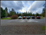 State Park Lot |
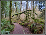 Mossy Arch |
 Lots Of Moss |
 Some Blue Sky |
 Nice Colors |
 Close Up Look |
 Moderate Grade |
 Varying Lighting |
 Mossy Branches |
 Perimeter Trail |
 Snow Line |
 Neat Snowy Tree |
 Another Arch |
 Debbie's View |
 Wide Angle |
 Lit By Sunshine |
 More Mossy Sunshine |
 Nice Colors |
 Sunshine & Snow |
 Tree On Stump |
 Into The Snow |
 From Spring To Winter |
 Blue Sky & Snow |
 Narrow Trail |
 Junction |
 Really Pretty |
 Big Gate |
 Squak Mt. Microwave |
 Tower |
 Bright Sunshine |
 Old Griz Trail |
 More Moss |
 Phil's Creek Trail |
 Snowy Log |
 Total Solitude |
 No Leaves |
 Bridge Crossing |
 Mossy Rock |
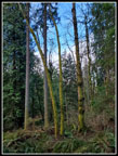
 Twin Cedars |
 Approaching Bridge |
 Last Big Bridge |
 Pretzel Tree |
Trips - 2023
Home