04-28-24
Gary
was free for a Sunday hike. I was out of town and only returned at 6:45
pm on Saturday. It looked to be a wet day and we decided on a close in
hike on Cougar Mountain. High winds and rain most of the day as of
10:00 pm Saturday. Sunday morning I woke to find future radar calling
for little if any rain. We ramped up a short trip to a longer one. We
arrived at Red Town at 7:28 am. The new bridge is coming along. It
looks to be in place though it is covered by a tarp as it has been
raining. We were on the trail at 7:P33 am. There were 7 or 8 cars in
the lot. Gary has done a similar loop clockwise. We set out to go
counterclockwise. On my last Cougar trip, I saw a couple bleeding
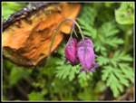
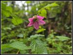
hearts blooming just up the trail. That was it for the day. This day,
there were many blooming right from the start and we kept seeing them
all day long. We crossed Coal Creek and then the road and were on the
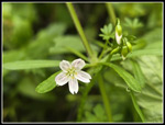
Wildside Trail. There were some trillium still in bloom but the rain
had them bent over. Later, we would see more farther up the trail. When
we reached the Indian Trail, we took a detour to the meadow. Gary and I
saw fawn lilies on Margaret's Way Trail several years ago. Gary then
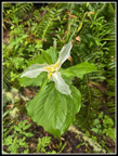
saw them on this meadow. I looked a year later and did not see any. A
report from several weeks earlier showed fawn lilies in bloom on Cougar
Mountain. I doubted they would still be blooming but it was a short
detour.
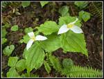
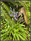
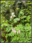
We arrived at the meadow to see a big patch of fawn lilies in bloom. It was the third time each of us had seen them. After seeing white bluebells the week before, this was another unexpected treat. Soon, we were off on the Indian Trail. This trail is pretty flat and we made good time. We passed by the short side trail to Far Country Falls. It did not sound like there was much water at the falls. We turned left on the trail up to Far Country Lookout. It was quiet so far as we had only seen one runner. The view at the lookout is narrowing but is still there. We continued on. At the junction with the trail up to Deceiver Ridge we turned right onto that trail. This is a little longer than staying on the Shy Bear Trail but with rain seeming to hold off until early afternoon we took the longer route. We did take the short trail to Doughty Falls. There was water running over the falls though not a lot. At the bridge over the creek, there was a duck sitting on the bridge. He took off as we approached. We passed to hikers going the opposite direction here.
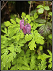
Now came the climb up Deceiver Ridge. As we ascended we entered the clouds. It was quite misty. We headed up to the top of Long View Peak. We left at 9:19 am. We had covered 3.75 miles in 1:46. On the way to Shy Bear Pass we went by patches of garden bluebells. Not the wild type. Many years ago I saw daffodils blooming in that spot. Someone has been planting seeds. We arrived at the pass and continued up Wilderness Peak. At 1595' that is the highest point on Cougar Mountain. A short way up Gary noticed some very pale bleeding hearts. These were just after some very dark pink and red ones. One patch had no ping at all. White bleeding hearts seen just a week after we saw white bluebells. Both were seen for the first time by both of us. Two days later I had a Facebook memory reminding me of the only white grass widows I saw 7 years earlier. I have seen pale pink bleeding hearts but these white ones were in a bigger patch of pale pink. That sighting alone made the trip memorable.
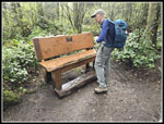
As usual, we saw several groups near the summit though we had the top to ourselves for a short break. We were 4.75 miles into our trip as we headed down. We retraced our steps back to Shy Bear Pass and took the trail heading for Fred's Railroad. Along the way we kept seeing colorful bleeding hearts and some salmonberry flowers and a few yellow violets and trillium. We passed the top of the Shy Bear Trail and then the top of the Quarry Trail at the start of Fred's Railroad. The East Fork Trail came up quickly and we turned right heading for the Clay Pit. We saw a past prime skunk cabbage then reached Jerry's Duck Pond. We went up and then down to the Clay Pit Road. We hiked a short way into the old clay pit. The top of Tiger Mountain was in the clouds. The rest was in sight. The old bench is gone and a new one is in it's place. After a few photos we turned onto the trail over to Anti-Aircraft Peak. We arrived at the Clay Pit at 10:56 am. We had traveled 7.1 miles in 3:23.
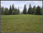
The Tibbetts Marsh Trail drops down to Tibbetts Creek. Along the way we saw a few blooming trillium and many more bleeding hearts. Many of the deciduous trees have leafed out since my last visit. Once across the creek, the trail meets two junctions then begins the climb up to Anti-Aircraft Peak. Just before the parking lot, we turned off on the short trail to the Million Dollar View. With leaves now out the view is even less than in the winter. We could see down to a bit of Lake Sammamish but the mountains were in the clouds. There was a little breeze now and I put on a wind shirt. We headed over to the first roofed picnic shelter and the wind was not in the shelter. We then walked across the meadow to the far shelter. That one was in the cold wind. We headed back to the first shelter. Now there was a little wind inside but it was not bad. We had our lunch break at 11:35 am. We had now completed 8.4 miles. With breaks and photo stops our total time was more than I expected. So far it was a completely dry hike.
We finished lunch and headed on at 11:50 am. We headed up to the highest point on AA Peak and started down the Lost Beagle Trail. With the moist overcast the color were very good all day. They were especially good on this section. At the bottom of the trail we turned left on the Klondike Swamp Trail. This nearly flat trail took us back to the Clay Pit Road. I took more photos of the mossy arbors on the trail. We crossed the road and quickly turned off on the Bypass Trail. This took us to the Cave Hole Trail. This is the route I used to take back to Red Town. Now I turn onto the Nike Horse Trail and take it to the Sky Country Trailhead. This trail passes the big meadow where missiles were once kept underground. On the Nike Trail it began to lightly rain. Our umbrellas came out.
With 1 miles to go we turned onto the Sky Country Trail. With just one downhill mile to go the light rain was not much of an inconvenience. We had one last turn onto the Military Road. That took us down to Red Town. The parking lot was now mostly full. We arrived at 1:10 pm. For the day we hiked 11.9 miles with 1900' of elevation gain in 5:37. The night before we planned a quick 6 or 7 mile wet hike with umbrellas. We ended up with just one mile of rain and nice conditions for the first 5 hours. That was much better than we expected.
The wildflower show was better than we thought it would be. The bleeding hearts were everywhere. Some trillium were still blooming. We saw some yellow violets, red currants, a skunk cabbage, salmonberry flowers, and a few others. Not profusion but a good sampling. Add to that our third fawn lily sighting and our first ever white bleeding hearts. It turned out to be a very enjoyable day on close to the city trails.
Click on thumbnails to get
larger pictures.
Trips - 2024
Home
We arrived at the meadow to see a big patch of fawn lilies in bloom. It was the third time each of us had seen them. After seeing white bluebells the week before, this was another unexpected treat. Soon, we were off on the Indian Trail. This trail is pretty flat and we made good time. We passed by the short side trail to Far Country Falls. It did not sound like there was much water at the falls. We turned left on the trail up to Far Country Lookout. It was quiet so far as we had only seen one runner. The view at the lookout is narrowing but is still there. We continued on. At the junction with the trail up to Deceiver Ridge we turned right onto that trail. This is a little longer than staying on the Shy Bear Trail but with rain seeming to hold off until early afternoon we took the longer route. We did take the short trail to Doughty Falls. There was water running over the falls though not a lot. At the bridge over the creek, there was a duck sitting on the bridge. He took off as we approached. We passed to hikers going the opposite direction here.
Now came the climb up Deceiver Ridge. As we ascended we entered the clouds. It was quite misty. We headed up to the top of Long View Peak. We left at 9:19 am. We had covered 3.75 miles in 1:46. On the way to Shy Bear Pass we went by patches of garden bluebells. Not the wild type. Many years ago I saw daffodils blooming in that spot. Someone has been planting seeds. We arrived at the pass and continued up Wilderness Peak. At 1595' that is the highest point on Cougar Mountain. A short way up Gary noticed some very pale bleeding hearts. These were just after some very dark pink and red ones. One patch had no ping at all. White bleeding hearts seen just a week after we saw white bluebells. Both were seen for the first time by both of us. Two days later I had a Facebook memory reminding me of the only white grass widows I saw 7 years earlier. I have seen pale pink bleeding hearts but these white ones were in a bigger patch of pale pink. That sighting alone made the trip memorable.
As usual, we saw several groups near the summit though we had the top to ourselves for a short break. We were 4.75 miles into our trip as we headed down. We retraced our steps back to Shy Bear Pass and took the trail heading for Fred's Railroad. Along the way we kept seeing colorful bleeding hearts and some salmonberry flowers and a few yellow violets and trillium. We passed the top of the Shy Bear Trail and then the top of the Quarry Trail at the start of Fred's Railroad. The East Fork Trail came up quickly and we turned right heading for the Clay Pit. We saw a past prime skunk cabbage then reached Jerry's Duck Pond. We went up and then down to the Clay Pit Road. We hiked a short way into the old clay pit. The top of Tiger Mountain was in the clouds. The rest was in sight. The old bench is gone and a new one is in it's place. After a few photos we turned onto the trail over to Anti-Aircraft Peak. We arrived at the Clay Pit at 10:56 am. We had traveled 7.1 miles in 3:23.
The Tibbetts Marsh Trail drops down to Tibbetts Creek. Along the way we saw a few blooming trillium and many more bleeding hearts. Many of the deciduous trees have leafed out since my last visit. Once across the creek, the trail meets two junctions then begins the climb up to Anti-Aircraft Peak. Just before the parking lot, we turned off on the short trail to the Million Dollar View. With leaves now out the view is even less than in the winter. We could see down to a bit of Lake Sammamish but the mountains were in the clouds. There was a little breeze now and I put on a wind shirt. We headed over to the first roofed picnic shelter and the wind was not in the shelter. We then walked across the meadow to the far shelter. That one was in the cold wind. We headed back to the first shelter. Now there was a little wind inside but it was not bad. We had our lunch break at 11:35 am. We had now completed 8.4 miles. With breaks and photo stops our total time was more than I expected. So far it was a completely dry hike.
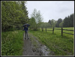
We finished lunch and headed on at 11:50 am. We headed up to the highest point on AA Peak and started down the Lost Beagle Trail. With the moist overcast the color were very good all day. They were especially good on this section. At the bottom of the trail we turned left on the Klondike Swamp Trail. This nearly flat trail took us back to the Clay Pit Road. I took more photos of the mossy arbors on the trail. We crossed the road and quickly turned off on the Bypass Trail. This took us to the Cave Hole Trail. This is the route I used to take back to Red Town. Now I turn onto the Nike Horse Trail and take it to the Sky Country Trailhead. This trail passes the big meadow where missiles were once kept underground. On the Nike Trail it began to lightly rain. Our umbrellas came out.
With 1 miles to go we turned onto the Sky Country Trail. With just one downhill mile to go the light rain was not much of an inconvenience. We had one last turn onto the Military Road. That took us down to Red Town. The parking lot was now mostly full. We arrived at 1:10 pm. For the day we hiked 11.9 miles with 1900' of elevation gain in 5:37. The night before we planned a quick 6 or 7 mile wet hike with umbrellas. We ended up with just one mile of rain and nice conditions for the first 5 hours. That was much better than we expected.
The wildflower show was better than we thought it would be. The bleeding hearts were everywhere. Some trillium were still blooming. We saw some yellow violets, red currants, a skunk cabbage, salmonberry flowers, and a few others. Not profusion but a good sampling. Add to that our third fawn lily sighting and our first ever white bleeding hearts. It turned out to be a very enjoyable day on close to the city trails.
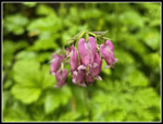 The First Bleeding Hearts |
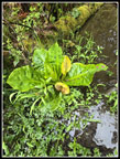
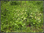 Fawn Lilies |
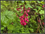 Red Currants |
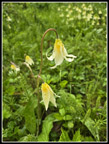 Fawn Lilies Close Up |
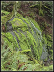
 First Mossy Arbor |
 Twin Trillium |
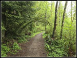
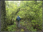
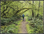
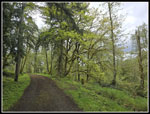
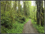 Indian Trail |
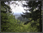 Far Country Lookout |
 Another Arbor |
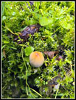 Small Mushroom |
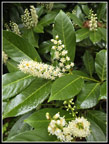 Flowers On Shrub |
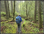 Narrow Trail |
 Doughty Falls |
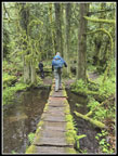 Gary On Bridge |
 Deceiver Ridge |
 Bluebells |
 Colorful Bleeding Hearts |
 Wilderness Peak Summit |
 White Bleeding Hearts |
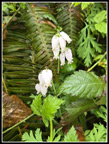 Whites Close Up |
 Salmonberry Flower |
 More Bleeding Hearts |
 Devil's Club |
 Wet Trillium |
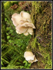 Fresh Fungi |
 Skunk Cabbage |
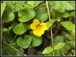 Yellow Violet |
 Hikers & Mossy Arbor |
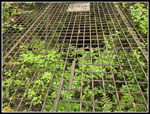 Primrose Mine Air Shaft |
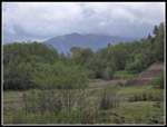 Tiger Mt. From Clay Pit |
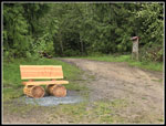 New Clay Pit Bench |
 Tibbetts Creek Bridge |
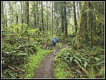
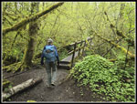
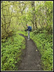 Gary On Trail |
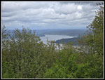 Million Dollar View |
 AA Peak Meadow |
 Road To AA Summit |
 Spring Beauty |
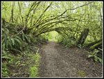 Even More Mossy Arbors |
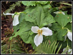 More Trillium |
 Raining At Big Meadow |
Trips - 2024
Home