07-19-25
Gary
was free or a Saturday hike.
I-5 northbound was closed for the weekend from I-90 to the U-District.
That made any trip south or west a possible nightmare coming home. We
looked north for a trip. Far north looked to be very cloudy. The
Stevens Pass area looked much better. I hiked to Janus Lake and Grizzly
Peak in 2016. I listed it as 16 miles with 3600' of gain. It is hard to
tell the gain as there are lots of small ups and downs. It is a long
hike and a challenging one. I loved it and planned on a repeat. Nine
years later it was time. Gary did the hike twice, once in 1975 and
again in 1987. It was well past time for him too. We met in Bothell at
6:15 am and headed east. Traffic was heavier than expected that early
on a Saturday. We headed over Stevens Pass and then up Smith Brook
Road. The road was in very good shape. We caught up with a car and it
took the last space in the parking lot. Gary managed to fit in an
unofficial spot. We were packed and on our way at 7:43 am.
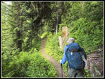
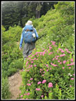
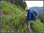
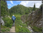
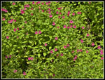
The partial overcast leading to mostly sunny was a little off. It was solid overcast and cool. The cool part was great. It was 94 degrees in Seattle three days earlier. A 52F start felt good. We headed up the trail at a good pace. It is about 1.3 miles with 680' of gain to Union Gap. Most people turn left on the Pacific Crest Trail (PCT) heading for Lake Valhalla and/or Mt. McCausland. We turned right heading for Lake Janus and Grizzly Peak. The trail drops 640' from Union Gap. As with the rest of our route, the drop was at a moderate grade. We gained 4000' for the day but over 16 miles it was never steep. That helped in keeping up a good pace but it did mean a last climb to Union Gap after 13 miles of hiking. We crossed a couple creeks that were still running. One has a cascading falls and a huge display of pink Lewis monkey flowers. We continued on and reached Lake Janus at about 3.5 miles. We had awful mosquitoes on a backpacking trip last weekend, especially when stopped. This day they were not bad while hiking but were a bit of a pain when we stopped.
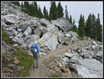
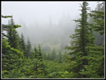
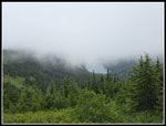
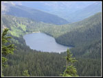
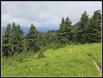
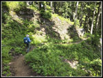
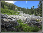
We detoured to the shore of Janus for a break. The low clouds hid all the peaks behind the lake. I was worried that it would not burn off and we would not see any peaks on the trip. We arrived at 9:19 am. There were no views but the misty clouds provided an ambiance of its own. The skeeters were waiting for us and we were back on the move five minutes later. Now came the climb up to the ridge top. It is all in forest and at a moderate grade. The trail is mostly smooth and easy to hike. I kept a lookout for the old Pacific Crest Trail System metal markers on trees and saw four of them. Right after crossing over the Cascade Crest to the east side the way became sub-alpine with meadows, boulders, and forest mixed with open areas. In one spot big boulders were blown up to create a smooth path. Views would normally be opening up but all we saw were clouds. Before reaching the ridge top we did see that a creek below the trail was still running.
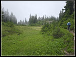
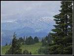
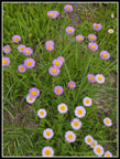
We started seeing asters and lots of partridge foot. The trail winds around to avoid cliffs as it follows the ridge dropping to the east in places and the west. One big meadow had a tarn and a little water running. On my end of July trip in 2016 there was not a drop of water on the ridge. The miles piled up as we went by mile 6 and 7. We had a look up to Grizzly Peak. It is very steep on the this side and much flatter on the north side. The trail began to climb towards the summit. The switchbacks had lots of flowers in bloom. Spirea was rampant along with valerian. Asters were also prevalent. We reached the summit turnoff where two hikers were standing. We had a short conversation and then hiked the last few feet to the top. We arrived at 12:08 pm. There were a few sucker holes of blue sky but mostly it was solid white. The mosquitoes were waiting for us. I put on a windshirt with a hood. I forgot my head net and did not need it. It was still in the 50s and comfortable. Another group arrived and found a place out of sight.
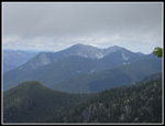
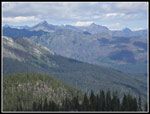
During the hike we passed hikers off and on. Many were PCT through hikers. A lot of them were heading south. We had lunch and then went a little farther north. The meadows continued. I had hoped to see Glacier Peak as I did in 2016. It was not to be. On the way in we saw Glasses Lake and Heather Lake below. We could see Heather from the summit. At 1:13 pm we were on our way down. On the switchbacks Gary noticed a bee on the Spirea. It seemed to be a bit slow from the cold. This allowed for time to photograph it. It had cleared a little and now we could see Saucer Lake across the valley. Below the switchbacks we headed back along the ridge of the Cascade Crest. We had a view to the northeast and now we could clearly see Mt. David, Whittier Peak, and Clark Mountain. Glacier Peak remained in clouds. My Peak Finder app helped to name the many peaks in view. The small ups and downs along the ridge became more noticeable as we passed 10 miles. When we reached the last crossing of the ridge it was back into forest and nearly all downhill to Lake Janus.
The moderate grade made for an easy descent. We arrived back at Lake Janus at 3:51 pm. This time we did not stop at the lake. We had some ups and downs crossing the two creeks and then a short down to the low point before the climb up to Union Gap. We now had views out that were not there in the morning. We even saw a few fireweed in bloom. Once across the rock field we went back into forest for the climb. It was warmer now but far from hot. With about 13.5 miles done, a steady uphill was not what we wanted. It is moderately grades and pretty smooth. We arrived back at Union Gap at 5:12 pm to find a couple with a tent set up. Now it was one last downhill to the trailhead. It went by pretty quickly and we reached the car at 5:52 pm. I was surprised to find only about a dozen or fewer cars in the lot and along the road. I thought more people would be out camping on a Saturday night.
Overall, this trip was a success. We did a three day backpacking trip a week earlier and were not sure we would want to go all the nearly 16 miles round trip to Grizzly Peak. The morning overcast seemed disappointing at the time but we had some moody cloudy conditions early then some views on the way back. The cool day was definitely great for me. We will have lots of hot hiking days left this summer but a cool day made the long distance much easier. We never did see Glacier Peak as it was in clouds all day. We did see a lot of peaks to the east later on. We did see wildflowers in bloom but after such a good spring and summer for flowers it was not a great show. The drive home was better than expected. Google showed slowdowns near Sultan but we sailed right through with hardly any slowing. I have been trying to get in more 14-17 mile day trips the past few years and this one really delivered.
Click on thumbnails to get
larger pictures.
Trips - 2025
Home
The partial overcast leading to mostly sunny was a little off. It was solid overcast and cool. The cool part was great. It was 94 degrees in Seattle three days earlier. A 52F start felt good. We headed up the trail at a good pace. It is about 1.3 miles with 680' of gain to Union Gap. Most people turn left on the Pacific Crest Trail (PCT) heading for Lake Valhalla and/or Mt. McCausland. We turned right heading for Lake Janus and Grizzly Peak. The trail drops 640' from Union Gap. As with the rest of our route, the drop was at a moderate grade. We gained 4000' for the day but over 16 miles it was never steep. That helped in keeping up a good pace but it did mean a last climb to Union Gap after 13 miles of hiking. We crossed a couple creeks that were still running. One has a cascading falls and a huge display of pink Lewis monkey flowers. We continued on and reached Lake Janus at about 3.5 miles. We had awful mosquitoes on a backpacking trip last weekend, especially when stopped. This day they were not bad while hiking but were a bit of a pain when we stopped.
We detoured to the shore of Janus for a break. The low clouds hid all the peaks behind the lake. I was worried that it would not burn off and we would not see any peaks on the trip. We arrived at 9:19 am. There were no views but the misty clouds provided an ambiance of its own. The skeeters were waiting for us and we were back on the move five minutes later. Now came the climb up to the ridge top. It is all in forest and at a moderate grade. The trail is mostly smooth and easy to hike. I kept a lookout for the old Pacific Crest Trail System metal markers on trees and saw four of them. Right after crossing over the Cascade Crest to the east side the way became sub-alpine with meadows, boulders, and forest mixed with open areas. In one spot big boulders were blown up to create a smooth path. Views would normally be opening up but all we saw were clouds. Before reaching the ridge top we did see that a creek below the trail was still running.
We started seeing asters and lots of partridge foot. The trail winds around to avoid cliffs as it follows the ridge dropping to the east in places and the west. One big meadow had a tarn and a little water running. On my end of July trip in 2016 there was not a drop of water on the ridge. The miles piled up as we went by mile 6 and 7. We had a look up to Grizzly Peak. It is very steep on the this side and much flatter on the north side. The trail began to climb towards the summit. The switchbacks had lots of flowers in bloom. Spirea was rampant along with valerian. Asters were also prevalent. We reached the summit turnoff where two hikers were standing. We had a short conversation and then hiked the last few feet to the top. We arrived at 12:08 pm. There were a few sucker holes of blue sky but mostly it was solid white. The mosquitoes were waiting for us. I put on a windshirt with a hood. I forgot my head net and did not need it. It was still in the 50s and comfortable. Another group arrived and found a place out of sight.
During the hike we passed hikers off and on. Many were PCT through hikers. A lot of them were heading south. We had lunch and then went a little farther north. The meadows continued. I had hoped to see Glacier Peak as I did in 2016. It was not to be. On the way in we saw Glasses Lake and Heather Lake below. We could see Heather from the summit. At 1:13 pm we were on our way down. On the switchbacks Gary noticed a bee on the Spirea. It seemed to be a bit slow from the cold. This allowed for time to photograph it. It had cleared a little and now we could see Saucer Lake across the valley. Below the switchbacks we headed back along the ridge of the Cascade Crest. We had a view to the northeast and now we could clearly see Mt. David, Whittier Peak, and Clark Mountain. Glacier Peak remained in clouds. My Peak Finder app helped to name the many peaks in view. The small ups and downs along the ridge became more noticeable as we passed 10 miles. When we reached the last crossing of the ridge it was back into forest and nearly all downhill to Lake Janus.
The moderate grade made for an easy descent. We arrived back at Lake Janus at 3:51 pm. This time we did not stop at the lake. We had some ups and downs crossing the two creeks and then a short down to the low point before the climb up to Union Gap. We now had views out that were not there in the morning. We even saw a few fireweed in bloom. Once across the rock field we went back into forest for the climb. It was warmer now but far from hot. With about 13.5 miles done, a steady uphill was not what we wanted. It is moderately grades and pretty smooth. We arrived back at Union Gap at 5:12 pm to find a couple with a tent set up. Now it was one last downhill to the trailhead. It went by pretty quickly and we reached the car at 5:52 pm. I was surprised to find only about a dozen or fewer cars in the lot and along the road. I thought more people would be out camping on a Saturday night.
Overall, this trip was a success. We did a three day backpacking trip a week earlier and were not sure we would want to go all the nearly 16 miles round trip to Grizzly Peak. The morning overcast seemed disappointing at the time but we had some moody cloudy conditions early then some views on the way back. The cool day was definitely great for me. We will have lots of hot hiking days left this summer but a cool day made the long distance much easier. We never did see Glacier Peak as it was in clouds all day. We did see a lot of peaks to the east later on. We did see wildflowers in bloom but after such a good spring and summer for flowers it was not a great show. The drive home was better than expected. Google showed slowdowns near Sultan but we sailed right through with hardly any slowing. I have been trying to get in more 14-17 mile day trips the past few years and this one really delivered.
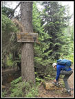 Trail Sign |
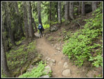 Smooth Trail |
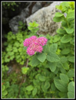 Spirea |
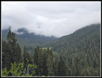 Clouds Low Over Meadow |
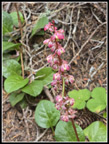 Wintergreen |
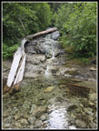 Small Falls |
 Lewis Monkey Flower |
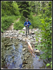 Crossing Creek |
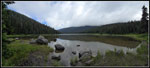 Lake Janus |
 Beyond The Lake |
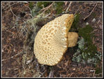 Big Mushroom |
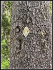 PCT Marker |
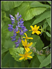
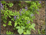 Lupine |
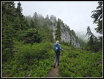
 Onto Open Ridge |
 Very Misty Meadow |
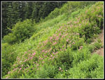
 Big Meadow |
 Bistort |
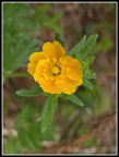 Cinquefoil |
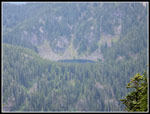
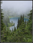 Glasses Lake |
 Nearing Grizzly Peak |
 Meadow Below Summit |
 More Spirea |
 Cloudy Heather Lake |
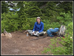 Gary On Grizzly Summit |
 Labyrinth Mountain |
 Clear Heather Lake |
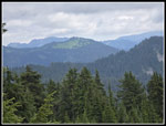
 Looking North |
 Meadows & Clouds |
 Two Colors Of Asters |
 Saucer Lake |
 Meadowy Mountain |
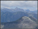 Mt. David & Burn |
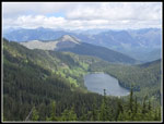 Heather Lake & Peaks |
 Gary At Work |
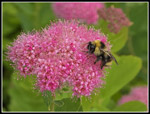 Bee On Spirea |
 Tenpeaks |
 Whittier, David, & Sopa |
 Returning On Ridge |
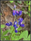 Colorful Lupine |
 Gary On PCT |
 Many Monkey Flowers |
 Nice Combination |
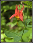 Columbine |
 Nearing Union Gap |
Trips - 2025
Home