01-08-26
After
taking a full week off to
start the year, it was time to get out on a hike. After missing the
first week of the year, I took off early from work on Thursday. It was
an overcast
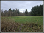
but dry day. I headed out to Red Town for a hike on Cougar Mountain. I
arrived at the trailhead at 12:33 pm. It was a balmy
36F. I decided to do a medium length clockwise loop. I hoped to be done
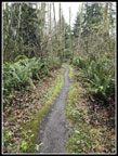
before the peak of rush hour traffic heading home. I started up the
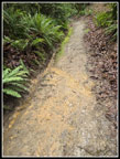
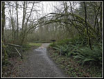
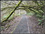
Military Road. It had been raining recently and there was some slick
mud in places. With the cool temperature I set a fast pace to warm up.
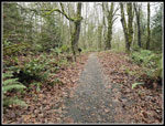
There were a million or so brown leaves as there are a lot of deciduous
trees along here. I reached the Sky Country Trailhead at 12:58 pm. That
was 1 mile in 25 minutes uphill. I took the Nike Horse Trail to the
Cave Hole Road and then the Bypass Trail to the Clay Pit Road. The
Klondike Swamp Trail took me to the Lost Beagle Trail. Even on this
medium length trail I hiked a dozen or more named trails. The Lost
Beagle climbs to the top of Anti-Aircraft Peak. At 1489', it would be
the highest point on my hike.
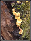
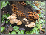
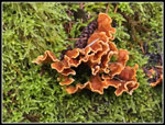
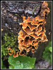
It was damp and overcast but still day. Recent rains left lots of puddles and mud. I wore slightly heavier waterproof shoes and was glad I did. I took a short food and water break and headed over to the Million Dollar View. I could see down to Lake Sammamish but not much more. My next objective was the Clay Pit. I dropped down the Tibbetts Marsh Trail. In half a mile I reached Tibbetts Creek. It is dry half the year but had a good flow this day. Once across the bridge it was all uphill to the Clay Pit. Just beyond the bridge, I cam upon a great display of an orange fungus. It looked a little like turkeytail but was a bit different and very colorful. A dozen photos later I was back on my way. I reached the Clay Pit Road and turned left a short way to the Pit. It was very muddy and I did not go far. I did take a few photos of Tiger Mountain and where Mt. Si would be. The top of Tiger and everything farther away was in clouds. I'm glad I did not go over there.
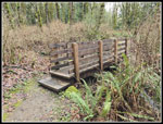
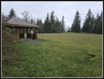
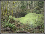
I arrived at the Clay Pit at 2:12 pm. I was now about 4.5 miles along with nearly all the elevation gain done. I took the East Fork Trail down to Fred's Railroad. Along the way I passed by Jerry's Duck Pond. It is covered with green algae or some such much of the year. In winter, it often goes back to open water. This winter has not been snowy land has not be as cold as usual. The duck pond still has much of its green cover. I reached Fred's Railroad and turned left. A right turn would have taken me back to the Bypass Trail near the Clay Pit Road. That would have been a much shorter hike back. I was making very good time downhill and decided to add a couple miles on the way down. Also the expected rain had held off this long and was not threatening so why not take the longer route. I soon reached the top of the Quarry Trail. Long ago, this was an old road that dropped to the Quarry near the meadow alongside Coal Creek. It starts on the road but then goes uphill left and is a nice trail down to the Indian Trail.
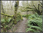
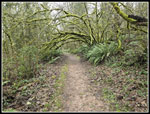
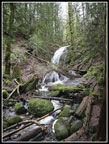
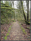
At the top of the just mentioned climb is a trail down to Coal Creek Falls. It is only a few tenths of a mile each way. I decided to add it to my route. I hoped that the recent rain would have a good flow going over the falls. I reached the falls to find out that while not a huge flow it was very good. I only stayed long enough for some photos. I climbed back up to the Quarry Trail and turned right heading downhill. The trail is nicely graded with switchbacks. That is not at all like the old Quarry Road/Trail that went right up and down the fall line. I reached the Indian Trail at 3:13 pm. I was now just about 1 mile from the trailhead. At the next junction both right and left turns go back to the Red Town Trailhead. Right is an old road. Left is trail. As usual, I chose the trail. There are ups and downs and lots of green mossy trees along the trail. In early spring there will be lots of bleeding hearts, yellow violets, and trillium in bloom. At the start of the year there was nothing in bloom.
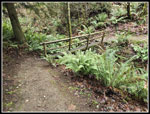
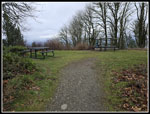
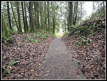
More than half way to the trailhead there was yellow tape that blocked the trail. A sign said the trail was closed due to flooding. We had a big flood a month earlier in Western Washington but most flooding was long over. I either had to go all the way back to the Indian Trail junction and take the other route or take a chance just ahead. I went ahead. I reached the flooding part to find an easy rock hop across. It turns out that the flooding was due to a beaver dam not the earlier heavy rain. I crossed with dry feet. A few minutes later I was back at the trailhead. It was a work day and now late in the afternoon and the parking lot was only about 20% full. I arrived back at my car at 3:31 pm. For the day I hiked about 8.3 miles with 1400' of gain. Both were less than my usual average but I was off of zero for the year. While I had some rain driving home, I had only a few sprinkles on the hike.
This turned out to be a good day to get out. I worked for 5 hours then had a short drive and did a 2:58 hike. Sunset was at 4:36 pm so I finished about an hour before darkness set in. Dry and upper 30s temperatures were fine without any rain. The one big orange fungus provided most of the color this day. As expected, there wee not may people out on the trail. I saw some but for a near to town trip I had a lot of solitude. All in all, it beat a full day in the house.
Click on thumbnails to get
larger pictures.
Trips - 2026
Home
It was damp and overcast but still day. Recent rains left lots of puddles and mud. I wore slightly heavier waterproof shoes and was glad I did. I took a short food and water break and headed over to the Million Dollar View. I could see down to Lake Sammamish but not much more. My next objective was the Clay Pit. I dropped down the Tibbetts Marsh Trail. In half a mile I reached Tibbetts Creek. It is dry half the year but had a good flow this day. Once across the bridge it was all uphill to the Clay Pit. Just beyond the bridge, I cam upon a great display of an orange fungus. It looked a little like turkeytail but was a bit different and very colorful. A dozen photos later I was back on my way. I reached the Clay Pit Road and turned left a short way to the Pit. It was very muddy and I did not go far. I did take a few photos of Tiger Mountain and where Mt. Si would be. The top of Tiger and everything farther away was in clouds. I'm glad I did not go over there.
I arrived at the Clay Pit at 2:12 pm. I was now about 4.5 miles along with nearly all the elevation gain done. I took the East Fork Trail down to Fred's Railroad. Along the way I passed by Jerry's Duck Pond. It is covered with green algae or some such much of the year. In winter, it often goes back to open water. This winter has not been snowy land has not be as cold as usual. The duck pond still has much of its green cover. I reached Fred's Railroad and turned left. A right turn would have taken me back to the Bypass Trail near the Clay Pit Road. That would have been a much shorter hike back. I was making very good time downhill and decided to add a couple miles on the way down. Also the expected rain had held off this long and was not threatening so why not take the longer route. I soon reached the top of the Quarry Trail. Long ago, this was an old road that dropped to the Quarry near the meadow alongside Coal Creek. It starts on the road but then goes uphill left and is a nice trail down to the Indian Trail.
At the top of the just mentioned climb is a trail down to Coal Creek Falls. It is only a few tenths of a mile each way. I decided to add it to my route. I hoped that the recent rain would have a good flow going over the falls. I reached the falls to find out that while not a huge flow it was very good. I only stayed long enough for some photos. I climbed back up to the Quarry Trail and turned right heading downhill. The trail is nicely graded with switchbacks. That is not at all like the old Quarry Road/Trail that went right up and down the fall line. I reached the Indian Trail at 3:13 pm. I was now just about 1 mile from the trailhead. At the next junction both right and left turns go back to the Red Town Trailhead. Right is an old road. Left is trail. As usual, I chose the trail. There are ups and downs and lots of green mossy trees along the trail. In early spring there will be lots of bleeding hearts, yellow violets, and trillium in bloom. At the start of the year there was nothing in bloom.
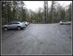
More than half way to the trailhead there was yellow tape that blocked the trail. A sign said the trail was closed due to flooding. We had a big flood a month earlier in Western Washington but most flooding was long over. I either had to go all the way back to the Indian Trail junction and take the other route or take a chance just ahead. I went ahead. I reached the flooding part to find an easy rock hop across. It turns out that the flooding was due to a beaver dam not the earlier heavy rain. I crossed with dry feet. A few minutes later I was back at the trailhead. It was a work day and now late in the afternoon and the parking lot was only about 20% full. I arrived back at my car at 3:31 pm. For the day I hiked about 8.3 miles with 1400' of gain. Both were less than my usual average but I was off of zero for the year. While I had some rain driving home, I had only a few sprinkles on the hike.
This turned out to be a good day to get out. I worked for 5 hours then had a short drive and did a 2:58 hike. Sunset was at 4:36 pm so I finished about an hour before darkness set in. Dry and upper 30s temperatures were fine without any rain. The one big orange fungus provided most of the color this day. As expected, there wee not may people out on the trail. I saw some but for a near to town trip I had a lot of solitude. All in all, it beat a full day in the house.
 Lot Of Leaves |
 Newish Bridge |
 A Little Muddy |
 Narrow Bridge |
 Big Meadow & Shelter |
 Near Clay Pit Road |
 Mossy Arbor |
 Klondike Swamp Arbor |
 Gravel & Arbor |
 Anti-Aircraft Peak |
 Million Dollar View |
 Mushrooms |
 Tibbetts Creek Ahead |
 Tibbetts Bridge |
 Mushrooms & Fungus |
 Nice Contrast |
 Another Fungus Shot |
 Clay Pit View |
 Another Arbor |
 Jerry's Duck Pond |
 East Fork Trail |
 Coal Creek Falls |
 Indian Trail |
 Wildside Trail |
 Washed Out Trail |
 Few Cars In Lot |
Trips - 2026
Home