05-25-26
On
the first day of the Memorial
Day Weekend I hiked 10 miles with 3300' of elevation gain. On Sunday I
hiked 8 miles with 2100' of gain. Now on Monday Kim joined me for an
easier hike on Cougar Mountain. Rain was supposed to be falling by
10:30 am so we were on our way early and arrived at the Sky Country
Trailhead in the middle of the mountain at 8:30 am. The lot was more
than half full. We packed up and were on our way at 8:40 am. The trail
starts out along the old chain link fence that surrounded the missile
silos. We quickly reached the big meadow that was all paved with
opening doors for the missiles when I first saw it in about 1983. We
immediately saw buttercups and pale bleeding hearts. This turned out to
be a much better wildflower hike than I expected. I did a very nice
flower hike on Cougar six weeks earlier. We had trillium and violets
and chocolate lilies and more. We reached the Cave Hole Road and tuned
right going downhill. At the next junction we turned left and headed
for Coal Creek Falls. I did not expect there to be much water but it is
still a nice sight. There was a group there when we arrived. There was
a little flow but not like earlier in the spring. The trail crosses the
creek on a bridge and begins to climb. We would have a number of ups
and downs on this loop trip. We saw starflowers and oyster mushrooms on
old snags. Mushrooms on trees was a theme of the day. We also saw a lot
more starflowers.
The tail reaches the Quarry Trail and we turned left. It drops to the the old Quarry Trail/Road that went up alongside the creek. The downhill part of the trail is completely gone. It's buried under 30 years of brush and fallen trees. We headed uphill. We saw the one and only honeysuckle flower of the day. There were lots of closed up spring beauties that would be open later in the trip. We saw one that was open in the morning. There are so many intersecting trails on Cougar Mountain that it is easy to create all kinds of loops and figure eight routes. The climbed stopped at the junction with Fred's Railroad. We turned left. A small bridge crosses a branch of Coal Creek. Six weeks ago it was running strong. Now it was bone dry. We saw more pale bleeding hearts as well as some very dark reddish ones. A few minutes later we turned right on the East Fork Trail. This leads up to the Clay Pit. The trail was green from the ground cover to the brush to the trees. Many shades of green were present. It as like that everywhere this day. The overcast brought out the colors.
When we reached Jerry's Duck Pond it was still covered with algae. I doubt a duck would try to land on it. There was very little open water. One more climb and drop brought us to the Clay Pit Road. Right across the road is one of the largest displays of coltsfoot flowers I have ever seen. Now all I could see were silver crown leaves and a couple seed pods. I guess the coltsfoot grows first and is replaced with the silver crown bushes soon after. We turned right for the short walk to the Clay Pit. For the first 35 or so years I hiked there, the Clay Pit was just that. It was big pit with orange clay walls and floor. The clay was mined for use at the brick plant a few miles away. The business closed and the pit was rehabilitated. Now it was a pond at the far end and grasses grow everywhere. We had a view out to West Tiger 1, 2, and 3 summits on the other side of Issaquah. The sky was white but we could see the surrounding Issaquah Alps. We took a break at a wooden bench. Just beyond is an impressive display of lupine They do not look exactly like the lupine we see in the mountains but it is definitely lupine. I took quite a few photos. Other hikers arrived and we gave up the bench and headed on.
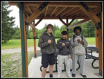
Our next leg was to drop down to Tibbetts Creek and then climb up to Anti-Aircraft Peak. We started to see big bunches of spring beauty. Some were open and others were getting there. We saw more oyster mushrooms near the creek. Kim even managed to spy a small patch of yellow slime mold. I would not have noticed it. The creek was still flowing though there was not a lot of water. We climbed out of the valley and up AA Peak. At the next junction I went left then right on the Lost Beagle Trail. This took us to the highest spot on AA Peak. We popped out of the forest onto an old paved road. On the other side is a picnic table. There are no views here but we stopped for the rest of our lunch. Below at the meadow are two shelters with multiple picnic tables inside. I expected we would use them as it should have started raining earlier. So far, it was totally dry. We arrived at 11:31 am. We started moving again at 11:54 am. It was a nice lunch break. While we were there a group of three young guys arrived. They were looking for the highest point on Cougar. AA Peak, where they were standing, is the second highest point. The highest is Wilderness Peak. It is nearly impossible to describe the route from AA to Wilderness Peak. There are a dozen junctions. We had a good discussion with the guys and they headed down the Lost Beagle Trail for an adventure.
We dropped down to the meadow and then over to the Million Dollar View. At the edge of the parking lot the very short trail to the viewpoint was closed by a fence. Construction closed the site from 4-16 to 6-1. It will be opening in a week. With the deciduous trees leafed out, there is not much of a view there, anyway. The other entrance was only closed with yellow tape but it is off limits too. We descended a bit and turned right. A minute later we were at the junction we had reached on the way up from Tibbetts Creek. We quickly reached the Lost Beagle Trail again and turned left this time. The trail over to Cougar Pass is now called the Harvey Manning Trail. This was the first I had heard of the name change. The forest over to the pass was really neat. It twists and turns. It was lined with buttercups, bleeding hearts, spring beauty, and good old Herb Robert. It was quite colorful. We noticed a huge vanilla leaf. It was several times larger than my hand. At the Pass, we turned right and descended to the Klondike Swamp Trail. We turned left. The old trail followed near the swamp and had some muddy spots. Now the trail leaves the swamp and goes uphill a bit on dry tread. The trail drops down to the Clay Pit Road. We crossed over and walked Fred's Railroad for sixty feet and turned right onto the Bypass Trail. This took us the the Cave Hole Road. Fred's Railroad and the Cave Hole Road are among the trails we hiked or crossed several times on this trip. Once on the Cave Hole Road we ran into the three young hikers once again. They were not on a route to Wilderness Peak but they were having fun.
They took off and we continued on the Cave Hole Road. We soon reached the spot where we reached the Cave Hole Road in the morning. Now we just had to turn right and in .30 miles we would be at the car. I suggested one last detour. We headed across the big meadow instead of staying on the trail. There is a new picnic shelter on the far side. It was built since the last time Kim was there. At the shelter table we saw a familiar face. It was one of the three hikers we saw earlier. A few minutes later the other two arrived. They had a cell signal here so I suggested downloading the Gaia GPS app. A few minutes later they had a map and GPS for navigation. The have so many more trails to explore just on Cougar, Squak, and Tiger Mountains. We talked ford a while and then walked the very short distance to my car. We finally arrived at 1:42 pm.
For the day we hiked 7 miles with about 900' of elevation gain. It was a nice easy day after the two harder hikes the previous two days. For the weekend, I hiked 25 miles with 6300' of gain. For the last 8 days I hiked 5 days for 48 miles with 11,200' of gain. I turned a really bad month into an average month with a full week to go. I could reach 90 miles this month. We had a good time hiking at a moderate pace with lots of breaks. The 10:30 rain forecast ended up with rain at 1:50 pm By then we were starting our drive home. The lush green forest and pretty good wildflower show were bonuses. It turned out to be a fun day on a trail close to home.
The tail reaches the Quarry Trail and we turned left. It drops to the the old Quarry Trail/Road that went up alongside the creek. The downhill part of the trail is completely gone. It's buried under 30 years of brush and fallen trees. We headed uphill. We saw the one and only honeysuckle flower of the day. There were lots of closed up spring beauties that would be open later in the trip. We saw one that was open in the morning. There are so many intersecting trails on Cougar Mountain that it is easy to create all kinds of loops and figure eight routes. The climbed stopped at the junction with Fred's Railroad. We turned left. A small bridge crosses a branch of Coal Creek. Six weeks ago it was running strong. Now it was bone dry. We saw more pale bleeding hearts as well as some very dark reddish ones. A few minutes later we turned right on the East Fork Trail. This leads up to the Clay Pit. The trail was green from the ground cover to the brush to the trees. Many shades of green were present. It as like that everywhere this day. The overcast brought out the colors.
When we reached Jerry's Duck Pond it was still covered with algae. I doubt a duck would try to land on it. There was very little open water. One more climb and drop brought us to the Clay Pit Road. Right across the road is one of the largest displays of coltsfoot flowers I have ever seen. Now all I could see were silver crown leaves and a couple seed pods. I guess the coltsfoot grows first and is replaced with the silver crown bushes soon after. We turned right for the short walk to the Clay Pit. For the first 35 or so years I hiked there, the Clay Pit was just that. It was big pit with orange clay walls and floor. The clay was mined for use at the brick plant a few miles away. The business closed and the pit was rehabilitated. Now it was a pond at the far end and grasses grow everywhere. We had a view out to West Tiger 1, 2, and 3 summits on the other side of Issaquah. The sky was white but we could see the surrounding Issaquah Alps. We took a break at a wooden bench. Just beyond is an impressive display of lupine They do not look exactly like the lupine we see in the mountains but it is definitely lupine. I took quite a few photos. Other hikers arrived and we gave up the bench and headed on.
Our next leg was to drop down to Tibbetts Creek and then climb up to Anti-Aircraft Peak. We started to see big bunches of spring beauty. Some were open and others were getting there. We saw more oyster mushrooms near the creek. Kim even managed to spy a small patch of yellow slime mold. I would not have noticed it. The creek was still flowing though there was not a lot of water. We climbed out of the valley and up AA Peak. At the next junction I went left then right on the Lost Beagle Trail. This took us to the highest spot on AA Peak. We popped out of the forest onto an old paved road. On the other side is a picnic table. There are no views here but we stopped for the rest of our lunch. Below at the meadow are two shelters with multiple picnic tables inside. I expected we would use them as it should have started raining earlier. So far, it was totally dry. We arrived at 11:31 am. We started moving again at 11:54 am. It was a nice lunch break. While we were there a group of three young guys arrived. They were looking for the highest point on Cougar. AA Peak, where they were standing, is the second highest point. The highest is Wilderness Peak. It is nearly impossible to describe the route from AA to Wilderness Peak. There are a dozen junctions. We had a good discussion with the guys and they headed down the Lost Beagle Trail for an adventure.
We dropped down to the meadow and then over to the Million Dollar View. At the edge of the parking lot the very short trail to the viewpoint was closed by a fence. Construction closed the site from 4-16 to 6-1. It will be opening in a week. With the deciduous trees leafed out, there is not much of a view there, anyway. The other entrance was only closed with yellow tape but it is off limits too. We descended a bit and turned right. A minute later we were at the junction we had reached on the way up from Tibbetts Creek. We quickly reached the Lost Beagle Trail again and turned left this time. The trail over to Cougar Pass is now called the Harvey Manning Trail. This was the first I had heard of the name change. The forest over to the pass was really neat. It twists and turns. It was lined with buttercups, bleeding hearts, spring beauty, and good old Herb Robert. It was quite colorful. We noticed a huge vanilla leaf. It was several times larger than my hand. At the Pass, we turned right and descended to the Klondike Swamp Trail. We turned left. The old trail followed near the swamp and had some muddy spots. Now the trail leaves the swamp and goes uphill a bit on dry tread. The trail drops down to the Clay Pit Road. We crossed over and walked Fred's Railroad for sixty feet and turned right onto the Bypass Trail. This took us the the Cave Hole Road. Fred's Railroad and the Cave Hole Road are among the trails we hiked or crossed several times on this trip. Once on the Cave Hole Road we ran into the three young hikers once again. They were not on a route to Wilderness Peak but they were having fun.
They took off and we continued on the Cave Hole Road. We soon reached the spot where we reached the Cave Hole Road in the morning. Now we just had to turn right and in .30 miles we would be at the car. I suggested one last detour. We headed across the big meadow instead of staying on the trail. There is a new picnic shelter on the far side. It was built since the last time Kim was there. At the shelter table we saw a familiar face. It was one of the three hikers we saw earlier. A few minutes later the other two arrived. They had a cell signal here so I suggested downloading the Gaia GPS app. A few minutes later they had a map and GPS for navigation. The have so many more trails to explore just on Cougar, Squak, and Tiger Mountains. We talked ford a while and then walked the very short distance to my car. We finally arrived at 1:42 pm.
For the day we hiked 7 miles with about 900' of elevation gain. It was a nice easy day after the two harder hikes the previous two days. For the weekend, I hiked 25 miles with 6300' of gain. For the last 8 days I hiked 5 days for 48 miles with 11,200' of gain. I turned a really bad month into an average month with a full week to go. I could reach 90 miles this month. We had a good time hiking at a moderate pace with lots of breaks. The 10:30 rain forecast ended up with rain at 1:50 pm By then we were starting our drive home. The lush green forest and pretty good wildflower show were bonuses. It turned out to be a fun day on a trail close to home.