06-07-26
I
did not hike on Saturday and
wanted to get in a longer trip while getting home by early afternoon. I
chose a close in trip. It would be cloudy so summit views were not a
priority. I do this trip every few years. The top of East Tiger is busy
but the second half of the trip is not. I was out of the house at 6:52
and made a stop for gas in Issaquah. It saved my 45 cents/gallon at
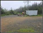
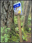
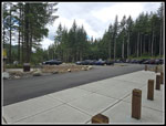
"only" $5.39/gallon. I arrived at the Tiger Summit Trailhead at 7:40
am. It was the second time I have been at this new and much larger
parking lot. There were only 7 or 8 cars in the lot. I was on my way at
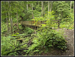
7:44 am. I quickly reached the second bridge to find three bikers on
the bridge. Seeing me they took off. I crossed the road and as I
reached the start of the Master Link Trail, three women runners zoomed
by heading up the ML. That was it for quite a while. I had the trail to
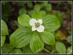
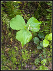
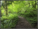
myself. There were a few flowers left but not many. I saw bleeding
hearts, foamflower, false lily of the valley, and one queen's cup
flower. I was making good time when I reached the big bridge. I started
entering the clouds. The air was misty but there was no rain all day.
Some of the leaves were wet, however. I passed the big erratic and
continued up. I reached the main logging road from Highway 18 at 8:48
am. I hiked 3 miles in 64 minutes. That is a good uphill pace for me.
In recent years I have walked up that logging road from the highway for
a long trip with a lot of solitude.
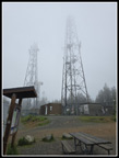
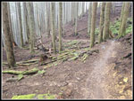
I crossed the road and continued on the Quick Link Trail. I often get passed by bikers from there to the summit. In just under half a mile I was back on the main logging road. A little uphill then a drop brought me to the junction with the East Tiger summit spur road. I went right heading for the summit. The last .70 miles climbs, turns flat, then climbs steeply to the top. I tried to keep up the best pace I could but I slowed on the final climb. As expected a couple groups of biker's did pass me along here. I reached the top at 9:16 am. It took me 1:32 to hike 4.5 miles. That is almost a 3 mph pace. There were three groups of bikers. The first left just after I arrived. There is only 1600' of gain up East Tiger and I wanted more. My plan was to drop down to the start of the summit spur and climb back up again. That adds about 360' of gain. The wind was almost non-existent for the hike up but it was cold and blowing on the top. I decided to go down the Powerlink Trail instead of the road. The trail is softer and smoother. It is a one way uphill bike trail but hikers can go in either direction. I dropped down to the bottom and hiked back up the road. I arrived back on top at 9:50 am. I was now about 5.9 miles in or about halfway for the day. My second summit stay was only about 5 minutes. A little food and water and I was on my way down. On the summit I could just barely see the tops of the towers. It was very cloudy. I dropped down the road a quarter mile to the East Tiger Trail. I went left a short way to the Off-The-Grid Trail. I turned right onto it.
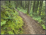
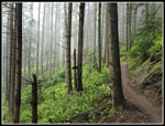
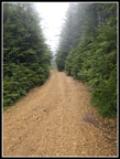
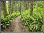
The Off-The-Grid (OTG) is a fun trail if you are a good mountain biker. I will never ride it. It has ups and downs and curves and jumps. The jumps are the only problem as I had to climb down them without falling. I managed to make it down without any falls this day. Much of the forest is dark with almost no ground cover. It is exactly where I would expect to find saprophytes. These strange plants do not need the sun to grow. Unfortunately, I saw none. It may still be too early in the year. The trail more or less follows along the main road. At one point the road moves away and comes back. The trail had some switchbacks. I am not sure which is shorter. I had several groups of bikers zoom by. They were out of sight very quickly. Other than that, I had the trail to myself. I finally reached the road crossing at 10:52 am. The trail continues as the Fully Rigid Trail.
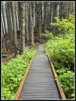
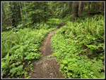
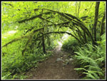
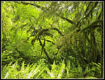
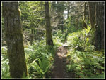
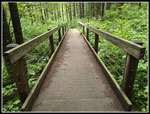
This trail is much different than above on the OTG. It is a thin brown line in a very green forest with lots of ground cover. There are a few jumps to climb down still. This is far from the crowds near East Tiger and I seldom see anyone until I am much closer to the trailhead. From here in there are a bunch of bridges over creeks. No two are exactly alike. All of them are of an interesting design. There are even some more ups and downs. The Silent Swamp trail comes in and then the Inside Passage does as well. The other end of the Inside Passage is off of the Master Link so I passed both ends. Part way along is one of my favorite mossy arbors. The dark sterile forest higher up gives way to almost a rain forest. That is one big change in a couple miles along the trail. I added a few more photos. The Fully Rigid becomes the Joy Ride Trail at some point. I was still feeling good on the descent and my pace stayed about the same. I was very happy to reach the Northwest Timber Trail. Now it was just a straight shot back to the trailhead. At first, that was gently uphill. I was already at about the elevation of the parking lot with 2.3 miles to go.
The trail follows Highway 18 as it climbs to Tiger Summit. The highway was far below at first but the gap slowly closes. In a few spots there are views over to Rattlesnake Mountain. I did have some views to the towers atop West Rattlesnake Mountain. As usual, I started to see some people over the last mile. I passed the bottom of the Master Link to close a big loop. Then the trail crosses the main road and climbs then drops to the parking lot. The lot was now about 90% full. That is a lot of cars. My route avoided most of them. The final tally was about 11.6 miles with 2100' of gain. It was a full day's hiking and I was back at 12:25 pm. On the last few miles some sunshine shone through the trees. My misty morning turned out to be partly sunny after all. I usually turn right onto Highway 18 because of all the traffic and the backup heading to I-90. This time I took the newly finished two lane road. I caught the first light and with the divergent diamond configuration there is no second light. I caught all the lights off the freeway and into the tunnel and made it back to Northwest Seattle non-stop from Tiger Summit. I do not expect to do that again anytime soon. It was a really nice hike on a close in trail with nearly 12 miles hiked and I was home by 1:15. I had a great day on the trail.
Click on thumbnails to get
larger pictures.
Trips - 2026
Home
I crossed the road and continued on the Quick Link Trail. I often get passed by bikers from there to the summit. In just under half a mile I was back on the main logging road. A little uphill then a drop brought me to the junction with the East Tiger summit spur road. I went right heading for the summit. The last .70 miles climbs, turns flat, then climbs steeply to the top. I tried to keep up the best pace I could but I slowed on the final climb. As expected a couple groups of biker's did pass me along here. I reached the top at 9:16 am. It took me 1:32 to hike 4.5 miles. That is almost a 3 mph pace. There were three groups of bikers. The first left just after I arrived. There is only 1600' of gain up East Tiger and I wanted more. My plan was to drop down to the start of the summit spur and climb back up again. That adds about 360' of gain. The wind was almost non-existent for the hike up but it was cold and blowing on the top. I decided to go down the Powerlink Trail instead of the road. The trail is softer and smoother. It is a one way uphill bike trail but hikers can go in either direction. I dropped down to the bottom and hiked back up the road. I arrived back on top at 9:50 am. I was now about 5.9 miles in or about halfway for the day. My second summit stay was only about 5 minutes. A little food and water and I was on my way down. On the summit I could just barely see the tops of the towers. It was very cloudy. I dropped down the road a quarter mile to the East Tiger Trail. I went left a short way to the Off-The-Grid Trail. I turned right onto it.
The Off-The-Grid (OTG) is a fun trail if you are a good mountain biker. I will never ride it. It has ups and downs and curves and jumps. The jumps are the only problem as I had to climb down them without falling. I managed to make it down without any falls this day. Much of the forest is dark with almost no ground cover. It is exactly where I would expect to find saprophytes. These strange plants do not need the sun to grow. Unfortunately, I saw none. It may still be too early in the year. The trail more or less follows along the main road. At one point the road moves away and comes back. The trail had some switchbacks. I am not sure which is shorter. I had several groups of bikers zoom by. They were out of sight very quickly. Other than that, I had the trail to myself. I finally reached the road crossing at 10:52 am. The trail continues as the Fully Rigid Trail.
This trail is much different than above on the OTG. It is a thin brown line in a very green forest with lots of ground cover. There are a few jumps to climb down still. This is far from the crowds near East Tiger and I seldom see anyone until I am much closer to the trailhead. From here in there are a bunch of bridges over creeks. No two are exactly alike. All of them are of an interesting design. There are even some more ups and downs. The Silent Swamp trail comes in and then the Inside Passage does as well. The other end of the Inside Passage is off of the Master Link so I passed both ends. Part way along is one of my favorite mossy arbors. The dark sterile forest higher up gives way to almost a rain forest. That is one big change in a couple miles along the trail. I added a few more photos. The Fully Rigid becomes the Joy Ride Trail at some point. I was still feeling good on the descent and my pace stayed about the same. I was very happy to reach the Northwest Timber Trail. Now it was just a straight shot back to the trailhead. At first, that was gently uphill. I was already at about the elevation of the parking lot with 2.3 miles to go.
The trail follows Highway 18 as it climbs to Tiger Summit. The highway was far below at first but the gap slowly closes. In a few spots there are views over to Rattlesnake Mountain. I did have some views to the towers atop West Rattlesnake Mountain. As usual, I started to see some people over the last mile. I passed the bottom of the Master Link to close a big loop. Then the trail crosses the main road and climbs then drops to the parking lot. The lot was now about 90% full. That is a lot of cars. My route avoided most of them. The final tally was about 11.6 miles with 2100' of gain. It was a full day's hiking and I was back at 12:25 pm. On the last few miles some sunshine shone through the trees. My misty morning turned out to be partly sunny after all. I usually turn right onto Highway 18 because of all the traffic and the backup heading to I-90. This time I took the newly finished two lane road. I caught the first light and with the divergent diamond configuration there is no second light. I caught all the lights off the freeway and into the tunnel and made it back to Northwest Seattle non-stop from Tiger Summit. I do not expect to do that again anytime soon. It was a really nice hike on a close in trail with nearly 12 miles hiked and I was home by 1:15. I had a great day on the trail.
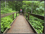 Biker On Second Bridge |
 Start Of Master Link |
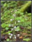 Foamflower |
 Entering The Clouds |
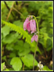 Bleeding Hearts |
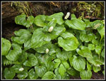 False Lily Of The Valley |
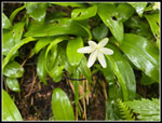 Queen's Cup |
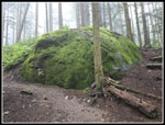 Big Green Erratic |
 On The Road |
 Bikers On The Summit |
 Towers In Clouds |
 Powerlink Trail |
 Up The Road Again |
 Back On Summit |
 OTG Bridges |
 Bare Forest |
 Road Crossing |
 Narrow Trail |
 Bunchberry |
 Another Bridge |
 Best Mossy Arch |
 More Mossy Goodness |
 Sunshine At Last |
 Northwest Timber Trail |
 Trillium |
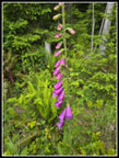 Foxglove |
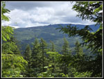 West Rattlesnake Mt. |
 Last Moss |
 Winding Trail |
 Sword Fern Forest |
 Almost Back |
 Lot Is Nearly Full |
Trips - 2026
Home