04-26-26
I
decided to do a hike I last did
in early May 2023. At that time Middle Tiger had a forested summit.
Since then, Middle Tiger has been clearcut on several sides. The trip
was a loop from Tiger Summit over Middle and East Tiger Mountains. I
wanted some wildflowers, some views, double digit miles, and some
elevation
gain. I also wanted to see the new Tiger Summit trailhead. I saw the
parking lot months ago when the finishing touches were being installed.
Now it had finally opened. This is a very popular mountain biking area.
Much of the Mountain is hikers only but the Highway 18 side is mostly
bike trails and roads. Some bike trails are downhill only and open only
for bikes. Some others are bikes uphill only. Hikers can go up and down
on the non-bike descent trails. I avoid the heavily used bike trails
except early in the morning. That leaves plenty of places where I
seldom see many hikers. With that in mind, I was out the door at 6:50
am. I stopped for gas in Issaquah. I noticed signs on I-90 stating a
detour for eastbound traffic on Highway 18. It turns out that eastbound
was closed heading for I-90. I was concerned about getting to the
trailhead but westbound was fine. I arrived at the trailhead at 7:37
am. There were about 6 to 8 cars in the lot. The lot is now huge. It
was chilly so I started immediately at 7:42 am.
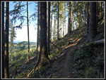
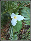
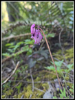
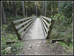
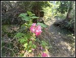
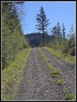
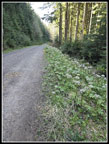
I had not decided which direction to hike. Clockwise meant starting on the Iverson Trail. This bike trail was likely to be empty in the early morning. It reaches Middle Tiger and its view faster. Counterclockwise means I could hike up the Master Link and Quick Link instead of hiking down the main gravel road. I chose the early views and empty bike trail and headed for Middle Tiger first. The Iverson Trail began with the same yellow violets and blooming trillium I have been seeing for weeks. The trail split with the more difficult bike trail going left. I took the gentler and longer trail to the right. Farther along, the trail has a clearcut to the left and forest to the right. Soon, Mt. Rainier came into sight. The sunshine led to some bleeding hearts in bloom and then some salmonberry flowers. It goes back into forest and comes to a junction. Left is the old Iverson Trail. To the right is the Side Hustle Trail. I went right. It did not take long until I reached a bridge. On the other side is a junction. To the right the Side Hustle now becomes a downhill only trail. To the left is the Tiger Mountain Trail (TMT) Connector. I went left.
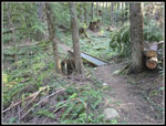
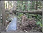
Now I saw more yellow violets. On my last visit, the Bomb Cyclone had left several big trees down on the trail or right along it. Now they have been cut out. The trail reaches a more open forest with some sun shining in. I started seeing blooming red currant bushes. There were also more trillium, I also saw some devil's club with leaves beginning to open. After crossing a logging road, the trail stays with some sunshine then goes back into darker forest. It nears a creek where I looked down and saw the trail on the other side. The trail dropped down and crossed Holder Creek. This is at the old Train Wreck Site. The wreck sign had fallen down but I put it back up. I quickly reached the TMT. This is actually a four way junction. Three are obvious but the old TMT is covered over. Someone posted a trip report including the much longer TMT section here. I looked and found the old trail. I turned right onto the new section of the TMT. This new trail is quite a shortcut. When I was last here with Gary, there were several big logs over the trail. I had to kneel down to get under one of them. They have now all been cut out. The only log left is high above the trail.
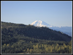
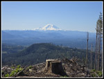
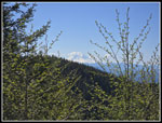
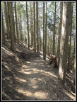
This section should have some flowers soon but all I saw in bloom were more red currants. Before long, I reached the new logging road that cuts across Middle Tiger Mountain. I continued on the TMT across the road. It did not take long to reach the junction with the Middle Tiger Trail. The trail below is no longer obvious. I headed uphill on the Middle Tiger Trail. I reached and cross the same road I had recently crossed. The trail is quite steep heading up Middle Tiger. The trail is still in forest though farther to the left is the very recent clearcut. I slowed a lot as the trail is steep and direct. Higher up, there are some switchbacks. I reached the ridge top and followed the trail towards the top. I met a new trail that drops to near the main Tiger Road that passes East Tiger and goes to West Tiger 1 and 2. I reached the summit of Middle Tiger at 9:20 am. I had traveled 3.80 miles so far. Mt. Rainier was very much out in the open. I could see Bellevue and Seattle too. Trees still cover the east side of the summit but to the southwest through northwest the views are pretty good. There is still one stand of trees in the middle of the view. The summit of East Tiger looked very close by as the crow flies. My route would not be so short. I sat down on the bench for a nice long break. It was still chilly but the sunshine shone down.
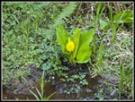
Two runners reached the top a few minutes later. They were the first people I had seen all day. My plan for some solitude paid off. One runner left immediately and the other stopped to talk about hiking. He was new to hiking Tiger and I had a few ideas to offer. He was doing marathon distance and I was going for less than half that. I still had a long way to go and packed up and headed on at 9:51 am. I had a full 31 minute stay on top. I dropped to the junction and headed down the new trail. It is a dark forest walk. near the end there is a wetland that still had some yellow skunk cabbage in bloom. I reached the old road down from Middle Tiger near the junction with the main road. The older road was lined with blooming coltsfoot. I stopped for photos and then headed up the main road. It starts steep as it climbs up towards East Tiger. Two mountain bikes passed by. I would see many more bikers on the rest of the trip. The main road had more coltsfoot and skunk cabbage in bloom.
The road reaches the upper end of the Side Hustle one way downhill bike only trail and the Preston RR Grade/East Tiger Trails. There were bikers at both junctions. The East Tiger trail is the shortest way to the summit. It is narrow with lots of bikes and I usually avoid it. Instead, I added some mileage by taking the road halfway around the mountain and then to the top. I found more solitude on this route. The road drops gently to another junction. Right drops back to Tiger Summit. That would be my route down. I went straight on the road leading up East Tiger. It climbs steeply. It was a bit rockier than I recalled. I reached the summit spur junction and turned left on it. The road takes .70 miles to the top gaining about 350'. There is a trail that also goes to the top but it is narrow. The road is easier to be passed by bikes though it is rockier. Before heading up, I stopped at the lower viewpoint. I had a look at Mt. Rainier again. I then took the road to the top, arriving at the 3004' summit at 11:02 am. I was not at the 6.6 miles point. I still had only about 2250' of gain so far. I took a short break and headed down a t 11:13 am. As expected, there were lots of bikers on top. I dropped down the road to the gate and continued up the other road to near the Predator Trail. I dropped back down and climbed to the summit one more time. Two times up would bring my mileage up to 12 and elevation gain up to 2600'.
I reached the top again at 11:45 am. I had lunch on my first summit. This time I took a short 6 minute break and headed down again. There were about a dozen bikes on top this time. I decided to take the trail down. It is narrow but less steep and softer footing than the road. I did have three bikers pass by in close quarters. The trail it bikers uphill only but hikers can go in either direction. I popped out on the summit spur road near the gate. I continued down on my route up. The steep road is rocky. At the bottom I turned left on the main road. Now I just had about 2.8 mils to go. The road is wide and it is easy to be passed by bikers. I finally saw a hiker on the road. So far, I had only seen bikers and a few runners. Few bikers were going down. Most were slowly riding up the road. Those with electric bikes were riding up very quickly. I was more than ready to leave the road. The trip ends with .30 miles on the Connector Trail between the road and the parking lot.
I arrived back at the trailhead at 1:08 pm. The upper lot was mostly full with half a dozen open parking spaces. I was soon on my way home. The new lower lot was about half full. There were lots of spaces left. As we go into summer and word gets out about the new larger parking lots I expect the lot to be full. This turned out to be just what I had hoped for. I had solitude, great summit views, wildflowers, and the miles and elevation gain I wanted. My drive home was a bit longer than I wanted as the Highway 18 traffic that was detouring off the highway was going on my route. I had some stopped traffic but at the May Valley Road I escaped it. The slowdown was as small price to pay for a very nice and sunny day on the trail.
Click on thumbnails to get
larger pictures.
Trips - 2026
Home
I had not decided which direction to hike. Clockwise meant starting on the Iverson Trail. This bike trail was likely to be empty in the early morning. It reaches Middle Tiger and its view faster. Counterclockwise means I could hike up the Master Link and Quick Link instead of hiking down the main gravel road. I chose the early views and empty bike trail and headed for Middle Tiger first. The Iverson Trail began with the same yellow violets and blooming trillium I have been seeing for weeks. The trail split with the more difficult bike trail going left. I took the gentler and longer trail to the right. Farther along, the trail has a clearcut to the left and forest to the right. Soon, Mt. Rainier came into sight. The sunshine led to some bleeding hearts in bloom and then some salmonberry flowers. It goes back into forest and comes to a junction. Left is the old Iverson Trail. To the right is the Side Hustle Trail. I went right. It did not take long until I reached a bridge. On the other side is a junction. To the right the Side Hustle now becomes a downhill only trail. To the left is the Tiger Mountain Trail (TMT) Connector. I went left.
Now I saw more yellow violets. On my last visit, the Bomb Cyclone had left several big trees down on the trail or right along it. Now they have been cut out. The trail reaches a more open forest with some sun shining in. I started seeing blooming red currant bushes. There were also more trillium, I also saw some devil's club with leaves beginning to open. After crossing a logging road, the trail stays with some sunshine then goes back into darker forest. It nears a creek where I looked down and saw the trail on the other side. The trail dropped down and crossed Holder Creek. This is at the old Train Wreck Site. The wreck sign had fallen down but I put it back up. I quickly reached the TMT. This is actually a four way junction. Three are obvious but the old TMT is covered over. Someone posted a trip report including the much longer TMT section here. I looked and found the old trail. I turned right onto the new section of the TMT. This new trail is quite a shortcut. When I was last here with Gary, there were several big logs over the trail. I had to kneel down to get under one of them. They have now all been cut out. The only log left is high above the trail.
This section should have some flowers soon but all I saw in bloom were more red currants. Before long, I reached the new logging road that cuts across Middle Tiger Mountain. I continued on the TMT across the road. It did not take long to reach the junction with the Middle Tiger Trail. The trail below is no longer obvious. I headed uphill on the Middle Tiger Trail. I reached and cross the same road I had recently crossed. The trail is quite steep heading up Middle Tiger. The trail is still in forest though farther to the left is the very recent clearcut. I slowed a lot as the trail is steep and direct. Higher up, there are some switchbacks. I reached the ridge top and followed the trail towards the top. I met a new trail that drops to near the main Tiger Road that passes East Tiger and goes to West Tiger 1 and 2. I reached the summit of Middle Tiger at 9:20 am. I had traveled 3.80 miles so far. Mt. Rainier was very much out in the open. I could see Bellevue and Seattle too. Trees still cover the east side of the summit but to the southwest through northwest the views are pretty good. There is still one stand of trees in the middle of the view. The summit of East Tiger looked very close by as the crow flies. My route would not be so short. I sat down on the bench for a nice long break. It was still chilly but the sunshine shone down.
Two runners reached the top a few minutes later. They were the first people I had seen all day. My plan for some solitude paid off. One runner left immediately and the other stopped to talk about hiking. He was new to hiking Tiger and I had a few ideas to offer. He was doing marathon distance and I was going for less than half that. I still had a long way to go and packed up and headed on at 9:51 am. I had a full 31 minute stay on top. I dropped to the junction and headed down the new trail. It is a dark forest walk. near the end there is a wetland that still had some yellow skunk cabbage in bloom. I reached the old road down from Middle Tiger near the junction with the main road. The older road was lined with blooming coltsfoot. I stopped for photos and then headed up the main road. It starts steep as it climbs up towards East Tiger. Two mountain bikes passed by. I would see many more bikers on the rest of the trip. The main road had more coltsfoot and skunk cabbage in bloom.
The road reaches the upper end of the Side Hustle one way downhill bike only trail and the Preston RR Grade/East Tiger Trails. There were bikers at both junctions. The East Tiger trail is the shortest way to the summit. It is narrow with lots of bikes and I usually avoid it. Instead, I added some mileage by taking the road halfway around the mountain and then to the top. I found more solitude on this route. The road drops gently to another junction. Right drops back to Tiger Summit. That would be my route down. I went straight on the road leading up East Tiger. It climbs steeply. It was a bit rockier than I recalled. I reached the summit spur junction and turned left on it. The road takes .70 miles to the top gaining about 350'. There is a trail that also goes to the top but it is narrow. The road is easier to be passed by bikes though it is rockier. Before heading up, I stopped at the lower viewpoint. I had a look at Mt. Rainier again. I then took the road to the top, arriving at the 3004' summit at 11:02 am. I was not at the 6.6 miles point. I still had only about 2250' of gain so far. I took a short break and headed down a t 11:13 am. As expected, there were lots of bikers on top. I dropped down the road to the gate and continued up the other road to near the Predator Trail. I dropped back down and climbed to the summit one more time. Two times up would bring my mileage up to 12 and elevation gain up to 2600'.
I reached the top again at 11:45 am. I had lunch on my first summit. This time I took a short 6 minute break and headed down again. There were about a dozen bikes on top this time. I decided to take the trail down. It is narrow but less steep and softer footing than the road. I did have three bikers pass by in close quarters. The trail it bikers uphill only but hikers can go in either direction. I popped out on the summit spur road near the gate. I continued down on my route up. The steep road is rocky. At the bottom I turned left on the main road. Now I just had about 2.8 mils to go. The road is wide and it is easy to be passed by bikers. I finally saw a hiker on the road. So far, I had only seen bikers and a few runners. Few bikers were going down. Most were slowly riding up the road. Those with electric bikes were riding up very quickly. I was more than ready to leave the road. The trip ends with .30 miles on the Connector Trail between the road and the parking lot.
I arrived back at the trailhead at 1:08 pm. The upper lot was mostly full with half a dozen open parking spaces. I was soon on my way home. The new lower lot was about half full. There were lots of spaces left. As we go into summer and word gets out about the new larger parking lots I expect the lot to be full. This turned out to be just what I had hoped for. I had solitude, great summit views, wildflowers, and the miles and elevation gain I wanted. My drive home was a bit longer than I wanted as the Highway 18 traffic that was detouring off the highway was going on my route. I had some stopped traffic but at the May Valley Road I escaped it. The slowdown was as small price to pay for a very nice and sunny day on the trail.
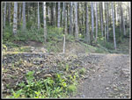
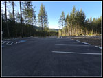 The New Parking Lot |
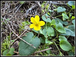 Yellow Violet |
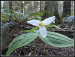 First Trillium |
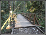 Iverson Trail Bridge |
 Nearing Clearcut |
 Mt. Rainier In Sight |
 Perfect Trillium |
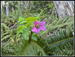
 Bleeding Hearts |
 Salmonberry Flower |
 Side Hustle Bridge |
 Trail Junction |
 TMT Connector Trail |
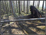
 Big Down Trees |
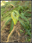 Devil's Club Leaves |
 Train Wreck Site |
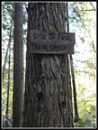 Train Wreck Sign |
 Red Currant Flowers |
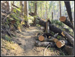 Lots Of Down Logs |
 More Yellow Violets |
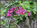 Red Currants Close Up |
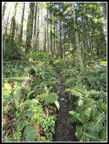
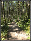
 Middle Tiger Trail |
 Steep Trail |
 Down Trees By Summit |
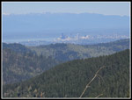 Downtown Seattle |
 Mt. Rainier |
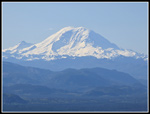 Mt. Rainier Close Up |
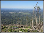 View To Southwest |
 The Brothers |
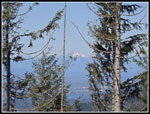
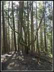 Neat Tree |
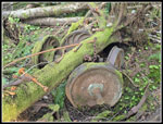
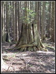 Eye Catching Stump |
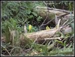 Skunk Cabbage |
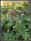 Coltsfoot |
 East Tiger In Sight |
 More Skunk Cabbage |
 Lined With Coltsfoot |
 Mt. Rainier Again |
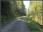
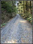 Loose Gravel Road |
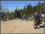 East Tiger Crowd |
 Powerlink Trail |
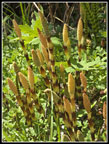 Horsetails |
 Descending Road |
 Almost Done |
Trips - 2026
Home