03-21-26
With
five day left before Hiking
Northwest's 24th Anniversary, I reached 1,199 trip reports. I needed
another hike to be able to reach 1,200 in exactly 24 years for 50 trip
reports per year. Last Sunday we snowshoed on 60" of new snow just east
of Snoqualmie Pass. Then it warmed up and rained and rained and rained.
Much of that fresh
snow melted away. Tiger had snow on the summits on Sunday. Now, just
six days later, I had no idea what the trails would look like. Reports
this week did talk about winds that knocked over a lot of trees, Tiger
had trees down on many trails. The weather looked marginal Friday night
but much better on Saturday morning. I packed up with high top
waterproof boots, microspikes, gaiters, an umbrella, a saw, and poles
and headed for Tiger and the High Point trails. I planned on a
clockwise loop from HPE over Tigers 1, 2, and 3. Gary and I did this
trip in November and detoured to Round Lake to bring the mileage up to
10 and elevation gain to 2900'. I was out the door at 8:00 am and on
the trail at 8:37 am. After a dry drive it rained from Issaquah to High
Point. I started out in light mist without using the umbrella. It is
not unusual to see half a dozen cars parked near the gate at that time.
I saw more than a dozen. That was unusual.
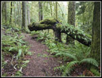
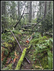
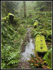
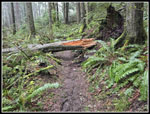
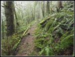
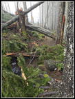
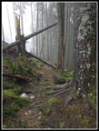
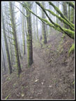
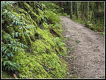
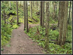
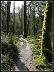
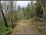
There was water running down the trail early and often. Any brush over the trail was soaking wet. I took the Lingering Trail to add a little mileage and because it is usually cleared of down logs later than the High Point Trail. I quickly found the biggest obstacle of the day. Limbs were across the trail and two logs on top of each other twenty feet later. Then a bigger log was down just after that. I sawed and removed the branches before the first two logs. They were about 8-10" in width. My saw was almost big enough but it would have taken too much time to try. The third log will need a bigger saw. I continued on and noticed that wet brush had soaked the lower part of my pants. Nylon pants mostly dried later. I was off to a good start. I passed the Dwight's Way junction and then turned left at the High Point junction then turned left almost immediately onto the Tiger Mountain Trail(TMT). I removed small branches here and on much of the route up Tiger 1. There were only a couple logs laying on the trail that were easily stepped over.
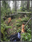
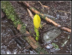
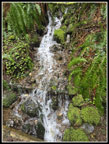
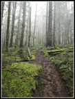
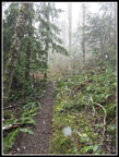
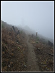
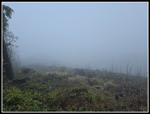
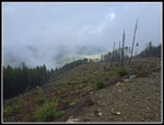
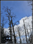
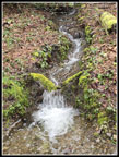
At Ruth's Cove I looked carefully and found one skunk cabbage plant and it already was bright yellow. By now I was entering the clouds. On the drive in I could see that most of Tiger was in a cloud. Now I was too. The trees were dripping a bit but the umbrella stayed on my pack. I turned left at the railroad grade, leaving the TMT, and the trail was now a creek. Normal rain does not do this. All the snow melt had water running down the trails in places I very seldom see it. I started seeing hikers and runners coming down already. I also stopped several times to divert water off the trail. I found several more logs or parts of logs across the trail. I was able to slide two of them down the slope. One creek that is dry most of the year had a high flow as it passed under the trail in a culvert. Above the trail was a waterfall I don't recall seeing before. High snow melt days can be scenic but I knew my route had no open creek crossings. I reached the Preston Trail and headed uphill. This trail is largely up the fall line but it was much drier than below.
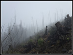
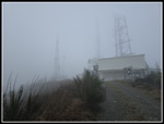
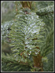
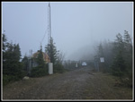
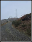
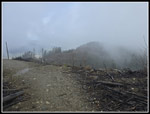
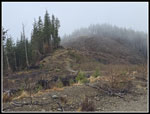
A group of three, than a solo hiker, and then three more passed me going down. I can't recall seeing seven hikers coming down within a few minutes on this trail in the morning. Then I saw another couple and another. At a bit of an open spot in the forest there was a little fresh snow on the ground. By about 2500' it was lightly snowing. That was not expected. It was never near 32F on my trip. I finally reached the upper junction where the Preston Trail goes up to the summit Ridge of Tiger I and the Bootleg trail goes left. I went right. It was snowing again and a few minutes later I stopped and took out my saw once again. Half a dozen long but not thick branches lay across the trail. Lots of small branches blocked the trail. It was not too hard to push through it but I took the time to remove it all. It took about 15 minutes. A group I passed at the start of the TMT now passed me. I never did catch up with them again. The trail climbs to the ridge in a clearcut. I was now in thick clouds with a little snow falling. The towers on the true summit of Tiger 1 were just above and I could barely make them out through the clouds. I reached the road just as a group of 7 passed by heading down the ridge road. Another big group? What was going on? I headed up the road to the summit and on a short spur road I saw another group of 7 hikers. I tagged the top and headed right down.
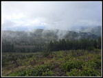
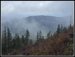
The group of 7 hikers were now moving and about to get on the trail that goes around Tiger 1 to the Hikers Hut on the west side. I just managed to get on the trail ahead of them. When I reached the Hikers Hut the visibility was still minimal. I could not see Tiger 2 at all though it is fairly close. I headed down the steep road towards Tiger 2. Part way down I could see the ground in Issaquah. It was lit up with sunshine. A small sucker hole was now bright blue above it. The rest of the sky was very dark white. Near the low point in the road, I came upon a group of 7 hikers. I sensed a pattern. I stopped to ask if all these groups were some Mountaineers group. Yes, they were. It was the first hike for the Scramble Course. They all had ice axes and were on their first outing. That answered just who all these hikers were. I reached the top of Tiger 2 at 11:36 am. I took 2:59 to hike about 5 miles. I was halfway around my loop but had finished about 90% of the elevation gain. Five hikers were on the actual summit, a spot where I seldom seen anyone. On a moist cloudy day I was seeing more people than ever up to this point. I had my lunch break just below the top. I could now see Tiger 3 off and on. At one point I could see downtown Issaquah and part of Lake Sammamish. I never saw Seattle or Bellevue. The top of Central Peak on Squak Mountain was now in the clear.
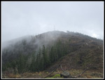
I next headed over to Tiger 3. At the top of the unsigned Seattle View Trail I saw a runner coming up. That seldom ever happens. Lots of seldoms were happening this day. Tiger 3 had a big crowd on top. I took a few cloud photos and headed down. On my November trip on this loop, we had steady 15 mph wind and clouds atop Tiger 3. Today I had no view but no wind. Other than a few small patches on Tiger 1, the route was snow free. One week earlier, snow was alongside I-90 at High Point. I saw the usual number of hikers and runners while descending Tiger 3. With all the wet rocks and roots I never did slip on the entire hike. At the bottom where the trail reaches the Tradition Plateau, A big tree is across the trail. I had to climb up and over it. It will require a big chainsaw or crosscut saw to remove. At the Bus Trail junction I turned left on the Bus Trail. By adding the Lingering Trail to his trip I gained about a third of a mile more than the 10 mile November loop trip. I did not need to go all the way to Round Lake to get my 10 miles. I wanted to check out the level anyway.
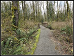
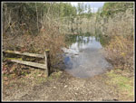
Round Lake is a big meadow with two large puddles in the summer and fall. In mid-November Gary walked out several hundred feet and kept dry feet. The meadow is usually a mud pit. It was nearly dry then. Over the winter I have watched the lake reform as usual. It was only about 4 feet low on my last visit. This day it was all the way up to the fence in front of two benches. It has been many years since I have seen it this full. I took a few photos of the lake and headed back. A minute later I ran into Don and Lyn Mollick. I have known them online at NWHikers for many years. Occasionally we run into each other, usually on Tiger Mountain. It was nice to have a chance to catch up. On the way back I left the Bus Trail and took the Around The Lake Trail back to the main parking lot. From there I took the Connector Trail back to the gate. That just left the road walk back to my car at High Point East. I counted about 60 cars along the road in addition to the nearly full main parking lot.
This turned out to be a very interesting day. I managed to hike over 10 miles with 2900' of gain. I had light rain, mist, falling snow, and even some sunshine after hiking half way down Tiger 3. I saw a lot more people than normally in places I seldom see them. I saw nearly 30 Mountaineers getting started on the Scramble Course. That is a course I took in 1993. I even did a bunch of trail maintenance. Since this would be my 1200th trip report, I wanted to have it be a memorable one. Tiger Mountain is seldom memorable but on this day I think I achieved it.
Click on thumbnails to get
larger pictures.
Trips - 2026
Home
There was water running down the trail early and often. Any brush over the trail was soaking wet. I took the Lingering Trail to add a little mileage and because it is usually cleared of down logs later than the High Point Trail. I quickly found the biggest obstacle of the day. Limbs were across the trail and two logs on top of each other twenty feet later. Then a bigger log was down just after that. I sawed and removed the branches before the first two logs. They were about 8-10" in width. My saw was almost big enough but it would have taken too much time to try. The third log will need a bigger saw. I continued on and noticed that wet brush had soaked the lower part of my pants. Nylon pants mostly dried later. I was off to a good start. I passed the Dwight's Way junction and then turned left at the High Point junction then turned left almost immediately onto the Tiger Mountain Trail(TMT). I removed small branches here and on much of the route up Tiger 1. There were only a couple logs laying on the trail that were easily stepped over.
At Ruth's Cove I looked carefully and found one skunk cabbage plant and it already was bright yellow. By now I was entering the clouds. On the drive in I could see that most of Tiger was in a cloud. Now I was too. The trees were dripping a bit but the umbrella stayed on my pack. I turned left at the railroad grade, leaving the TMT, and the trail was now a creek. Normal rain does not do this. All the snow melt had water running down the trails in places I very seldom see it. I started seeing hikers and runners coming down already. I also stopped several times to divert water off the trail. I found several more logs or parts of logs across the trail. I was able to slide two of them down the slope. One creek that is dry most of the year had a high flow as it passed under the trail in a culvert. Above the trail was a waterfall I don't recall seeing before. High snow melt days can be scenic but I knew my route had no open creek crossings. I reached the Preston Trail and headed uphill. This trail is largely up the fall line but it was much drier than below.
A group of three, than a solo hiker, and then three more passed me going down. I can't recall seeing seven hikers coming down within a few minutes on this trail in the morning. Then I saw another couple and another. At a bit of an open spot in the forest there was a little fresh snow on the ground. By about 2500' it was lightly snowing. That was not expected. It was never near 32F on my trip. I finally reached the upper junction where the Preston Trail goes up to the summit Ridge of Tiger I and the Bootleg trail goes left. I went right. It was snowing again and a few minutes later I stopped and took out my saw once again. Half a dozen long but not thick branches lay across the trail. Lots of small branches blocked the trail. It was not too hard to push through it but I took the time to remove it all. It took about 15 minutes. A group I passed at the start of the TMT now passed me. I never did catch up with them again. The trail climbs to the ridge in a clearcut. I was now in thick clouds with a little snow falling. The towers on the true summit of Tiger 1 were just above and I could barely make them out through the clouds. I reached the road just as a group of 7 passed by heading down the ridge road. Another big group? What was going on? I headed up the road to the summit and on a short spur road I saw another group of 7 hikers. I tagged the top and headed right down.
The group of 7 hikers were now moving and about to get on the trail that goes around Tiger 1 to the Hikers Hut on the west side. I just managed to get on the trail ahead of them. When I reached the Hikers Hut the visibility was still minimal. I could not see Tiger 2 at all though it is fairly close. I headed down the steep road towards Tiger 2. Part way down I could see the ground in Issaquah. It was lit up with sunshine. A small sucker hole was now bright blue above it. The rest of the sky was very dark white. Near the low point in the road, I came upon a group of 7 hikers. I sensed a pattern. I stopped to ask if all these groups were some Mountaineers group. Yes, they were. It was the first hike for the Scramble Course. They all had ice axes and were on their first outing. That answered just who all these hikers were. I reached the top of Tiger 2 at 11:36 am. I took 2:59 to hike about 5 miles. I was halfway around my loop but had finished about 90% of the elevation gain. Five hikers were on the actual summit, a spot where I seldom seen anyone. On a moist cloudy day I was seeing more people than ever up to this point. I had my lunch break just below the top. I could now see Tiger 3 off and on. At one point I could see downtown Issaquah and part of Lake Sammamish. I never saw Seattle or Bellevue. The top of Central Peak on Squak Mountain was now in the clear.
I next headed over to Tiger 3. At the top of the unsigned Seattle View Trail I saw a runner coming up. That seldom ever happens. Lots of seldoms were happening this day. Tiger 3 had a big crowd on top. I took a few cloud photos and headed down. On my November trip on this loop, we had steady 15 mph wind and clouds atop Tiger 3. Today I had no view but no wind. Other than a few small patches on Tiger 1, the route was snow free. One week earlier, snow was alongside I-90 at High Point. I saw the usual number of hikers and runners while descending Tiger 3. With all the wet rocks and roots I never did slip on the entire hike. At the bottom where the trail reaches the Tradition Plateau, A big tree is across the trail. I had to climb up and over it. It will require a big chainsaw or crosscut saw to remove. At the Bus Trail junction I turned left on the Bus Trail. By adding the Lingering Trail to his trip I gained about a third of a mile more than the 10 mile November loop trip. I did not need to go all the way to Round Lake to get my 10 miles. I wanted to check out the level anyway.
Round Lake is a big meadow with two large puddles in the summer and fall. In mid-November Gary walked out several hundred feet and kept dry feet. The meadow is usually a mud pit. It was nearly dry then. Over the winter I have watched the lake reform as usual. It was only about 4 feet low on my last visit. This day it was all the way up to the fence in front of two benches. It has been many years since I have seen it this full. I took a few photos of the lake and headed back. A minute later I ran into Don and Lyn Mollick. I have known them online at NWHikers for many years. Occasionally we run into each other, usually on Tiger Mountain. It was nice to have a chance to catch up. On the way back I left the Bus Trail and took the Around The Lake Trail back to the main parking lot. From there I took the Connector Trail back to the gate. That just left the road walk back to my car at High Point East. I counted about 60 cars along the road in addition to the nearly full main parking lot.
This turned out to be a very interesting day. I managed to hike over 10 miles with 2900' of gain. I had light rain, mist, falling snow, and even some sunshine after hiking half way down Tiger 3. I saw a lot more people than normally in places I seldom see them. I saw nearly 30 Mountaineers getting started on the Scramble Course. That is a course I took in 1993. I even did a bunch of trail maintenance. Since this would be my 1200th trip report, I wanted to have it be a memorable one. Tiger Mountain is seldom memorable but on this day I think I achieved it.
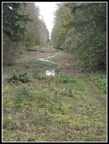
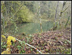 High Point Pond |
 Mossy Green Tree |
 Old TMT |
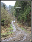 Very Muddy Road |
 The Dragon |
 Blowdown Mess Before |
 And After |
 A Big Puddle |
 Another Log Over Trail |
 Skunk Cabbage! |
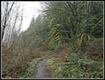
 Tiger Mountain Trail |
 Cascades |
 On The Railroad Grade |
 Preston Trail |
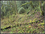
 Mossy Ground |
 It Is Snowing |
 Another Mess (Before) |
 After |
 Cloudy Tower Above |
 Not Much Visibility |
 Tiger 1 Summit |
 Icy Tree Needles |
 Poo Top Trail |
 The Hikers Hut |
 View Of Tiger 2? |
 Cloudy One View Ridge |
 Almost To Tiger 2 |
 Tiger 3 View Is Clearing |
 A Little Sunny Spot |
 Heading To Tiger 3 |
 Squak Mountain |
 Tiger 2 From Tiger 3 |
 Blue Sky At Last! |
 Very Bright Green |
 Winding Trail |
 Great Contrast |
 Out In The Open |
 Bus Trail |
 Lots Of Water |
 Round Lake Is Full |
 Wet Trail |
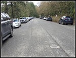 Lots Of Parked Cars |
Trips - 2026
Home