10-02-11
Summer
is over. No more warm days
on the trail. Time for another visit to the Teanaway. This is a great
loop trip with a little scrambling to complete the loop. I hate the
heat of mid summer on the east side but it has cooled down plenty by
October. Out of the house at 6:30 and up the NF Teanaway Road and
Beverly Creek Road to the Beverly trailhead by 8:37 am. 10 minutes
later I was on my way. The Beverly Road is awful. Not the road itself,
that is just fine. The water bars are the problem. I managed to bottom
out once each way with a mid sized sedan. No damage but no reason for
the ditches where there has never been erosion problems. Okay, off my
soapbox and back to the report.
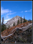
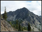
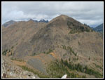
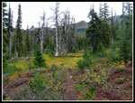
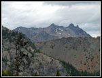
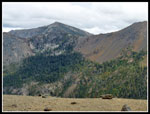
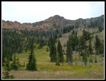
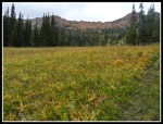
I had clouds all the way from Seattle to Cle Elum but there was a nice big area of blue sky over the Teanaway. Short sleeves to start. The crossing of Bean Creek was very easy. The trail is in fine shape with logs cut out all the way around the loop. Even the County Line trail beyond Fourth Creek Pass was recently logged out. Looking back to my report from last year I see that I started at the same time and took almost exactly the same time for each leg of this trip. Deja vu all over again. Nice views of Bill's and Teanaway Peaks while coming up the valley. Blue sky over head.
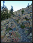
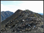
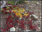
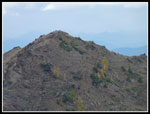
Still a few flowers hanging on. I saw my first ever blooming scarlet gilia in October. Fall color began right out of the parking lot. Not peaking color but some very good red, yellow, and orange. It was even better on the switchbacks beyond the Beverly Creek crossing. High in the basin the clouds came in. One minute clear sky and a minute later it was gray. I reached the Iron - Teanaway saddle to find some wind. Not enough to require a jacket but the sleeves were rolled down. I camped on Iron Peak in April and the snow was as deep as I have seen. Quite a contrast to see it bare once again. The ridge walk went quickly. I passed a lone hiker on a high point just before the summit. I arrived on top at 11:03, making it 2:16 to cover the 5 miles and 2900' of gain.
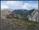
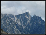
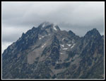
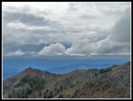
I could see the peaks of the Cascade Crest but Mt. Daniel was in the clouds. All the Teanaway peaks were in the clear but Mt. Stuart was nowhere to be found. Just a wall of gray. Nothing like the clear views I had in April. I spent 20 minutes on the summit. The register is empty. Just a small piece of paper. Heading down I met the lone hiker. He came up the Iron Peak Trail. Near the saddle I met two more folks heading up. That was it for the day. No more people for the rest of the day. I quickly dropped back down to the Fourth Creek junction and headed uphill to Fourth Creek Pass. Right on 7 miles so far. One hallmark of this trip was that every campsite had a huge fire pit showing recent use. Several in Beverly Basin, at Fourth Creek Pass, and in Bean Creek Basin. I've never seen them before at most of those sites.
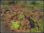
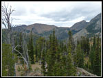
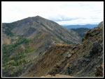
The County Line Trail to the saddle next to Volcanic Neck is one of my favorite stretches of trail. The larch trees above were still green but the ground cover was every shade of red, yellow, and orange. Some really nice color. This was the slowest section of the day as the camera stayed in my hand. The over head gray grew darker and for the first time it looked like it might rain. I left my umbrella in the car and began to rue the decision. The cool day made the climb to the saddle easier than usual. The views had improved as much of the Stuart Range was now out of the clouds. The top of Stuart refused to clear.
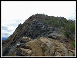
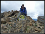
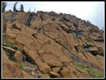
The ridge scramble was fun. Not much wind. This side of Bean Peak is much less precipitous than the Bean Creek Basin side. I had no problems scrambling up to the summit. It was 1:30 when I reached the top. Still early though the dark gray clouds made it seem later. Looking back to the ridge between Bean and Mary Peaks I saw a lot of green larch trees. A close look at the trees right below the summit of Mary showed them to be golden. Some larch above 6000' have begun to turn color. This bodes well for Ingalls Pass in a week or two.
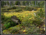
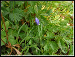
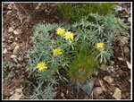
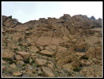
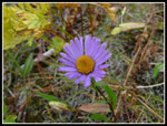
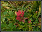
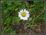
I spent almost 50 minutes on the summit. At 2:18 I headed down. The rock scramble is steep and a lot of fun. Really sticky rock. The rest of the descent is a bit tedious down grassy and rocky slopes. I unexpectedly ran into a boot path compete with switchbacks the last 300 or so feet. After so many wildflowers on my early summer visit to the basin it seems a little empty now. Still there are some flowers hanging on and others, like gentians, just getting started. All the yellow grass has a beauty all it's own.
As I reached the lower basin the raindrops began to fall. Not hard but steady. I picked up the pace and reached the forest before I needed to stop for rain gear. In fact. the rain was on and off all the way back to the car. I reached the trailhead at 3:55 making my day just over 7 hours. The loop is a little over 12 miles with 4400' of gain. Two trips with a GPS agree. Much of the drive home was in the rain but I was pleased to have had most all the hike be dry. Two summits, lots of fall color, and almost no other people made for a great day in the mountains.
Click on thumbnails to get
larger pictures.
Trips - 2011
Home
I had clouds all the way from Seattle to Cle Elum but there was a nice big area of blue sky over the Teanaway. Short sleeves to start. The crossing of Bean Creek was very easy. The trail is in fine shape with logs cut out all the way around the loop. Even the County Line trail beyond Fourth Creek Pass was recently logged out. Looking back to my report from last year I see that I started at the same time and took almost exactly the same time for each leg of this trip. Deja vu all over again. Nice views of Bill's and Teanaway Peaks while coming up the valley. Blue sky over head.
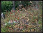
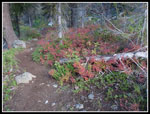
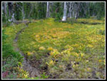
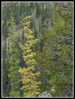
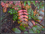
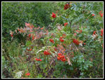
Still a few flowers hanging on. I saw my first ever blooming scarlet gilia in October. Fall color began right out of the parking lot. Not peaking color but some very good red, yellow, and orange. It was even better on the switchbacks beyond the Beverly Creek crossing. High in the basin the clouds came in. One minute clear sky and a minute later it was gray. I reached the Iron - Teanaway saddle to find some wind. Not enough to require a jacket but the sleeves were rolled down. I camped on Iron Peak in April and the snow was as deep as I have seen. Quite a contrast to see it bare once again. The ridge walk went quickly. I passed a lone hiker on a high point just before the summit. I arrived on top at 11:03, making it 2:16 to cover the 5 miles and 2900' of gain.
I could see the peaks of the Cascade Crest but Mt. Daniel was in the clouds. All the Teanaway peaks were in the clear but Mt. Stuart was nowhere to be found. Just a wall of gray. Nothing like the clear views I had in April. I spent 20 minutes on the summit. The register is empty. Just a small piece of paper. Heading down I met the lone hiker. He came up the Iron Peak Trail. Near the saddle I met two more folks heading up. That was it for the day. No more people for the rest of the day. I quickly dropped back down to the Fourth Creek junction and headed uphill to Fourth Creek Pass. Right on 7 miles so far. One hallmark of this trip was that every campsite had a huge fire pit showing recent use. Several in Beverly Basin, at Fourth Creek Pass, and in Bean Creek Basin. I've never seen them before at most of those sites.
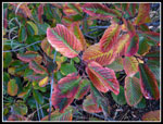
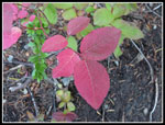
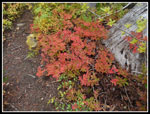
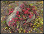
The County Line Trail to the saddle next to Volcanic Neck is one of my favorite stretches of trail. The larch trees above were still green but the ground cover was every shade of red, yellow, and orange. Some really nice color. This was the slowest section of the day as the camera stayed in my hand. The over head gray grew darker and for the first time it looked like it might rain. I left my umbrella in the car and began to rue the decision. The cool day made the climb to the saddle easier than usual. The views had improved as much of the Stuart Range was now out of the clouds. The top of Stuart refused to clear.
The ridge scramble was fun. Not much wind. This side of Bean Peak is much less precipitous than the Bean Creek Basin side. I had no problems scrambling up to the summit. It was 1:30 when I reached the top. Still early though the dark gray clouds made it seem later. Looking back to the ridge between Bean and Mary Peaks I saw a lot of green larch trees. A close look at the trees right below the summit of Mary showed them to be golden. Some larch above 6000' have begun to turn color. This bodes well for Ingalls Pass in a week or two.
I spent almost 50 minutes on the summit. At 2:18 I headed down. The rock scramble is steep and a lot of fun. Really sticky rock. The rest of the descent is a bit tedious down grassy and rocky slopes. I unexpectedly ran into a boot path compete with switchbacks the last 300 or so feet. After so many wildflowers on my early summer visit to the basin it seems a little empty now. Still there are some flowers hanging on and others, like gentians, just getting started. All the yellow grass has a beauty all it's own.
As I reached the lower basin the raindrops began to fall. Not hard but steady. I picked up the pace and reached the forest before I needed to stop for rain gear. In fact. the rain was on and off all the way back to the car. I reached the trailhead at 3:55 making my day just over 7 hours. The loop is a little over 12 miles with 4400' of gain. Two trips with a GPS agree. Much of the drive home was in the rain but I was pleased to have had most all the hike be dry. Two summits, lots of fall color, and almost no other people made for a great day in the mountains.
 Mountain Ash |
 Colorful Leaves |
 Trailside Color |
 Red & Green |
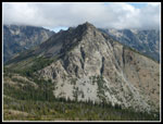
 Bill's Peak |
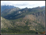
 Beverly Basin Trail |
 Green & Color |
 Colorful Grass |
 Lone Wildflower |
 Bill's Peak Summit |
 Iron Summit Ridge |
 Mt. Stuart In The Clouds |
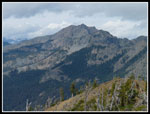
 Mighty Bill's Peak |
 My Route To Bean Peak |
 Three Queens |
 Hawkins Mountain |
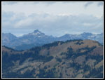
 Teanaway Peak |
 Little Annapurna |
 Nice Contrast |
 Thistle |
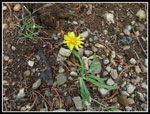 Lone Yellow Flower |
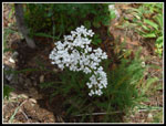 White Flowers |
 Grass & Granite |
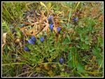 Gentians |
 Color & Bean Peak |
 Narrow Trail |
 Great Color |
 Colorful Rock |
 Turning Larch |
 Fortune & Ingalls Peaks |
 Stuart Nearly Clear |
 Looking Back To Iron Pk |
 Navaho Peak |
 Flowers On Ridge |
 Nearing Bean Summit |
 Ridge To Earl Peak |
 Golden Larch Under Mary |
 Colorful Clouds |
 Self Portrait On Bean |
 Steep Descent |
 Red Rocks |
 Blooming Aster |
 Bean Peak From Basin |
 Indian Paintbrush |
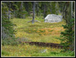
 Grassy Basin |
 Multiple Colors |
 Mountain Ash Berries |
 Last Wildflower |
Trips - 2011
Home