7-21-12
Gary
and I had a bike and backpack trip on an abandoned trail set up for the
weekend. The forecast deteriorated on the west side but looked ideal on
the east side. Rather than climb over wet downed trees to get to no
views we had a last minute change of plans. We headed east to Cle Elum
then up the NF Teanaway Road and on to the Stafford Creek Road. The
bridge over Stafford Creek is gated as there is still logging going on
down the road. This has never been a wildly popular trail but to my
surprise at 8:30 am there were already a dozen cars parked along the
road. This was not a big concern as the route I had planned would have
few hikers on it for most of the day. Most folks would be heading up to
Navaho Pass or Peak and returning the same way.
It was a little chilly at first but it soon turned into a shorts and short sleeves day. The Stafford Creek Trail gains elevation at a steady rate. Never steep, it is also mostly well above the creek. We set out at a good clip but apparently not all that fast. After passing a family of three a pair then a single hiker passed us. I did this exact route once before in 2004 with the Mountaineers. I guesstimated it as 15 miles with 6000' of gain. This time I had a GPS to see how close I came.
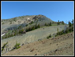
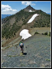
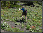
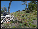
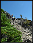
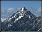
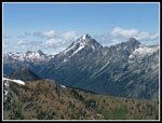
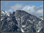
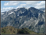
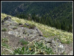
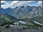
After several switchbacks at 3.57 miles gaining 1700' we reached the creek crossing. It was time to leave the trail. We headed straight up the slope to the right of the creek. Very quickly the forest thinned and views out to Earl Peak across the valley opened up. Lots of very small flowers were blooming along here. The route is steep but footing is good. We cranked out the elevation gain heading up towards the saddle between Navaho and Little Navaho Peaks. As we neared the saddle Three Brothers came into view. That would be our first destination. The climb was .75 miles gaining 1100'. There is still snow on the northeast side of the ridge but only at the top. No snowfield leading into the valley below.
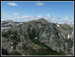
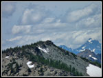
On my last visit in 2010 we dropped down over the saddle. I preferred the ridge scramble up towards Navaho meeting the County Line Trail. It was such a clear sunny day that dropping into a valley did not sound as appealing as a ridge walk. The scramble up starts steep but its pretty easy scrambling. Soon the ridge levels out. Views over to Three Brothers, Navaho ahead, and Little Navaho and Miller Peaks behind. Throw in Earl Peak and the views are complete. Well almost. There are those peaks of the Stuart Range too. Gary noticed the County Line Trail as I was about to cross right over it. It is not that obvious on the bare rocky ground. A little steep hard snow covered the top of the slope down. No problem. Rather than taking out our ice aces for this short bit we just walked around the snow and picked up the trail below the snow.
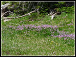
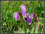
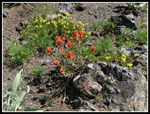
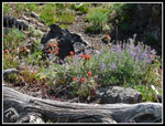
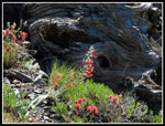
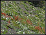
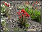
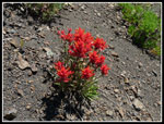
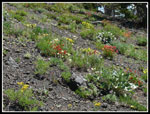
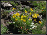
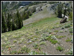
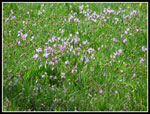
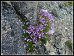
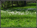
This section of the County Line Trail does not get much use. It is disappearing under vegetation in places. No problem as the route drops down to the saddle below the west most of the Three Brothers. Some great flower fields on the way. Lots of shooting stars plus glacier lilies, paintbrush, lupine and scarlet gilia. We had seen a lot of scarlet gilia back along the Stafford Creek Trail. It continued most of the way around the loop. I have never seen gilia along so much trail as this day. We reached th saddle at 12:00 pm and had a food and water break. With 3400' of gain done we now were ready for the longest steep climb.
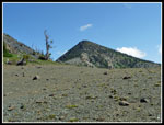
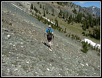
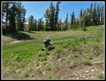
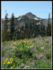
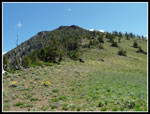
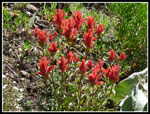
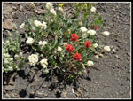
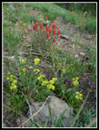
It proved to be a slower climb than planned. There wee blooming balsamroot on the start of the climb. Also fields of white and yellow flowers covered the slope. Throw in bright back lit Indian paintbrush and scarlet gilia as we rose. Some lupine and others too. In all my visits I had never seen such of wildflower show on this hike. To good to speed past. Many photos ensued. After about 500' of climbing the flower show petered out. It was getting warm but we had a cool breeze much of the way up. It made a huge difference. I did not overheat. The ridge seems to go on and on but at long last it flattened out for the last bit to the summit. The top is a flat ridge rather than a pointed summit. We went to several small bumps before finding the summit registers and sitting down.
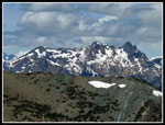
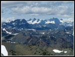
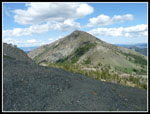
Such spectacular views from the summit. Rather than looking across at Mt Stuart as from most Teanaway peaks you look up Ingalls Creek to the mass of Stuart. At 7303' we were high enough to see to the Cascade crest. Ingalls Peaks nearby and Hibox, Alta, and Three Queens near the crest. Puffy clouds had been building all morning but they just provided a few moments of shade and did not block any views. We spent 1:15 enjoying the views and wandering a little farther down the ridge towards the Middle Brother. At 2:30 pm we packed up and headed down.
The descent was faster though the loose dirt and scree in places minimized our speed. It was much warmer out of the wind but back at the pass a cool breeze made it very pleasant. Now came 1200' more climbing to get to the top of Navaho Peak. Back in May of 1992 I met Gary at Navaho Pass. We were about the only people on the trail that day. Gary, his friend, and I then headed up Navaho Peak. It was my first ascent. We planned to go back this past May. The logging and closure of the Stafford Road nixed that idea. Two months later we made our return trip to Navaho. Rather than hiking around the snow near the ridge top I just kicked steps up it. The Navaho Ridge is pretty easy walking. As we neared 6000' of gain for the day I was feeling the effort.
We expected to see a number of people on Navaho and were not disappointed. They were the first people we had seen since early in the day. We had a short stay on top. From Navaho it is almost all downhill. I usually do the peak on snow and the last few times on dirt I have been amazed at how the old hard to follow boot path has turned into a trail all the way to the top. No navigation problems coming down. Nearer to the pass we saw several groups of backpackers heading higher. It would be a dry camp for them. All told we passed 13 backpackers just above or below Navaho Pass. There were several more groups camped at the meadow. Below that the crowds nearly vanished. Only a few more late afternoon hikers coming up.
The trail down was just a long slog. My GPS recorded 5.91 miles from Navaho Pass to the trailhead. We reached the car at 7:17 pm. Just over 10 1/2 hours on the trail. The GPS recorded 15.43 miles for the loop. Just about exactly what I estimated in 2004. 6000' gained days are rare for me and this was a very good one. The day urned out almost perfectly. Great weather, terrific wildflowers, almost no snow, terrific views on the ridges and summits and only a few short stretches where we saw any people. At the trailhead I counted 19 cars. That is an awful lot for this trail. We did not go on our planned trip this weekend but the alternative proved to be fantastic.
Click on thumbnails to get
larger pictures.
Trips - 2012
Home
It was a little chilly at first but it soon turned into a shorts and short sleeves day. The Stafford Creek Trail gains elevation at a steady rate. Never steep, it is also mostly well above the creek. We set out at a good clip but apparently not all that fast. After passing a family of three a pair then a single hiker passed us. I did this exact route once before in 2004 with the Mountaineers. I guesstimated it as 15 miles with 6000' of gain. This time I had a GPS to see how close I came.
After several switchbacks at 3.57 miles gaining 1700' we reached the creek crossing. It was time to leave the trail. We headed straight up the slope to the right of the creek. Very quickly the forest thinned and views out to Earl Peak across the valley opened up. Lots of very small flowers were blooming along here. The route is steep but footing is good. We cranked out the elevation gain heading up towards the saddle between Navaho and Little Navaho Peaks. As we neared the saddle Three Brothers came into view. That would be our first destination. The climb was .75 miles gaining 1100'. There is still snow on the northeast side of the ridge but only at the top. No snowfield leading into the valley below.
On my last visit in 2010 we dropped down over the saddle. I preferred the ridge scramble up towards Navaho meeting the County Line Trail. It was such a clear sunny day that dropping into a valley did not sound as appealing as a ridge walk. The scramble up starts steep but its pretty easy scrambling. Soon the ridge levels out. Views over to Three Brothers, Navaho ahead, and Little Navaho and Miller Peaks behind. Throw in Earl Peak and the views are complete. Well almost. There are those peaks of the Stuart Range too. Gary noticed the County Line Trail as I was about to cross right over it. It is not that obvious on the bare rocky ground. A little steep hard snow covered the top of the slope down. No problem. Rather than taking out our ice aces for this short bit we just walked around the snow and picked up the trail below the snow.
This section of the County Line Trail does not get much use. It is disappearing under vegetation in places. No problem as the route drops down to the saddle below the west most of the Three Brothers. Some great flower fields on the way. Lots of shooting stars plus glacier lilies, paintbrush, lupine and scarlet gilia. We had seen a lot of scarlet gilia back along the Stafford Creek Trail. It continued most of the way around the loop. I have never seen gilia along so much trail as this day. We reached th saddle at 12:00 pm and had a food and water break. With 3400' of gain done we now were ready for the longest steep climb.
It proved to be a slower climb than planned. There wee blooming balsamroot on the start of the climb. Also fields of white and yellow flowers covered the slope. Throw in bright back lit Indian paintbrush and scarlet gilia as we rose. Some lupine and others too. In all my visits I had never seen such of wildflower show on this hike. To good to speed past. Many photos ensued. After about 500' of climbing the flower show petered out. It was getting warm but we had a cool breeze much of the way up. It made a huge difference. I did not overheat. The ridge seems to go on and on but at long last it flattened out for the last bit to the summit. The top is a flat ridge rather than a pointed summit. We went to several small bumps before finding the summit registers and sitting down.
Such spectacular views from the summit. Rather than looking across at Mt Stuart as from most Teanaway peaks you look up Ingalls Creek to the mass of Stuart. At 7303' we were high enough to see to the Cascade crest. Ingalls Peaks nearby and Hibox, Alta, and Three Queens near the crest. Puffy clouds had been building all morning but they just provided a few moments of shade and did not block any views. We spent 1:15 enjoying the views and wandering a little farther down the ridge towards the Middle Brother. At 2:30 pm we packed up and headed down.
The descent was faster though the loose dirt and scree in places minimized our speed. It was much warmer out of the wind but back at the pass a cool breeze made it very pleasant. Now came 1200' more climbing to get to the top of Navaho Peak. Back in May of 1992 I met Gary at Navaho Pass. We were about the only people on the trail that day. Gary, his friend, and I then headed up Navaho Peak. It was my first ascent. We planned to go back this past May. The logging and closure of the Stafford Road nixed that idea. Two months later we made our return trip to Navaho. Rather than hiking around the snow near the ridge top I just kicked steps up it. The Navaho Ridge is pretty easy walking. As we neared 6000' of gain for the day I was feeling the effort.
We expected to see a number of people on Navaho and were not disappointed. They were the first people we had seen since early in the day. We had a short stay on top. From Navaho it is almost all downhill. I usually do the peak on snow and the last few times on dirt I have been amazed at how the old hard to follow boot path has turned into a trail all the way to the top. No navigation problems coming down. Nearer to the pass we saw several groups of backpackers heading higher. It would be a dry camp for them. All told we passed 13 backpackers just above or below Navaho Pass. There were several more groups camped at the meadow. Below that the crowds nearly vanished. Only a few more late afternoon hikers coming up.
The trail down was just a long slog. My GPS recorded 5.91 miles from Navaho Pass to the trailhead. We reached the car at 7:17 pm. Just over 10 1/2 hours on the trail. The GPS recorded 15.43 miles for the loop. Just about exactly what I estimated in 2004. 6000' gained days are rare for me and this was a very good one. The day urned out almost perfectly. Great weather, terrific wildflowers, almost no snow, terrific views on the ridges and summits and only a few short stretches where we saw any people. At the trailhead I counted 19 cars. That is an awful lot for this trail. We did not go on our planned trip this weekend but the alternative proved to be fantastic.
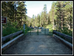 Gated Bridge |
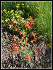 Scarlet Gilia |
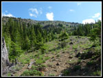 Off Trail Climbing |
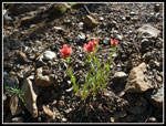 Indian Paintbrush |
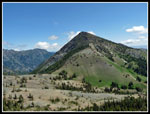
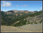 Earl Peak |
 Nearing Saddle |
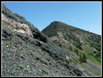
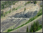 Interesting Geology |
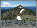
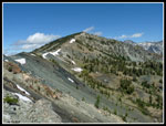
 Three Brothers & Saddle |
 Above Saddle |
 Three Brothers & Gravel |
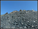 Climbing Up Gravel |
 Little Navaho & Saddle |
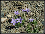 Small Flowers |
 Brothers From Ridge |
 Navaho Peak |
 Gary Descending |
 Shooting Stars |
 Close Up |
 Gary At Work |
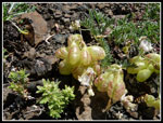
 Western Anemone |
 Navaho Ridge |
 Balsamroot & Lil Nav |
 Falls Creek Saddle |
 Bouquet Of Colors |
 Log & Colors |
 Paintbrush & Gilia |
 Great Color |
 Even More Color |
 Bunch Of Paintbrush |
 Close Up Paintbrush |
 Red & White |
 More Photos |
 Silver, Sky, & Flowers |
 Locoweed |
 Flowers Keep Going |
 Blooming Balsamroot |
 Back To Scrambling |
 Fortune & Ingalls Peaks |
 Mt. Stuart |
 Earl & Navaho |
 Ingalls & Stuart |
 Cascade Crest Peaks |
 Little Annapurna |
 People On Navaho |
 Dragontail & Little Anna |
 Diagonal Color |
 Almost Back To Saddle |
 More Shooting Stars |
 Three Brothers Again |
 Stuart Range |
 Navaho Penstemon |
 Still More Flowers |
 Green & White |
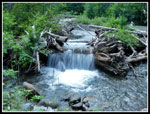 Waterfall |
Trips - 2012
Home