8/31-9/02/13
On
Labor Day weekend nine years ago
Gary and I made our first visit to the Goat Rocks. We had a great four
day loop trip. This year Gary, John, and I scheduled a trip to the
White Cloud Mountains in Idaho and had to cancel at the last minute due
to smoke from fires. This was the second year in a row we canceled
Idaho at the last minute. Instead, we chose a return trip to the Goat
Rocks for Gary and I and a first visit for John. We had three days vs.
four back in 2004 so we put together a different loop this time. The
plan was last minute as we had a few days of good weather between rainy
days. We started on Saturday and finished up on Monday.
Day 1
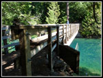
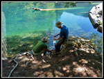
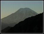
I met Gary and John in Kent at 6:30 am and we headed south. Enumclaw, Cayuse Pass, and on to Packwood. The trailhead is just six paved miles from town. Maybe a dozen cars in the lot but plenty of room left. It took just over two hours to drive from Kent. We arrived at the 2700' trailhead at about 8:35 am. Soon we were on the trail. It was warm enough for shorts and short sleeves from the start. The high for the first two days was forecast at about 80 degrees for 2857' Packwood Lake. The second evening and day three would be dicier as it was expected to be cloudy with a chance of rain. The trail is not quite flat as it gains 500' going in and nearly as much coming out. We had a view of Mt. Rainier right from the trailhead. Then we blasted out a quick hike into Packwood Lake. The 4.5 miles took us 1:30. We had carried little water and pumped our bottles full for the climb to Lost Lake.
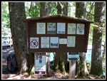
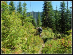
There were fires at campsites along the lake. We crossed the outlet and passed some campers along the lakeshore. Soon we reached the trail junction. Straight ahead is the Upper Lake Creek Trail which would be our return route. We turned left uphill on the Packwood Lake Trail. The lake is surrounded by the Goat Rocks Wilderness but is not a part of the Wilderness. We hiked in wilderness before the lake and soon reached the permit box and reentered the wilderness. The 3.5 miles up to the junction with the Coyote Ridge Trail gained 2350' on well graded trail. There were a number of downed logs across the trail but none proved to be much of a problem. The ground was very green with a lot of moss. It was now getting warm and that was the only problem on this stretch. Gary and John set out at a faster pace and I had a little solitude along here.
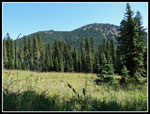
At Mosquito Lake I caught up as they were stopped to feast on huckleberries. We found a number of patches up high on our trek. We were going to stop for lunch but a swarm of flies had us quickly moving again. The trail leveled off and in open meadows we had views up to Coyote Ridge. Gary and I really enjoyed that trail on our 2004 trip and included it this time too. We expected these trails at the north end of the wilderness to be much less crowed on a holiday weekend than the southern parts near Snowgrass Flats and Goat Lake. We were proven correct though it was more crowded than in 2004. The bugs were a little less bothersome where we did stop for lunch.
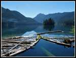
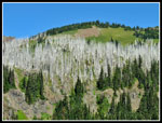
Back on trail we climbed up to the Junction with the Coyote Ridge Trail. It was still early enough so we took the short jaunt over to Lost Lake. On our previous visit we spent a misty rainy night at Lost Lake. This day was sunny and very warm. There were several groups at the lake. Some folks fishing and some more out on inflatable boats. The silvered forest behind the lake is the most striking visual feature. We arrived at the lake at about 1:20 pm and spent an hour. Reluctantly, we headed back to the junction and hefted our packs once again. The Coyote Ridge Trail is very dry. After some heavy rains the past week we did find three creeks running. This time of year the best bet is Beaver Bill's Creek. We stopped there on our first visit and thought it would be fun to camp there. This time we did. It was a little more than 1.5 miles to the creek. The first part of the ridge is mostly in forest as it climbs higher.
When we reached the campsite we were surprised to see it was already taken. Someone else planned to camp at Beaver Bill's Creek? Yep. We searched around and found another spot to camp. There was plenty of water in the creek. We set up camp and after dinner took a walk higher on the slope to find some views out at sunset. For the day we hiked just under 11 miles with about 4000' of elevation gain.
Click on thumbnails to get
larger pictures.
Report Page 2
Trips - 2013
Home
Day 1
I met Gary and John in Kent at 6:30 am and we headed south. Enumclaw, Cayuse Pass, and on to Packwood. The trailhead is just six paved miles from town. Maybe a dozen cars in the lot but plenty of room left. It took just over two hours to drive from Kent. We arrived at the 2700' trailhead at about 8:35 am. Soon we were on the trail. It was warm enough for shorts and short sleeves from the start. The high for the first two days was forecast at about 80 degrees for 2857' Packwood Lake. The second evening and day three would be dicier as it was expected to be cloudy with a chance of rain. The trail is not quite flat as it gains 500' going in and nearly as much coming out. We had a view of Mt. Rainier right from the trailhead. Then we blasted out a quick hike into Packwood Lake. The 4.5 miles took us 1:30. We had carried little water and pumped our bottles full for the climb to Lost Lake.
There were fires at campsites along the lake. We crossed the outlet and passed some campers along the lakeshore. Soon we reached the trail junction. Straight ahead is the Upper Lake Creek Trail which would be our return route. We turned left uphill on the Packwood Lake Trail. The lake is surrounded by the Goat Rocks Wilderness but is not a part of the Wilderness. We hiked in wilderness before the lake and soon reached the permit box and reentered the wilderness. The 3.5 miles up to the junction with the Coyote Ridge Trail gained 2350' on well graded trail. There were a number of downed logs across the trail but none proved to be much of a problem. The ground was very green with a lot of moss. It was now getting warm and that was the only problem on this stretch. Gary and John set out at a faster pace and I had a little solitude along here.
At Mosquito Lake I caught up as they were stopped to feast on huckleberries. We found a number of patches up high on our trek. We were going to stop for lunch but a swarm of flies had us quickly moving again. The trail leveled off and in open meadows we had views up to Coyote Ridge. Gary and I really enjoyed that trail on our 2004 trip and included it this time too. We expected these trails at the north end of the wilderness to be much less crowed on a holiday weekend than the southern parts near Snowgrass Flats and Goat Lake. We were proven correct though it was more crowded than in 2004. The bugs were a little less bothersome where we did stop for lunch.
Back on trail we climbed up to the Junction with the Coyote Ridge Trail. It was still early enough so we took the short jaunt over to Lost Lake. On our previous visit we spent a misty rainy night at Lost Lake. This day was sunny and very warm. There were several groups at the lake. Some folks fishing and some more out on inflatable boats. The silvered forest behind the lake is the most striking visual feature. We arrived at the lake at about 1:20 pm and spent an hour. Reluctantly, we headed back to the junction and hefted our packs once again. The Coyote Ridge Trail is very dry. After some heavy rains the past week we did find three creeks running. This time of year the best bet is Beaver Bill's Creek. We stopped there on our first visit and thought it would be fun to camp there. This time we did. It was a little more than 1.5 miles to the creek. The first part of the ridge is mostly in forest as it climbs higher.
When we reached the campsite we were surprised to see it was already taken. Someone else planned to camp at Beaver Bill's Creek? Yep. We searched around and found another spot to camp. There was plenty of water in the creek. We set up camp and after dinner took a walk higher on the slope to find some views out at sunset. For the day we hiked just under 11 miles with about 4000' of elevation gain.
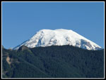 Mt. Rainier |
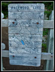 Map At Trailhead |
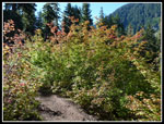 Fall Color Beginning |
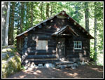 Ranger Cabin |
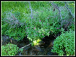
 Bridge At Outlet |
 Filtering Water |
 Trail Info |
 Packwood Lake |
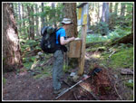 Wilderness Permit |
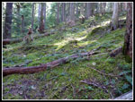 Open Forest |
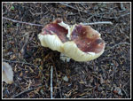 Mushroom |
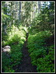 Brushier Trail |
 Eating Berries |
 Coyote Ridge |
 Leaf Shadow |
 Silver Forest |
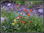
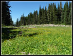 Lost Lake Flowers |
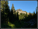
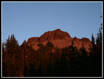
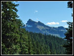 Johnson Peak |
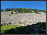 Talus Field |
 Indian Paintbrush |
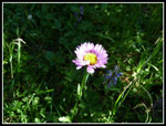 Sun Lit Aster |
 Monkeyflower |
 Point On Coyote Ridge |
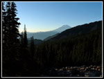 Rainier Near Dark |
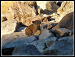 Pika |
 Rainier Close Up |
 Alpenglow |
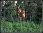 On Fire? |
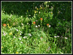
 More Wildflowers |
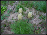 Western Anemone |
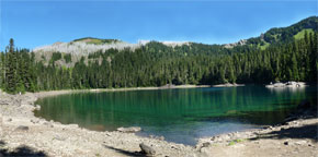 Panorama View Of Lost Lake |
Report Page 2
Trips - 2013
Home