Day 3
We
were in for a real change on day 3. It was cloudy but dry as we packed
up camp at Marmot Lake. It is only 1.2 miles from the lake to O'Neil
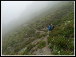
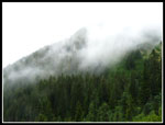
Pass. At 4950' it would be the highest point of the day. Clouds swirled
over the pass and into the valley. The hike over to the pass was on
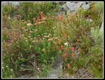
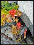
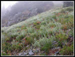
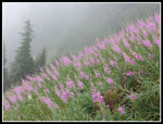
grassy slopes. lots of colorful fireweed was blooming. We also saw
western anemone seed heads. They look like blond heads and nothing like
the flowering stage. We arrived at the pass at 8:40 am. It was cool but
not too cold. The trail rounds the bend and heads north high above the
Enchanted Valley. We had looked down on it the previous day from the
ridge top saddle. That day we were in bright sunshine looking down to
clouds. This day we were completely in the clouds. That would not
change all day long.
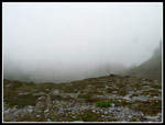
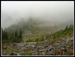
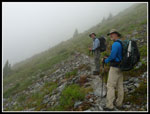
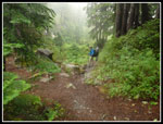
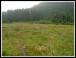
The foggy clouds gave the terrain a very different feel. Like a complete change from the two previous days. The cool was even refreshing. The route is varied. At times on steep sidehills and at times entering a number of basins. Much more variety than I was expecting. The trail is a long way from any trailhead and it does not get a lot of maintenance. It has sloughed in places and can be very narrow because of it. A few places have collapsed leaving some big steps to get back on grade. For the most part though, it is in reasonably good shape. On my hikes I sometimes see pink Lewis monkeyflower. Usually alongside streams. On rare occasions I see yellow Tiling's monkeyflower. This hike was most unusual. We saw a little pink monkeyflower but a whole lot of the yellow variety. Probably as much as I've seen in 33 years of hiking combined. Every little dripping creek seemed to be lined with yellow. Most of the basins along this stretch were full of it.
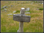
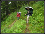
O'Neil Pass is at 4950'. 7.4 miles further the trail ends at 3300' at the junction with the route from the Enchanted Valley to Anderson Pass. Half way along we seemed to have not lost any elevation. Ups and downs but not much change. Then things became more interesting. The trail became very grassy. Very high grass in long meadows. Then the rain started. There is no way to stay dry in those conditions. And we did not. About 52 degrees and soaking wet brush plus falling rain. Only one day earlier the mid 80s heat was getting to me. Well, we did have a real variety of weather. Umbrellas and rain gear helped but there was no way to stay dry.
We reached White Creek at about six miles from O'Neil Pass. It was a little tougher to cross but not too hard. Soon after the trail reached camping sites and then seemed to disappear. A path went stright ahead then petered out. Another went uphill and ended. The GPS software suggested we should go straight ahead. There was a dry rocky creek bed here. We went back looking for a missed turn. The tread was minimal in thick wet grass from the crossing of White Creek. No other trails were seen. We were stumped. Finally Gary noticed a cut log down the rocky creek bed. Yep, that is the trail. It looked to be at least knee deep in the spring. Down the creek we went and soon left it on obvious trail. At the campsites where the trail seems to end, go down the middle of the creek.
Now the trail began to descend in a hurry. Many switchbacks dropped us down to the junction with the trail to Anderson Pass. Just before the junction we met the first person of the day. We was heading to O'Neil Pass. The trail now climbs about 1200' in 1.6 miles. The rain stopped and we began the uphill slog. We met a party with minimal gear heading down. They were day hiking from the Enchanted Valley. A little later we met four women backpacking up the Dosewallips and down the Quinault. We inquired about campsites. Camp Siberia just below Anderson Pass was our planned spot. They said Honeymoon Meadows was much better. With the lousy weather we had already been kicking this idea around.
We reached 4464' Anderson Pass at 3:05 pm. It was gray and misty but not raining. On my one previous visit I day hiked up from the Enchanted Valley on a sunny Memorial Day weekend hike in 1992. There was several feet of snow at the pass. I headed up to the glacier to enjoy a great views. That was not going to be the case this day. We went by the .9 mile glacier side trail and headed down. We met another couple here who did not seem to be having a good day. Now thoroughly soaked we headed downhill to find more tall wet brush and a rocky trail. Not what the doctor ordered. We stopped at Camp Siberia and found no campers. The shelter was tempting as it would provide a dry spot for dinner but we continued down the trail. 1.6 miles from the pass we reached the LaCrosse Pass Trail junction. That would be our route the next day. We dropped another .30 miles to Honeymoon Meadows. At the campgrounds there was one solo hiker. We found a good spot for all three tents. We set up camp and it rained lightly as we ate dinner. By 7:10 pm we headed to our tents. It was a long night.
For the day we hiked about 12.5 miles with 2600' of elevation gain.
The foggy clouds gave the terrain a very different feel. Like a complete change from the two previous days. The cool was even refreshing. The route is varied. At times on steep sidehills and at times entering a number of basins. Much more variety than I was expecting. The trail is a long way from any trailhead and it does not get a lot of maintenance. It has sloughed in places and can be very narrow because of it. A few places have collapsed leaving some big steps to get back on grade. For the most part though, it is in reasonably good shape. On my hikes I sometimes see pink Lewis monkeyflower. Usually alongside streams. On rare occasions I see yellow Tiling's monkeyflower. This hike was most unusual. We saw a little pink monkeyflower but a whole lot of the yellow variety. Probably as much as I've seen in 33 years of hiking combined. Every little dripping creek seemed to be lined with yellow. Most of the basins along this stretch were full of it.
O'Neil Pass is at 4950'. 7.4 miles further the trail ends at 3300' at the junction with the route from the Enchanted Valley to Anderson Pass. Half way along we seemed to have not lost any elevation. Ups and downs but not much change. Then things became more interesting. The trail became very grassy. Very high grass in long meadows. Then the rain started. There is no way to stay dry in those conditions. And we did not. About 52 degrees and soaking wet brush plus falling rain. Only one day earlier the mid 80s heat was getting to me. Well, we did have a real variety of weather. Umbrellas and rain gear helped but there was no way to stay dry.
We reached White Creek at about six miles from O'Neil Pass. It was a little tougher to cross but not too hard. Soon after the trail reached camping sites and then seemed to disappear. A path went stright ahead then petered out. Another went uphill and ended. The GPS software suggested we should go straight ahead. There was a dry rocky creek bed here. We went back looking for a missed turn. The tread was minimal in thick wet grass from the crossing of White Creek. No other trails were seen. We were stumped. Finally Gary noticed a cut log down the rocky creek bed. Yep, that is the trail. It looked to be at least knee deep in the spring. Down the creek we went and soon left it on obvious trail. At the campsites where the trail seems to end, go down the middle of the creek.
Now the trail began to descend in a hurry. Many switchbacks dropped us down to the junction with the trail to Anderson Pass. Just before the junction we met the first person of the day. We was heading to O'Neil Pass. The trail now climbs about 1200' in 1.6 miles. The rain stopped and we began the uphill slog. We met a party with minimal gear heading down. They were day hiking from the Enchanted Valley. A little later we met four women backpacking up the Dosewallips and down the Quinault. We inquired about campsites. Camp Siberia just below Anderson Pass was our planned spot. They said Honeymoon Meadows was much better. With the lousy weather we had already been kicking this idea around.
We reached 4464' Anderson Pass at 3:05 pm. It was gray and misty but not raining. On my one previous visit I day hiked up from the Enchanted Valley on a sunny Memorial Day weekend hike in 1992. There was several feet of snow at the pass. I headed up to the glacier to enjoy a great views. That was not going to be the case this day. We went by the .9 mile glacier side trail and headed down. We met another couple here who did not seem to be having a good day. Now thoroughly soaked we headed downhill to find more tall wet brush and a rocky trail. Not what the doctor ordered. We stopped at Camp Siberia and found no campers. The shelter was tempting as it would provide a dry spot for dinner but we continued down the trail. 1.6 miles from the pass we reached the LaCrosse Pass Trail junction. That would be our route the next day. We dropped another .30 miles to Honeymoon Meadows. At the campgrounds there was one solo hiker. We found a good spot for all three tents. We set up camp and it rained lightly as we ate dinner. By 7:10 pm we headed to our tents. It was a long night.
For the day we hiked about 12.5 miles with 2600' of elevation gain.
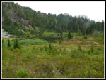 Leaving Marmot Lake |
 O'Neil Pass Is Ahead |
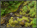
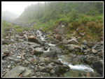
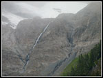 Big Waterfalls |
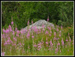 Blooming Fireweed |
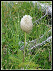 Western Anemone |
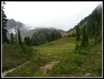
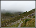 Clouds Near Pass |
 What Views? |
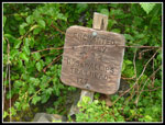
 O'Neil Pass Sign |
 Misty Trail |
 Wildflowers |
 Indian Paintbrush |
 Stonecrop |
 Misty Color |
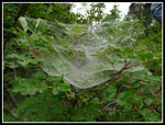 Wet Web |
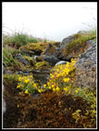
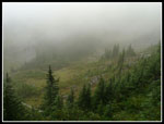 Basin In The Mist |
 Another Basin |
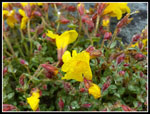 Twiling's Monkey Flower |
 Flowers In Creek Bed |
 Still Smiling |
 More Fireweed |
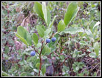 Ripe Berries |
 Great Color |
 Big Gully |
 Umbrella Is Out |
 White Creek |
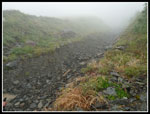
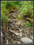 Creek Bed Is Trail |
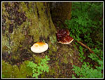 Fungi |
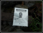 Beware Of Bears |
 Junction Sign |
 More Clouds |
 Anderson Pass |
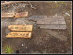 Old Signs |
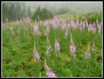 Even More Fireweed |
 Honeymoon Meadows |
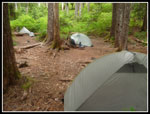 Night 3 Camp |
<< Day >>
Olympic Mountains Loop Report
Home