Day 3
Our
third day was very much up in
the air. The plan was too hike into Fire Creek Basin then find the way
trail over to Fire Creek Pass. None of us had done it. Gary had taken a
route up Fire Mountain that would have been roughly on the route.
Unfortunately, that was quite a few decades ago and he understandably
did not recall the off trail route. What information we did have was
somewhat contradictory. Add in the fact the trip did not come together
until shortly before hand and we were not sure this plan would work. If
we did spend the day on this route that would leave us 13.5 mils to
hike out on Tuesday. That did not seem like a problem until we saw how
narrow and rough the trail is. That seemed like a lot for the last day.
With all that in mind, we were out of bed just after 6:00 am. An early
start would give us the possibility of moving camp back to Owl Creek.
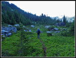
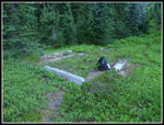
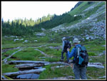
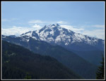
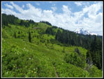
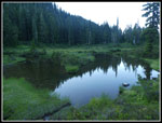
The earlier forecast had some clouds this day and we had a few in the morning but not that many. We were on our way by 6:20 am. The trail climbs to another forested rib then descends down into the basin of Fire Creek. One map showed the high route way trail leaving the main trail at the start of the basin and taking a rising traverse over rocks and low green brush. There was a cliff so that route would have to go above it. We also had a written description that mentioned leaving from the old shelter site. We decided to cross the basin to the shelter site. We crossed Fire Creek on the far side of the basin and quickly found the square flat spot with old logs around the perimeter. I would guess this was the shelter. There was no sign of a route heading uphill.
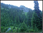
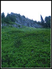
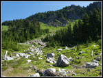
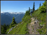
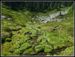
We beat our way through a little brushy forest and found an alley heading straight uphil. Forest was on both sides. We had to get around a big down tree blocking the way. Then the slope became much steeper. Going along the left side just in the forest we had enough vegetable belays to haul ourselves up the slope. We stopped at one flat spot and tried to figure out where to go ahead. The route would have to go to the right towards a forested rib coming down from Fire Mountain. Right above us was another cliff wall. As we neared the cliff John's inclinometer read 50 degrees. Seriously steep on grass, false hellebore, and other green slippery ground cover. We could not see a reasonable way to get where we needed to be. At that point we decided that Fire Creek Pass was not all that important.
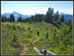
We slowly and gingerly worked our way back down into the basin. Back we went over the rib and back to our campsite. By 9:00 am we were back at camp. We decided to go at least as far as Owl Creek this day. At 9:00 am we were packed up and on our way. The day was warming quickly and we had that steep climb out of the basin. 450' does not seem like much but on a narrow overgrown trail it was slow going. At the top the steep climb down to the next basin went a lot better than we thought it would. It seemed slick on the ascent but we went down just fine. Now we settled in to more ups and downs as we traversed several more basins. There was one steam with a good flow where we stopped to filter water. Enough to get us back to Owl Creek.
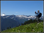
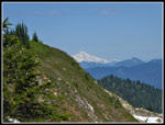
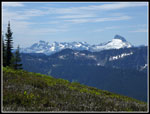
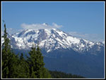
The day was warming quickly and we were all glad to reach the 6000' ridge top viewpoint again. We took another long stop there. Unlike the day before, there were some clouds now but other than Mt. Rainier we could see all the other summits. This day we saw not a single other person. We reached the top at 11:35 am. We were in no hurry to leave. After lots more photos and lunch we finally packed up at 1:12 pm. We had 2.5 miles to get back to Owl Creek. Since it was so early in the day we discussed continuing on and spending the night at Meadow Lake. I recalled it being an easy trail down to the lake.
On the hike back we looked for the way trail over the ridge to Diamond Lake. We saw the lake from the ridge top and it looked easy enough to get there from the basin below the ridge to the north. We never did see a trail up to and over the ridge from the main trail. It was on all our maps and the gps map. At the spot on the map there was just a very steep slope with no trace of a route. That one will remain a mystery to us. We arrived at Owl Creek at 2:21 pm. After many hours out in the sunshine we needed some shade. There was just a small amount of it. We pumped more water and decided that Meadow Lake would be our destination. Not wanting to reach a buggy lake too early we stayed at Owl Creek until 3:32 pm. We started with another climb up that 400' climb to the ridge top.
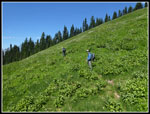
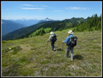
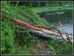
We dropped down into the big dry meadow. Much of the route is out of the forest with great views. I could mention them over and over. Pugh, Sloan, Whitechuck, Three Fingers, etc. The beat just kept going. We were all glad to reach the junction with the trail to Meadow Lake. My memory of an easy stroll down to the lake proved to be a little faulty. Okay, maybe a lot faulty. It is .70 miles and has some steep narrow sections. It has some muddy sections. It feels like a lot more than .70 miles. The guys were wondering it we would ever get there. When the trail started to climb they were no amused. Eventually we did drop down to Meadow Lake. There was a big log down over the trail just above the lake heading to the obvious campsite. We could not get over it. We ended up retracing our steps up and down another trail then dropping the last 25' on slick greenery. Then we made it to camp.
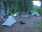
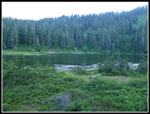
We only found one campsite and it was plenty large. We did not poke around across the outlet looking for any more. It was 5:20 pm and we were glad to be done for the day. One interesting thing about the lake is the outlet. It turns into a big meandering river in a big meadow below the lake. The outlet creek was at least 20' wide in places. We did cross the outlet and hunt around and found the old backcountry toilet. It was falling over in 2007. Now there is just a wooden floor and with a hole in the middle.
Before going to bed we took another look at the offending log blocking the trail. The wood was wet and broke off easily. Chunks of tree would just break off. By the time we were done we had dismantled a good chunk of the log. We could now easily climb over it. We stayed up until dark. This night proved to be much warmer than the prior two. It was still about 50 degrees when we woke up. For the day we hiked 8.9 miles with 2430' of gain.
The earlier forecast had some clouds this day and we had a few in the morning but not that many. We were on our way by 6:20 am. The trail climbs to another forested rib then descends down into the basin of Fire Creek. One map showed the high route way trail leaving the main trail at the start of the basin and taking a rising traverse over rocks and low green brush. There was a cliff so that route would have to go above it. We also had a written description that mentioned leaving from the old shelter site. We decided to cross the basin to the shelter site. We crossed Fire Creek on the far side of the basin and quickly found the square flat spot with old logs around the perimeter. I would guess this was the shelter. There was no sign of a route heading uphill.
We beat our way through a little brushy forest and found an alley heading straight uphil. Forest was on both sides. We had to get around a big down tree blocking the way. Then the slope became much steeper. Going along the left side just in the forest we had enough vegetable belays to haul ourselves up the slope. We stopped at one flat spot and tried to figure out where to go ahead. The route would have to go to the right towards a forested rib coming down from Fire Mountain. Right above us was another cliff wall. As we neared the cliff John's inclinometer read 50 degrees. Seriously steep on grass, false hellebore, and other green slippery ground cover. We could not see a reasonable way to get where we needed to be. At that point we decided that Fire Creek Pass was not all that important.
We slowly and gingerly worked our way back down into the basin. Back we went over the rib and back to our campsite. By 9:00 am we were back at camp. We decided to go at least as far as Owl Creek this day. At 9:00 am we were packed up and on our way. The day was warming quickly and we had that steep climb out of the basin. 450' does not seem like much but on a narrow overgrown trail it was slow going. At the top the steep climb down to the next basin went a lot better than we thought it would. It seemed slick on the ascent but we went down just fine. Now we settled in to more ups and downs as we traversed several more basins. There was one steam with a good flow where we stopped to filter water. Enough to get us back to Owl Creek.
The day was warming quickly and we were all glad to reach the 6000' ridge top viewpoint again. We took another long stop there. Unlike the day before, there were some clouds now but other than Mt. Rainier we could see all the other summits. This day we saw not a single other person. We reached the top at 11:35 am. We were in no hurry to leave. After lots more photos and lunch we finally packed up at 1:12 pm. We had 2.5 miles to get back to Owl Creek. Since it was so early in the day we discussed continuing on and spending the night at Meadow Lake. I recalled it being an easy trail down to the lake.
On the hike back we looked for the way trail over the ridge to Diamond Lake. We saw the lake from the ridge top and it looked easy enough to get there from the basin below the ridge to the north. We never did see a trail up to and over the ridge from the main trail. It was on all our maps and the gps map. At the spot on the map there was just a very steep slope with no trace of a route. That one will remain a mystery to us. We arrived at Owl Creek at 2:21 pm. After many hours out in the sunshine we needed some shade. There was just a small amount of it. We pumped more water and decided that Meadow Lake would be our destination. Not wanting to reach a buggy lake too early we stayed at Owl Creek until 3:32 pm. We started with another climb up that 400' climb to the ridge top.
We dropped down into the big dry meadow. Much of the route is out of the forest with great views. I could mention them over and over. Pugh, Sloan, Whitechuck, Three Fingers, etc. The beat just kept going. We were all glad to reach the junction with the trail to Meadow Lake. My memory of an easy stroll down to the lake proved to be a little faulty. Okay, maybe a lot faulty. It is .70 miles and has some steep narrow sections. It has some muddy sections. It feels like a lot more than .70 miles. The guys were wondering it we would ever get there. When the trail started to climb they were no amused. Eventually we did drop down to Meadow Lake. There was a big log down over the trail just above the lake heading to the obvious campsite. We could not get over it. We ended up retracing our steps up and down another trail then dropping the last 25' on slick greenery. Then we made it to camp.
We only found one campsite and it was plenty large. We did not poke around across the outlet looking for any more. It was 5:20 pm and we were glad to be done for the day. One interesting thing about the lake is the outlet. It turns into a big meandering river in a big meadow below the lake. The outlet creek was at least 20' wide in places. We did cross the outlet and hunt around and found the old backcountry toilet. It was falling over in 2007. Now there is just a wooden floor and with a hole in the middle.
Before going to bed we took another look at the offending log blocking the trail. The wood was wet and broke off easily. Chunks of tree would just break off. By the time we were done we had dismantled a good chunk of the log. We could now easily climb over it. We stayed up until dark. This night proved to be much warmer than the prior two. It was still about 50 degrees when we woke up. For the day we hiked 8.9 miles with 2430' of gain.
 Into Fire Creek Basin |
 Shelter Site |
 Heading Up There |
 Turnaround Point |
 Back In Fire Creek Basin |
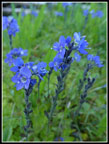 Blue Flowers |
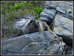 Marmot |
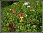
 Many Columbine |
 Close Up Columbine |
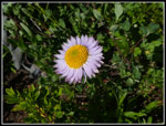 Aster |
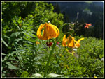 Tiger Lilies |
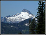 Sloan Peak Again |
 Another Glacier Peak |
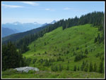
 Another Basin |
 John At Work |
 The Guys Cross Meadow |
 Ridge Top & Mt. Baker |
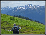
 John On Trail |
 View Southeast |
 Heading Down |
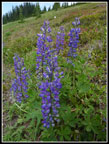 Lupine |
 More Views |
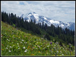 Glacier Peak & Flowers |
 Big Meadow Ahead |
 Looking Back |
 Back At Owl Creek |
 Into Big Dry Meadow |
 Croak |
 Clouds Atop Glacier |
 2 Mile Marker |
 Meadow Lake Camp |
 Meadow Lake |
 Outlet Creek |
 Blocking Log |
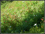
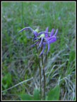 Shooting Stars |
<< Day >>
Meadow Mountain Report
Home